
Discover the tutorial threads dedicated to working with ArcGIS OPro and its integration with other platforms within the standard pricing package.
I Creating categorized styles
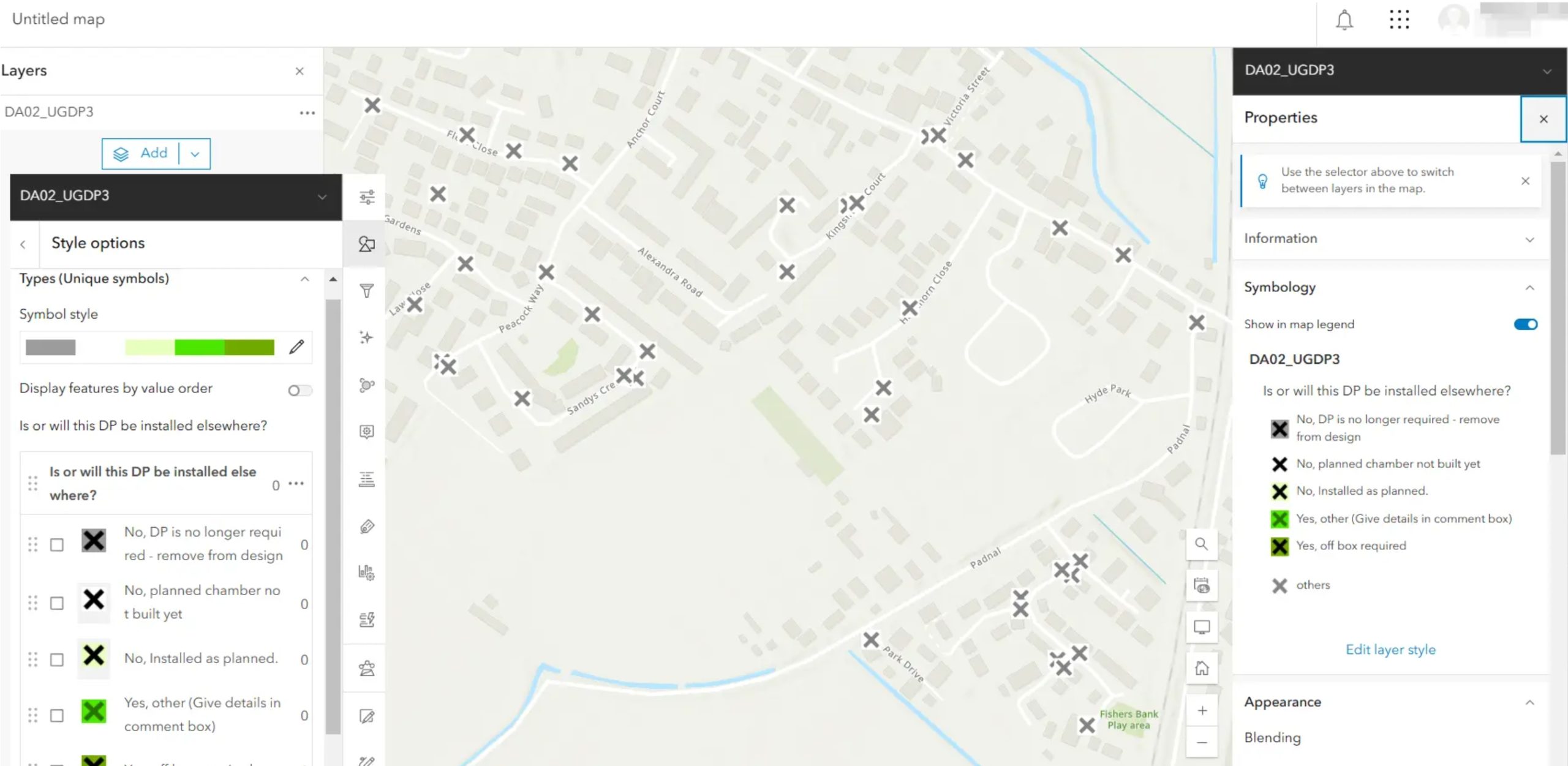
Here, I would like to briefly describe how to prepare categorized styling in ArcGIS Pro, which will later be used in Field Maps Designer.
We can start from the raw layer without any styling.
…
After sharing, I see that your layer and all the symbology work well in ArcGIS Online. All the symbols should be transferred without problems. Remember that if, at some point, you decide to modify the symbology on ArcGIS Online, you may lose the original icons created in ArcGIS Pro. The reason is simple—ArcGIS Online doesn’t have an extensive symbol library.
————————————————– MORE ————————————————–
Ask for access
…………………………………………………………………………………………………………………………………………………..
II Creating custom icons
This brief text explains how to use custom icons in ArcGIS Pro. The “custom icons” here mean the symbology patterns, which cannot be obtained from ArcGIS Pro in any way. First, we must know how to create advanced icons in ArcGIS Pro. You can find a lot of information on this on the web.
…
What is best here is that even the signature produced in a custom way in ArcGIS Pro can be successfully displayed on the ArcGIS Online map.
————————————————– MORE ————————————————–
Ask for access
…………………………………………………………………………………………………………………………………………………..
III Sharing a fully equipped layer on the web
The standard method for sharing an ArcGIS Pro layer on the Web (ArcGIS Online) has been discussed here. This method is quick, although it doesn’t cover the details of the given layer, which might be needed later in the Online-based work. The way of sharing presented there doesn’t cover the elements like:
…
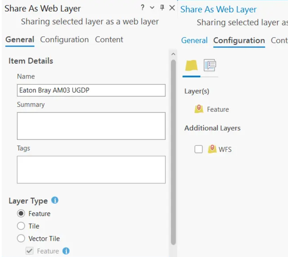
All the options must be adjustable to your needs. This article explains one way to set up your layer correctly and avoid additional hassle later in ArcGIS Online.
————————————————– MORE ————————————————–
Ask for access
…………………………………………………………………………………………………………………………………………………..
IV Preparing question forms for Field Maps Designer
The pivot role of ArcGIS Pro, in collaboration with ArcGIS Online, enables users to prepare data almost instantly. Once all the elements are sorted, the layer can be shared with the web-based platform with a single click. It applies to all the generic layers and the setup made before it, allowing relevant files to migrate. The task is relatively straightforward, as only styling and attribute tables are considered. However, if we plan to utilize this layer in a broader sense, for example, by completing the questionnaire on-site, we should consider advanced preparation. Besides sharing the layer with all its equipment, the questionnaire should also be prepared. This stage will prevent us from creating questions whenever we are later in the Field Maps Designer app by doing it once and for all. This text will guide you through all the steps to consider when preparing the Field Maps Designer questionnaire successfully.
…
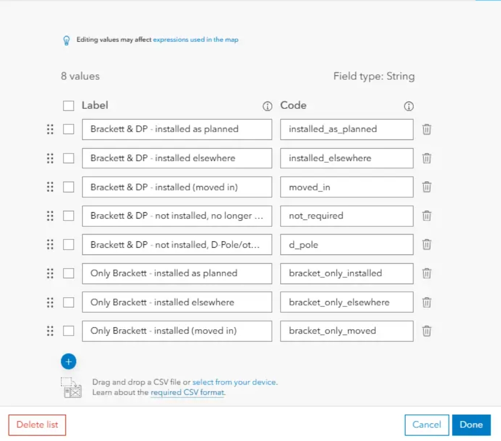
When entering the Edit list, you can see all the content specified within the domain created in ArcGIS Pro. This list is editable so that you can drag, remove, or add new queries as usual in Field Maps Designer.
————————————————– MORE ————————————————–
Ask for access
…………………………………………………………………………………………………………………………………………………..
V Migration tables between databases
Preparation of fields, values, and domains can take some time. The process isn’t complicated, as you can read here, but the work can become tedious since we have many layers of the same questions in other maps and databases. This text discusses the process of replicating attribute tables in another database using the same questions.
…
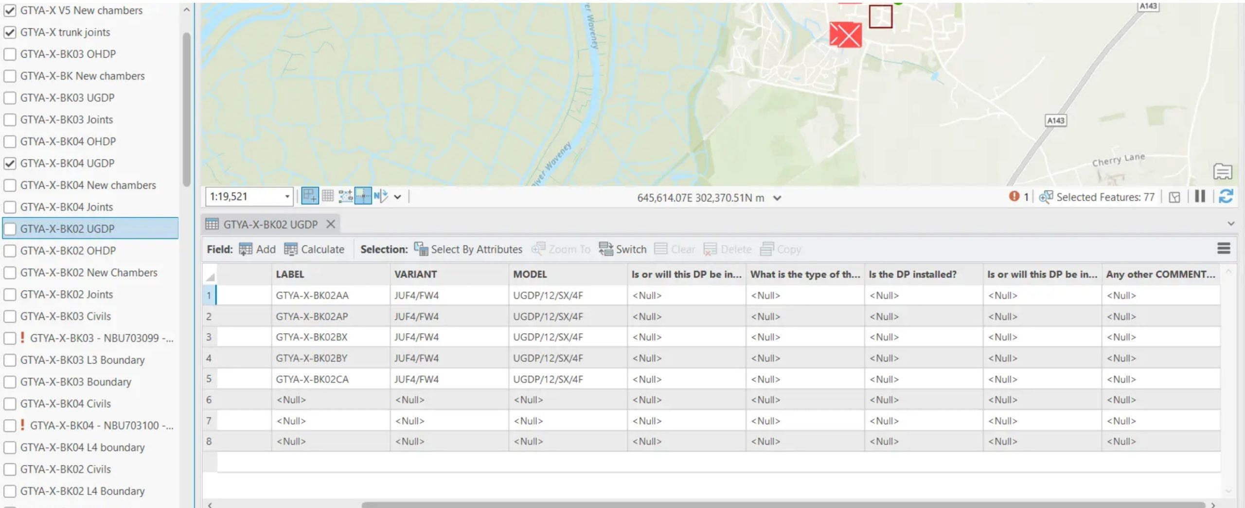
As you can see, all the settings determined in the layer at our previous project are now pulled through to the current project. Our layer is the same; it covers a different area, and these settings are used without hassle. Since all your further projects are analogical with layers, you can use this method to transfer the fields and their domains over the same layers you’ve produced.
————————————————– MORE ————————————————–
Ask for access
…………………………………………………………………………………………………………………………………………………..