
Discover the tutorial threads dedicated to working with ArcGIS Online and its integration with other platforms within the standard pricing package.
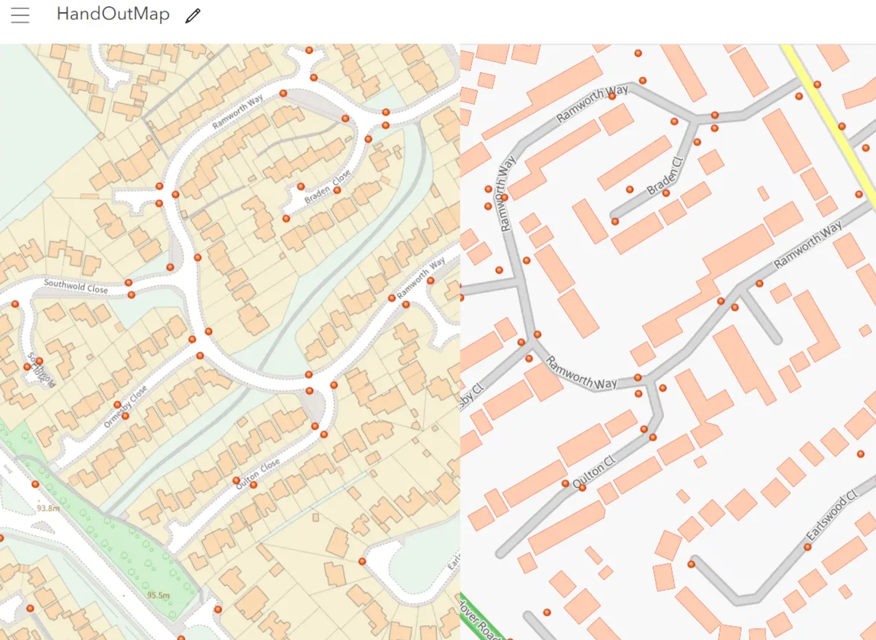
I ArcGIS Online with Ordnance Survey Basemap
ArcGIS Online, as a web-based map platform, includes several base maps, analogous to the open-source map styles or XYZ tiles available in QGIS. Some of them aren’t useful concerning the level of detail, and others resemble just the OpenStreetMap base map. OpenStreetMap features a high level of detail, but only in certain areas, as this mapping platform is contributed to by users worldwide. It means that some areas can be prepared well, but others are not. How about the situation when we need to work with a more detailed map canvas? In any case, regardless of our platform or application, we can provide a custom map canvas based on the XYZ or WMTS layer. The same applies to the Ordnance Survey maps.
…
————————————————– MORE ————————————————–
Ask for access
…………………………………………………………………………………………………………………………………………………..
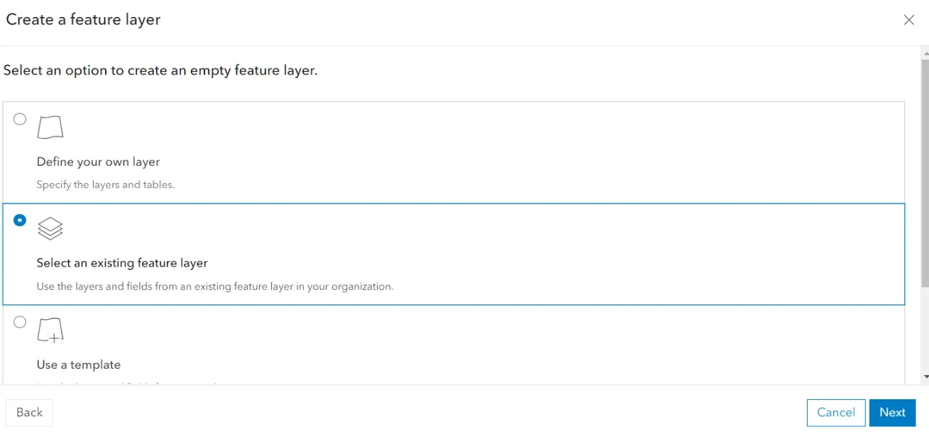
II Adding a feature layer from an existing feature layer
…
Creating the layer based on the existing feature layer has the following advantages:
– replicates the layer settings,
– transfers the layer properties defined i.e. in the Field Map Designer question forms,
– migrates partially the content of popups
…
————————————————– MORE ————————————————–
Ask for access
…………………………………………………………………………………………………………………………………………………..
III Field Map Designer random workaround
This section covers the following:
1. The map pop-up dependency,
2. Autoloading list with .csv files
and subsections:
1. Condition-based questions in Field Maps Designer.
————————————————– MORE ————————————————–
Ask for access
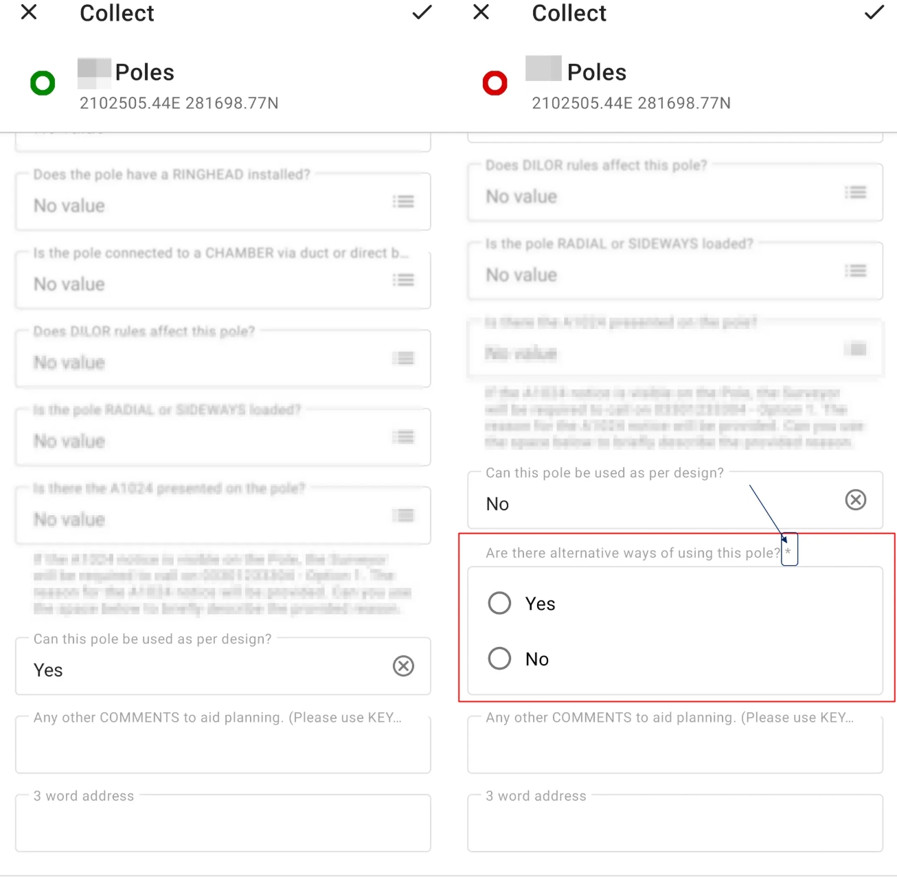
III 1. Condition-based questions in Field Maps Designer
One of the coolest options in the Field Maps Designer form builder is creating condition-based questions. Their foundation is the conditional statement in the Arcade language, which is created automatically in this case.
…
This is the most straightforward approach to the Arcade language, which enables ArcGIS Online to be dynamic. By simply modifying the generic formula, we can prepare questions based on specific conditions.
————————————————– MORE ————————————————–
Ask for access
…………………………………………………………………………………………………………………………………………………..
IV Advanced styling of the layers
This section covers the following:
1. Background for text labels,
2. Zoom-based label visibility,
3. Copy color to another element,
4. Lines or objects with various thicknesses,
5. More than one label for an item,
6. Conditional-based labels
and subsections:
1. Reproducing the layer with styling in ArcGIS Online.
————————————————– MORE ————————————————–
Ask for access
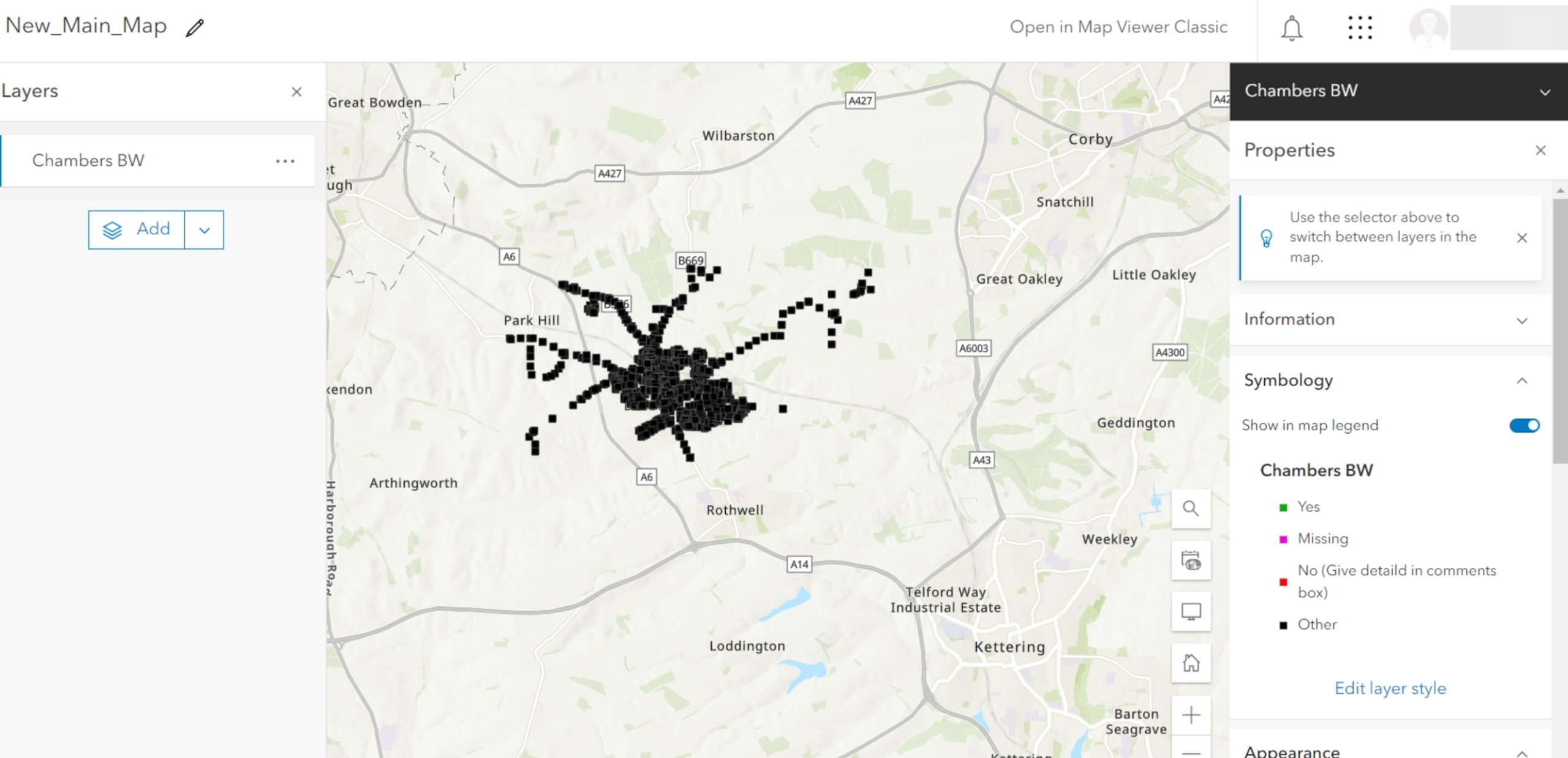
IV 1. Reproducing the layer with styling in ArcGIS Online
The ArcGIS Online Pro doesn’t have a direct option for reproducing the styles of the given layer. Usually, when the new layer is created or uploaded from the FileGeoDataBase file, we have to set up our style again. It can be painful, especially when our styling is quite advanced and requires a significant amount of time to complete. This text presents the tricky, but doable solution that helps us retain the layer style as well as other settings without any additional hassle. In this method, everything is retrieved accurately, but again, it’s tricky, and we must be careful doing it. Therefore, if you wish to learn how to do it successfully, follow the steps below carefully.
…
————————————————– MORE ————————————————–
Ask for access
…………………………………………………………………………………………………………………………………………………..
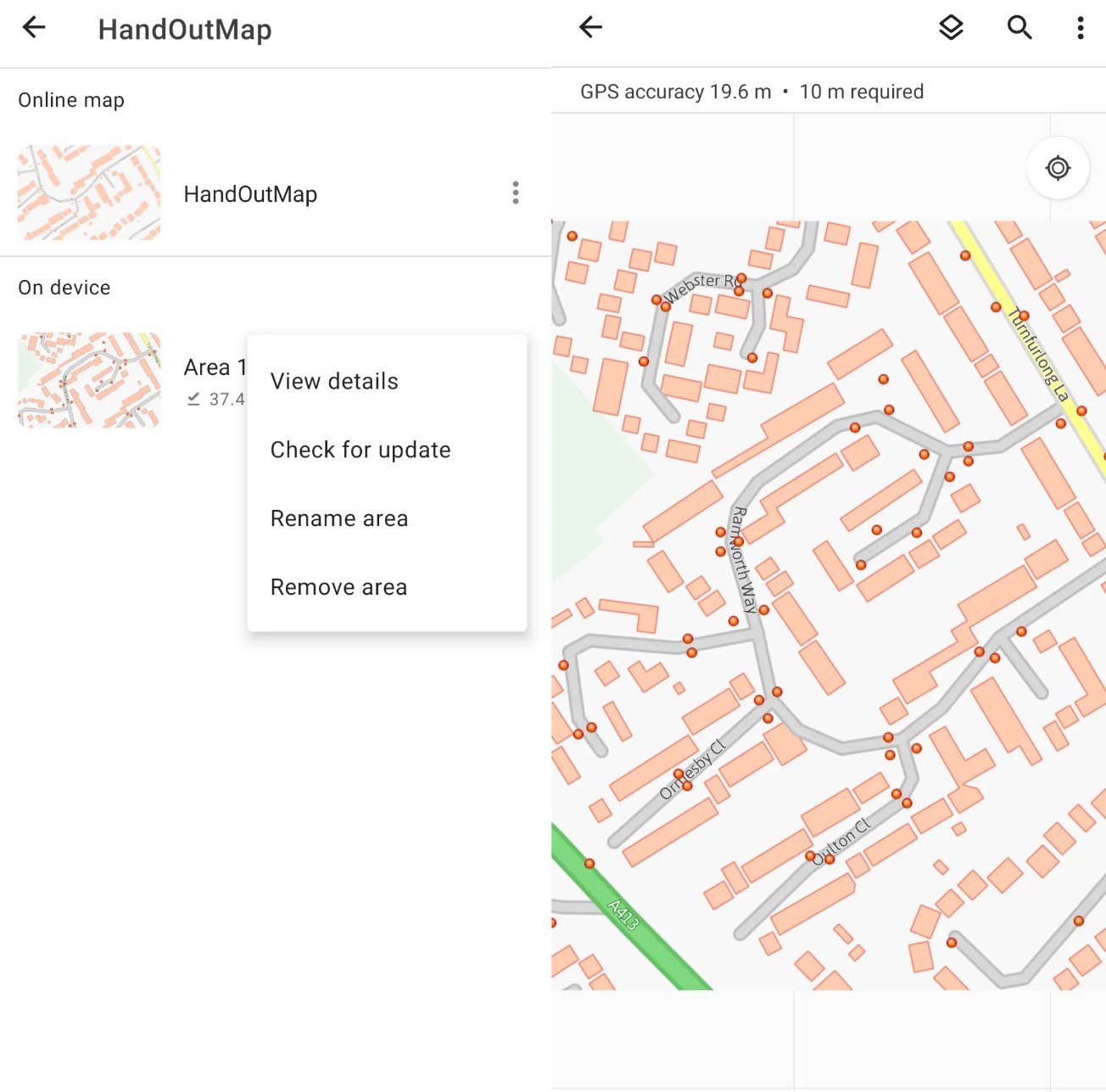
V. Using maps offline
One of the most important features offered by ArcGIS Online is the ability to use the maps in Offline mode. It sounds like the contradiction of the major platform, which is intuitively dedicated to Online work only. The Offline mode requires certain conditions to be met upon launching, but everything can be done quite easily.
…
————————————————– MORE ————————————————–
Ask for access
…………………………………………………………………………………………………………………………………………………..
VI Download & extract database file
When you finish work on your ArcGIS Online project, everything is stored on the ArcGIS Online server. Next, you have several options for downloading it. Unfortunately, ArcGIS Online, unlike ArcGIS Pro, doesn’t have the option for multiple data downloads. You must go through every single feature hosted layer and collect your data.
…
————————————————– MORE ————————————————–
Ask for access
…………………………………………………………………………………………………………………………………………………..
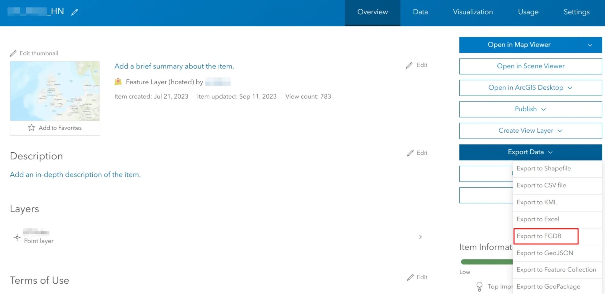
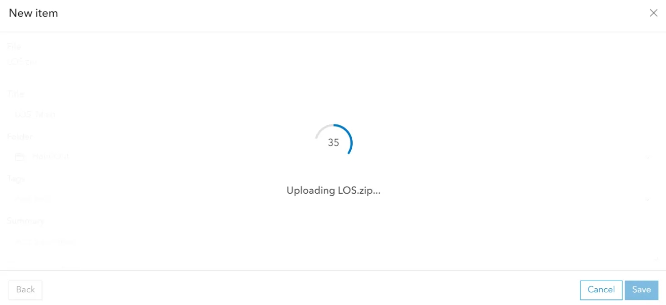
VII Uploading a geodatabase file to the map
In this article, I’ve explained to you how to download the full content of your ArcGIS Online map after edits. It has been said that the crucial FileGeoDataBase (FGDB) format which can export all the items with their attachments. This text shows the opposite way, which can be needed for retrieval of the layers in other ArcGIS Online accounts if the same layer must be used elsewhere.
…
————————————————– MORE ————————————————–
Ask for access
…………………………………………………………………………………………………………………………………………………..
VIII ArcGIS for Excel
ArcGIS is the ESRI add-on that can be used in Excel.|
————————————————– MORE ————————————————–
Ask for access
VIII 1. Loading Excel data to the ArcGIS Online map
This brief tutorial will guide you through loading and customizing Excel data in an ArcGIS Online map.
…
————————————————– MORE ————————————————–
Ask for access
…………………………………………………………………………………………………………………………………………………..
IX Short guide for creating dashboards
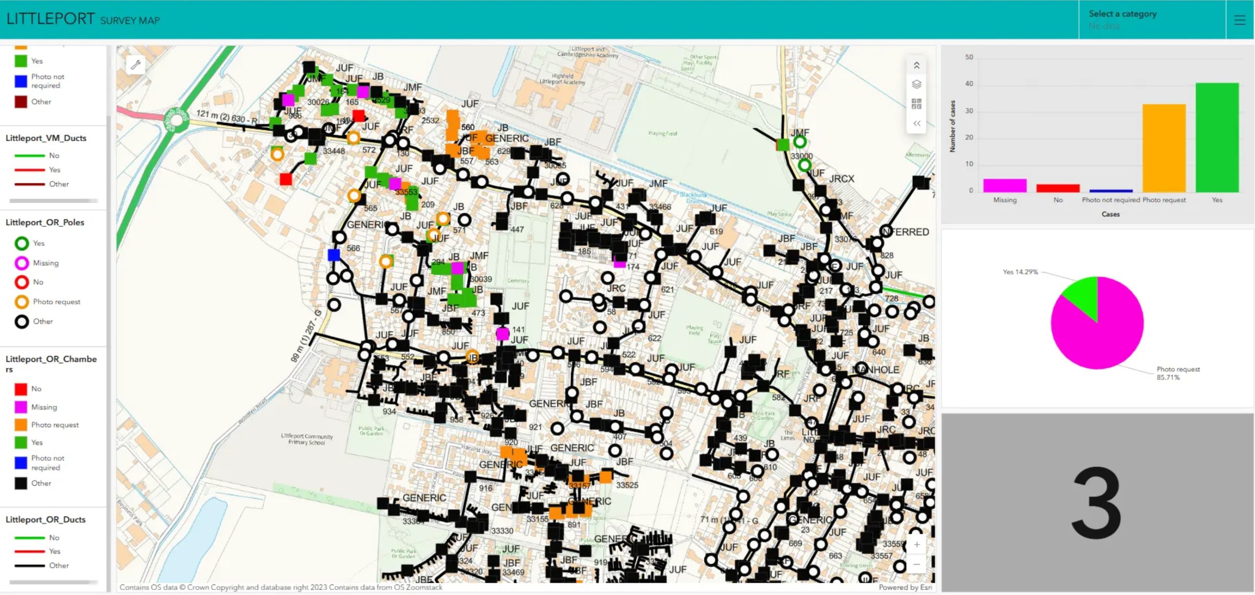
The ArcGIS Online dashboard is a non-code-based, dynamic presentation of geographic information or data that allows you to gain real-time insight into the content, monitor events, and make fast and efficient decisions. The Dashboard is an ArcGIS Online application designed to display multiple visualizations together on a single screen, providing a comprehensive view that facilitates at-a-glance actions. Dashboards comprise configurable and data-driven elements, such as maps, lists, gauges, indicators, and tables, which present information to a targeted audience.
This article explains how to create an ArcGIS Online dashboard and visualize your data using the most built-in elements.
…
————————————————– MORE ————————————————–
Ask for access
…………………………………………………………………………………………………………………………………………………..