
The road speed limit is somewhat guidance of what speed is considered safe and reasonable in the given section of the road or area. The primary goal of the speed limit is to keep everyone safe, not only the car driver but also the people affected nearby (pedestrians, cyclists, etc.).
All speed limits are based on what 85% of drivers would drive comfortably on their own without posted limits. Since speed limits help limit your speed, they give you a bit longer amount of time for you to react to unforeseen changes on the roadway and make it easier for you to stop the vehicle when necessary.
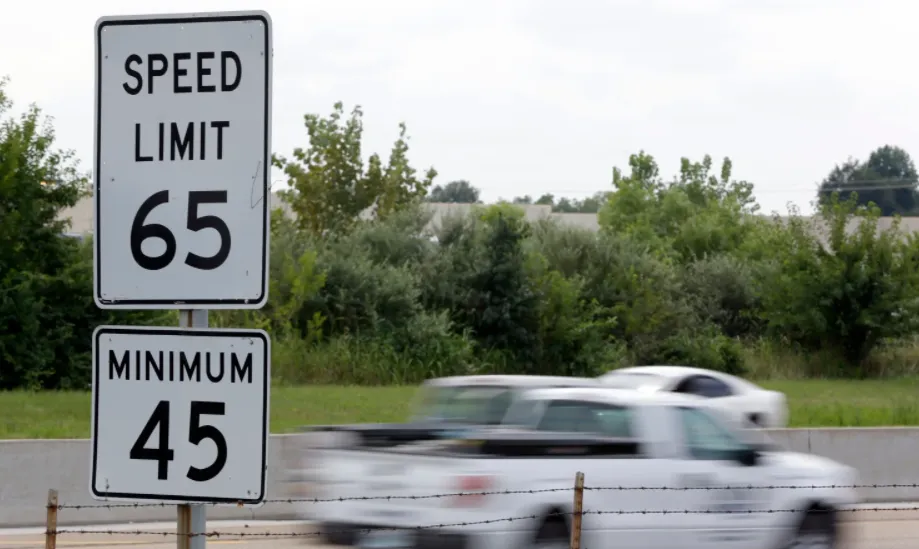
The general speed limits are widely available. Every country has its own speed limit restrictions for a certain type of road (Pic. 1).


However, sometimes we must know in detail, what is the speed limit for certain road sections because we need it i.e. for Traffic Management purposes. In this event, we cannot rely on the general national speed limits only, as they don’t cover i.e. subsidiary roads in residential areas, city byways, internal roads, etc. We need more detailed information about the speed limit on those types of roads. In turn, it’s good to check the local speed limit map, if available. Nowadays, the local speed limit maps grow on trees like coconuts. You can see some examples below (Pic. 3 – 5).


You can find many more examples like this on the web (Pic. 6).

Nevertheless on their levels of detail, if they’re not interactive, we can still have problems with quick access to the road, which we are interested in. The best accessible application informing us about the speed limit at certain road sections is the Google Maps Android App, where you can have an instant actualization of the speed restrictions when driving on certain roads (Pic. 7)

The similar information we can get in other Android Apps like Velociraptor or HereWeGo Maps. However, in all these cases there is no option to get this information straight from your desktop (Windows, Linux, or macOS).
To answer this problem I would like to show a very simple way of collecting the speed limit data for the given road section.
There is one good platform, which includes this data. This is Waze.com, where under a live map you can see what is the speed limit for a particular road section. It’s not possible straight from the live map platform (Pic. 8).

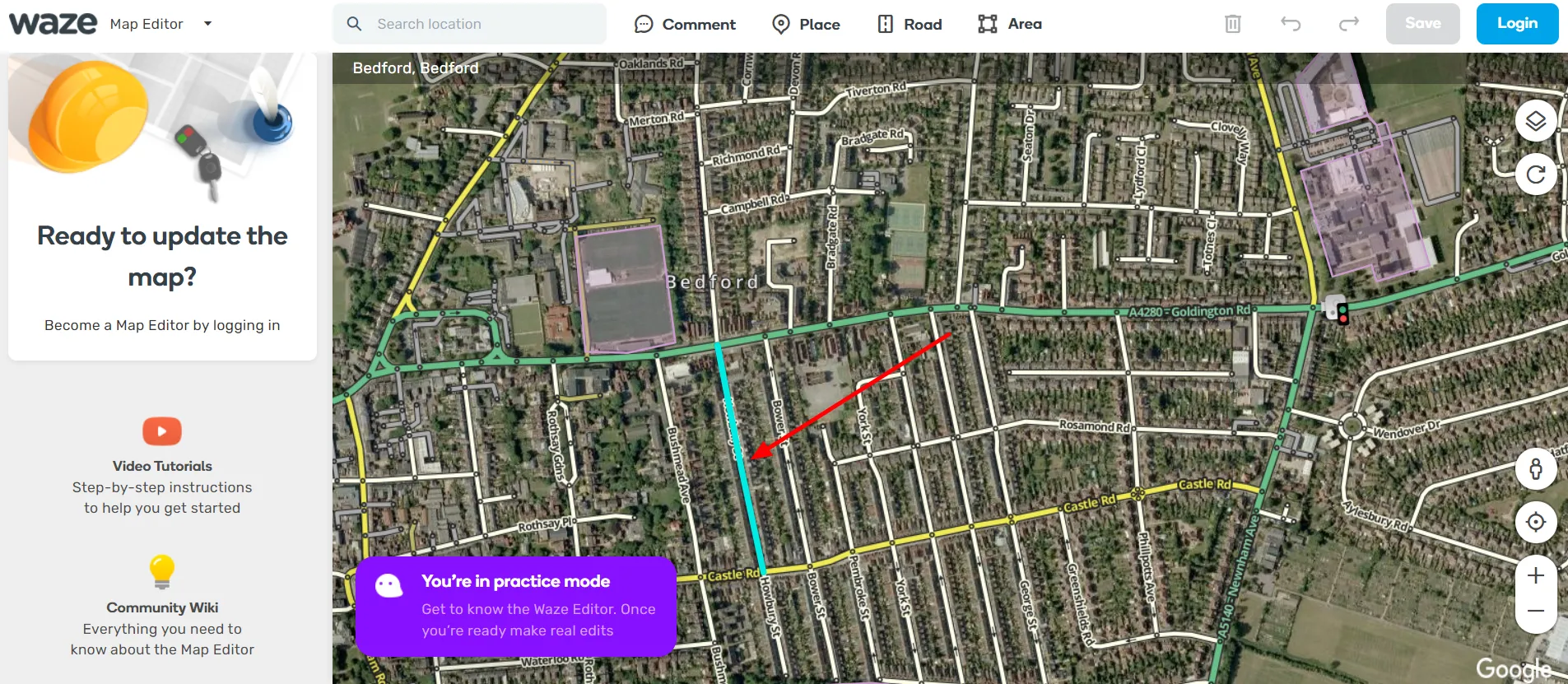
You have to turn on the map editing mode. In the image above there is a dropdown menu marked red. This menu is located at the top left corner of the map. Click here and use the dropdown (Pic. 9), from where you should select the “Edit the Map” option.

By clicking the “Edit the Map” option, the platform will ask you about the login details. You can easily skip them by selecting the option below – the “Try to practice mode” (Pic. 10).

You will be redirected to the map editor platform, which is based on the hybrid map, as we know from Google. Every road overlaid on the satellite imagery can be selected now. When you hover over the road, it turns turquoise (Pic. 11).
Now you are getting all the details about this road when clicking on it once. They are populated on the left sidebar. One of these details is the speed limit (Pic. 12).

Apart from the speed limit information, you can also see the directions on that given road, expressed by arrows highlighted along with the turquoise color. When you are dealing with the long road, it is divided into sections. Each section is linked by smallish black circles placed inside the road signature line. For instance, when you look at the yellow road in the picture above, the signature is not uniform, because is split by little black circles. In this case, you can highlight only the current road section instead of a whole road, and get the speed limit information about this given section (Pic. 13) in one or both directions.

The speed limits are served in miles per hour worldwide. If you have the km/h unit in your country, then it can be easily calculated by Google (Pic. 14).

If you do so, the job is done. You’ve got the speed limit information about the street you were looking for.
If for some reason you have no information about the speed limit, it’s good to check the Street View of the local area. Predominantly there is no access for the public to that road (Pic. 15), in other cases, roads are characterized by restricted access (i.e. lack of tarmac, and so on).

Waze Maps was preparing also another option to check the speed limit data. The goal was to show it on a colored map. There is a script available here, which you can download and install in your Chrome browser. Next, you can play with it a bit.
Remember the credibility of this data. It’s the same situation as in Wikipedia. We can’t be 100% sure, that the information provided is correct, although because of the growing amount of true users and reviewers, we can rely on most of this data.
Mariusz Krukar
References:
- Silva T.H., et al., 2013, Traffic condition is more than colored lines on a map: characterization of Waze alerts, (in:) Jatowt A., et al., SocInfo 2013, LNCS 8238, p. 309-318, Springer International Publishing Switzerland 2013
Links:
- https://www.geoawesomeness.com/now-you-can-see-speed-limits-with-google-maps/
- https://www.zdnet.com/article/google-maps-to-roll-out-speed-limit-and-speed-camera-features/
- https://techcrunch.com/2019/05/29/google-maps-adds-ability-to-see-speed-limits-and-speed-traps-in-40-countries/
- Christchurch (New Zealand) – Speed limit map
- London – digital speed limit map
- WME Speedlimits script
- WME color speeds script
- https://www.mksguide.com/here-wego-vs-waze-maps/
- https://www.herrmanandherrman.com/blog/why-do-we-have-speed-limits/
Forums:
- How can google map show me the current speed limit and also the speed am currently driving
- Google maps now also showing speed cameras in the Netherlands
- Where/how does Waze get its speed limit data?
- https://stackoverflow.com/questions/58661346/how-to-get-raw-traffic-flow-data
- Reddit: Google Maps vs Waze Beta
- [Script] WME Color Speeds v1.2.6
- https://www.quora.com/Why-are-speed-limits-important
- Waze.com: Adding speed limit when driving
Wiki: