

The georeferencing option in QGIS is very handy when we want to have some interesting images on the map canvas. I mean the map images in the vast majority (optionally historical maps), and they will be subject to my explanation in this article.
The georeferencing is fairly possible by the Georeferencer plugin (Georeferencer GDAL), which can be installed from the list of plugins available in the software. I don’t want to go into the details here, as the process has been widely explained on the web. My goal plays around one of the most advantageous methods, which I have discovered recently by the growing experience within this task – the “envelope method“. This is an output of at least a dozen or so map images, which I had to plot into QGIS canvas in a relatively short time. I hope, that my advice will be helpful for you.
Omitting completely the georeferencing process, described, for example, here, we are focusing on the total number of the georeference points. Maybe you will be surprised, but we don’t need more than the minimum amount required! This is the quintessence of this process, and what is most important, you will get your map accordingly retrieved against the local coordinates, which is absolutely great!
Well, the georeferencing tool in QGIS allows us to put at least 4 georeference points, although it has been told in various tutorials, that your result will be better when you provide more coordinates. Translating it into a practical sense we would think, that the number of points will be varied across the different sizes of our .webp map image. For instance, if we have a small map, then 4, 5, or 6 points should be OK, but when our map is larger, then we would need 20 or more. Everything depends on the level of detail, provided by our image and their correspondence with the area we want georeference to. Important are “anchor points” – the most recognizable places in our image map, which we can refer to as our map canvas. For example, the best will be some bends, corners, etc., which should be clearly compared to the map canvas (or alternatively the satellite imagery, when the map canvas seems to be not detailed enough). Unless your image map corners have already coordinates defined, then is much easier to do so, as explained in this article.
My method leads to gaining the best georeference accuracy with 5 points only, regardless of the size of your map image. The key role here plays is the displacement of the points across our image. We should place the coordinates in the most extreme parts of our image map preferably in the middle (Pic. 1).
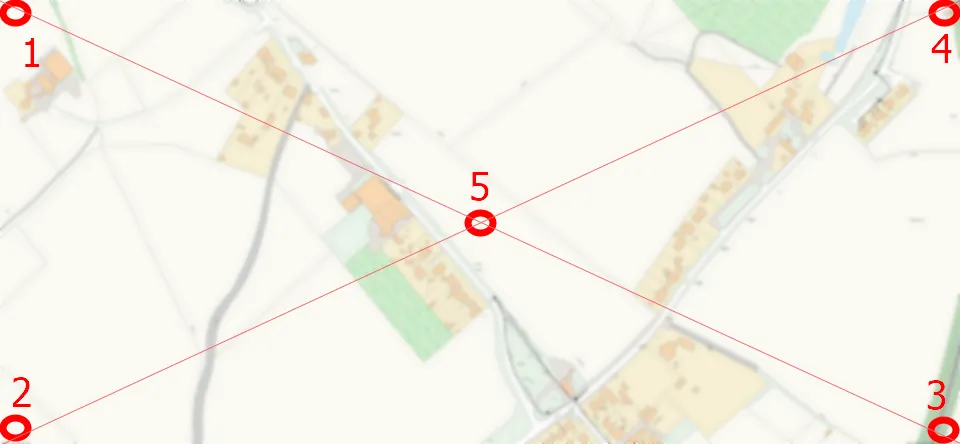
This is the image georeferencing by the “envelope” method. We have one point in the middle, whereas another 4 are located in the corners, being finally displaced evenly against the center. Regardless of the image map size, you should get the same effect. The georeferencing quality should be good because you are able to cover all the parts of your image. By having the correspondence to the map canvas in a configuration like this, the georeferencing tool will be able to calculate the coordinates of local circumstances accurately.
Unfortunately, this is often a theory, as we rarely have our “anchor points” roughly there. If, for instance, there is nothing to stick to in our image corner, we should consider the nearest characteristical place or point, which will be easily recognized from the map canvas or satellite imagery. Otherwise, the method doesn’t make sense. See my examples below. When I wasn’t really able to pick up the point from the middle I selected something near the edges instead (Pic. 2 – 7).


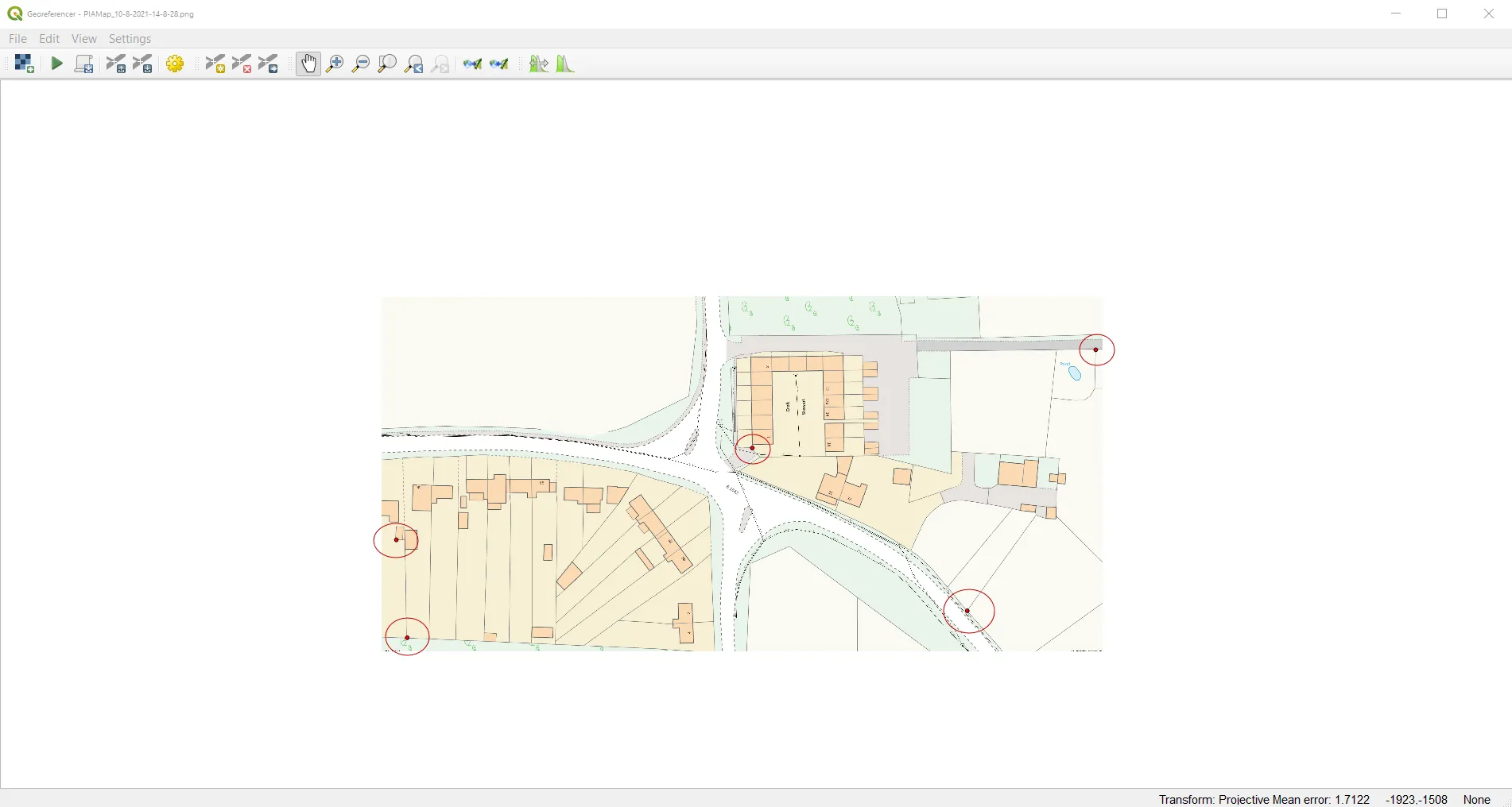
As you can see above examples, it’s quite hard to fit the theoretical assumption of the “envelope method” of georeferencing images in QGIS. We often need to set the points, which lie in the vicinity or are the nearest to the theoretical pattern. The principle is, that as all the points are closer to the “envelope” pattern, then our image is georeferenced more accurately. On the contrary, you have to stick to the general georeference rules saying about “more coordinates” by picking up other points preferably near the image edges.
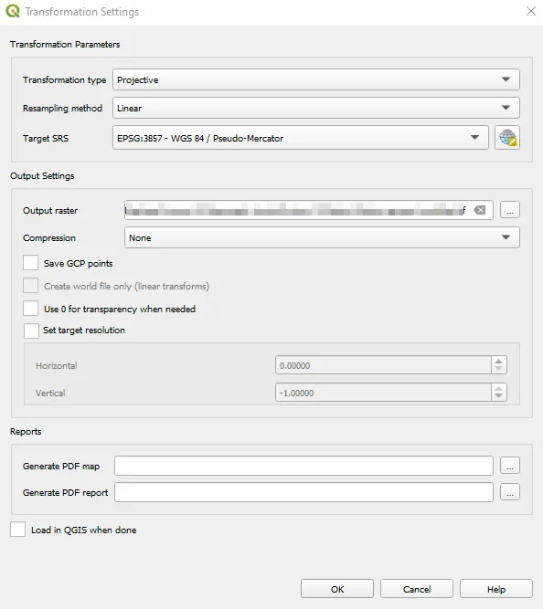
When you are done, remember about the proper settings depending i.e. on the CRS system you use in your QGIS project (Pic. 7).
When you are sure, that everything is alright, then hit OK and add your raster layer (newly georeferenced .tiff map) to QGIS and see the result. In my case, any shifts were not noticeable, which confirms the effectiveness of this method (Pic. 8, 9).

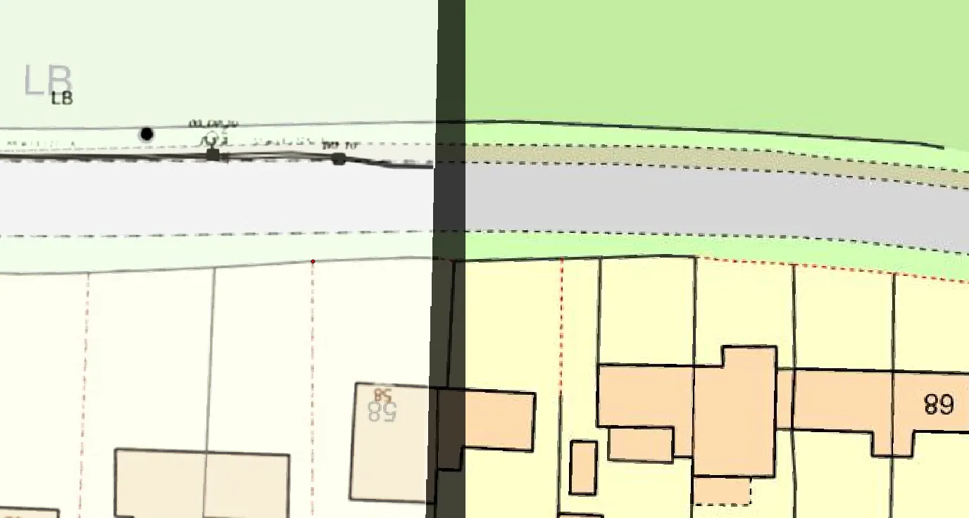
Looking at the results above we can see a very good quality of our georeference. It has been strikingly expressed especially in the lower image, where you can see the overlay on your left. There are no shifts at all. However, my situation was quite straightforward, as I referenced the points to clear raster maps underneath. You have to make sure, that your map canvas is genuine. Be cautious when you use satellite imagery. The images are not always from a geometrical zenith. Moreover, some objects (like houses) might be extended against their polygons on the map (because of roofs, etc.). In turn, also trees and vegetation disrupt the accuracy. I will cover in the future how to georeference the image map from the satellite imagery effectively.
Mariusz Krukar
Links:
- QGIS georeferencer plugin
- QGIS georeferencing procedure
- QGIS – georeference by the map corners
- https://gis-university.com/georeferencing-in-qgis/
- https://digital-geography.com/qgis-tutorial-i-how-to-georeference-a-map/
Forums:
- https://gis.stackexchange.com/questions/283556/georeferencing-old-map-in-qgis
- https://www.reddit.com/r/QGIS/comments/kfk86g/georeferencing_using_corners_edges_of_raster_file/
Youtube:
https://www.youtube.com/watch?v=IpxNl8CX2Uk&ab_channel=CapeRADD