
There is a way in QGIS, which allows us to display the tourist trails overlay on Google Satellite imagery. It wouldn’t be interesting that much if not for the fact, that it can be exported as an image or printable as a map in Print Layout. In the next few sentences, I will demonstrate to you how to get to this point and render the tourist trail overlay in QGIS.
1. After opening a new empty project we should go to the Browser panel and select proper XYZ tiles, which are Google Satellite and Mapy.cz – tourist version (Pic. 1).
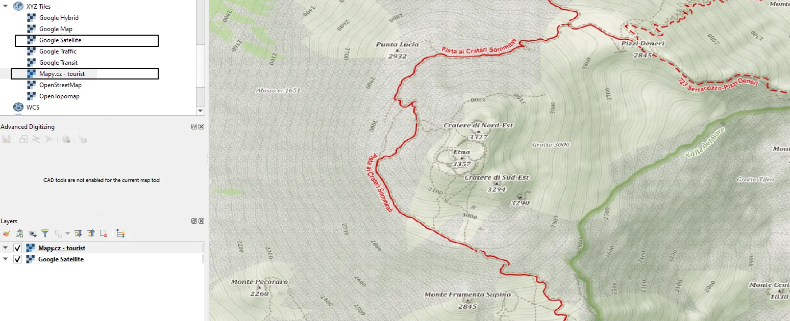
I am assuming, that the CRS matter with your project and maps has been already solved. If you don’t have the following XYZ tiles available in your Browser panel (where just OpenStreetMap comes as default) you can jump to this page and learn how to add them.
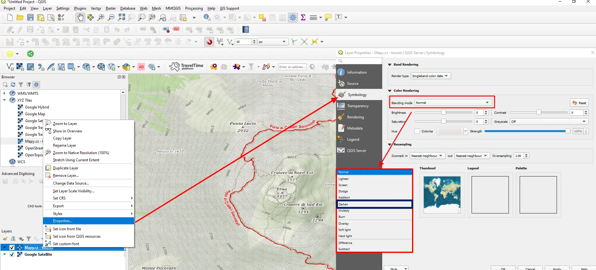
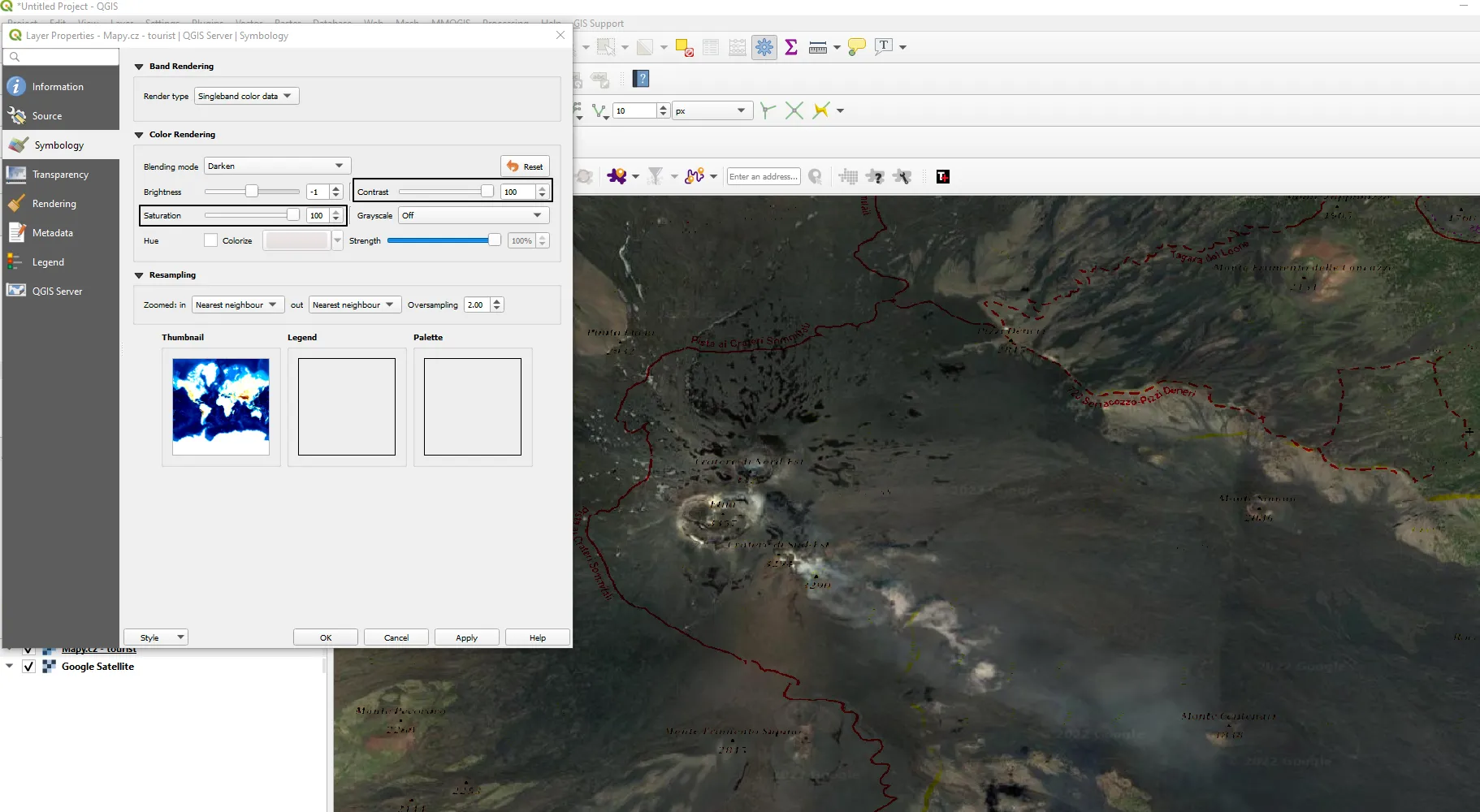
2. Make sure, that the Mapy.cz map tile is at the bottom, then right-click and select Properties -> Symbology. You will have an option for changing the styling of these map tiles as discussed on this page. Focus on Blending Mode and choose Darken as shown below (Pic. 2).
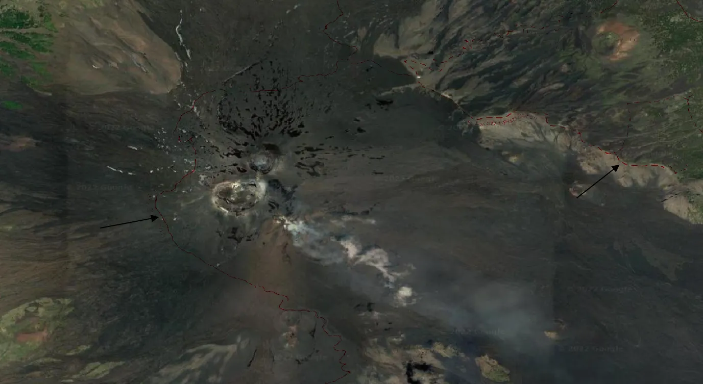
3. At first glance you should see the Satellite imagery beneath, as our first layer is almost fully vanished leaving just an outline of tourist trails (Pic. 3).
4. The last step is adjusting the Saturation and Contrast in order to emphasize the information about tourist trails (Pic. 4). Alternatively, we can play with Brightness or apply other blending modes (Multiply or Burn). The effect will be similar.
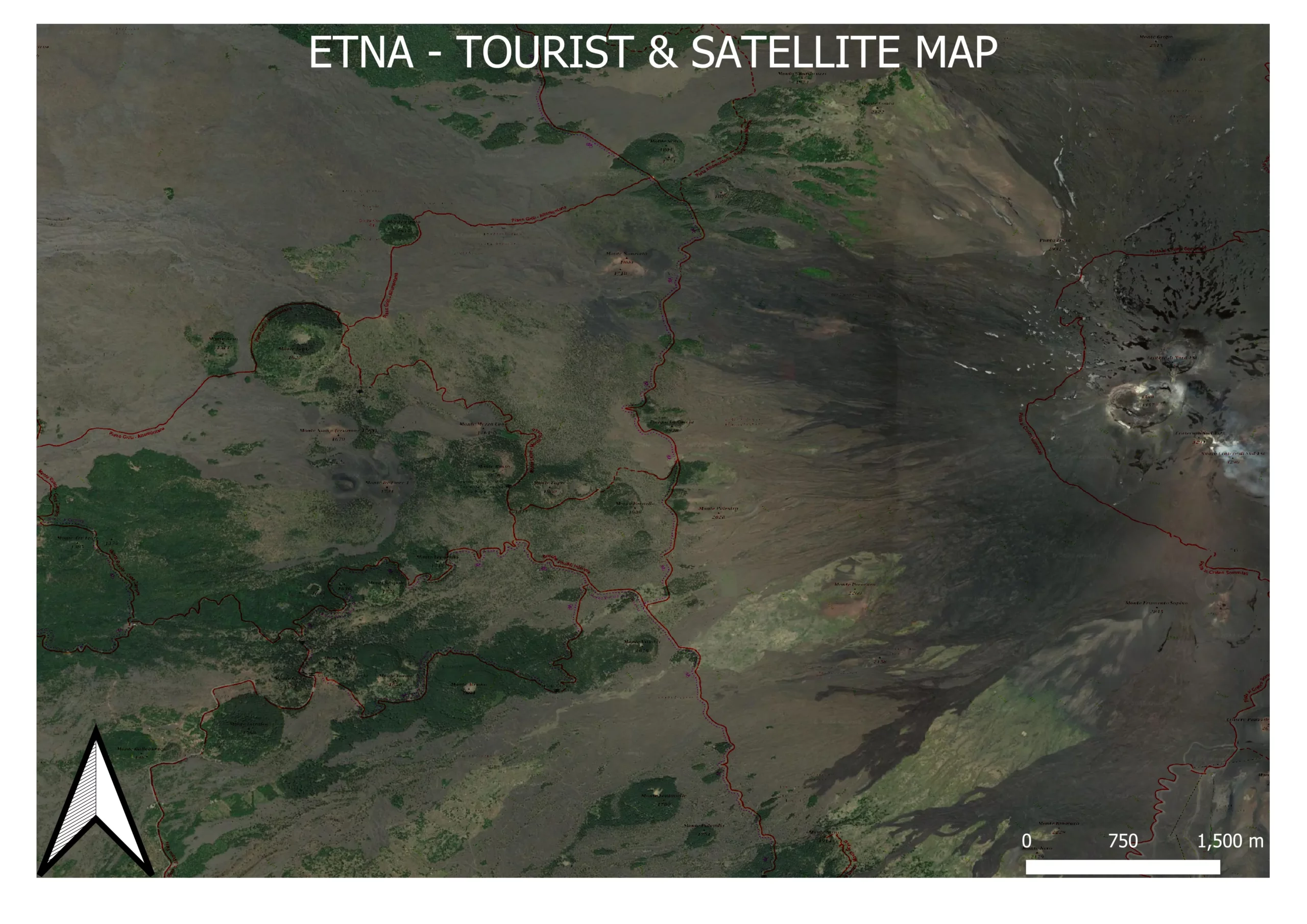
5. Finally, we can produce our map in Print Layout, export, and enjoy! (Pic. 5). This method is not 100% accurate with styling, so apart from emphasized tourist trails, you will get some outlines of major peaks nearby or even roads. However, the method can be handy if we want to check the correspondence of our trail with a satellite view.

Mariusz Krukar