<<< Read the 1st part of The solar eclipse visualization on Google Earth
In the 1st part of this article, I showed you how to create the “umbra” in Scribble Maps and use it in Google Earth as a .kml file. Here I would like to demonstrate step by step how to create a pretty good animation from the .kml “umbra” file, which you have gained already.
Creating the animation
Well, you have a ready-prepared umbra, which you can use in the Google Earth software. However, the biggest drawback of this is an option only for one certain moment. You can’t see what how would be your observation like during the mid-eclipse, 3rd contact, etc. until you create a few other ‘shadows’ in the immediate vicinity.
- To create a new umbra for Google Earth you need to move your previously created shape 1, 2, 5, or more ‘seconds’ ahead on your Scribble Map. I moved mine in just about 10 seconds. Be said this is the shortest interval between manual photos taking during the totality, especially when the changing of parameters is needed.
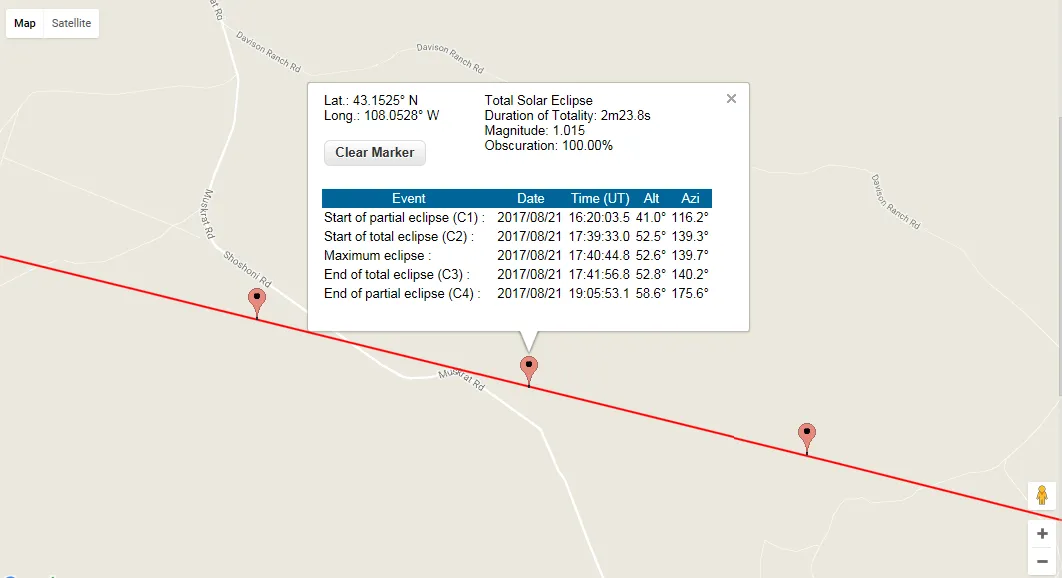
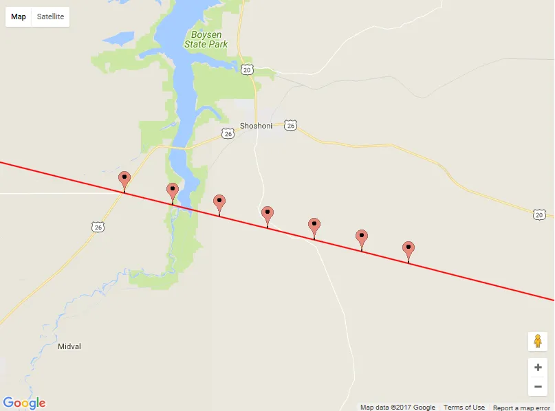
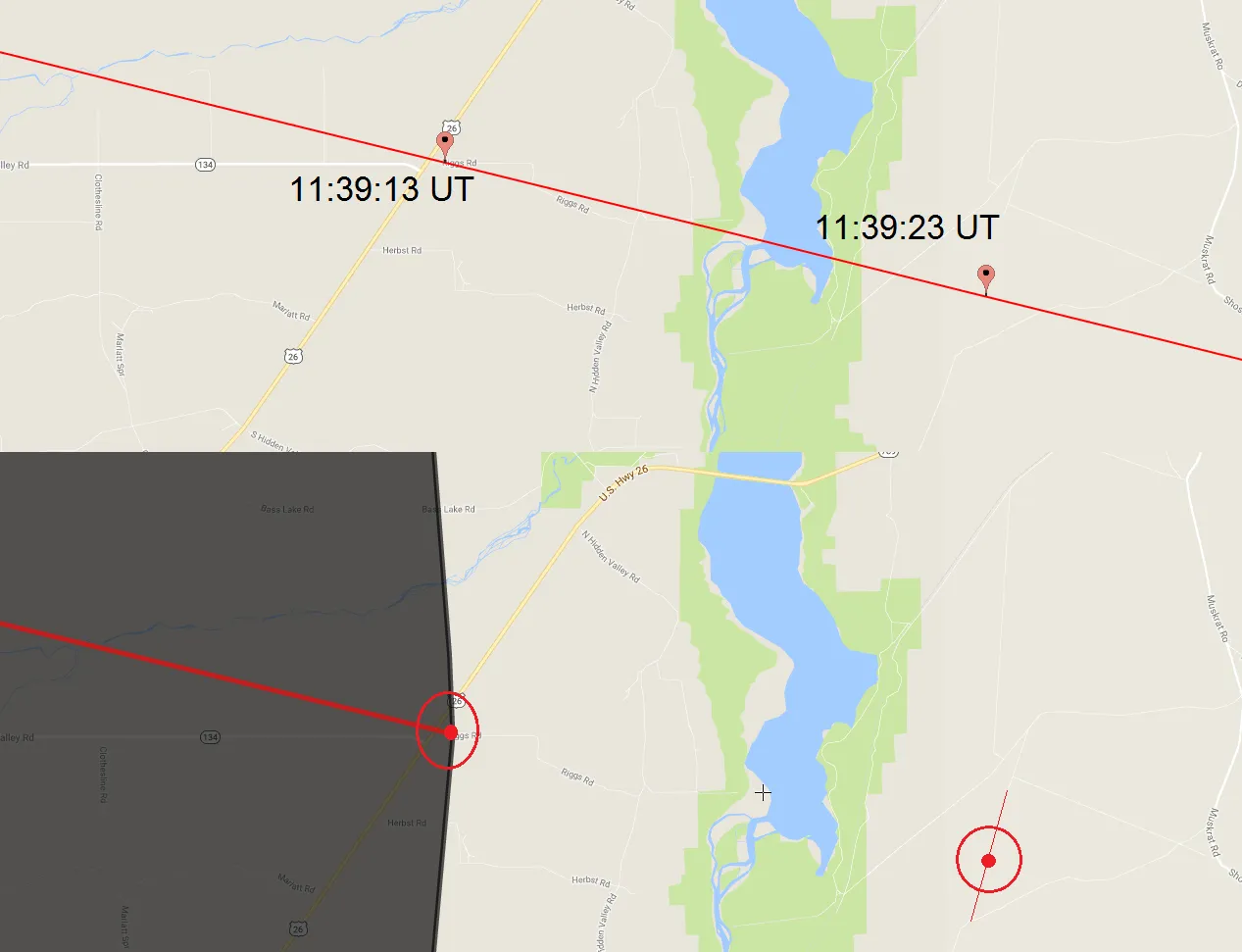
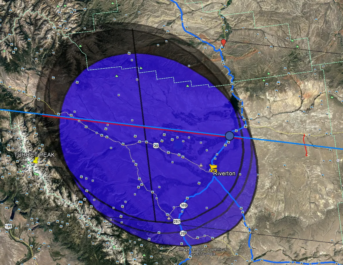
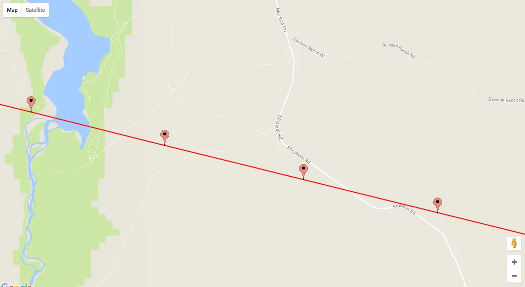
- To move the whole ‘shadow’ ahead, you need first to map proper time values on the NASA interactive map. Find the places that correspond with appropriate time values (pic. 1 – 3).
3. Go to Scribble Maps and select the cursor from your top bar. Next, you can move your cursor on your selected object to hover it (pic. 4). When an object has hovered you can move it. Remember that to move the object you need to see your cursor like a cross. Usually, in the meantime, the hovered object will turn blue. Now to move an object you must click, then hold and drag gently to your next position. Remember that the operation should be carried out slowly. The best way to make a good movement is by keeping an eye on exactly one point and moving it slowly. This “point” is supposed to be on the centerline. It will allow you to lead your “umbra” roughly within the calculated path of Totality and control everything step by step. I have moved my “umbra” every 10 seconds. It’s good to do likewise when you start to draw the polygon in Scribble Maps – keep both the eclipse.nasa.gov interactive map and your scribble map on the same zoom level (pic. 5).

4. Do the same things for all your eclipse elements: centerline and mid-eclipse line. An order may be random. In my case, I moved the centerline as a first, the umbra as a second, the mid-eclipse as a third, and the grazing zone area as a last.
5. When you finish remember to save your map and what is most important save your .kml file, naming it as a time value.
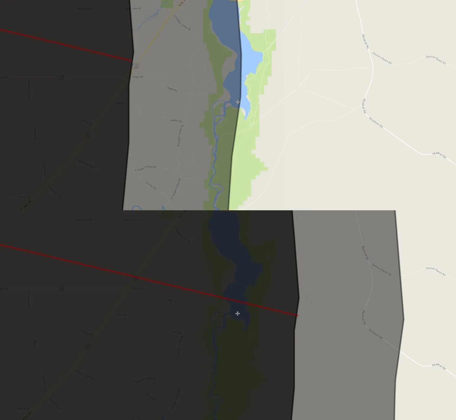
6. After a few similar operations, you should have several .kml files on your Google Earth ‘Places’ list. Making all of them active you should receive a nice “umbra” movement sequence (pic. 7).
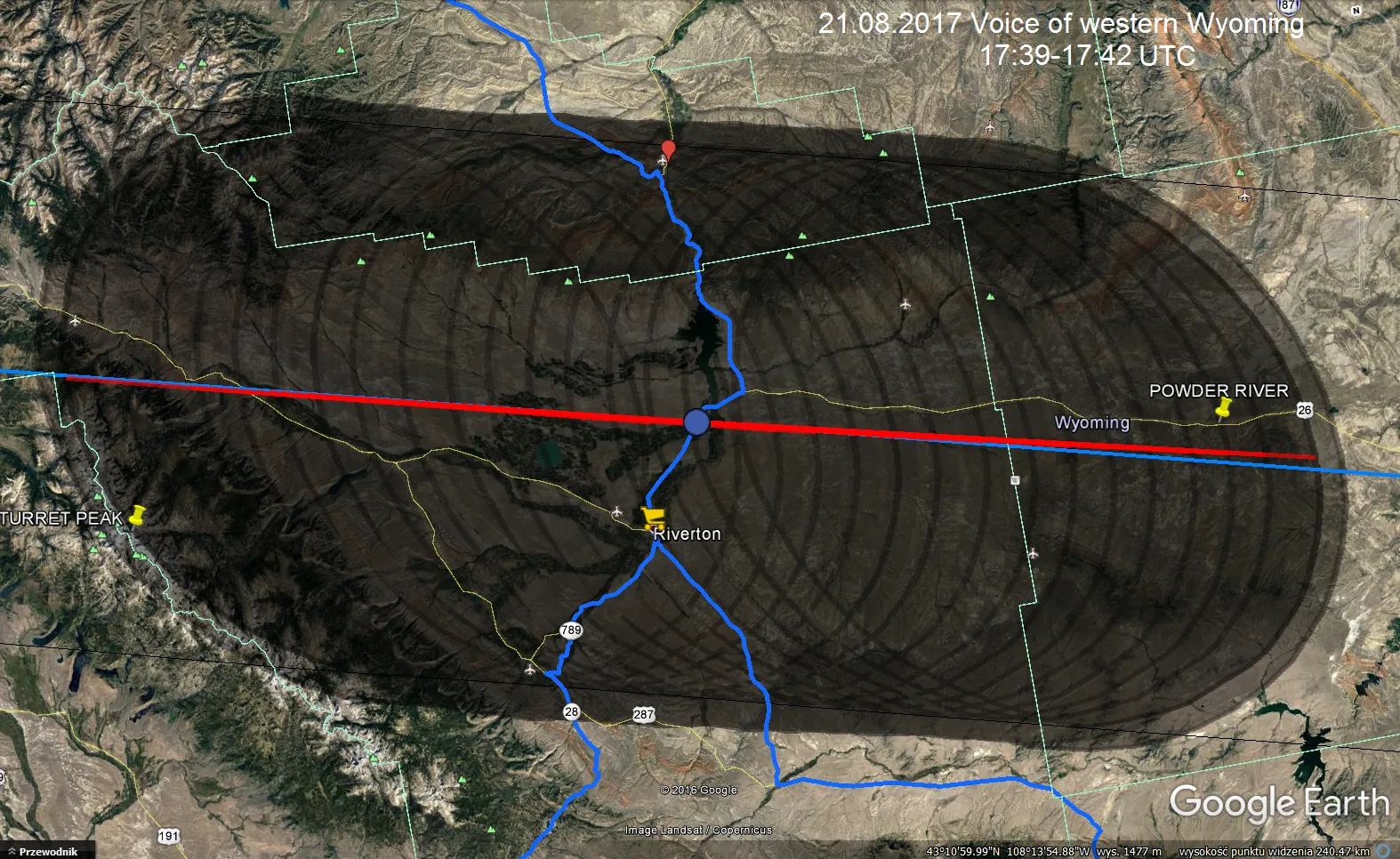
7. For the TSE Google Earth animation, you will need around 15 umbra models separated by 10-second intervals (pic. 8). However, you can always make more if you need to.
8. Now, when you have your full sequence you can analyze the total solar eclipse for your position with 10-second intervals. You can do it either from the top or from an oblique view. When your observation place is located in a mountainous area you can visualize it using the ground view also. Everything you are doing using the left bar with “places” where you switch off 1 layer (umbra) and switch on the following one (pic. 8 – 12).
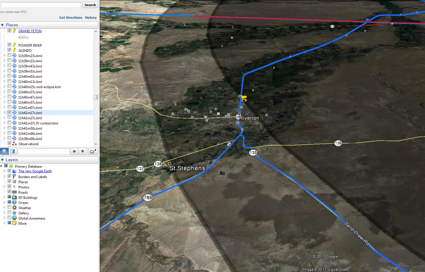

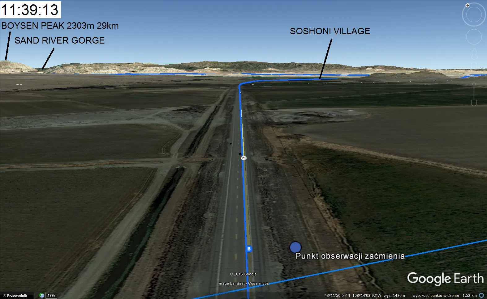
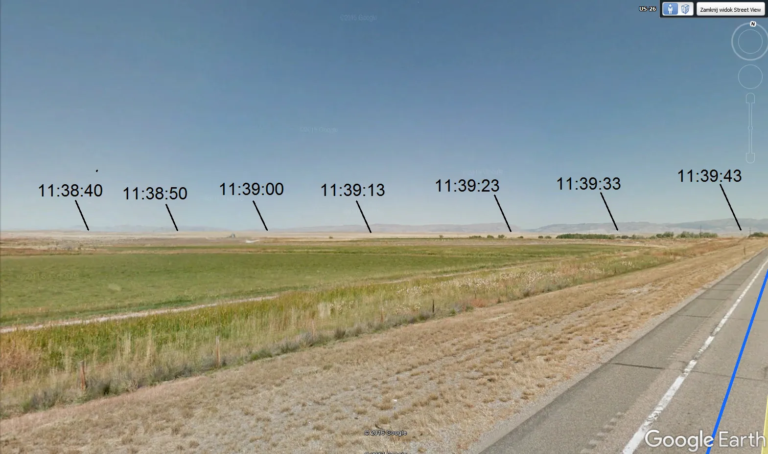
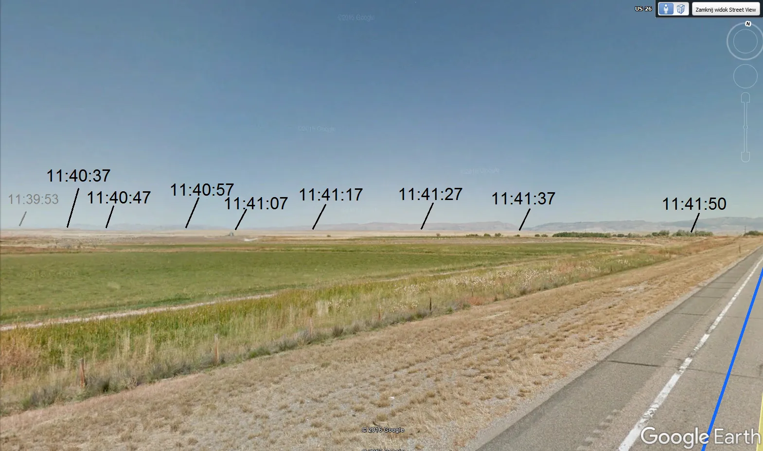
9. For the TSE animation purpose you need to save every snap received in Google. You can do it quickly by clicking Ctrl+Alt+S.
10. When you have everything that you need you can create the animation of the total solar eclipse adequate to your observation site using e.g. Windows Movie Maker. See the effect below:
Umbra in the Earth’s atmosphere
Aside from the “umbra” on the ground you are able to generate another shadow, hung up in the Earth’s atmosphere. Before I describe to you how to do it I will explain to you the essence of this step.
Presumably, you have seen the Earth’s shadow which is to be seen every day before sunrise and after sunset also. If you take a detailed look at it you will spot that Earth’s shadow looks like a vast roll moving across the sky. Now let’s consider which part of the atmosphere causes the Belt of Venus known also as a twilight wedge. The best moment to look at it is when the Sun is around 3-4 deg below the horizon. Then the twilight wedge is located around 10-20 deg above the horizon and appears like a diffused reddish band (pic. 13).
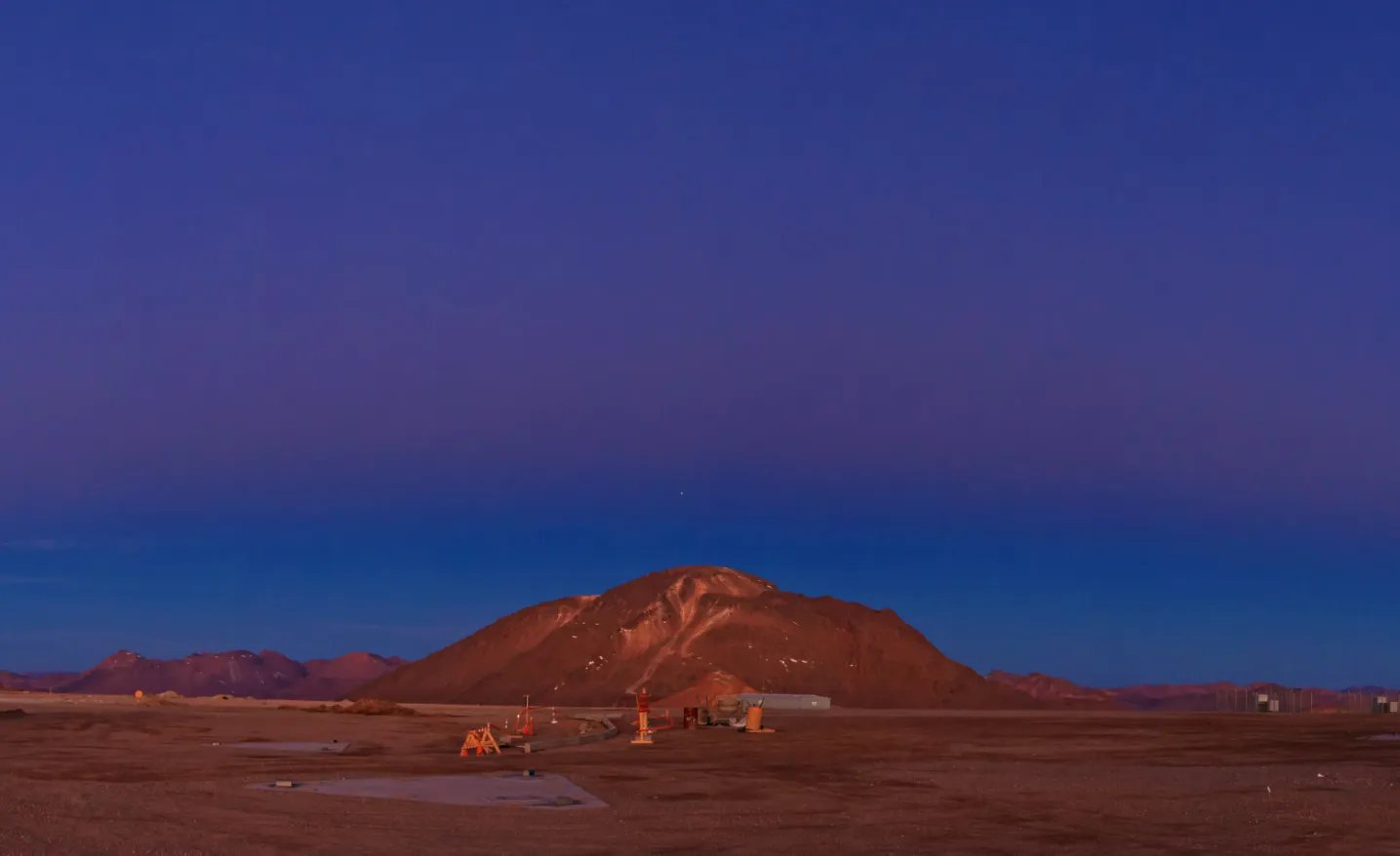
At this moment you can see the most effective contrast of sunlight dispersion in the Earth’s atmosphere. This effect is very similar during a total solar eclipse. We can see the soft umbra edge. There are 2 basic things making a diffused border between the umbra and penumbra in the atmosphere:
- Rapidly diminishing sunlight according to logarithmic function pattern,
- Baily’s beads’ appearance, makes the light-dropping effect stronger.
It should make this effect slightly stronger than during the twilight.
Let’s consider which layer of the atmosphere is “responsible” for both the twilight wedge and “on the sky” umbra. There are a few formulas, which allow you to calculate the relation between altitude and dip of the horizon. I used the formula below (pic. 14).

This formula may be used up to 200 miles above the ground. Your “Alpha” will be the angle between the line of the horizon and the visual horizon.
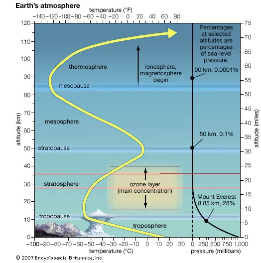
I could count the altitude of this phenomenon. It takes in the Ozone Layer, which covers the lower stratosphere between 20 and 40 km. I created me “on the sky” umbra 27,5 km above ground, however, this is an assumptive value. You need to know that the dip of the horizon from this layer is 6 deg (pic. 15).
How to create the “on the sky” umbra then?
Basically, there are 2 ways. I will show you the easy one first and try to describe it more complicated next.
Way 1
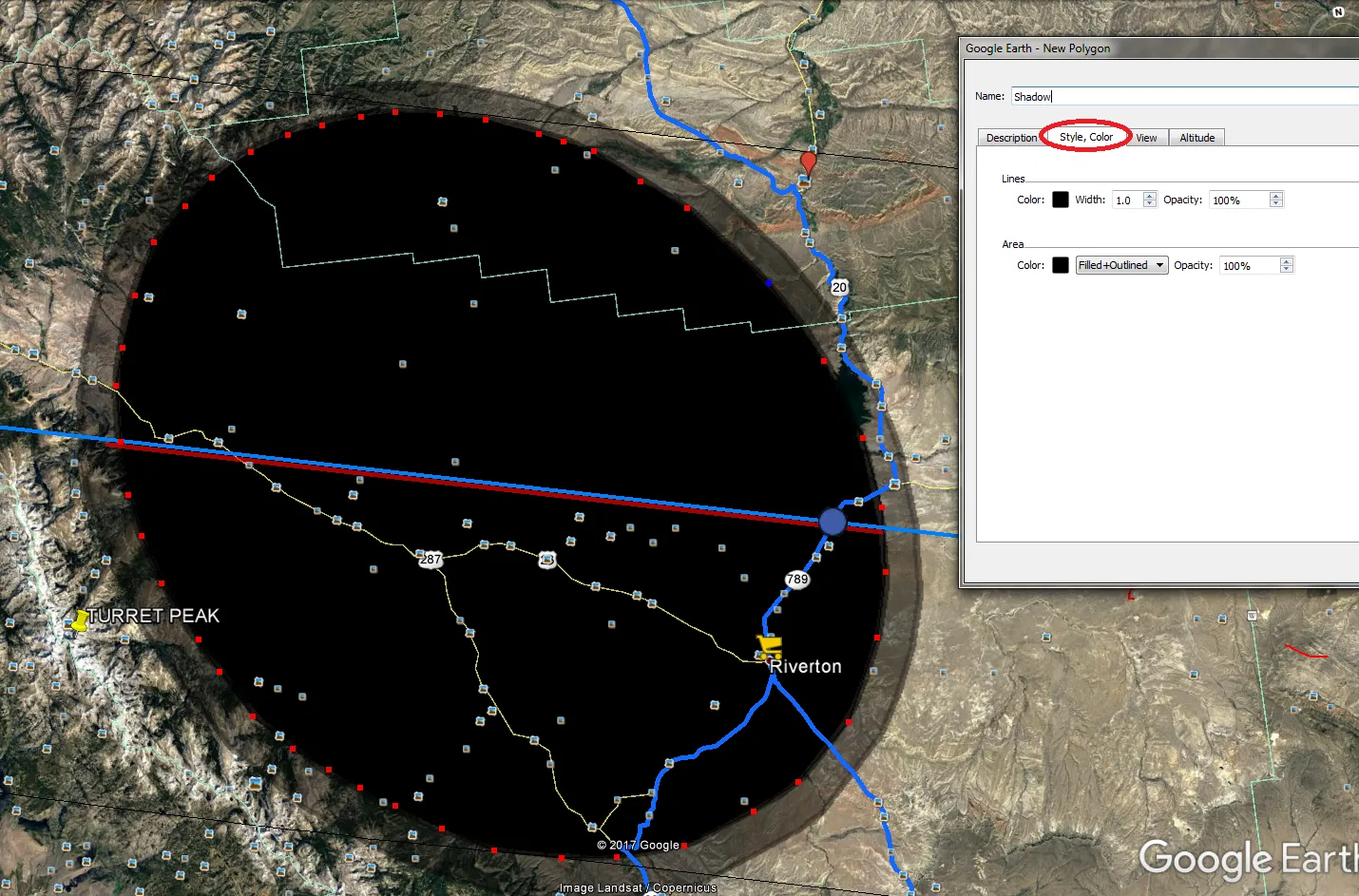
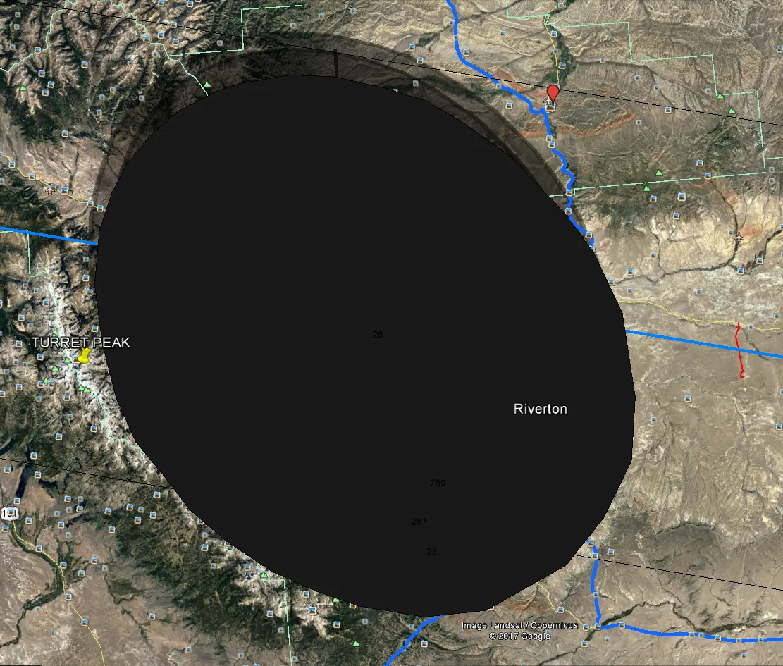
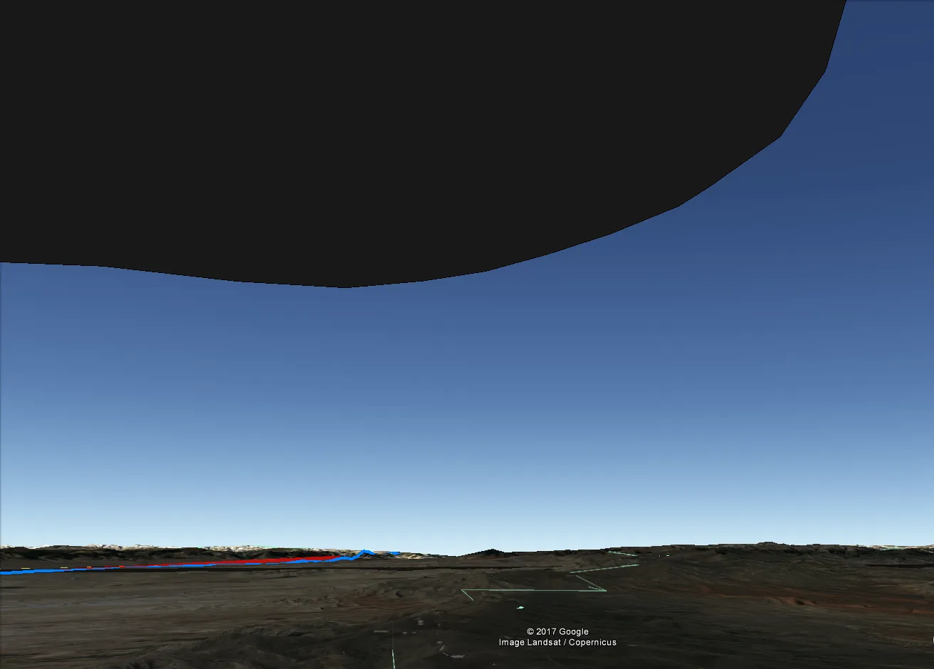
- Go on your newly created umbra in Google Earth and sketch out exactly the same one making it completely dark. I put 100% opacity for mine. Repeat the process in the case of the grazing zone to make it slightly more transparent (I put 50% opacity for my one) (pic.16 – 17).
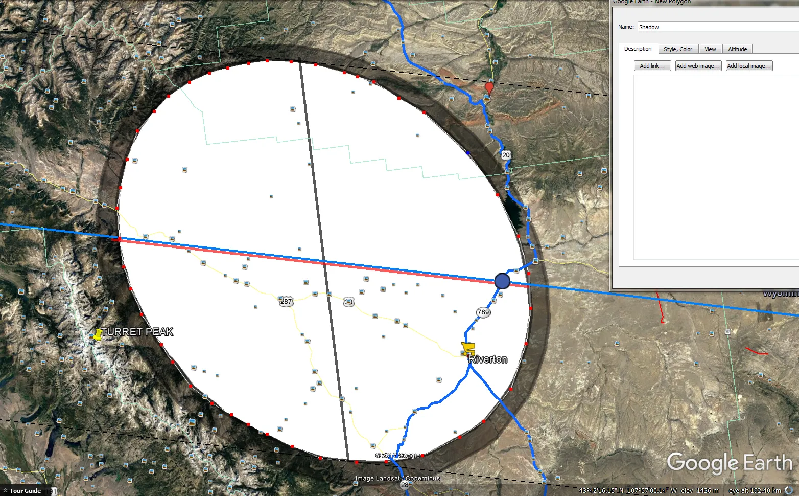
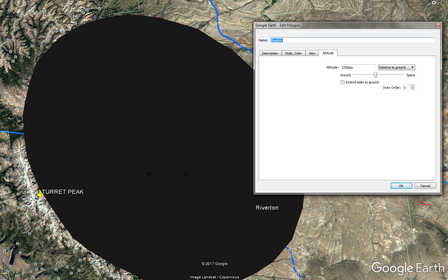
2. In the altitude, section select the “Relative to the ground” option and put the value 27500 m on the left. Do the same for the grazing zone layer (pic. 18).
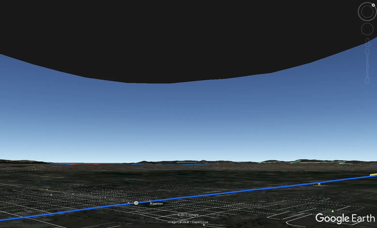
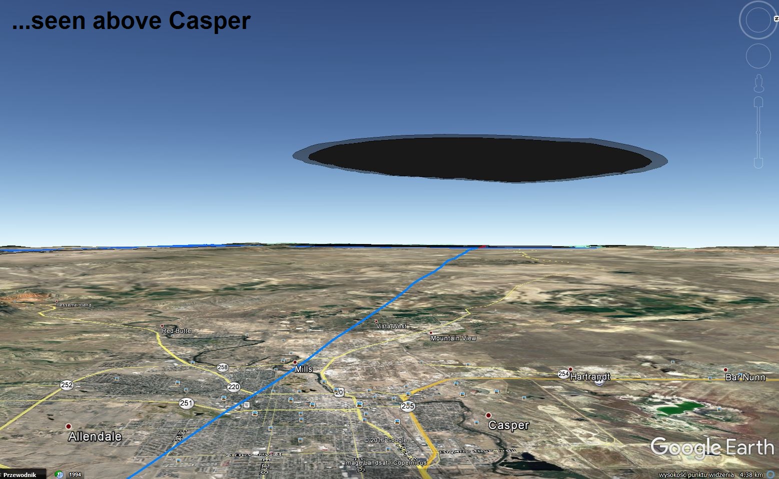
3. Now you can enjoy your full total solar eclipse simulation with an umbra both on the ground and in the sky. You can obviously zoom in and out, however when you have both “shadows” created the best way to see the virtual eclipse phenomena is by looking from the ground level. You must be aware that this model is simplified. We are taking into account the situation when the eclipsed Sun is shining in the zenith. Those situations are very rare.
Way 2
To prepare a more realistic visualization of the “sky” umbra you need to:
- Know about the azimuth and height of the Sun at the moment of the total solar eclipse. For Casper, it will be accordingly 140 deg and 53 deg.
- Use the trigonometric functions for the calculation (tangent only) (pic. 21) and calculate the proper value.
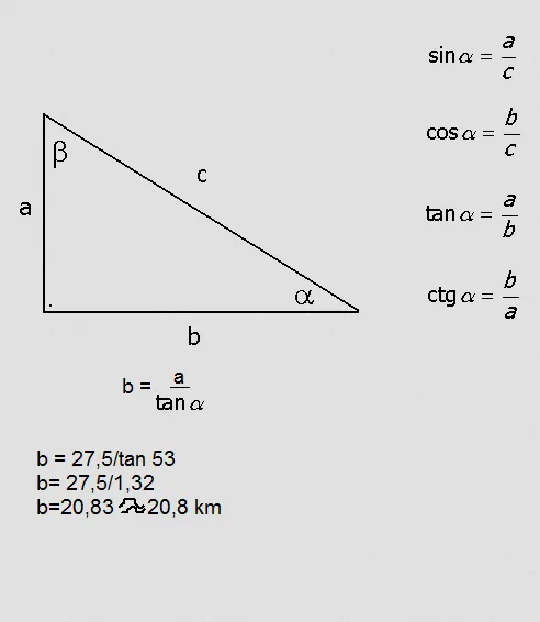
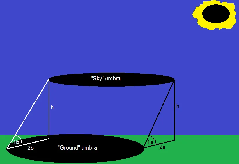
Taking into account the Sun’s height above the horizon in Casper during the totality (53 deg) we can guess, that the Sun’s height will be around 52,5 degrees (1a) on the southeasternmost edge of the umbra and around 53,5 degrees (1b) on the northwesternmost edge of the umbra. This 1-degree difference lies in the diameter of the umbra – around 110 km (on Earth every degree of longitude falls around 111 km). Knowing the Sun’s height above the horizon in both cases we can calculate the distance from the “ground” umbra edge, where the “sky” umbra edge will be seen at the zenith. In both cases, this area will be southeast of the edge of totality, due to the sun’s position. For the south-east area, the “sky” umbra will be seen in the zenith around 20,5 km outside the edge of totality (2a) unlike to opposite place, where the Moon’s shadow in the sky will be seen in the zenith around 21,4 km inside the edge of “ground” umbra (2b). There are mathematical wonders only. Unfortunately, I am a person, who has not ever seen the totality. I am basing my knowledge on the YouTube footage only for this time being.
3. Your calculated value given in km allows you to carry on the process in the Scribble Maps. First, lead the line bearing on the Sun’s azimuth on the calculated distance of around 21,4 km (pic. 23).
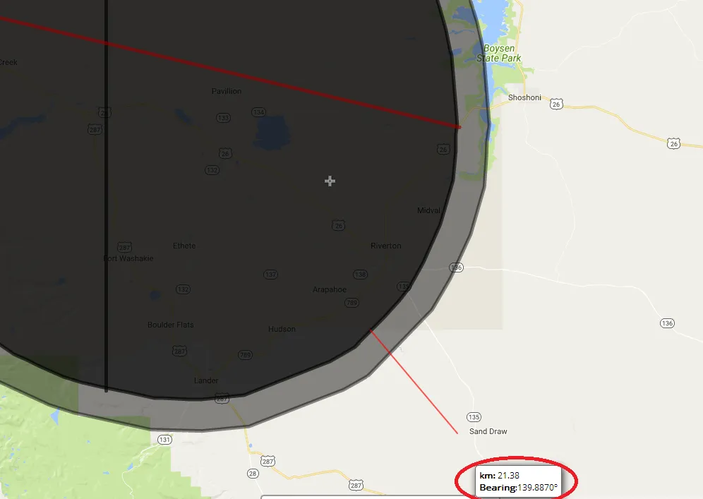
4. Drag your “ground” umbra towards the Sun azimuth at the moment of the total solar eclipse for the value in km, that you counted before (pic. 24). You don’t need the mid-eclipse and the centerline. Remove it, making your shape simple.

5. Once you do it change the color of your new “umbra” to avoid a mess in the next step in Google Earth (pic. 25).
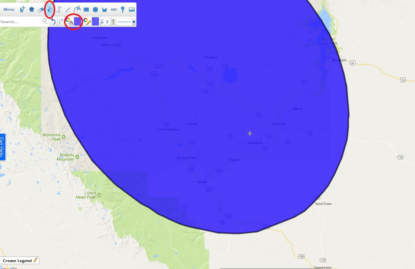
6. Save your newly located shape as a .kml file and open your Google Earth software.
7. Do the same thing with your shape as described above (way 1 point 2).
8. Now you can enjoy the entire visualized phenomena. If you decide to make the animation remember to repeat your measurements for at least an umbra-long distance to adjust the correct position of the Sun.
I presented the painstaking method of visualization of the total solar eclipse. I am deeply hoping that my work will influence the spectrum of the solar eclipse computer software and someone will use my idea to prepare some eclipse program based on Google Earth, that will enable everyone to make this kind of visualization automatically.
Mariusz Krukar
Links:
The dip of the horizon calculation


Hi, constantly i used to check web site posts here early in the daylight, for the reason that i
like to find out more and more.
Hi,
I am going to develop the solar eclipse issues, based on my last observation in 2017. The articles soon, for sure before the 2019 totality 🙂