Scientific report of March 29, 2025 partial solar eclipse
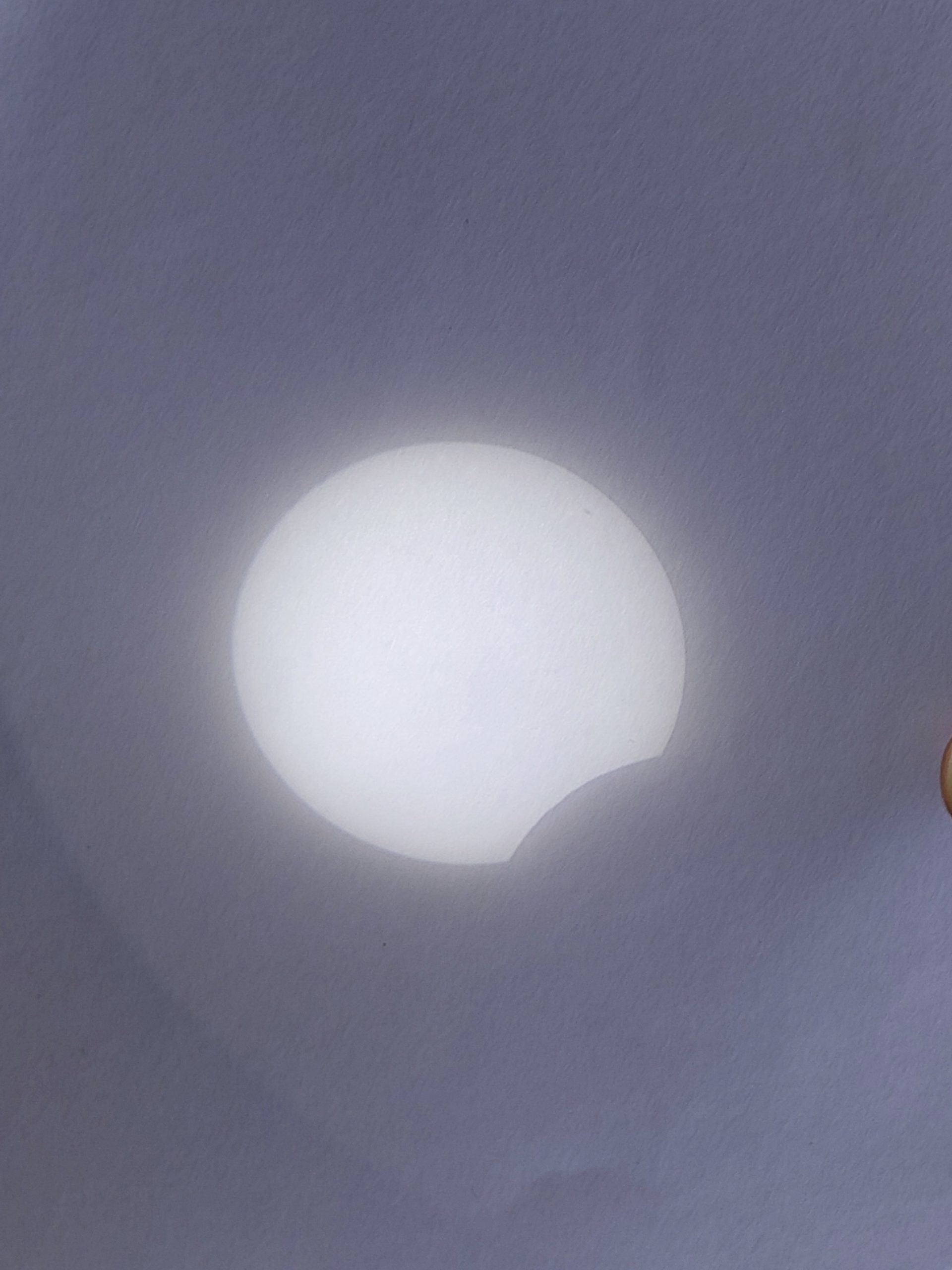
We are over a month ahead of the last partial solar eclipse on Saturday, March 29, 2025. It wasn’t a big eclipse in most European countries. Because of the largest magnitude of 0.9376, this eclipse was classified as a deep partial. Considering the Gamma factor 1.0405, the totality was visible about 210 km above the … Read more