How to show the coordinate grids in Google Earth and Google Maps?

Google Maps MGRS

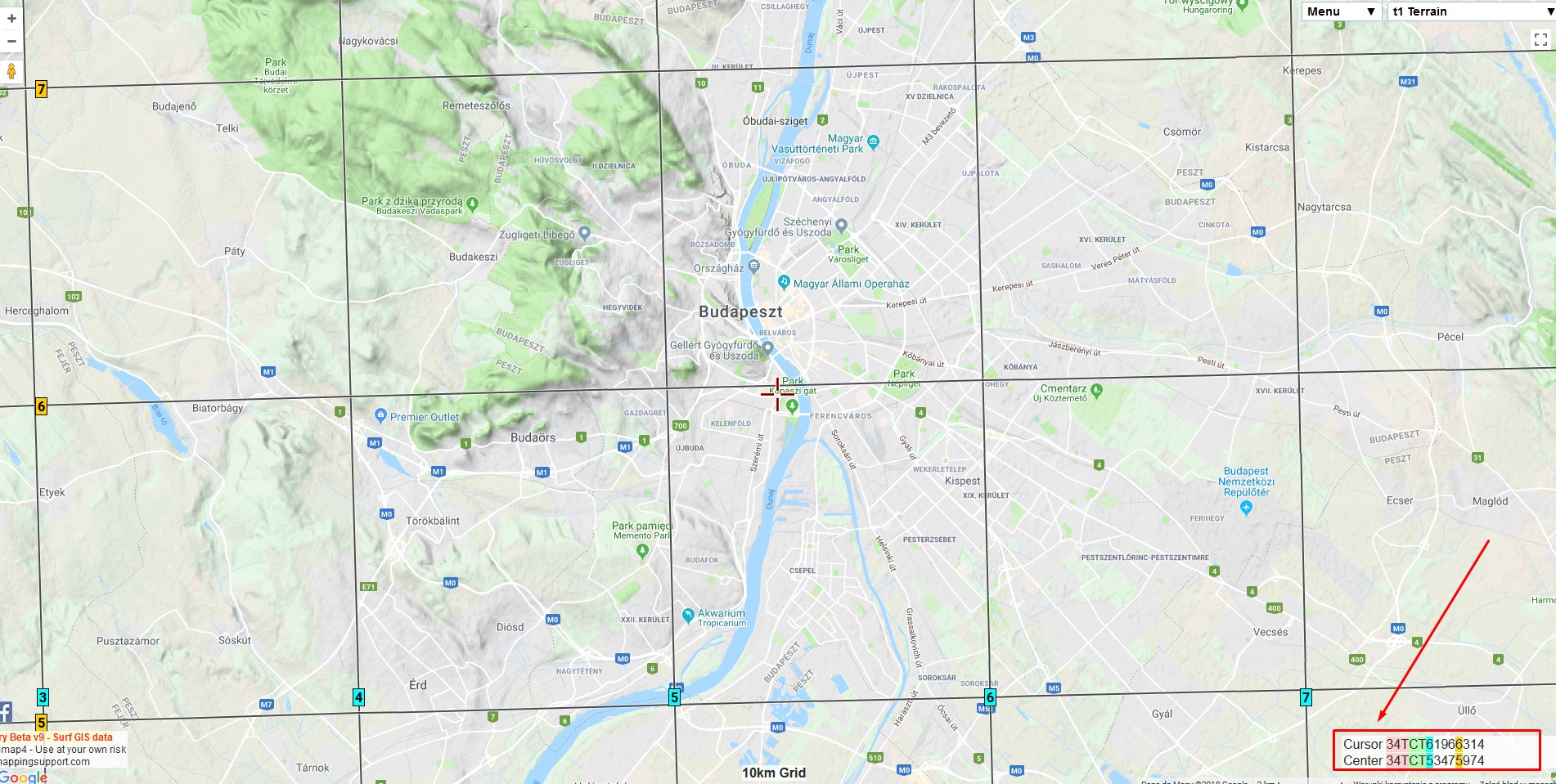
There are a few ways to show the coordinate grids on Google Earth. The easiest way to show the coordinate grids in Google Earth is to select “Grids” from the “Tools” options. Then you will have full zoomable coordinates grid cover (Pic 1 – 3). The default coordinate system bound to Google Earth is the … Read more

Using Heywhatsthat.com to generate a multiple summit-perspective views in Google Earth – part 2

Heywhatsthat multi-summit panorama2

In this part of the article, I would like to say more about multiple summit-perspective views in Google Earth. First of all, previously I have described largely how to manage the heywhatsthat.com panoramas in Google Earth. Now you will see how to put a few summits into your Google software and manage them correctly. Let’s … Read more

Using Heywhatsthat.com to generate a multiple summit-perspective views in Google Earth – part 1

Heywhatsthat multi-summit panorama

Google Earth has been widely used in geography and GIS. Previously I showed you how to simulate a flood and total solar eclipse path in this tool. There are not only things, that I am going to show you over the forthcoming months. First of all, Google Earth is one of the programs, that I … Read more

Total solar eclipse vizualisation on Google Earth, part 2

Solar eclipse visualization Google Earth

<<< Read the 1st part of The solar eclipse visualization on Google Earth In the 1st part of this article, I showed you how to create the “umbra” in Scribble Maps and use it in Google Earth as a .kml file. Here I would like to demonstrate step by step how to create a pretty … Read more

The flood simulation in Google Earth

Flood simulation in Google Earth

Introduction Google Earth is a handy tool to browse terrain in any part of the globe. Due to detailed satellite imagery, you are able to characterize the interesting area in any line of geographic research. Nowadays 3D quality imagery manages to develop across the World, especially in the most populated areas. The 3rd dimension of … Read more