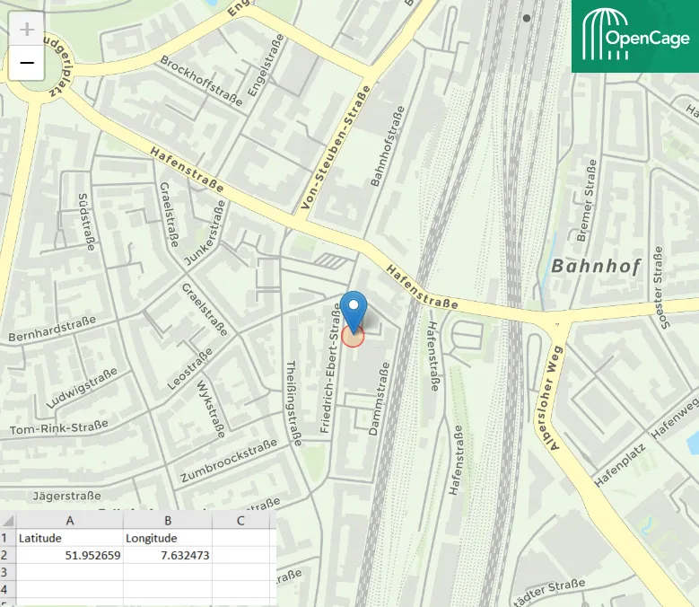
Opening Google Street View in VBA Excel

Open Street View from Excel

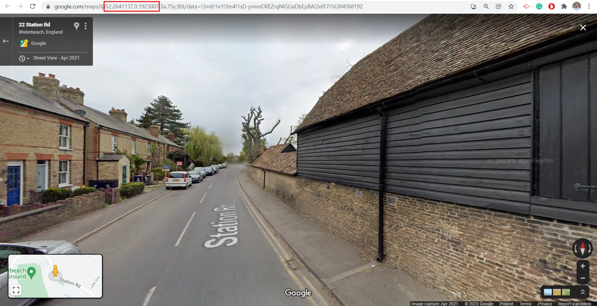
Opening websites programmatically at their certain addresses is quite a straightforward thing regardless of the programming language. Previously I dealt with launching Google Maps from the Excel document with the Google Chrome browser.  Now I would like to explain to you briefly the option, which allows you to open the Street View image anywhere you … Read more

Original Street View colors without Google API Key

Street View colour inversion

Street View is a good tool, which can be incorporated into your own interactive maps like Leaflet or OpenLayers. Unfortunately, since 2018 Google hasn’t served it for free. In turn, the Google Maps products can’t be set up properly, because you can see the “For development purposes only” information along with the poor quality of … Read more

Saving Openlayers custom drawings as the .geoJSON file

OpenLayers custom drawings

In this short post, I would like to demonstrate to you the programmatic method of saving the custom shapes in OpenLayers as the .geoJSON file. Drawing your own features on the OpenLayers map canvas equipped with some existing layers, like it takes place in the case of the map rendered by the QGIS2Web plugin can … Read more

Batch styling of KML files in Google Earth

Batch styling KML files in Google Earth

Probably you used Google Earth many times, watched at least a few tutorials, and tried to manipulate some files by yourself. On the Web, you can find many sources, where the process of creating some simple elements in Google Earth is explained. Besides the drawing features, Google Earth can be a place where a user … Read more

Clever way of batch converting Latitude/Longitude to Ordnance Survey XY in Excel

Converting Lat/Lon to OSGB in Excel

The Ordnance Survey grid conversion is usually required when dealing with some projects across the UK. Usually, along with the standard WGS 84 datum, we need to define X (Easting) and Y (Northing) coordinates. This task might be quite time-consuming when converting our locations one by one. Fortunately, we have some tools, which can do … Read more

How to capture any interactive map larger than screen easily?

Capturing the map larger than screen

There are a few nice tools, which help you to get your map larger than the screen of your desktop. However, all of them are predominantly focused on Google Maps, which is the most popular interactive map platform. If you want to have your Google Map bigger than your screen, even up to 12000x12000Px resolution … Read more

How to display your KML file on Google Earth with the map tile layer?

OpenStreetMap in Google Earth Sierra Nevada

Google Earth is a handy tool, which includes much information. Most of this information can be shown as the layer overlaid on the satellite imagery covering our virtual globe. These layers can be displayed along with our own .kml files plotted into our area. The layers built into Google Earth are not sole. The user … Read more

Bulk text field name changes in multitude of KML files without programming knowledge

Bulk text name changes in KML files

In this thread, I would like to describe a swift method, which allowed us to make some changes within the .kml files. I am focusing on the names of columns inherited from the .shp files, although the described method can be applied to other texts and even some values too.  What is most important, we … Read more

Good way to sanitizing a bulk address list, part 1 – Excel & VBA

Sanitizing addresses in Excel

When you work with any Excel data, probably you experienced sometimes, that the spreadsheet input looks messy.  I personally deal with the address data predominantly, which you could notice by reading my previous articles about geocoding and reverse geocoding.  What is the most fun here, even the reverse geocoding results can bring confusion to our … Read more

QGIS2web legend & scale and other elements in OpenLayers map library

QGIS legend and scale edits

Legend and scale besides the pop-up window and labeling is another important map element, which everyone wants to have clean and tidy. In this shorter (I hope) article I want to explain to you how to customize the legend for your OpenLayers map generated by the QGIS2web plugin and add some relevant elements like a … Read more

Reverse geocoding in Excel without loosing money

Reverse geocoding in Excel

The previous 3 articles concentrated on the geocoding process in Excel for free. I considered the Google Sheets option and also the VBA Excel tools applicable to Bing, Nominatim, and others. Now it’s the best time to explain the process from another way around. Sometimes we have a situation when reverse geocoding is more needed … Read more

Creating your own speed limit map in QGIS and showing it interactively in Google Maps

Recently I showed you how to collect the speed limit data about the specified section of the road. It’s obviously a huge step toward the speed limit map preparation.  Reading the last article you got to know some examples of beautiful and very useful speed limit maps. In this reading, you will get knowledge about … Read more

The costless way to geocoding addresses in Excel – part 3, bulk data geocoding with Nominatim and other geocoding tools

Nominatim address geocodinmg Excel

The 3rd part of this vast article about geocoding is slated for discussion about another free geocoding tool for MS Excel, namely the OpenStreetMap Nominatim geocoding and other remaining tools, which could be worth attention. NOMINATIM GEOCODING TOOL The usage of this small tool is very simple, even simpler than Bing Maps API geocoding, however, … Read more