5 fantastic tips & tricks for the Ulrich Deuschle panorama generator

Udeuschle blueness of the horizon

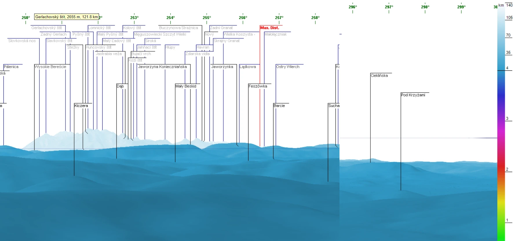
If you are interested in long-distance observations or simply panoramic views from some location, mainly mountain peaks or hills, you should have heard about the Ulrich Deuschle panorama generator. This is the web-based tool, which in 2010 successfully superseded its predecessor – Kashmir 3D software, which was based on simple digital elevation model (DEM) files … Read more

Using Heywhatsthat.com to generate a multiple summit-perspective views in Google Earth – part 2

Heywhatsthat multi-summit panorama2

In this part of the article, I would like to say more about multiple summit-perspective views in Google Earth. First of all, previously I have described largely how to manage the heywhatsthat.com panoramas in Google Earth. Now you will see how to put a few summits into your Google software and manage them correctly. Let’s … Read more

The flood simulation in Google Earth

Flood simulation in Google Earth

Introduction Google Earth is a handy tool to browse terrain in any part of the globe. Due to detailed satellite imagery, you are able to characterize the interesting area in any line of geographic research. Nowadays 3D quality imagery manages to develop across the World, especially in the most populated areas. The 3rd dimension of … Read more