

Now is not the best time for traveling around the world, because it’s restricted due to the coronavirus outbreak worldwide. Nevertheless, if our life is affected by a pandemic or not, this type of sightseeing always has pros.
1. REASONS FOR TRAVELLING & SIGHTSEEING FROM HOME
The rudimental reason for it is the preparation for the trip, which we are dreaming about or planning to go for in the foreseeable future. Looking at the pictures, often the spherical ones, where you can literally “turn around your head” and get as much around as you can from the given place. Apart from gathering information from our future trip, remote sightseeing causes other reasons:
– willing to know some places in the world, that we can’t visit right now or in the nearest future
– broadens and confirmes our geographical or historical knowledge, which is often previously based on the various knowledge from assorted scientific or popular papers, magazines, books, guides, etc
– convenient analyzing of the local environment circumstances in real-time (webcams)
– willing to get to know the wide natural phenomena, which happen around the globe from time to time (earthquakes, volcano eruptions, severe weather, and so forth)
2. FORMS OF TRAVELLING & SIGHTSEEING FROM HOME
There are a few wonderful forms for doing sightseeing without leaving home. I would like to describe all of them, giving you the most useful links and advice.
Street View
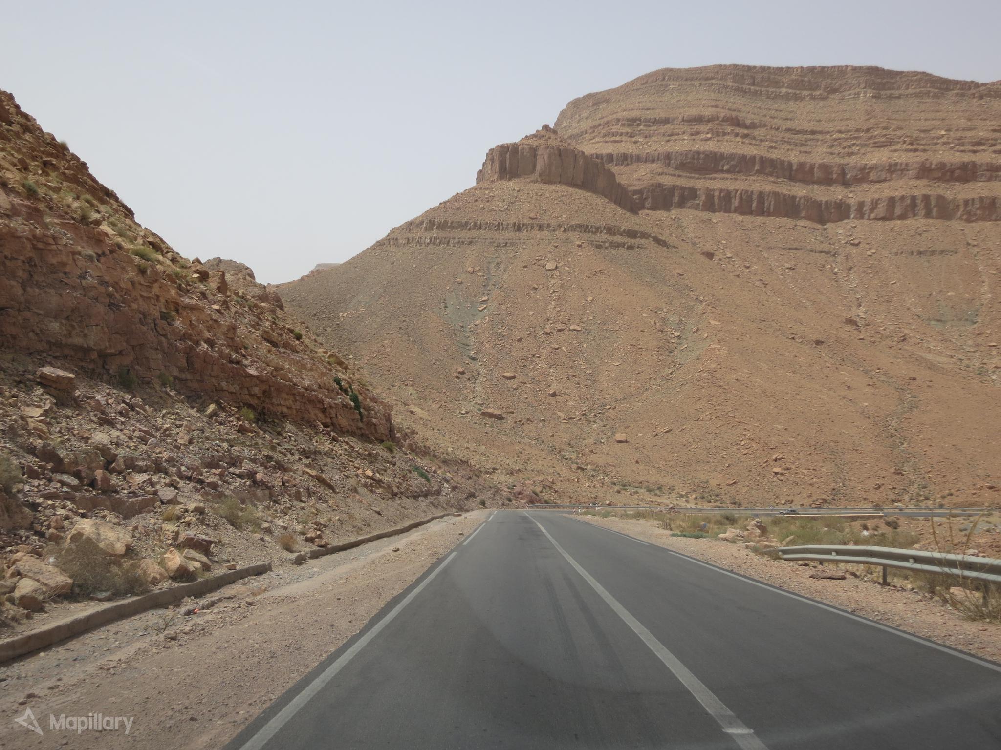
There is no brainer, that Street View is the best tool so far, enabling us to become the virtual tourist with 360deg views around. The Street view is a “virtual interpretation of Google Maps”, where a user, who has millions of spherical images bound together into long routes or single places can easily get around. Google Street View has 2 ways of sourcing – Google Inc. and single contributors.
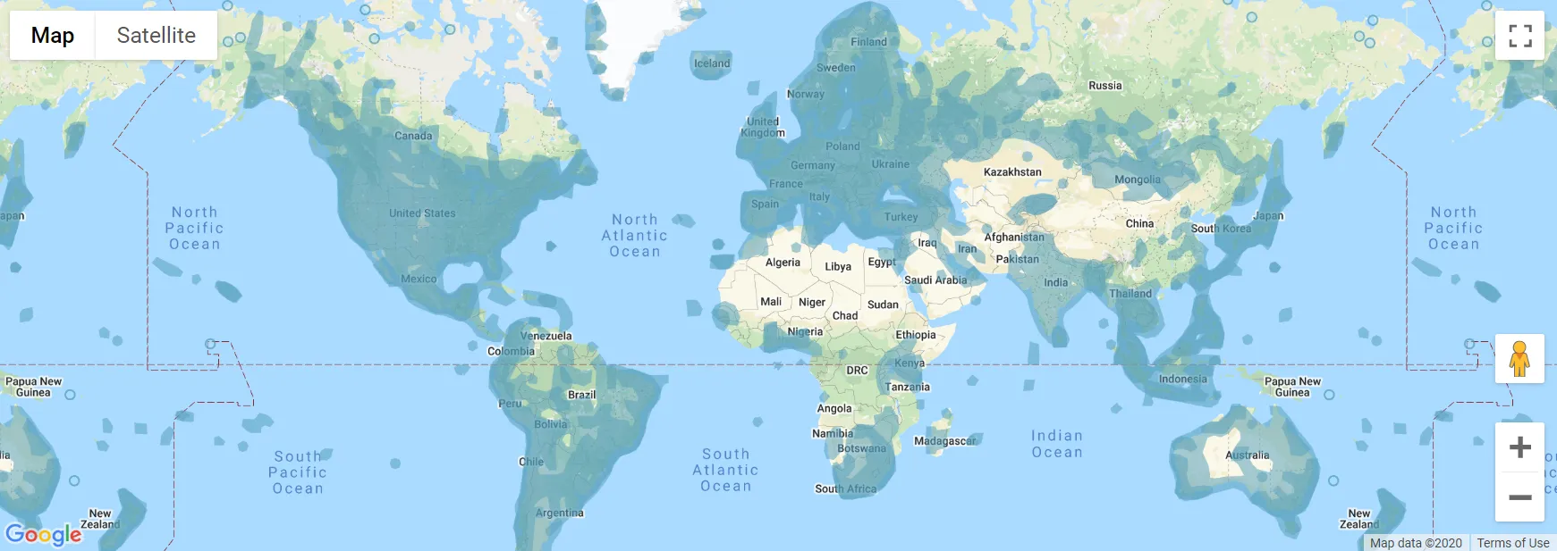
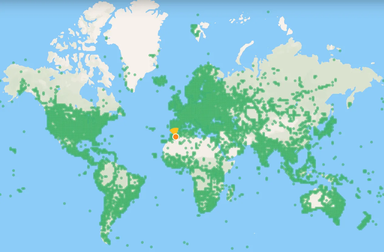
The feature is constantly developed and actualized, which can be easily found here. The general map of current Street View coverage is quite impressive. We have two of the third part of the World with an option to take a look in (Pic. 1).
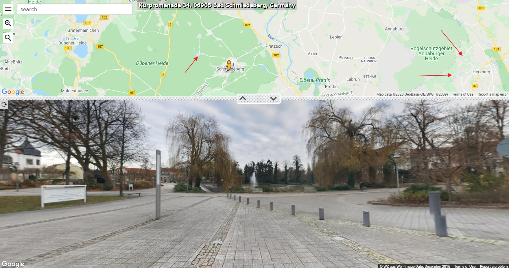
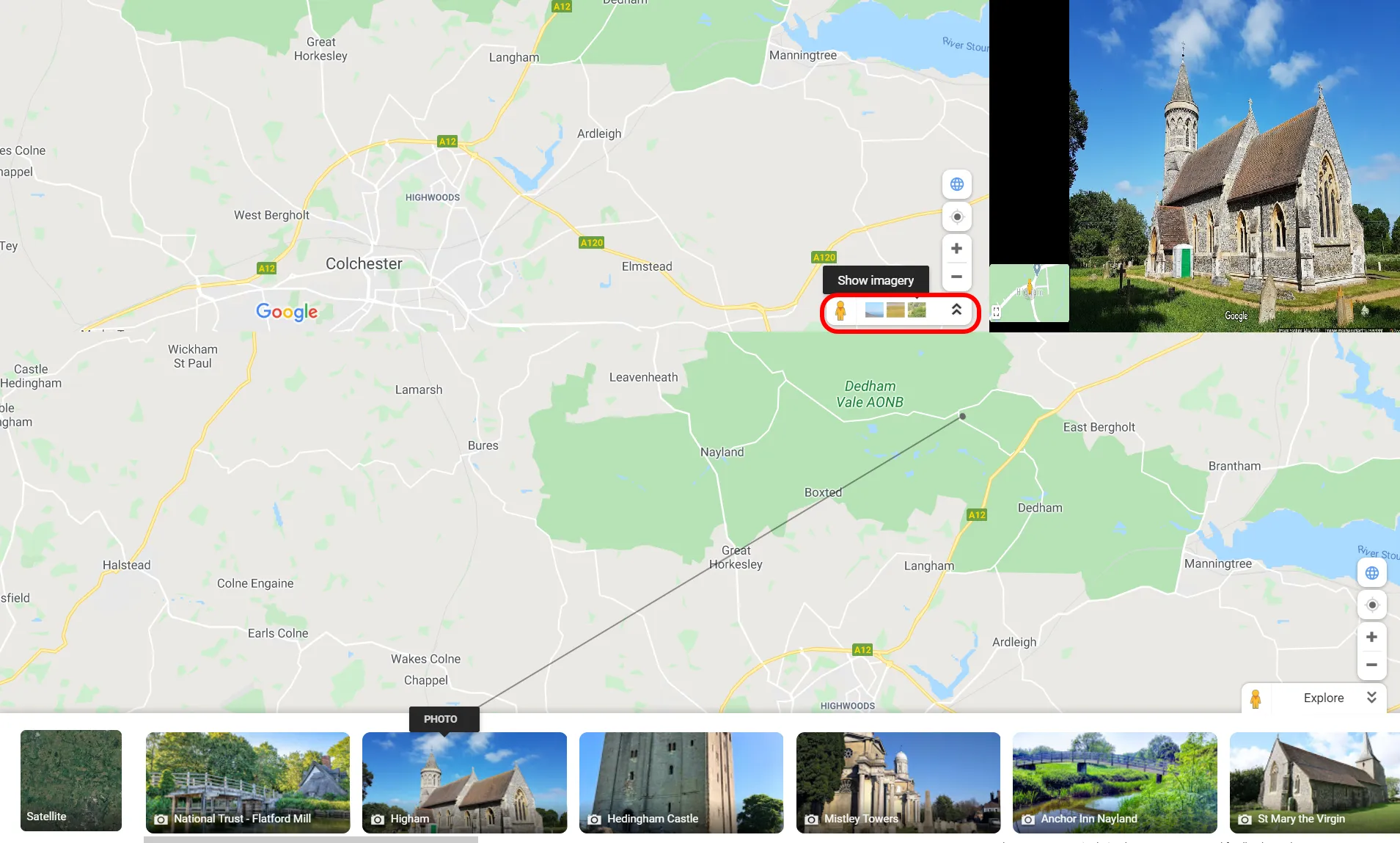
The usage of Google Street View could be better I think. This is driven by the upper limit of zooming out and lack of toggling between Google Maps (showing the Street View layer coverage) and Street View imagery (Pic. 2).
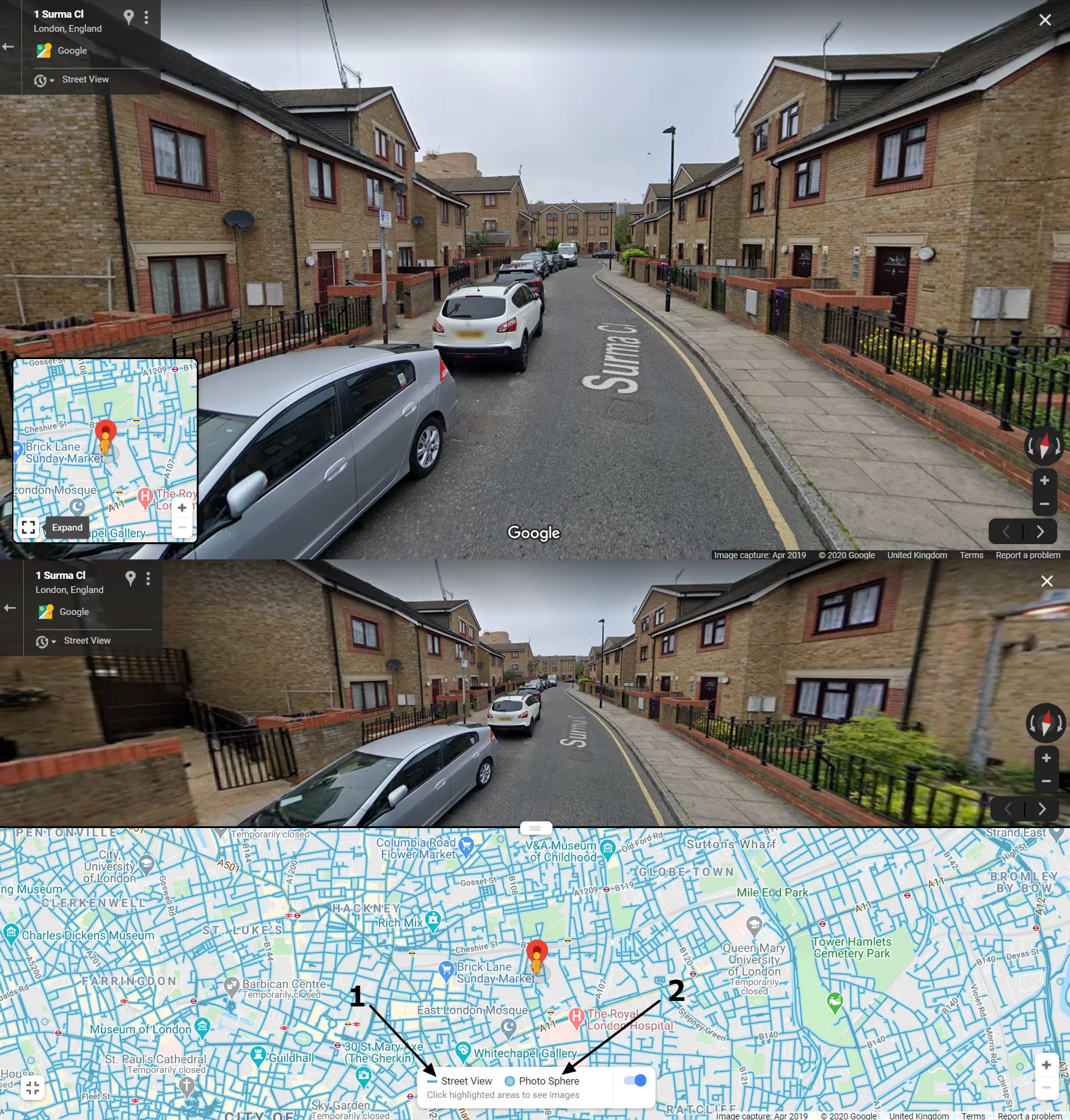
Moreover, the map is collapsed initially, and not everyone realizes, that we can expand it (Pic. 2), by clicking on the gunpoint at the bottom left corner (showing “Expand” after hovering.
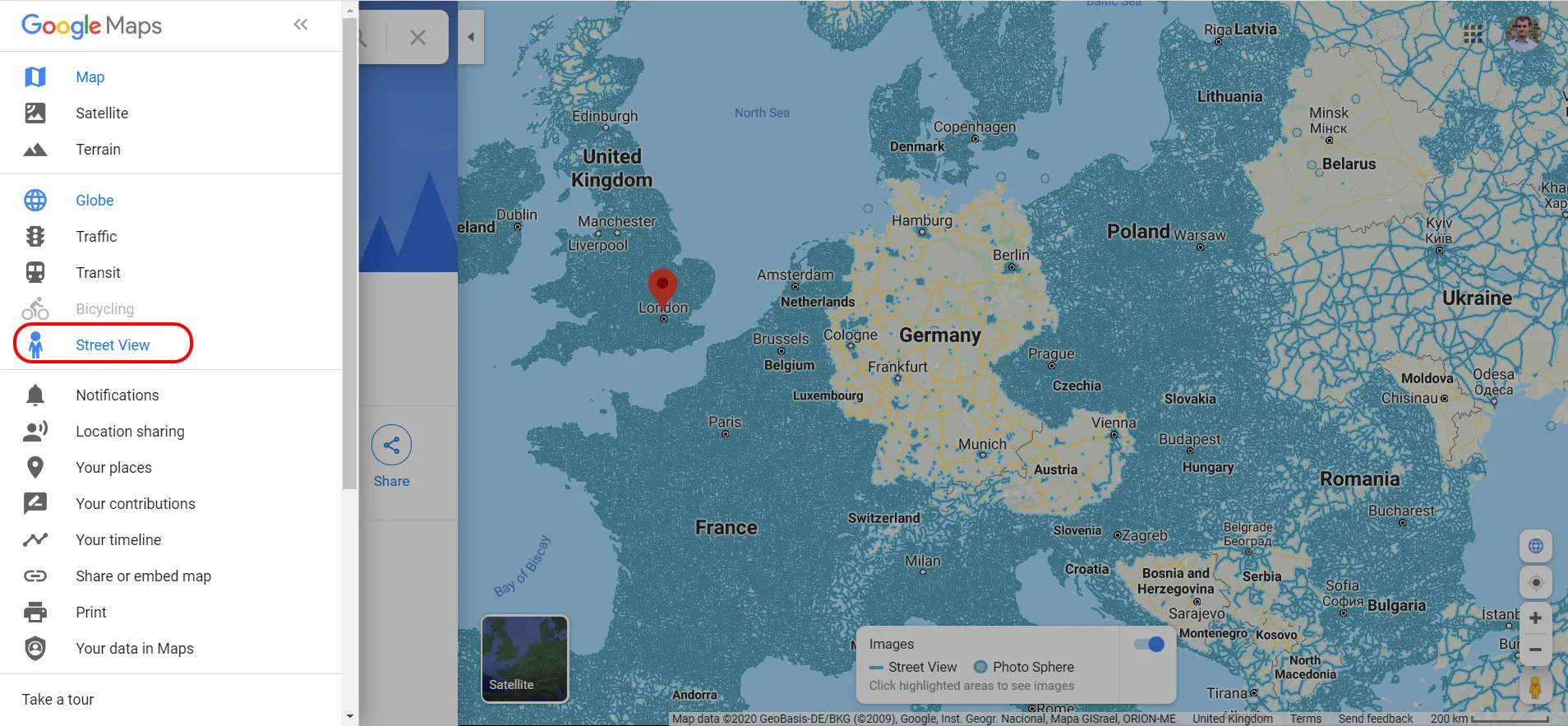
Alternatively, you can switch on the “Street View” layer from your main Google Maps sidebar (Pic. 3). It will help you only to see the worldwide coverage, but when you drop your pegman somewhere on the street, the result will be exactly the same as above.
This is not a problem since the official Google Street View page is not the only one, we can find on the web. There are other services, based on Google Street View, where the navigation appears to be more convenient unless we use it just not exclusively for pure sightseeing purposes. In that case, the main Google Street View offers all of the handy options like sharing, embedding, directions, etc.
Staying with only one exercise, which is dropping our pegman to the specified location, and seeing its coverage first, the best way is to apply Google Street View from other sources, which are listed below:
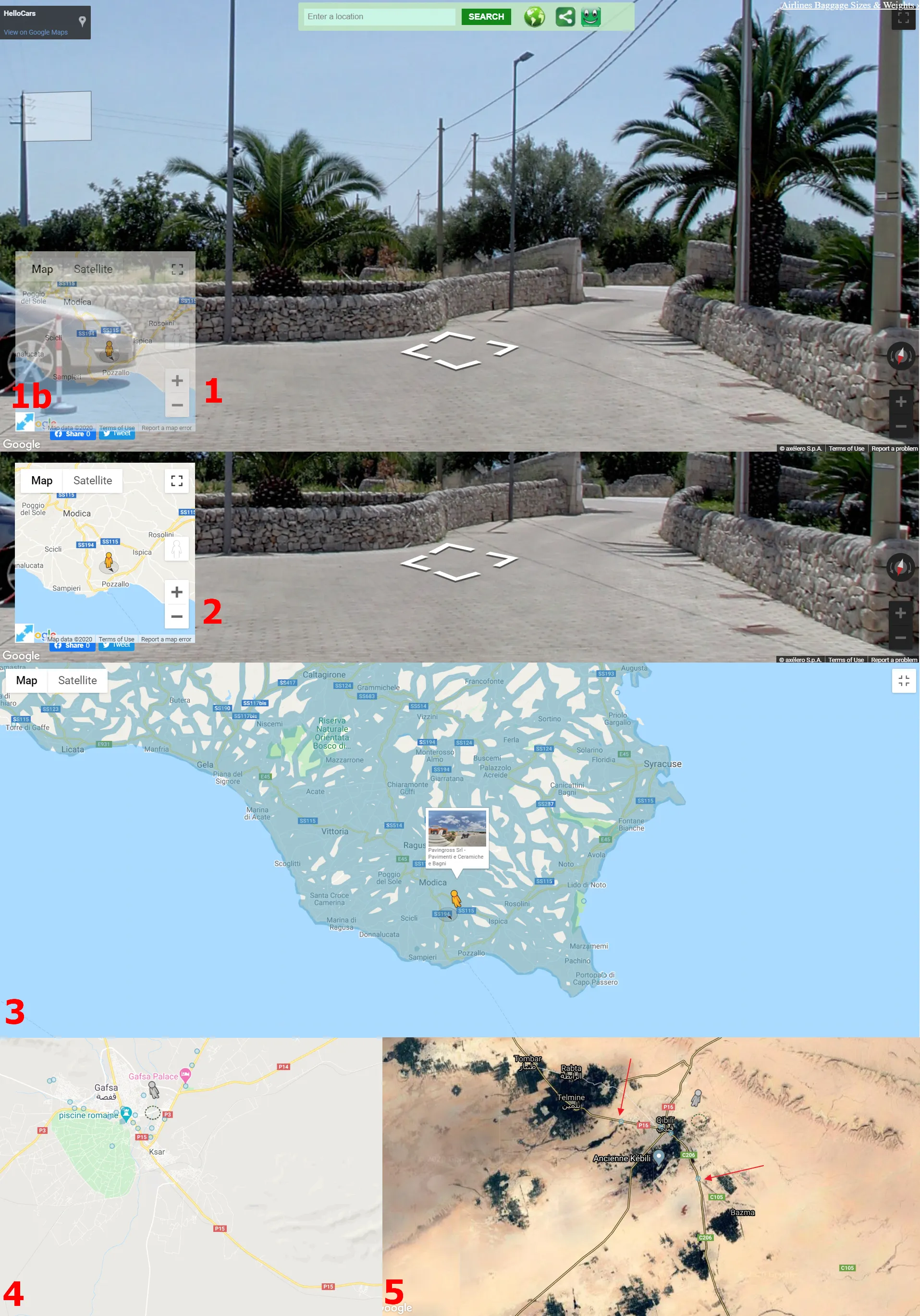
A. Showmystreet.com – the service, where you type the location, and the tool instantly redirects you to the Google Street View available there (Pic. 4).
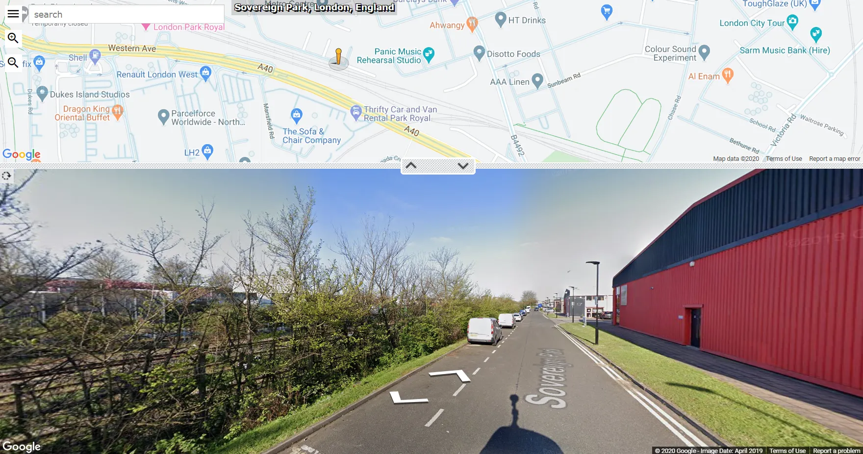
You can zoom out your map even down to level 0, showing a whole world, unlike on the main Google Street View page.
Moreover, it’s easier to find the coverage, because you don’t need to grab the yellow pegman and drag it above the map, as you used to do on Google pages. This pegman is already placed on the map. Both the Street View and Photosphere are visible at once. The major demerit of this tool is the relatively weak color, which can make area recognition more difficult (Pic. 5).
The arrows in the middle are tailored for easy dragging between the Street View sphere and Google Maps.
B. InstantStreetView.com – very similar to the previous one. You can have almost a full-size Street View image when you hide your map thumbnail (Pic. 6).

C. FastStreetView.com – another good tool, although you cannot get the full screen with Street View, because of the annoying advert placed at the top right corner, which encases the toggle of the full-screen mode (Pic. 7).

If you install the Adblocker plugin, then this annoying advert is gone, and the service looks really nice (Pic. 6). You have easy access to the toggle the full-screen button, which is placed exactly there. On top of that, the view is smarter I believe, as your thumbnail Google Map remains as a watermark, unless you hover it (1), or hide it completely (1b). On top of that the Street View coverage color is stronger, which gives you a way to chase some photospheres and routes even in satellite mode (Pic. 8). The one problem here can be the address at the top left, which is sometimes very dubious.
These services described above are not the only ones, that can show us Google Street View, but I believe they’re the best.
Apart from typical Google Street View imagery, we can try to reach the services, catching the most interesting or the funniest images captured by Google.
Google Street View is not the only one, which we can use for remote traveling. This is undeniably the best platform for virtual panoramas, which is unparalleled. Nevertheless, the lack of coverage in less developed countries makes it not often as paramount as it could be. I do not mean i.e. the Bing Street view, whose coverage isn’t big, but mostly the neutral platforms, where the coverage depends on the individual user’s contributions.
The list of other Street View platforms operating worldwide you can find below with a short description too:
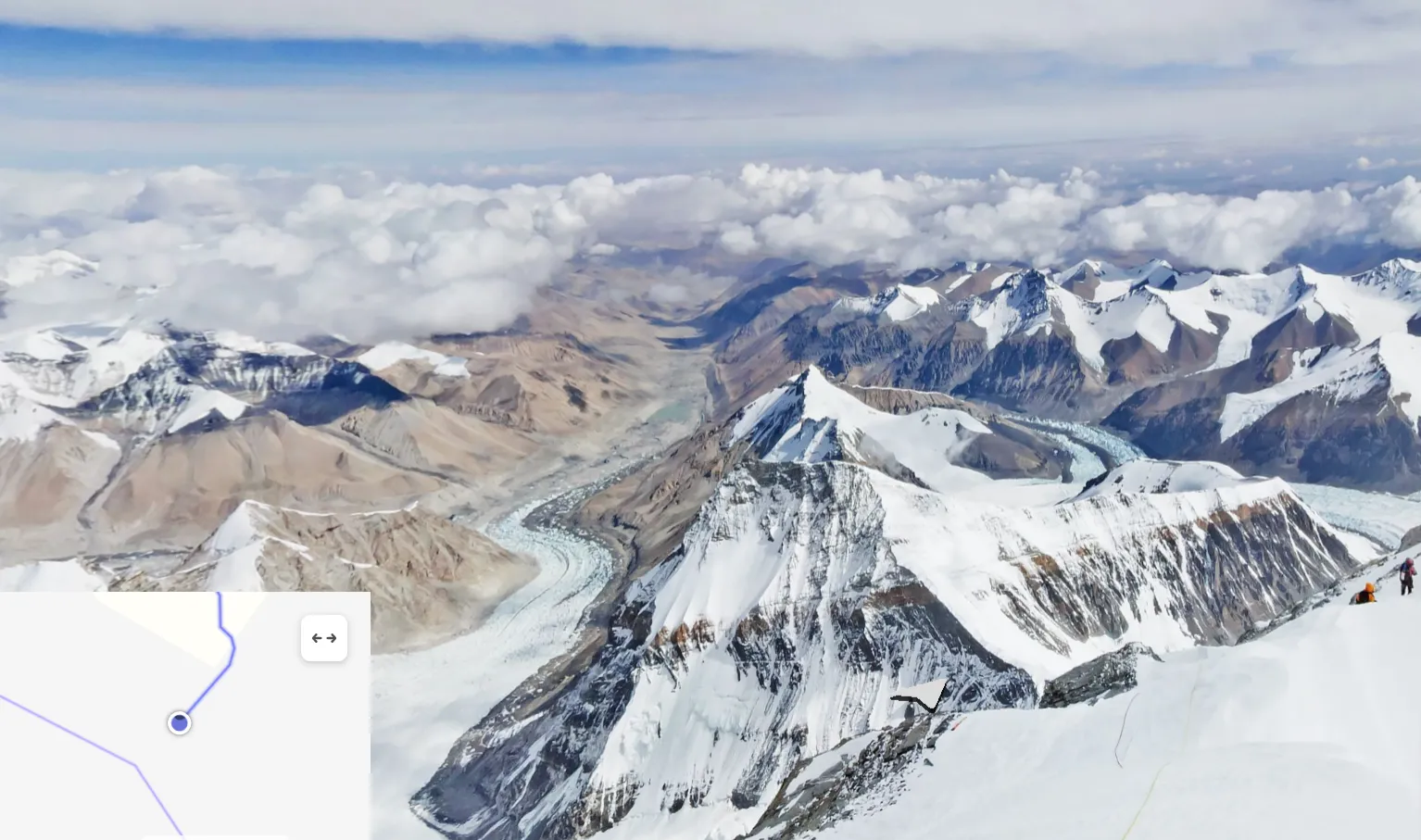
1. Yandex Street View – is an accurate counterpart of Google Street View. It can be really useful for all post-soviet countries, which Google hasn’t reached so far, but mostly for metropolitan areas (Pic. 8). There are obviously some exceptions from it, such as the Street View route on the top of Mount Everest, captured in 2016 (Pic. 10).
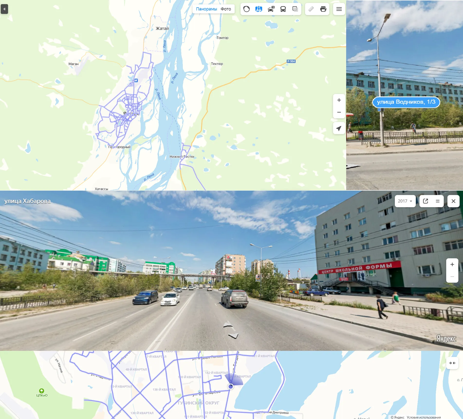
Another feature of the Yandex street view is an address label, which can be seen a front of the buildings.
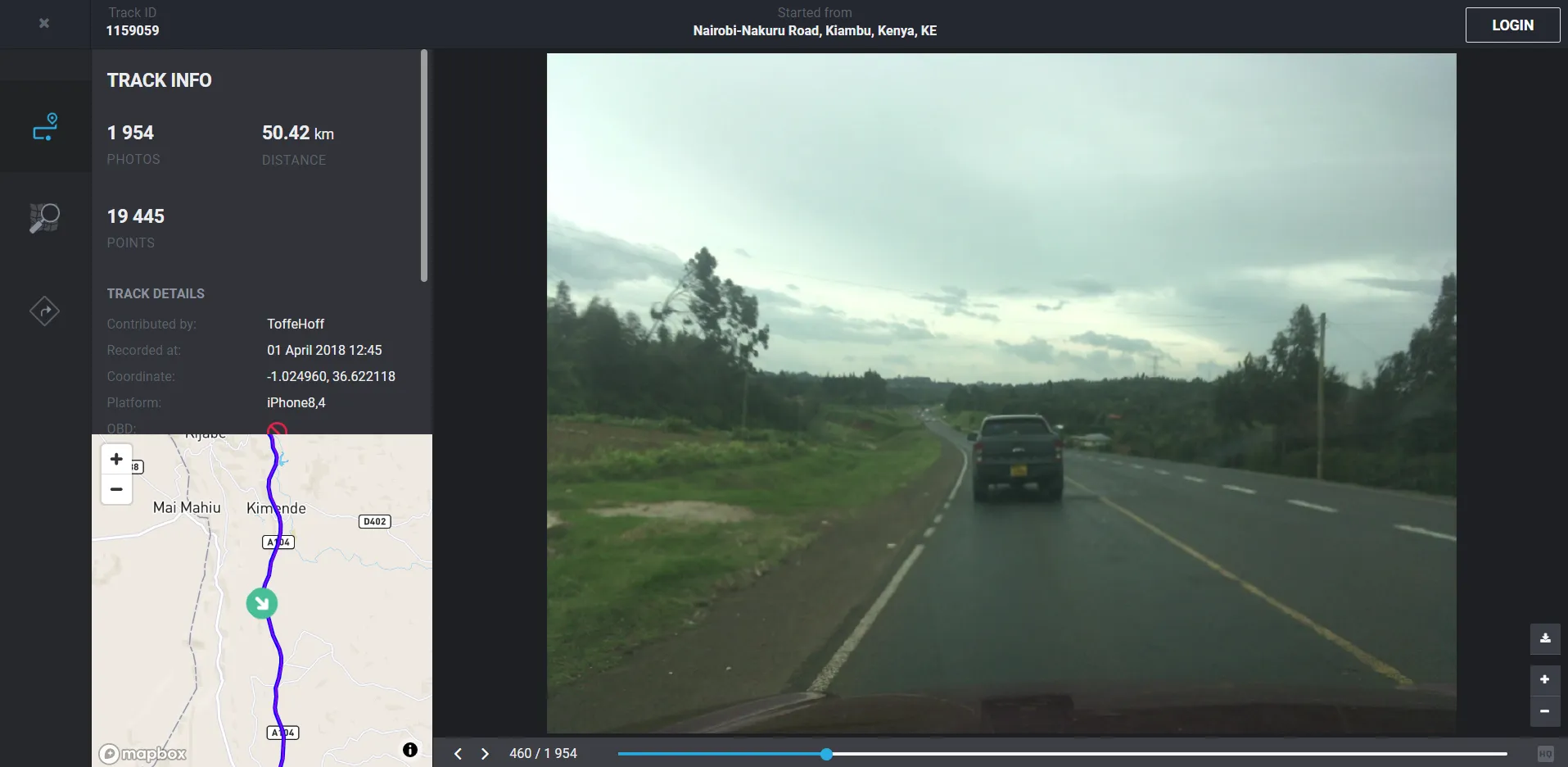
2. OpenStretCam.org – unlike Yandex, Bing, and Google StreetView this street-level imagery platform offers images in one direction only. These directions are obviously driving directions. Photos apparently come from the dash cams mounted on the windshield (Pic. 13). It’s still something, which can help, especially in the countries, which haven’t seen the spherical imagery at all (Pic. 12).

The biggest attitude of this platform is the easy way to download every image. You can do it after simply clicking on the download icon, located at the bottom right above zoom options.
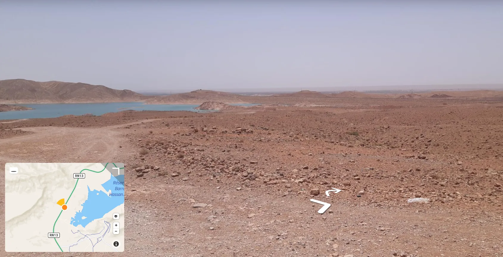
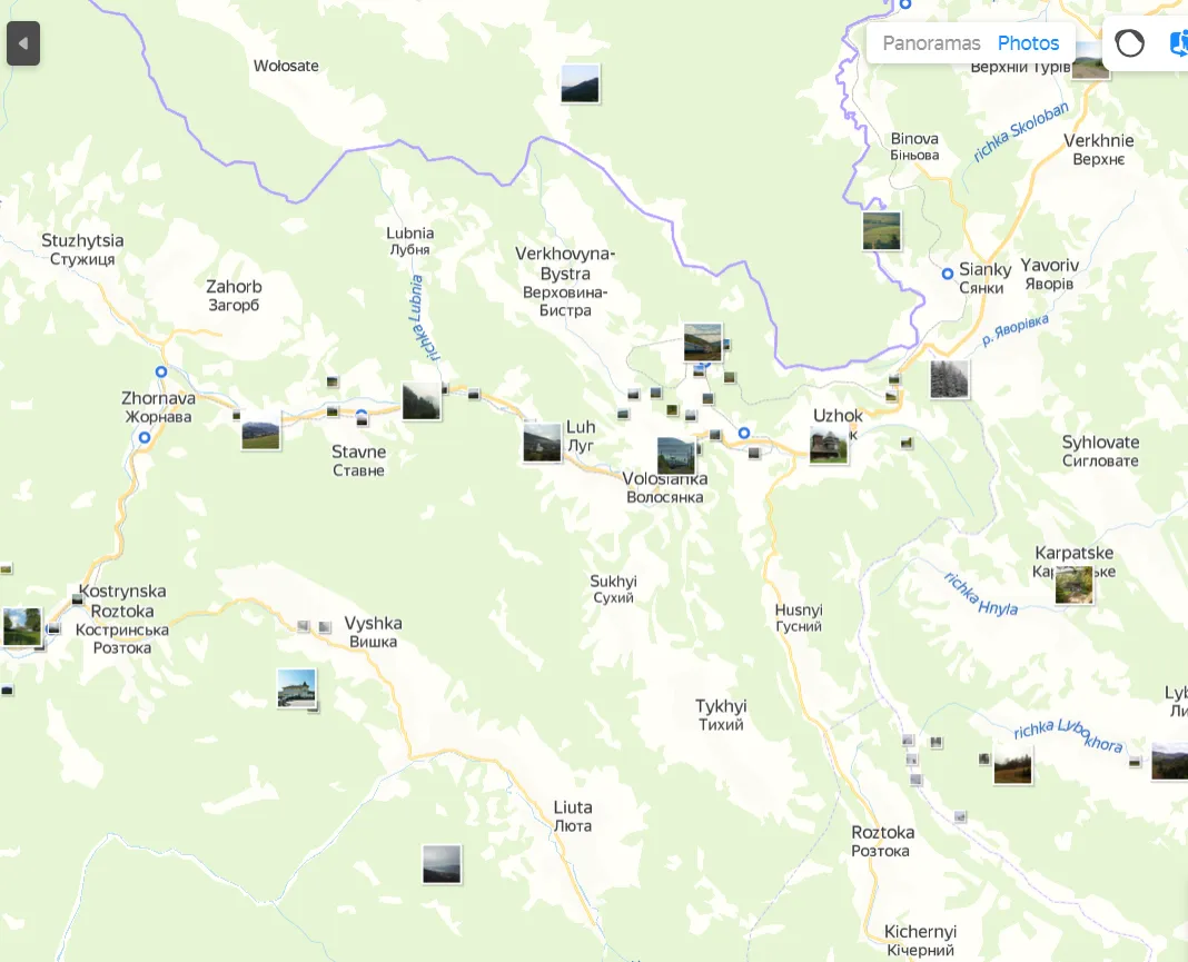
3. Mapillary.com – another neutral street-level platform, which works pretty much on the same basis as the previous one. The world coverage looks better (Pic. 14), although I would be careful about some single images in the middle of nowhere, as they might show the landscape, which completely doesn’t match with the local area (I checked it in the Sahara desert). Another serious drawback is the picture quality. Sometimes the dash-cams cath dirty windshield, even with some cracks too. Believe me, it strongly damages our vista.
Sometimes we can encounter the sphere or panoramic images in Mapillary too (Pic. 15). All the images are also easily downloadable, but you will get the Mappillary logo in the corner (Pic. 16).
In both street-level services mentioned here, we can be sometimes disappointed with our view both because of the glass purity, sunlight reflection, etc. as well as the traffic jam on the way, car overtakes, etc.
Unlike OpenStreetCam, Mapillary is not OpenSource.
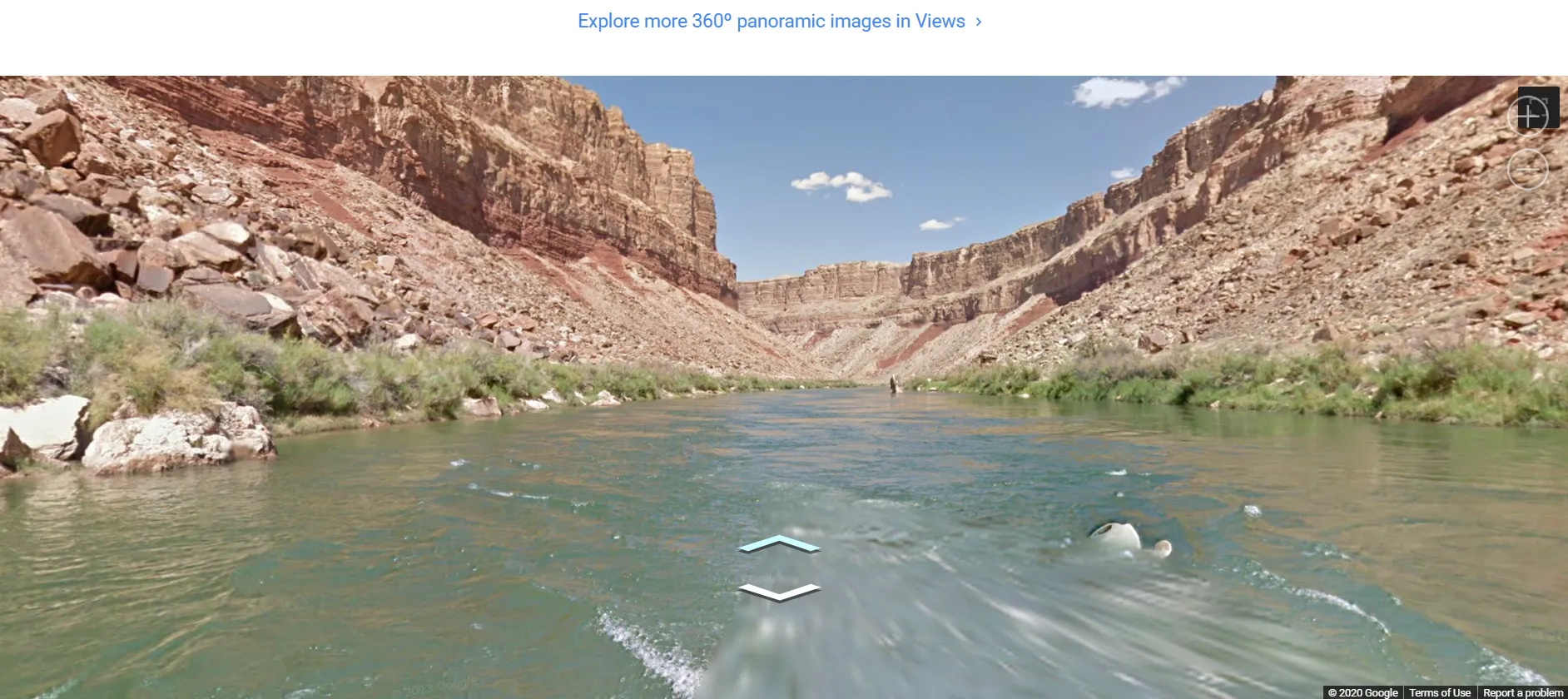
4. Google (Maps) Trekker – a specific form of “Street View” function, which in this case has been expanded off-road and is prepared mostly for mountaineers. You can take a virtual walk on the top of Mount Blanc or float down the Colorado River (Pic. 17).
I would like to remind, you that Yandex Maps also has the same feature for some mountainous areas, like Mount Everest (Pic. 11).
Photo Imagery
Besides the Street View tools, the user can also scout the world by browsing the various images. I am a person, who really loved the Panoramio.com platform, but regrettably, it doesn’t work anymore. This tool was tailored for Google Earth users mostly, who by clicking on the image icon could see what the local area looks like. There were only traditional images, no spherical ones, although we could see them via the 360Cities platform, which is described below.
Nowadays, Panoramio.com, as well as the Picasa role has been implemented into Google Maps, where the user can browse all the images in the local area (Pic. 18).
We must know, that Google Maps are not only one image provider. We can make our virtual trip from the other sources and image stocks too, which are:
1. Yandex Maps – the biggest topographic platform in Russia and all post-soviet countries. Looking at the multitude of image thumbnails on the map we can recall what Google Maps looked like a few years ago (Pic. 19). Obviously, the image amount increases as you zoom in. Opening each of them by clicking.
What is most important, there are a lot of images not only from Eastern Europe and Russia but from around the world.
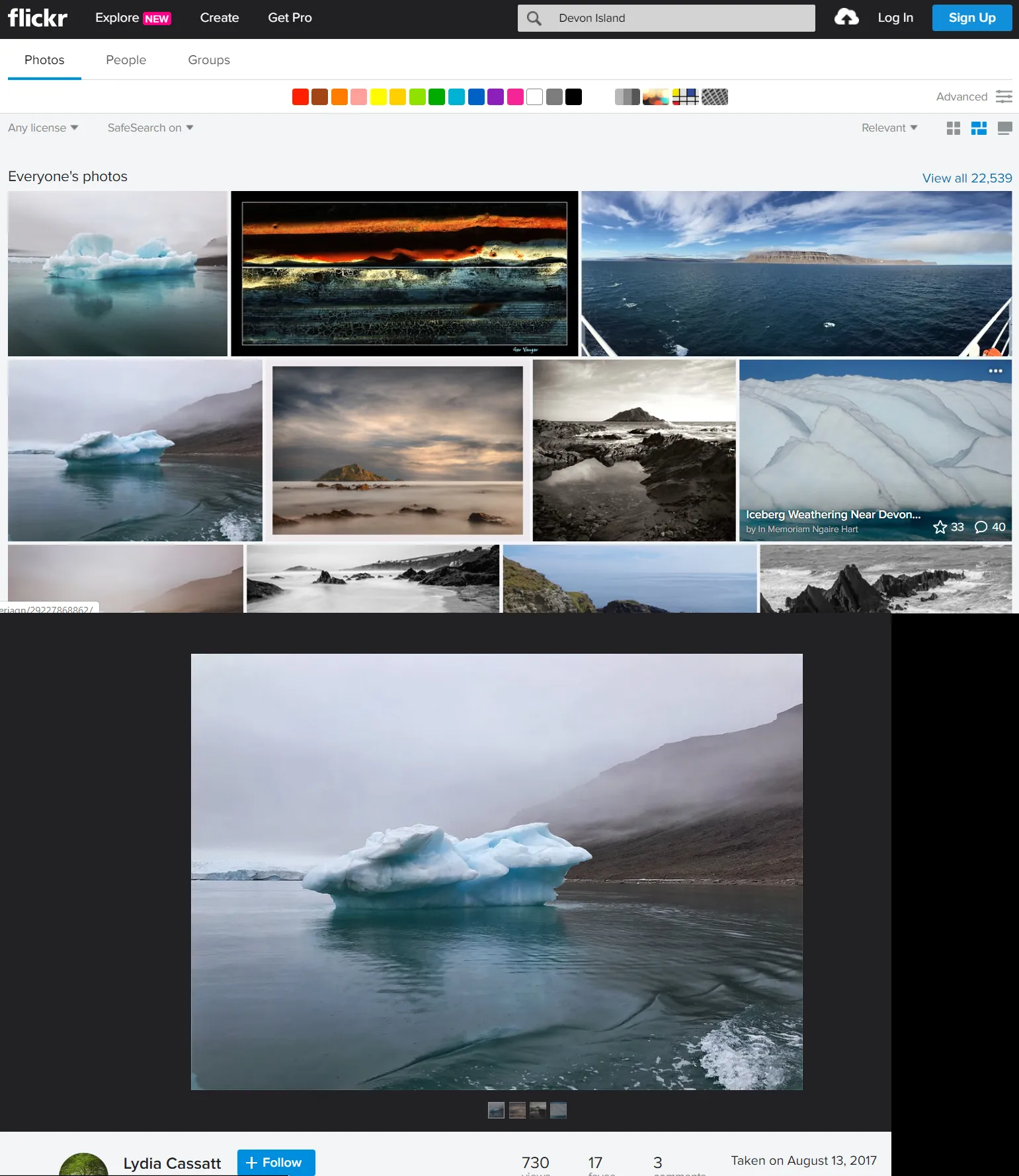
2. Flickr.com – the best image hosting in my opinion, although since it is not free anymore, there might be some shortage of pics there, especially for little-visited places. Nonetheless, it still is deemed as the most convenient image stock, where you can easily preview or download the image in full size, as I told you in this article.
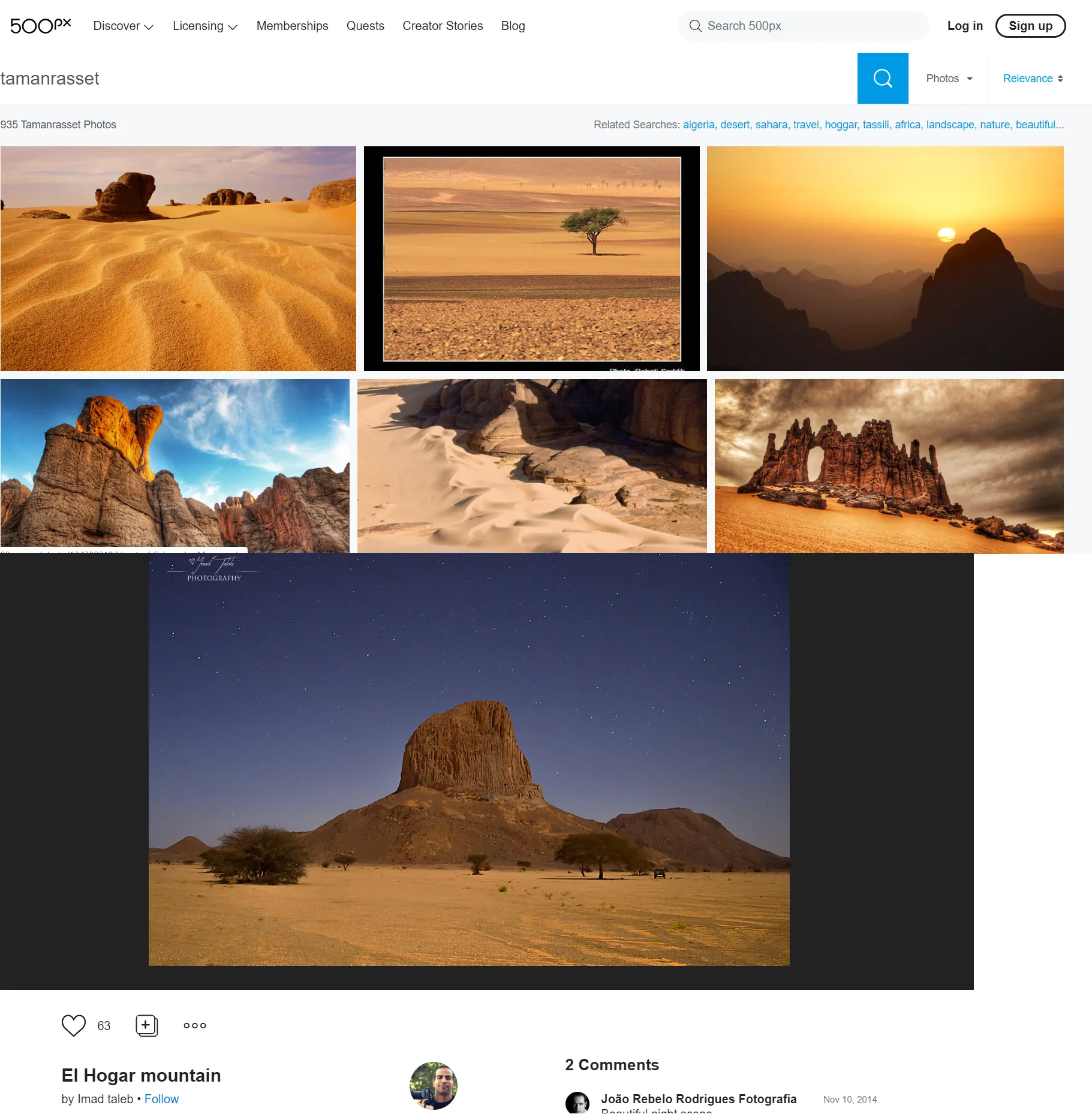
3. 500px.com – another image stock, which I recommend with the heartbeat. The same as in the previous one you can type the phrase – place, which you are interested in. Downloading the images is not so simple here, unfortunately.
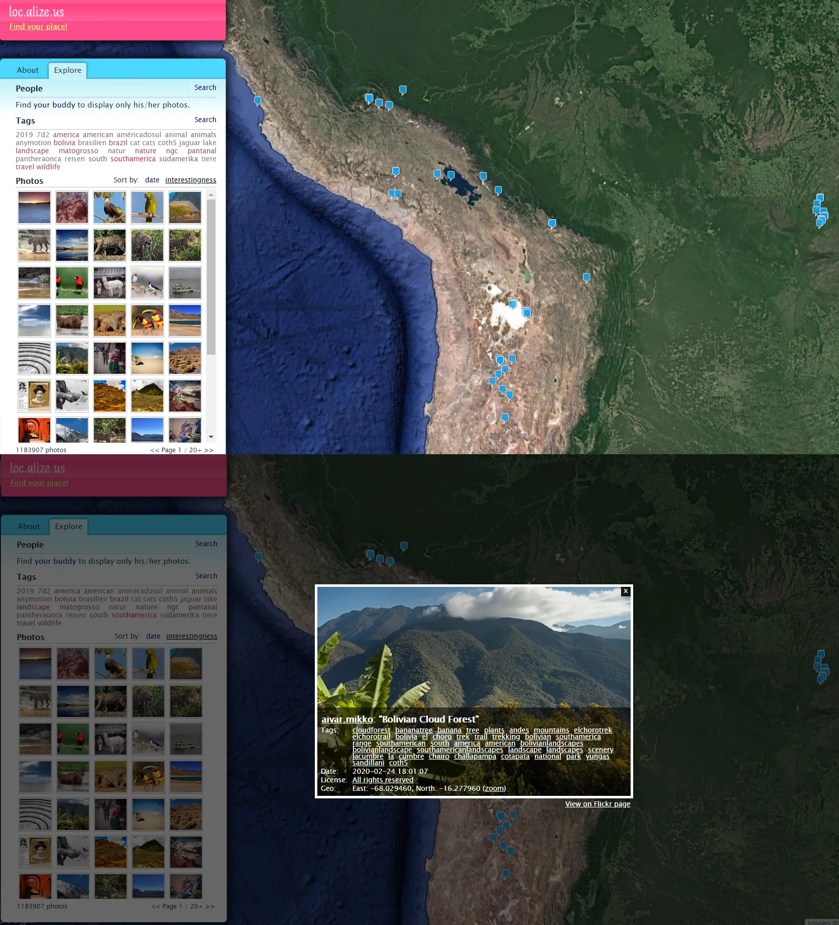
4. Loc.Alize.Us – the image stock with the Google Maps and Google Street View background. All the pictures come from Flickr.com. This platform is good because of the map, where you can quickly navigate between some regions and find images with short descriptions.
Moreover, you can try to search the images from some places by using the other common image stocks, which are unfortunately not for free. Even if you can’t download the full-size image you will face the logos on the smaller ones (Pic. 23).

360-degree sphere images
Another way to scout some areas is by browsing the sphere imagery, which becomes bigger on the web. The best platform, linked with Google Earth is 360cities.net offers high-quality sphere pictures, as we know from Google Street View, also with the zoom option (Pic. 24).
The specific branch of 360cities.net is the Gigapixel, where users upload very high-detailed images (Pic. 25).
Obviously, we can still find some decent alternatives to this platform, which are:
1. Kuula.co – a very good server with high-quality images. The basic version is free. This platform is also good for virtual tours.

2. Roundme.com – another professional platform with spherical images. The best attitude about it is the world map, where you can easily find some panoramic images available in some regions (Pic. 27). Moreover, you can change the display mode (Pic. 28).

3. Viewat.org – another image sphere server. The major downside of this server is a lack of categories, which means that all the panoramic images come randomly (Pic. 29).
Apart from the image sphere platforms presented here, there are other platforms available only for Android or iOS, which haven’t been covered here directly, and you can find them in the links at the end. Moreover, my aim in the future is to tinker with the spectrum of 360-panorama tools available online, which facilitate you uploading the spherical images and embedding them on the website.
Virtual tours
Virtual tours are something more than the sphere image only. These platforms feature at least a few photo spheres bound together into one route, often with some short description or giveaway. Sometimes the virtual tour character can appear in typical 360-degree image services like the aforementioned Kuula.co. Often the providers offer their own individual products. It means, that it’s much harder to find the versatile stack of virtual tours enveloping the whole world. I found these ones:
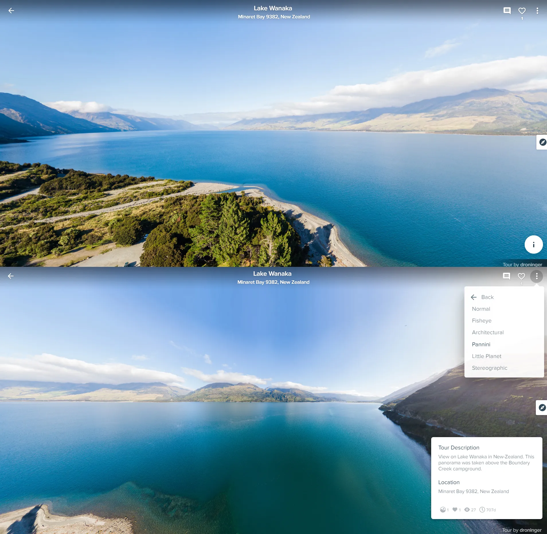
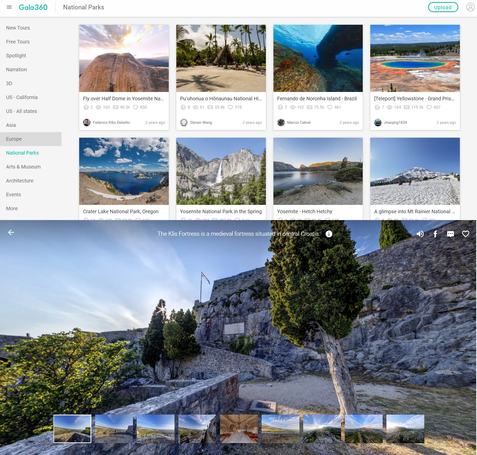
1. Gala360 – undeniably the best virtual tour worldwide, where you can search the panoramic views by continents and other tags. All of the images have been grouped by the spot, which they show. Moreover, you have a few panoramas in 3D mode.
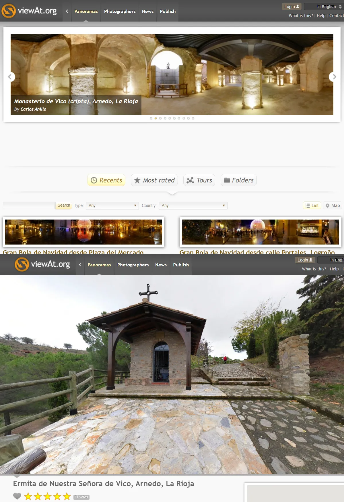
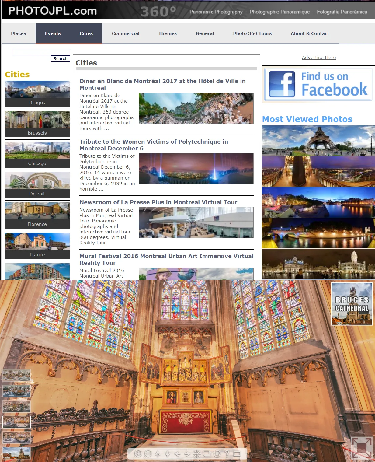
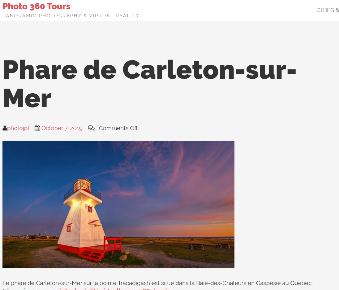
2. Photojpl.com – another good one, aimed at the specified landmarks mostly, although you can find here other spots too. The choice of sites is not so big, unfortunately, but sometimes you can see even a few beautiful landmarks inside in one city.
3. Photo360tours.com – another panoramic photography and virtual reality tour, but not developed enough so far I think.
4. Airpano.com – a specific virtual tour platform based on aerial images made from a helicopter or by drone. Easy to use and navigate. You can quickly find the stuff on the map provided.
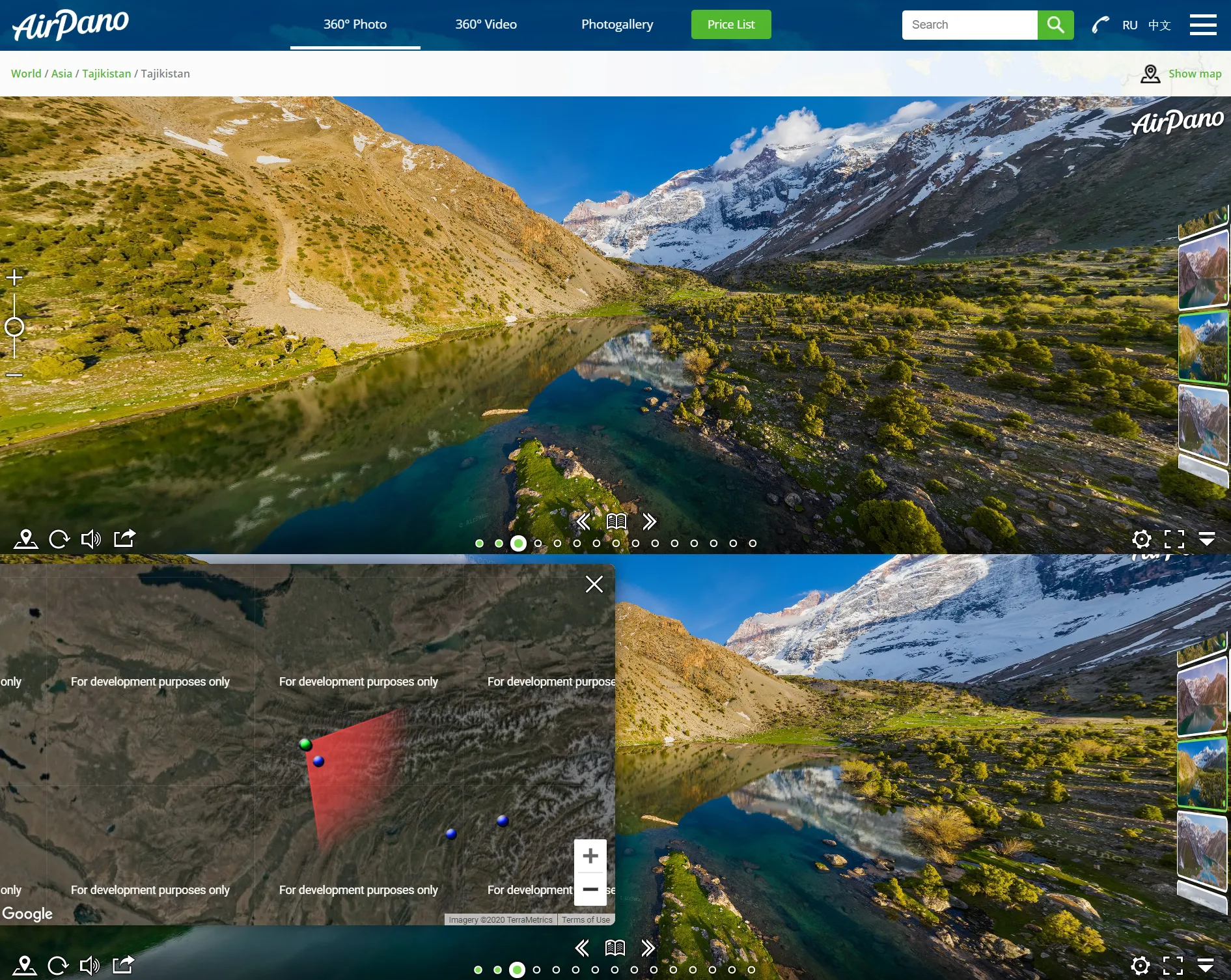
Besides, the website offers also video 360deg tours, available on their Youtube channel.
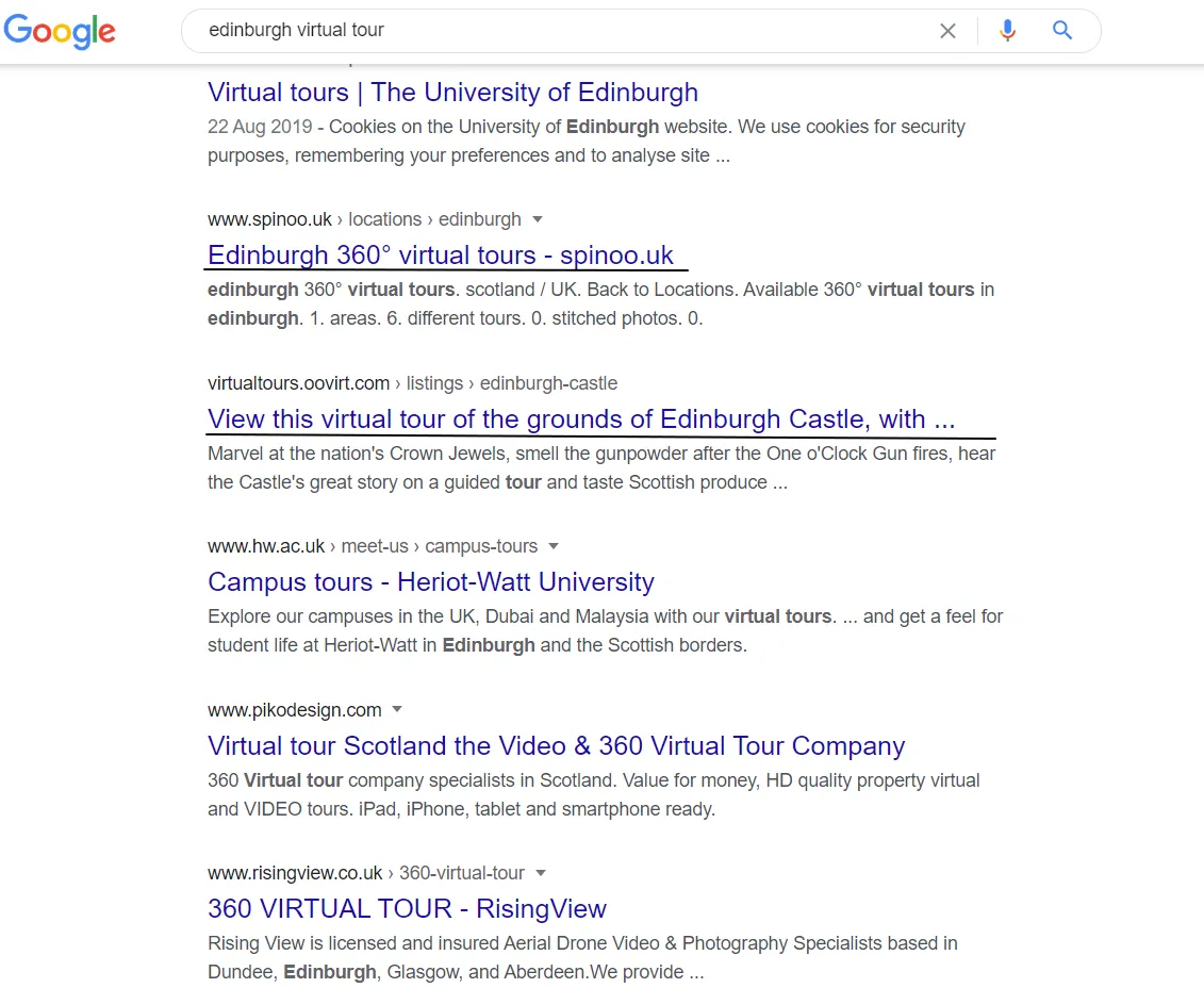
Well, there is a multitude of virtual tours, which show roughly 1 or a couple of places in detail, instead of many of them sketchily. The only advice, I can give you is to search in Goole for “my place virtual tour”, or something like that (Pic. 34).
Instead of your place, you can enter the name of the country. It’s highly likely, that you will find a platform similar to those, shown above.
Another option is to type “Top 10” or “best virtual tours” or sth like that. You will be floated in the virtual realities of the most famous landmarks and other places worldwide. The other matter for future dealing with is creating your own virtual tour. It exceeds this article right now, but I would like to explain how to prepare your virtual tour the next time.
Streaming platforms
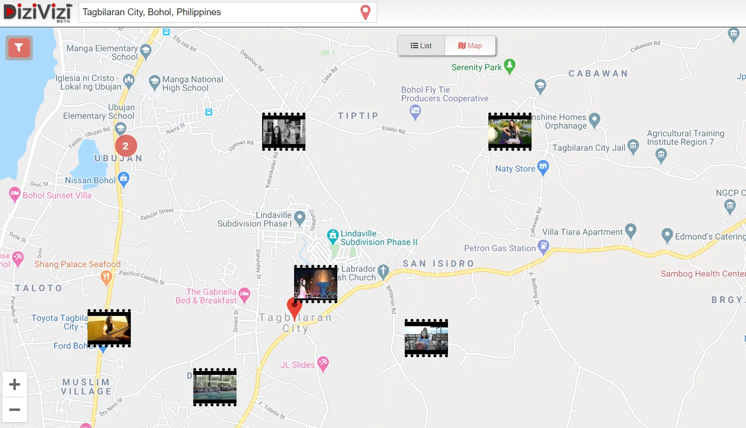
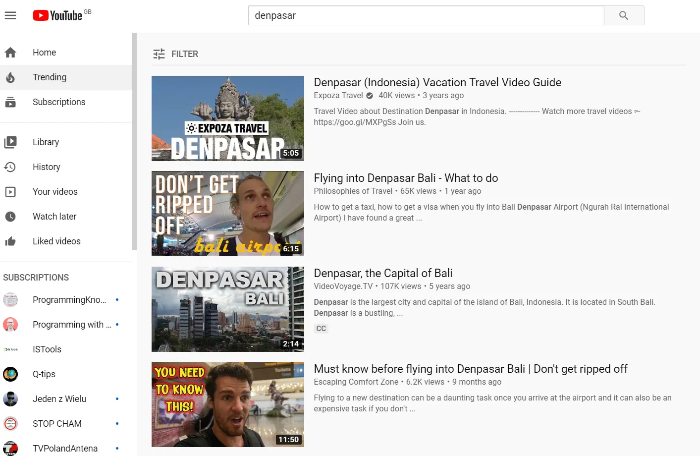
The specific way to get around in some areas is by watching any kind of footage from the region, in which we are interested. The quickest way to check this out is the DiziVizi platform, where you have a basic map with some geotagged YouTube movies clustered nearby (Pic. 35).
Apparently, there are not all the footage, comes from this area. For a more detailed onlook, I would recommend using the Youtube.com search and typing the relevant keyphrase (Pic. 36).
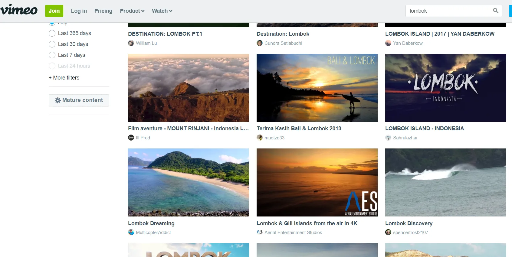
Alternatively, you can use the Vimeo platform, which also provides high-quality videos. The search mechanism is the same (Pic. 37).
There are another few streaming platforms, however, these 2 ones are the best, and you can get profitable search results instantly.
Web cameras
Web cameras are useful when we have to take a look at a random place right now. However, these items themselves are not directly related to virtual traveling, because we use them mostly for checking the weather, watching some natural phenomena, vegetation processes, etc.
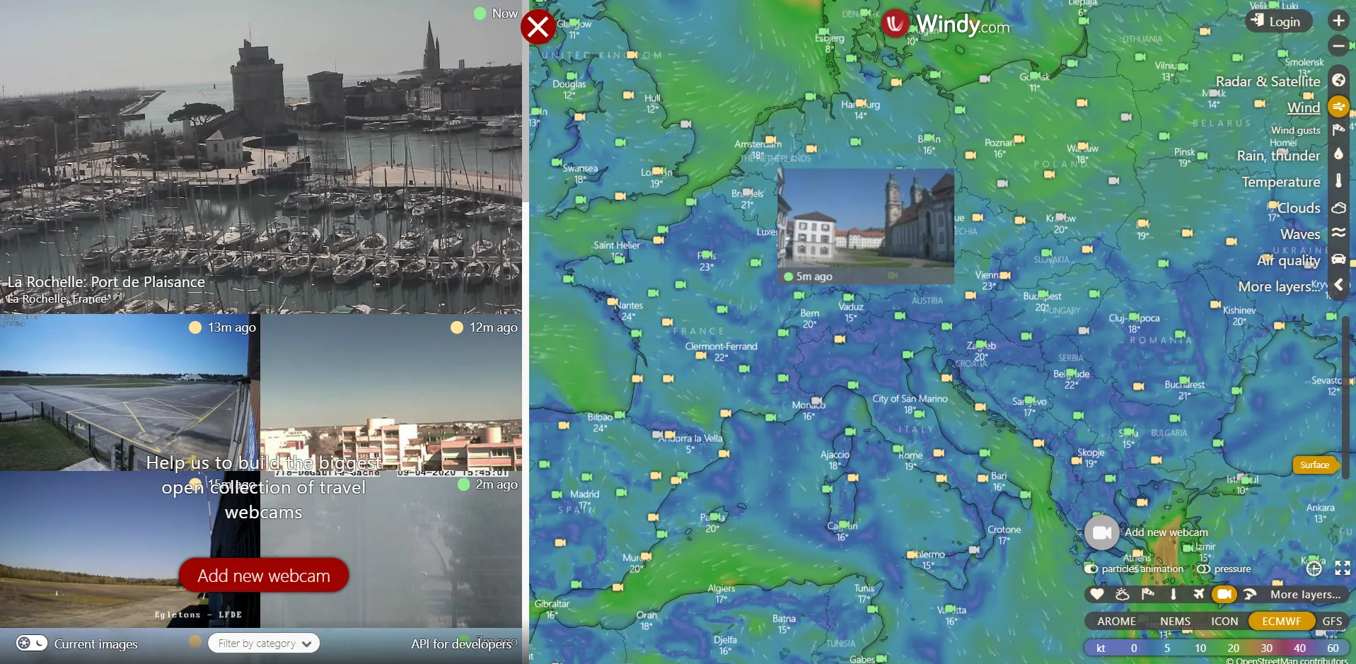
The quickest access to webcam locations worldwide is possible by two sources, where one of them is reliant on the major one. The main webcam source is the Windy.com weather platform, where you can select any webcam from the map, which is very convenient (Pic. 38).
Similar access you can get from the most popular weather forecast in recent times – Meteoblue.com (Pic. 39).
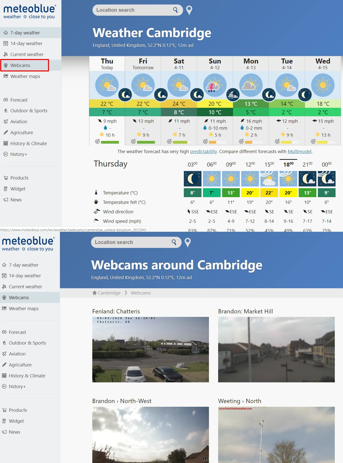
The webcam base in Meteoblue.com comes from Windy.com. The major drawback of most of these cameras is very low quality. For this reason, I would recommend you use the different providers, which rages are often restricted to some specified areas or places:
1. Deckchair.com – personally for me the best webcam platform, which provides HD views from a multitude of places worldwide.
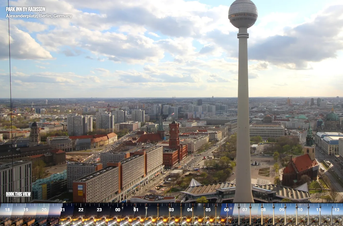
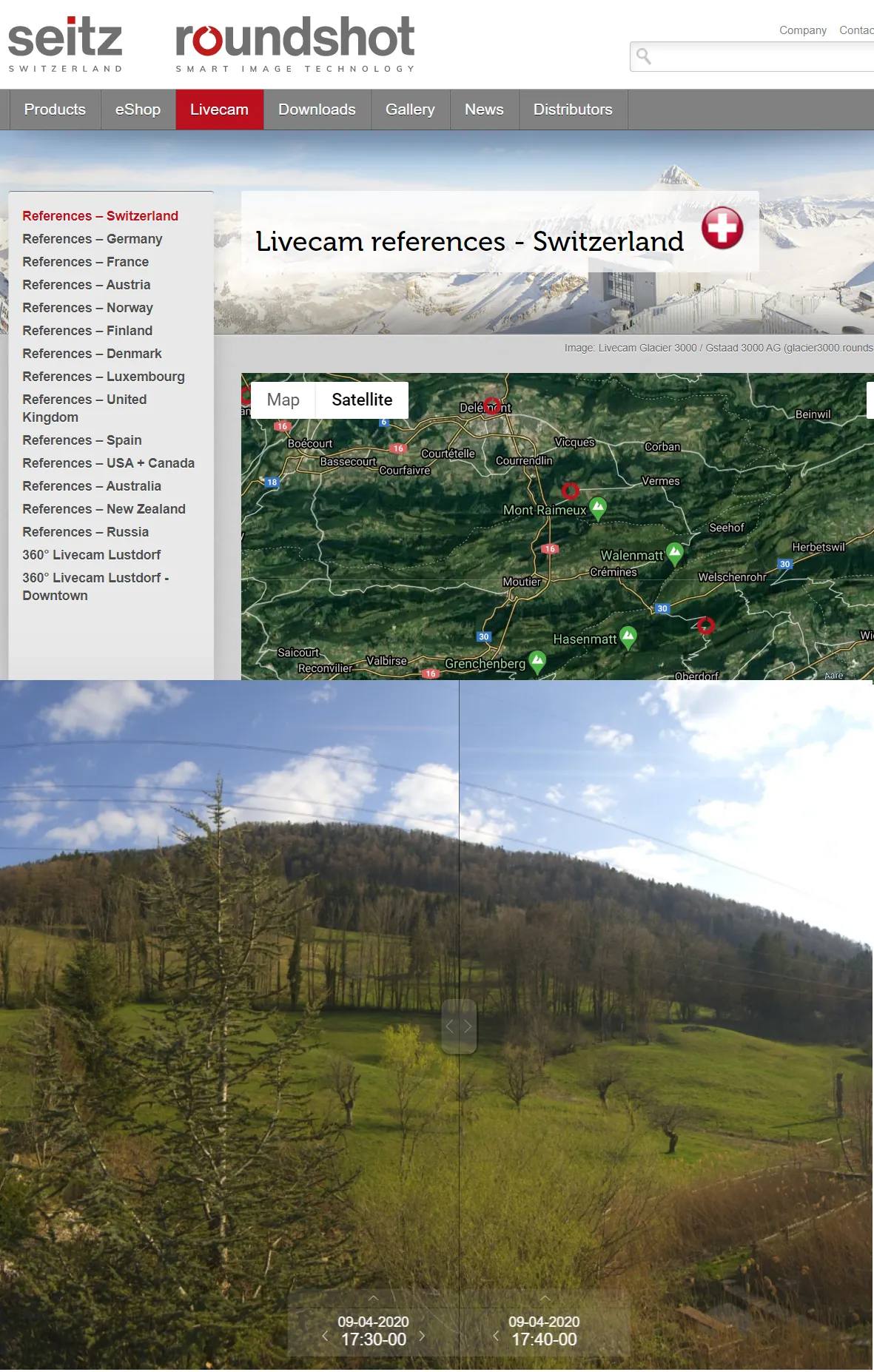
2. Roundshot.com – another good high-quality webcam provider. You have a lot of options for image manipulation here. You can do comparisons between two moments, create the time-lapses, and take a big look back in time since their archives reach up to 2014 sometimes.
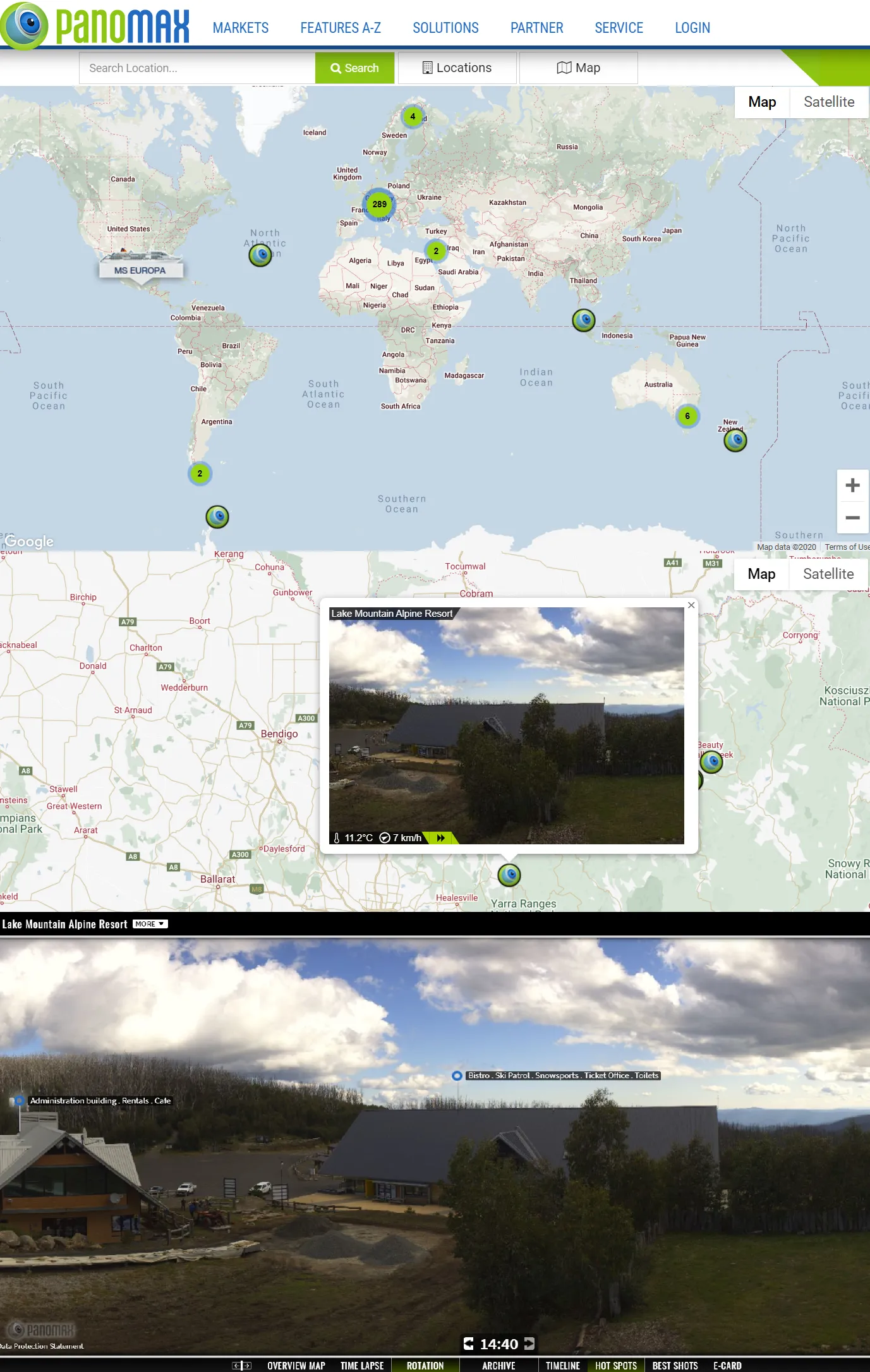
3. Panomax.com – another HD webcam platform, very similar to the previous one. It works like the on-time virtual tour, where you can see some basic descriptions of objects visible in the webcam frame.
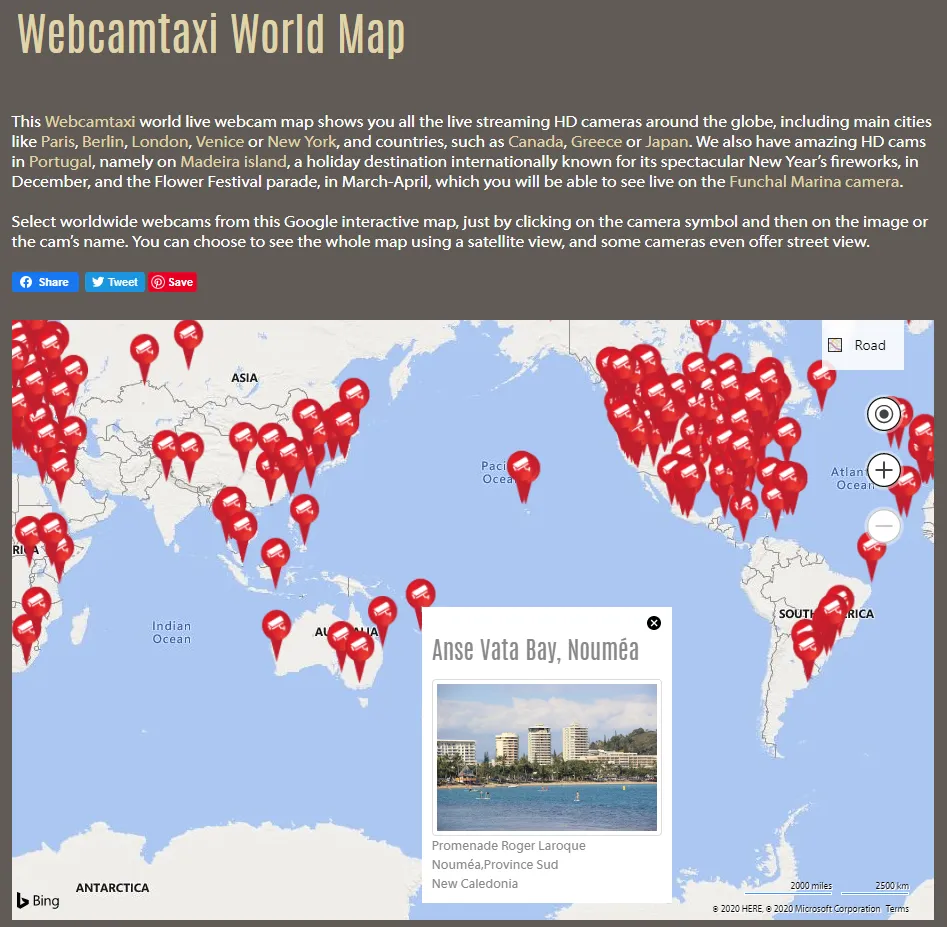
4. Webcamtaxi.com – another good, high-quality webcam provider, which I can recommend. Most of the cameras have their live stream from YouTube. This server allows you to find them quickly anywhere in the world.
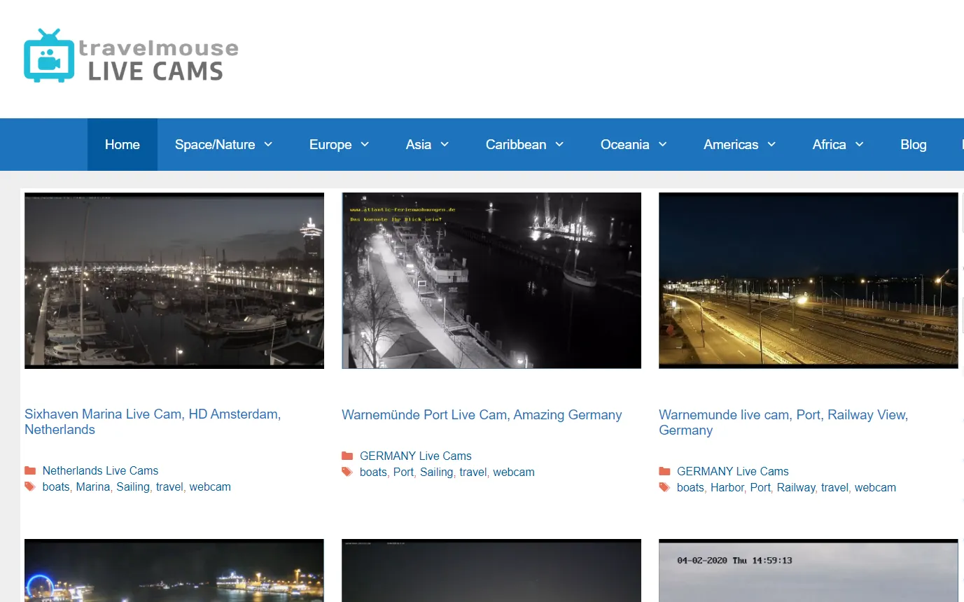
5. Travelmouse.co.uk – another Youtube-based webcam provider worldwide. It works very similarly to the previous one.
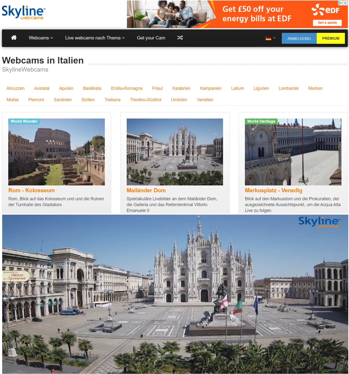
6. Skylinewebcams.com – very good German service, providing a multitude of FullHD webcams worldwide. They transmit only live, without any dates back except for remarkable moments captured randomly. Anyway, it’s really worth attention.
Additionally, we can find a lot of local webcam providers, confined to specified regions, like the Alps, Sumava, Baltic, or the boreal region in Europe. Their quality is much better than those offered on Windy.com.
Satellite imagery
The best and most unparalleled satellite imagery comes from Google and everyone agrees with it. Moreover, lots of users have the Chrome browser installed, where you can scout the area with the 3D layer (Pic. 46).
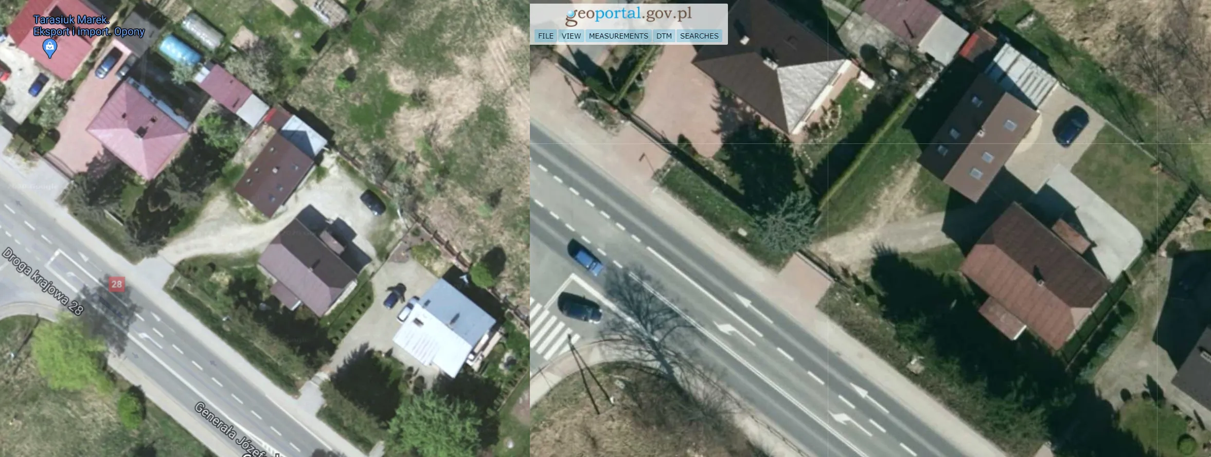
There is no point in searching for better satellite images, than Google ones. Again, Google satellite imagery is the best worldwide. However, if we take a look more locally, we can find more detailed pictures, which are provided mostly by national Geoportal websites (Pic. 47).
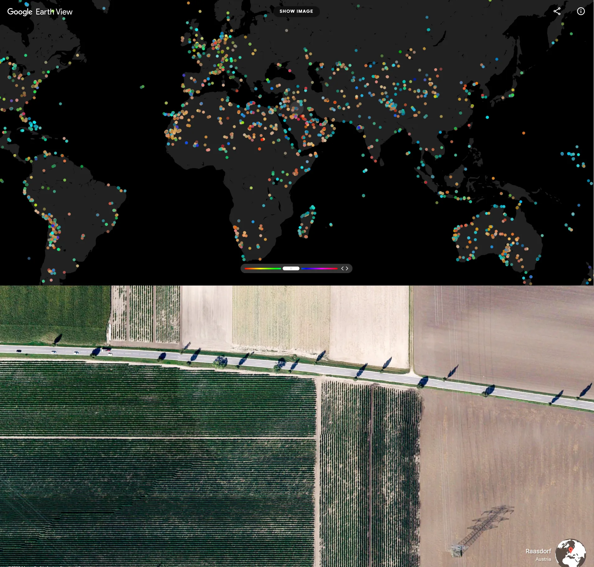
Another option is Earth View – the Google satellite imagery collection fetched from random beautiful places worldwide (Pic. 48).
The bank of knowledge
The last source of sightseeing, which I would recommend refers to the text information, graphs, etc., which we know from books. There is no brainer, that Wikipedia.org gives us the quickest access to the many of information worldwide. The same as in the case of Google Imagery, Wikipedia is sort of unparalleled. It’s worth knowing, that this encyclopedia is written jointly by various people – experts in their fields. Nowadays people’s belief in fake facts regarding some matters in Wikipedia still lingers. The truth is somewhere in the middle. As long as people will do it completely for free we can expect problems like these. On the other hand, the number of wiki users checking the quality of the information input increases globally, preventing this kind of situation. Today’s Wikipedia is not the encyclopedia from the period of the origination of it 20 years ago.
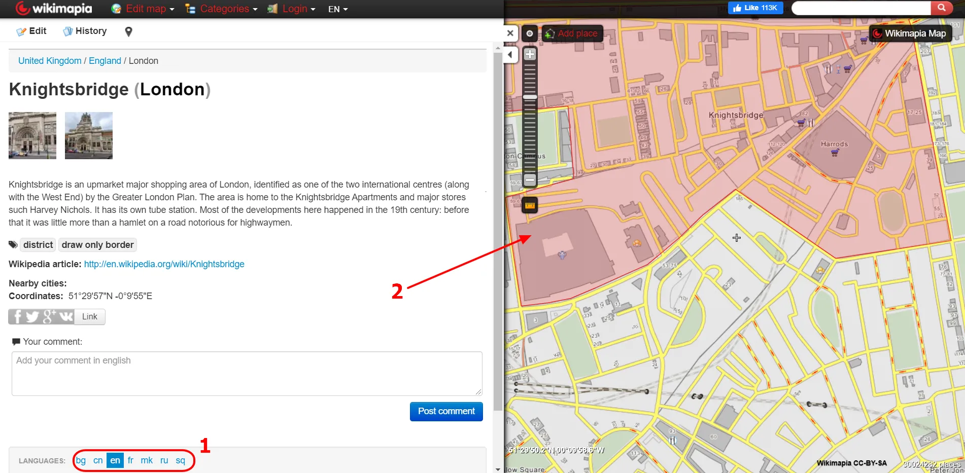
Along with Wikipedia, we can enter Wikimapia.org – its cousin, which can show us a lot of places, streets, etc. described in Wikipedia. It’s also the effect of human collaboration without any earnings.
For more genuine information you can visit the Encyclopedia Britannica.
We can try to get some information from the Google Sightseeing platform, although they will apply to the most curious places only.
On a similar basis the VirtualGlobTrotting service works, where daily map and place described changes. This website is also good to visit.
In the end, I would advise using Google Search or Google Books in order to find some travel guides, texts, and articles about the area, in which we are interested. I will leave it with you.
Travel applications
I will write something about the tools, which might help us to travel from home. However, the installation always requires much more memory, than using the web browser only, which will slow down our computer eventually. I am also focusing here on the desktop instead of mobile apps because everyone wants to see the results in a big size, which cannot be reached from a phone. The major geographic application, widely available and free of use is Google Earth. Obviously, it has a few alternatives, but it’s the best and you don’t need to search for the other ones. Some data has been conveniently presented here, giving you instant access to the relevant sources (Pic. 52, 53). The major downside of Google Earth is memory consumption, making the program slow from time to time.


Basically, Google Earth perfectly summarizes my whole article about remote traveling. Browsing your area of interest you can see the deployment of most of the features described above and also much more, which haven’t been mentioned but are also very interesting. You can make them visible by selecting all of the layers, which you want to see in this area (Pic. 54).

Google Earth encapsulates perfectly everything we need, except the webcams I think. Everything we discussed previously has been placed on the map. This is a very handy tool, which brings you a sufficient recap of the destination venue or region.
3. SUMMARY
This article shows the most advantageous ways to make your own journey without leaving home. I have explained how to use Street View effectively and how to access the image stacks quickly. This whole post eventually has turned somewhat into the link base, where you have got decent access to all the ways of travel listed above. I am treating this writing as a kind of flashpoint for a future grand tourist object base, which could work pretty much as a combination of Google Earth the TripAdvisor. It would be extremely beneficial for everyone to have a high-quality, lightweight world map with all of the elements listed, based on their individual purposes and features, which hasn’t been done on TripAdvisor. Google Earth, in turn, is a very handy tool with considerable fault – it’s too heavy for a lot of desktops. Despite it covering about two of the third stuff presented by myself in this article, the tool can be tough for planning some trips or visiting some regions from home.
All the materials shown here are a suggestion. There are more sources, that you can use for doing your virtual journey, but the best example is a multitude of layers in Google Earth.
Unfortunately don’t expect, that each region is presented at the same level of detail. Some regions are better equipped with various documentation, whereas the other ones suffer from an utter lack of decent images or information. It led me to think about another potential solution, which would solve this affliction. There is still a lot to do in terms of virtual traveling. One of my ideas is turning the Street View imagery into a virtual guide. A piece of this has been done with Yandex streetside, where we have the flat numbers overlapped with the image. Not to mention the bulk of information, which would be embedded into these pins, text boxes, or whatever you would like to call them. It could be a perfect startup, marking the new way in current tourism development.
For the time being, we have very wide opportunities for virtual journeys worldwide, better than ever. Let’s make the most of it and get to know the places, which visiting we dream about.
Mariusz Krukar
Links:
- https://www.google.com/streetview/
- Publishing images to Google Street View
- http://street-sphere.appspot.com/
- https://showmystreet.com/
- InstantStreetView.com
- https://www.faststreetview.com/
- https://www.mentalfloss.com/article/51904/16-amazing-places-visit-google-street-view
- https://www.streetviewfun.com/
- Bing Streetside
- https://yandex.ru/maps
- Google Maps vs Yandex Maps – which one is right for your logistics software
- https://www.mapillary.com/
- https://openstreetcam.org/
- https://www.google.com/maps/about/treks/#/grid
- https://www.theverge.com/2018/11/1/18051950/flickr-1000-photo-limit-free-accounts-changes-pro-subscription-smugmug
- https://www.360cities.net/
- https://kuula.co/
- https://roundme.com/
- http://www.viewat.org/
- https://360rumors.com/lookabout-new-360-photo-sharing-app-heres-list-seventeen-360-photo-sharing-platforms/
- https://veer.tv/blog/best-platforms-upload-share-360panoramic-photos/
- https://www.flickr.com/groups/360degrees/
- https://photo-sphere-viewer.js.org/
- https://github.com/AltspaceVR/photo-viewer
- https://veer.tv/blog/top-13-panorama360-degree-photo-viewers/
- https://gala360app.com/
- https://www.photojpl.com/
- https://photo360tours.com/
- https://www.airpano.com/
- https://www.panoramic-photo-guide.com/virtual-tour-360-photography/how-to-create-virtual-tour-360-summary.html
- https://www.topbestalternatives.com/google-street-view/
- https://www.theguardian.com/travel/2020/mar/30/10-best-virtual-tour-worlds-most-famous-landmarks
- https://www.timeout.com/travel/virtual-landmark-tours#
- http://www.virtualfreesites.com/
- https://www.goodhousekeeping.com/life/travel/a31784720/best-virtual-tours/
- https://www.spinoo.uk/
- https://dizivizi.com/
- https://vimeo.com/
- https://www.windy.com/-Webcams/
- http://www.deckchair.com/
- https://www.roundshot.com/xml_1/internet/en/application/d170/f172.cfm
- https://www.panomax.com/en.html
- https://www.webcamtaxi.com/en/
- https://travelmouse.co.uk/
- https://www.skylinewebcams.com/
- https://www.foto-webcam.eu/
- http://webcam.sumava.eu/
- https://balticlivecam.com/
- http://www.kystnor.no/
- https://earthview.withgoogle.com/
- https://www.britannica.com/
- http://www.googlesightseeing.com/
- https://books.google.com/
- https://oedb.org/ilibrarian/top-7-alternatives-to-wikipedia/
- https://beebom.com/google-earth-alternatives/
- https://www.360cities.net/help/google-earth/view-panoramas-on-google-earth
- TOP 100 virtual tours around the world 2020
- https://www.thebestvancouver.com/best-virtual-tours-vancouver/
- https://www.bestinireland.com/best-virtual-tours-ireland/
- https://vr.space/news/education/vr-educational-field-trips/
- https://www.topreviews.co.nz/best-virtual-tours-new-zealand/
Forums:
- https://www.quora.com/Is-there-an-alternative-to-Panoramio
- Alternatives to Panoramio!!!
- https://webapps.stackexchange.com/questions/114274/how-to-access-photos-previously-in-google-panoramio
Wiki:
- Coverage_of_Google_Street_View
- List_of_street_view_services
- Mapillary
- OpenStreetCam
- Panoramio
- Yandex_Maps
Read also: