
Make a Virtual Travel Guide like Street View
A couple months ago I described my opinions about getting appropriate information about your own trip. I wrote this to the tour guides mainly however, this issue applies to everyone who is planning the trip and want to see and get to know about something interesting. I mentioned the kind of applications like (Google) Travel Guide. Read more here.
There is no application directly called the Google Travel Guide, however, when you type the “Google Travel Guide app” you will receive a huge amount of various guide apps. Those tools will help you prepare for the trip and show you the most remarkable spots around your travel destination. There are many applications in this range. Moreover, you can download the guide for many countries if you need it. In my case, the most interesting is a tourist guide for Poland, my mother country. Let’s check it inside then.


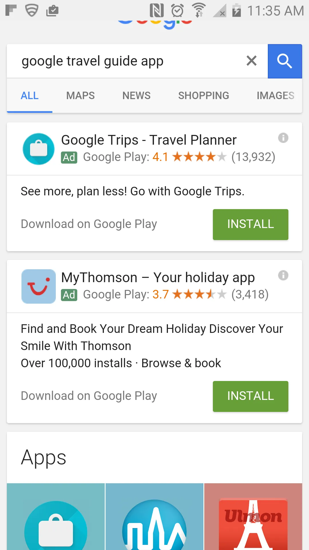
Pic. 1 – 6. The guide applications are displayed after the “google travel guide app” keyword.
Let’s see the guide app example below.


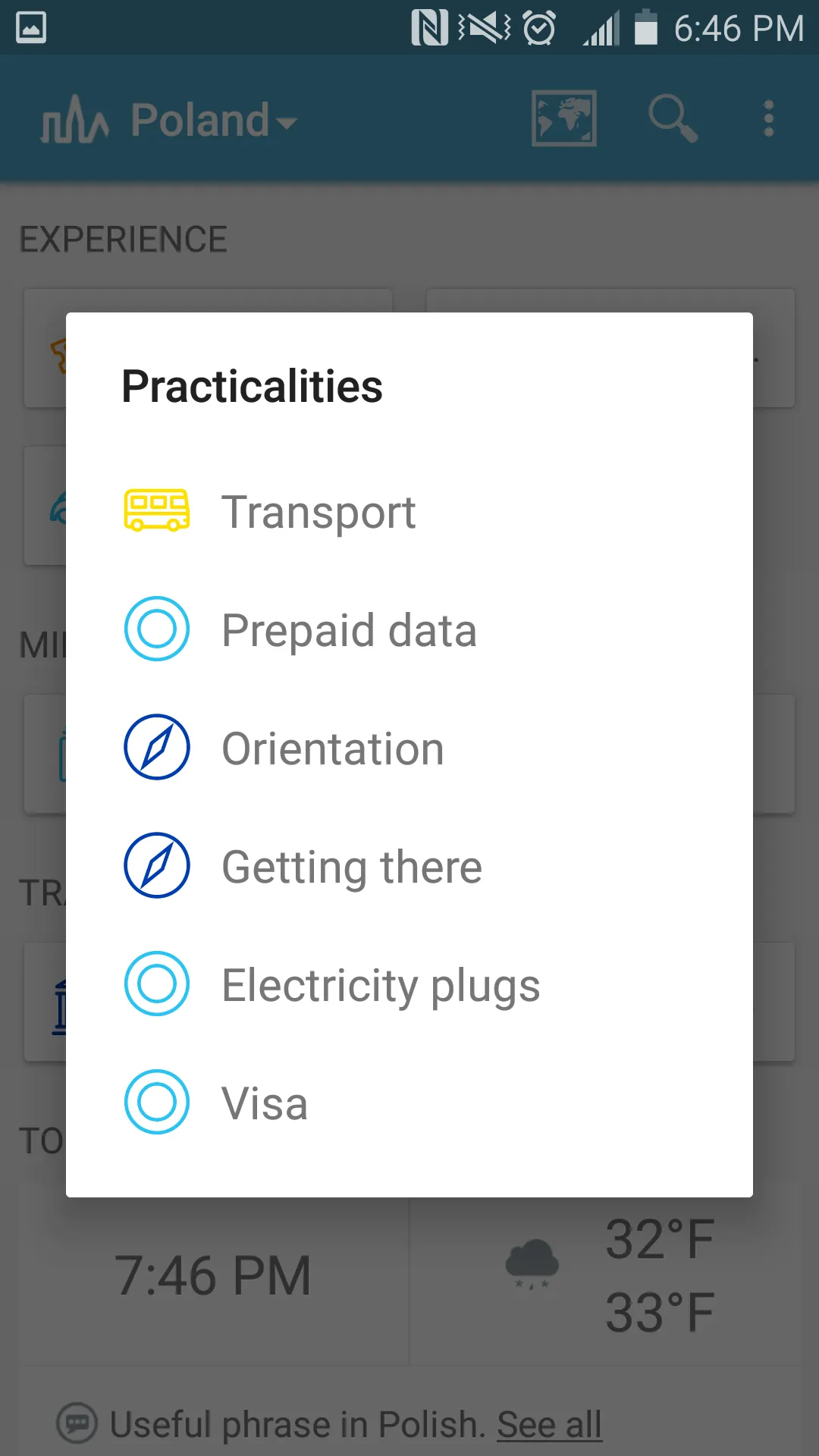
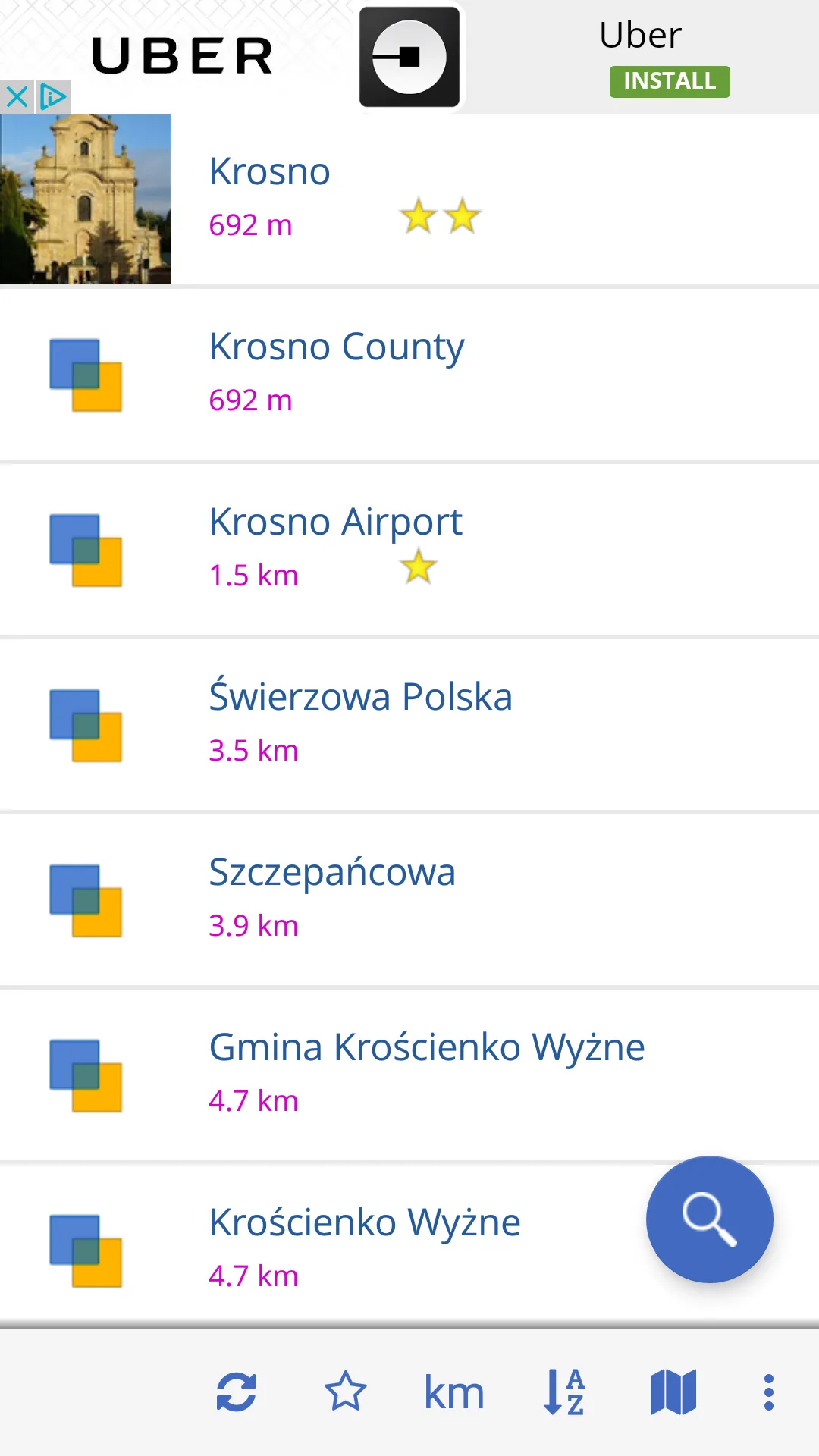
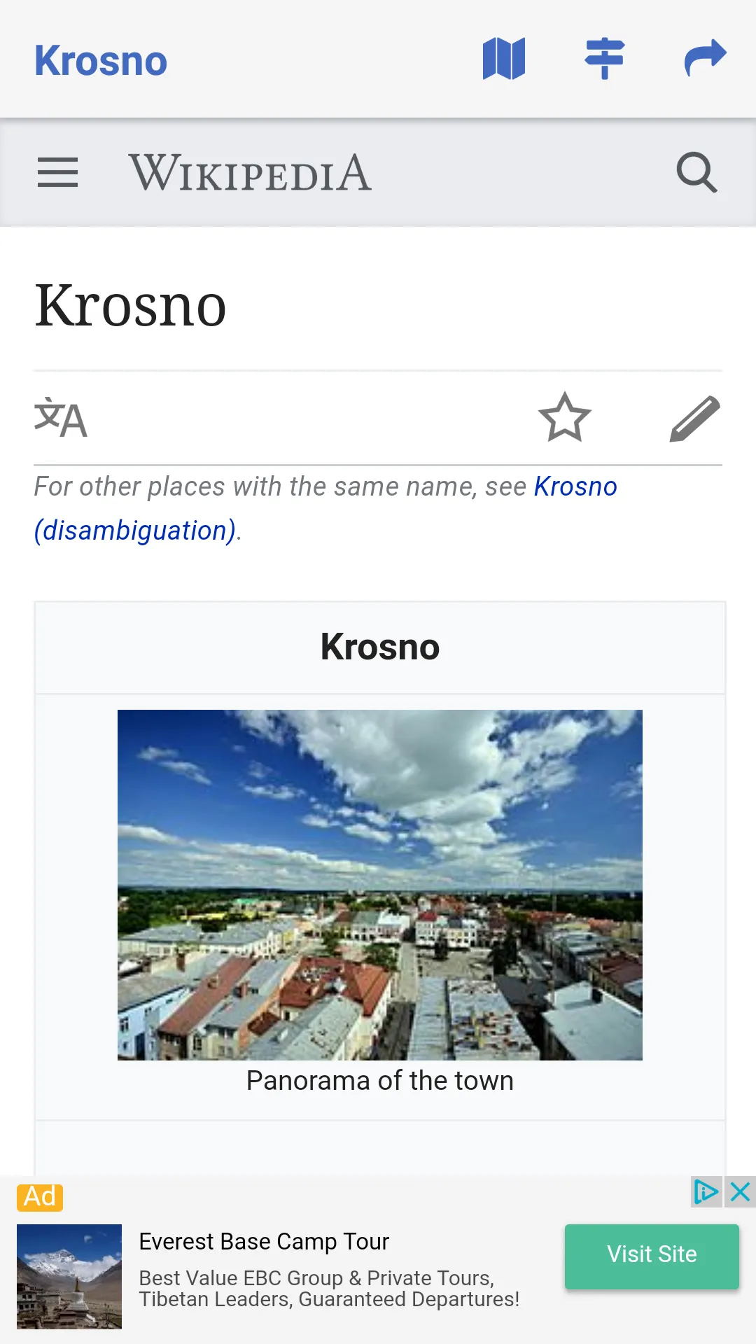
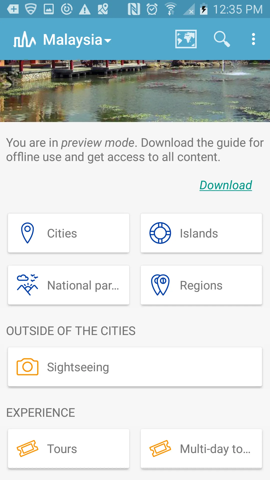
Pic. 7 – 9 The Triposo guide app on the Krosno county example.
This is the guide for Poland made by Triposo. In my opinion, this is the best mobile guide for Poland. I took a little overview of this application and now I can share with you some conclusions. Firstly the guide is really well prepared. You have the choice of the following: cities, national parks, regions, and sightseeing (outside the city). You have also an option to create and modify your tour, day trip, and multi-day tour from your destination selected.
The Triposo Travel Guide provides many other facilities essential during your trip like a local phrasebook, and places to get around (restaurants, hotels, nightlife). The guide uses also Vikivoyage and Wikipedia to provide you cultural, historical, and geographical information.
Next to the Triposo is worth telling something about the World Explorer app. The World Explorer is a must-have worldwide app for all your trips. There are over 850k articles, which consist of the database of universal travel guides for your pocket.

Pic. 10 – 12 The World Explorer interface. The basic information engine for this app is traditionally Wikipedia. You can choose your language, although it may make a difference in the information level.
Other apps can’t reach both Triposo and the World Explorer levels. Generally speaking, many guide apps like TripIt, Field Trip, IZI travel, etc. are well prepared locally only. For instance, if you are going to visit the United Kingdom it won’t be a problem using any of them. If you will choose a different destination country is really better to install either Triposo or World Explorer.

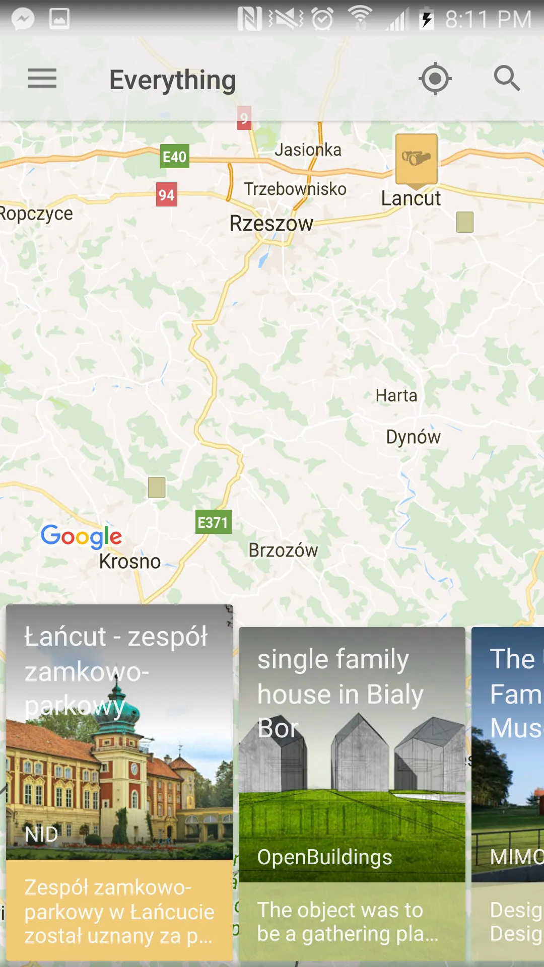
Pic. 13,14 Using the Field Trip app: 1 – in the United Kingdom (Cambridge), 2 – in Poland (Krosno).
Pic. 15. The Triposo app allows you to download a virtual tour guide of any country around the World.
Everything would be fine, but they’re all apps that have a drawback, which put them into the common denominator.
There are no landmarks provided. On top of that, many of them are just mentioned without any description. I think that work in this range is still not enough. It should be much more knowledge about the tourist places.
There is no street mode at all. This mode would allow you to see the information not only about the route, which you are going through, but raise up some curious topics about the local area. It would consist of a solid background for your country-touring trip, especially for people, who are keenly interested in e.g. historical facts or the local environment.
Except for the guide apps, we can also use the image to recognize mobile apps, of which the most popular are Google Goggles and Bixby Vision (especially for Samsung devices). Google Goggles can identify various labels or landmarks. Thanks to this a user can learn about them easily without any text-based research. A very similar role plays the Bixby Vision, which gives some information about the recognized object (Pic. 16).
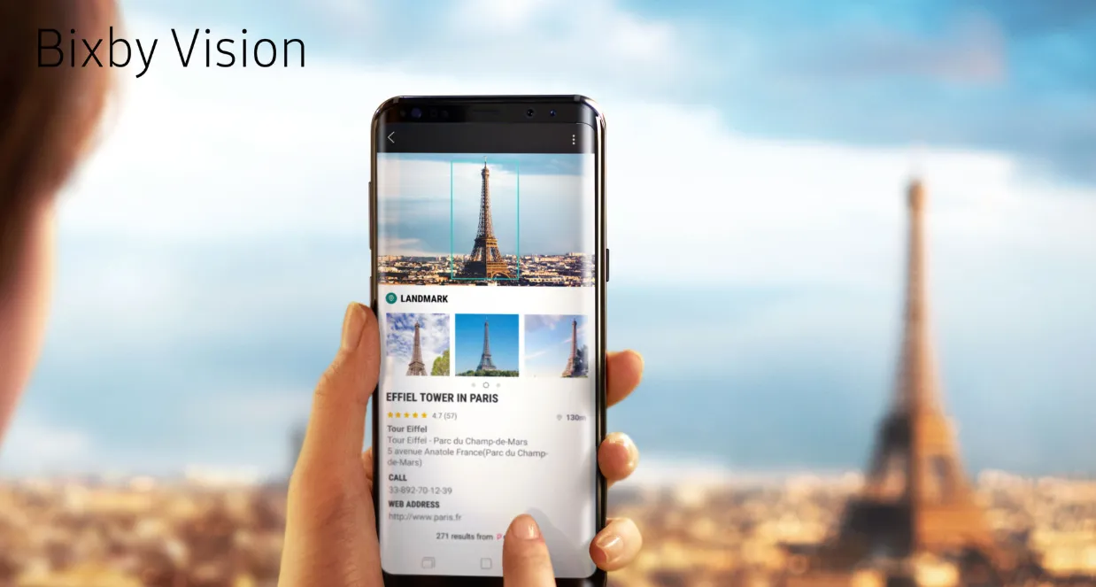
Pic. 16 Bixby Vision in use (Ifworlddesignguide.com)
Bixby Vision identifies also the products and other items. Similarly, like Google Goggles this app identifies whatever the camera is pointed at. It also analyses the related products/images and is able to find other places nearby when possible. This is a kind of intuitive research by identifying whatever is seen right now.
The Google Goggles, for instance, are able to read the text too, using optical character recognition. The gained text snipped can be also translated into different languages.
The Google Goggles are going to be superseded by a completely new tool soon. It will be Google Lens.
Google Lens is going to be an image recognition technology responsible for bringing up relevant information about an object or item, where the camera is pointed at. This similar tool to Google Goggles will feature a bigger capability and integration both with Google Photos and Google Assistant.
The tool described above is a perfect example of see-know technology, as we can use nowadays. The basic downside is, that these tools work, once you are online.
How it can be referred on a virtual way? Can I have this information, even when I point the cursor on some object i.e in some random picture?
My idea is to make the (Virtual) Tour Guide like a street view where next to the view towards some object you will have the option to pop up the information cloud about it. You would get knowledge about the place, which you are looking for now. It could contain 3 blocks of view (closest area, adjacent area, and remote area) described in my previous article.
Using the street view to browse some areas (streets, buildings, etc.) you could receive the information after clicking on an appropriate place (spot). Under this point, you could receive pop-up information. To better imagine this process let’s use Google Earth. When you want to know something about some interesting object you can use the “W” signature, which automatically redirects you to the article in Wikipedia (Pic 15). The Wikipedia platform is also a basic tool for the World Explorer app, where moreover you can read the same article in many different languages when possible (Pic 12).
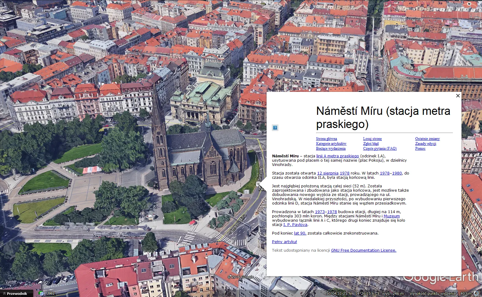
Pic. 17 The Google Earth guide example is based on the Wikipedia information engine. The language of the popped-up article depends on the language set in the Google Earth software. Prague city underground station.
The pros and cons of both Google Earth and World Explorer information are quick accessibility to knowledge, but this knowledge isn’t equal. It usually depends on the place which you are interested in (more popular places are much better described) and what language are you using. For instance, places in England are much better described in English, some other places in Russia are better described in Russian, and so on. On top of that Wikipedia, the handy encyclopedia provides some inconsistencies or information without proving the source. Eventually, we can’t be sure about that information without decent proof.
My idea is to describe every spot, which you are seeing at this moment. It’s good to refer those considerations into the Street view tool. It would be like in the images below.
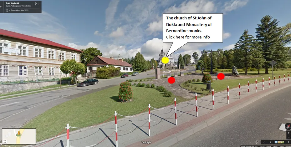
Pic. 18 The (Virtual) Travel Guide example based on the Street View tool: red spots indicate the places of interest, and the yellow spot is showing the actual active place. When the yellow button is active you can see the name of the place (landmark, monument, outcrop, etc) with the option “Click here for more info” which can redirect you to the article. Dukla, Trakt Węgierski street.
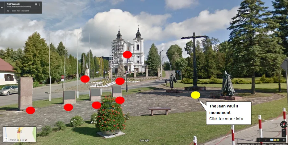
Pic. 19 The Street View option gives you the opportunity to little zoom in on the framed area. Once you will zoom into your object of interest you will receive more red spots, showing the places situated in the immediate vicinity of the main spot. Obviously, the yellow button is already active and you can know what are you actually watching with the “Click for more info” option to receive much more knowledge. Dukla, Jean Paul II monument.
A person who would use the street view could click on some interesting element of view (object next to the captured street) to see the information details like history, way of use, etc. Every object in the Street View would be marked by a proper keyword (usually the name of the object) redirecting to information details. The world changes all the time. It means that street view provides us the images taken on a certain date. Unfortunately, we don’t know what kind of object/building was in this place before. If you would have the option to take an insight into the information provided you would learn more about it.
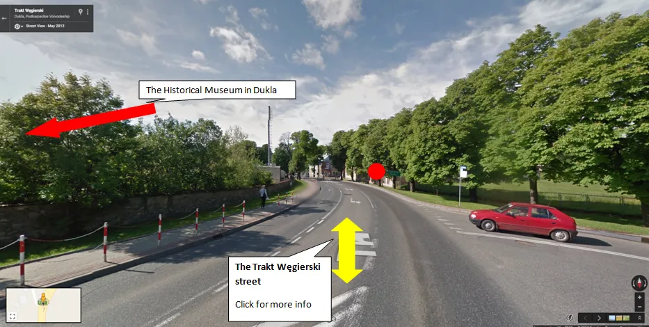
Pic. 20 The street mode example: when you are “going” some route you have the option to see detailed information for instance where the name of the street comes from, etc. See also a red arrow on your left course, which informs you about other must-see places in the proximity.
Everyone knows, that trip is not only bombarding information about history, geography, or economy. Every tourist needs to know where is the closest shop, place to eat, or place to stay. The (Virtual) Travel Guide would cater to these needs and meet the client’s expectations through to display of every object, which is marked on Google Maps software (Pic. 19,20).

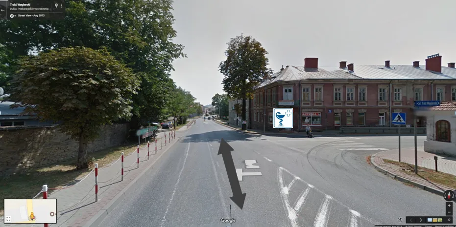
Pic. 21,22. Places of public use are marked in the Virtual Travel Guide, according to Google Maps.
When you select the place, likewise to the landmarks you will be given some basic information, in this case, contact details also.

Pic. 23 The contact details for one of the public places. You can see also options (arrows) to select routes. The red arrow shows you a rough place of the Dukla market at once.
Let’s go now to further places. When you will have a clear view you will see red arrows, informing you about tourist destinations situated a few kilometers ahead. Moreover, you will able to see other blue arrows showing you the most prominent hills (mountains) in the local area.
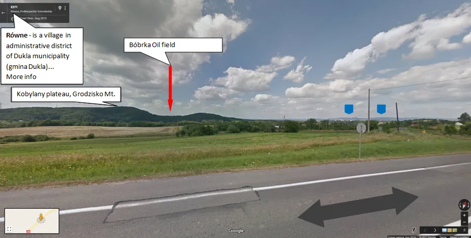
Pic. 24 The Virtual Tour Guide example in the Równe village. On your top left, you have the option to pop up the information about the Równe. Under the information callbox about the village, you may spot the name of the local hills also. The red arrow showing is your local tourist destination situated a few kilometers from your current position. On your right course far up above the horizon, you may see two blue arrows, which are indicating the most prominent hills: Królewska Mountain and Sucha Mountain in the Dynowskie Foothills.

Pic. 25 After the zoom-in option you are able to see more interesting places in that area. Far up in the background, you may spot 3 blue arrows which are indicating the mountainous-looking roughness of Dynowskie and Strzyżowskie Foothills. The yellow arrow is actually active and ready to pop up more information.
I described basically what it could be like. There are many colors and signatures. It’s good to attach some key for it. I prepared a basic legend for this below:
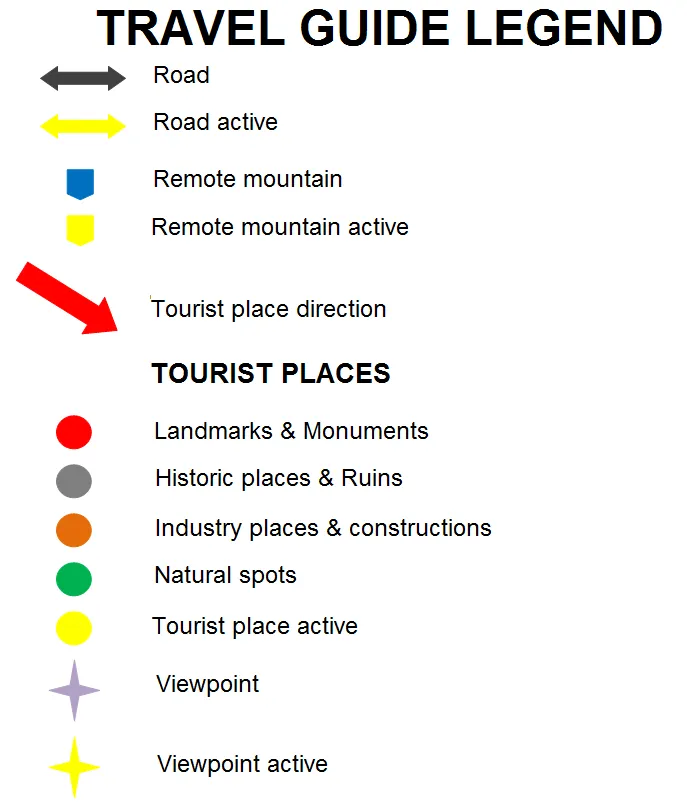
Pic. 26 The Virtual Tour Guide legend. This is a signature and basic list. I can take many other options into the account.
I have considered the Virtual Tour Guide on Polish examples, very close to my hometown due to the familiarity. This project may be implementable in any place in the World.
Generally speaking both Google Travel Guide apps and the Street View tools are very handy in trip planning today, although some things are still missing. I hope that my idea of combining those 3 elements: current guide apps, street view, and information base provided by see-know technology will become useful for many travelers around the world.
Mariusz Krukar
Links:
https://techcrunch.com/2016/09/19/google-launches-a-personalized-travel-planner-google-trips/
https://www.triposo.com
Google Lens vs Bixby Vision
Wiki:
Youtube: