
ArcGIS Online as the web-based map platform includes several base maps, analogous to the open-source map styles or XYZ tiles available in QGIS. Some of them aren’t useful concerning the level of detail, the others resemble just the OpenStreetMap base map. The OpenStreetMap features a large level of detail, but just in places as this mapping platform is self-contributed by all the users worldwide. It means, that some areas can be prepared well, but the other ones are not enough. How about the situation when we need to work with a more detailed map canvas? In any case, regardless of our platform or application, we can provide the custom map canvas based on the XYZ or WMTS layer. The same applies to the Ordnance Survey maps.
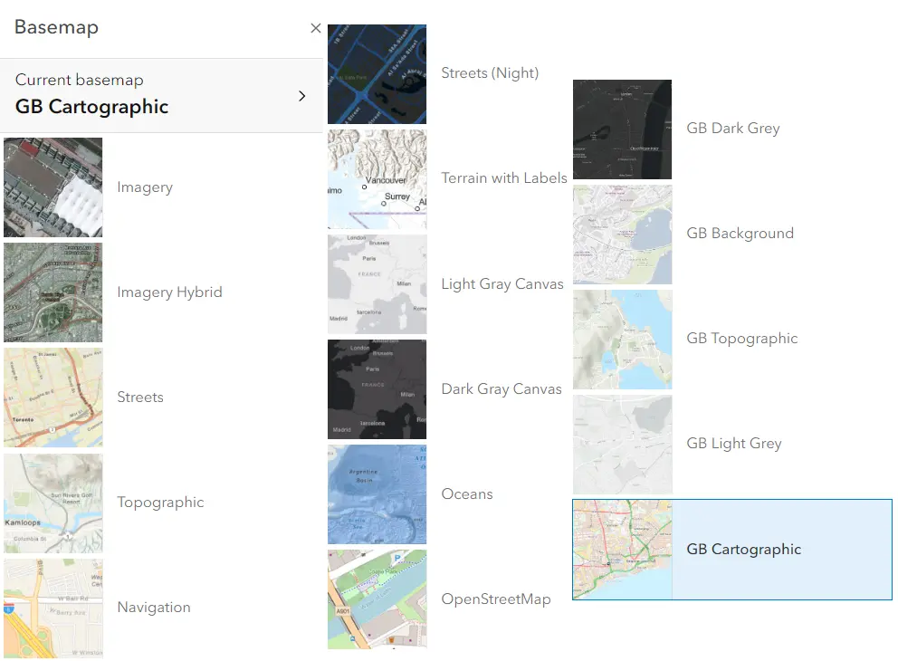
Pic. 1 Basemaps available in the ArcGIS Online platform.
You need to open the Ordnance Survey Data portal and set up your account if you haven’t done it yet. You need to select the Premium account (Pic. 2). The Premium account allows you to use the OS Maps API credits for up to £1000 monthly. In the end, you will be asked about the account number, which can be skipped for now.

Pic. 2 Ordnance Survey Premium plan.
Once confirm your email and log in successfully again, you will see the following main page (Pic. 3).
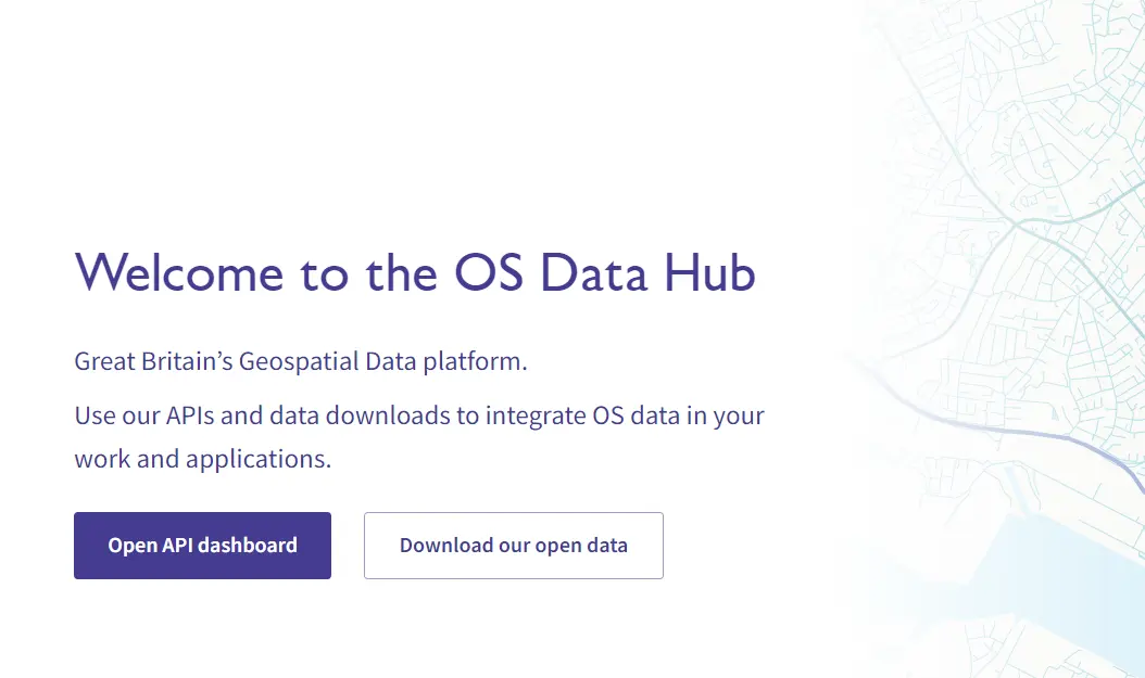
Pic. 3 OS Data Hub main page.
At first, your API dashboard is empty, so probably your first step will be a new project creation (Pic. 4).
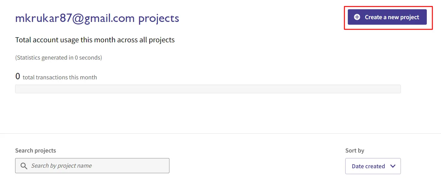
Pic. 4 Ordnance Survey Data Hub – the Create a new project option.
This is just setting a new project name and conforming it (Pic. 5).
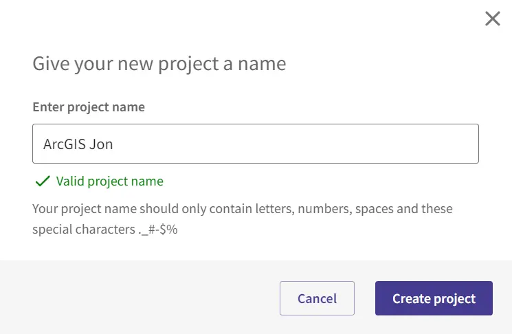
Pic. 5 Providing project name.
If our project map isn’t valid or already exists, you will see the text information in red instead of green.
Pic. 6 Adding API to our OS Data Hub project.
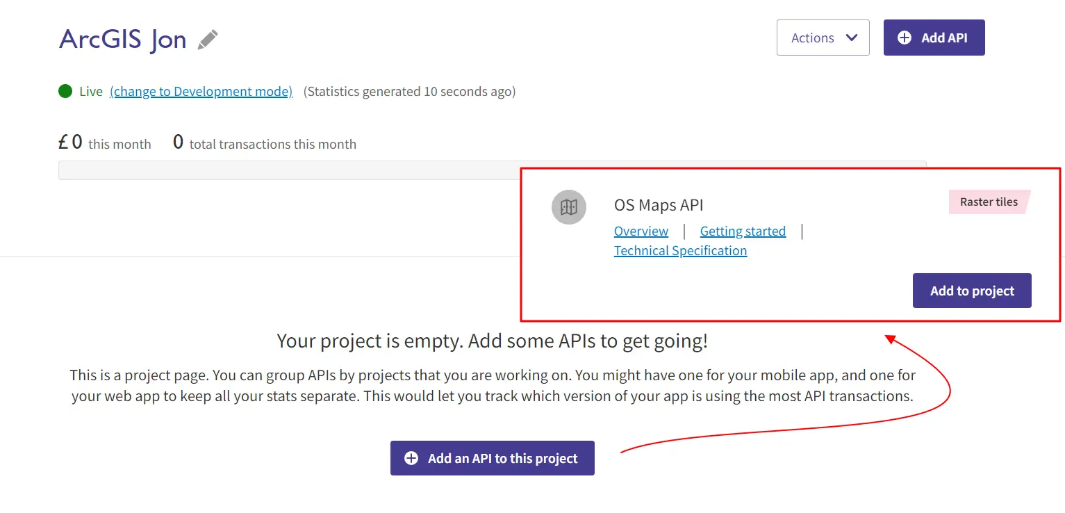
The situation becomes more complicated when we click Create Project. Ordnance Survey has a few of them, so you must know which one is relevant to our map. You must scroll down to the end and select the OS Maps API option. This API includes the WMTS layer for the high-detailed Ordnance Survey maps used i.e. by the City of London interactive maps. The details can be checked in the links available below. By clicking the Add to project button you will have your API project listed in the main panel. By clicking it, you can see the details as well as change its name when typed incorrectly (Pic. 7).
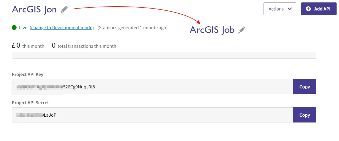
Pic. 7 The Ordnance Survey API project details with the option of name change when typed incorrectly.
In your API project details are important to look at the Project API Key. It is needed for firing up the OS map layer in ArcGIS Online and other platforms I believe.
When you are on the ArcGIS Online map, dropdown the Add menu and select Add a layer from the URL (Pic. 8).
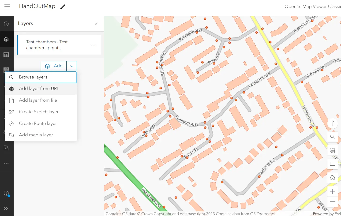
Pic. 8 ArcGIS Online – Add layer from URL option.
Next, you will see the box for pasting your URL and layer type selection, which are empty for now (Pic. 9).
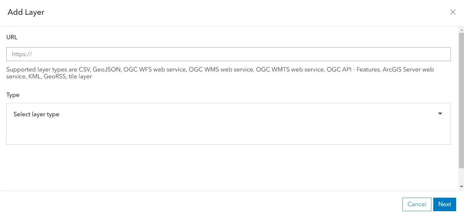
Pic. 9 ArcGIS Online add layer from URL options.
The URL address can be obtained from the OS Data Hub page, where your Ordnance Survey API project appears. By scrolling down through its details, you will eventually see the WMTS address, which must be copied (Pic. 10).

Pic. 10 The Ordnance Survey API project details with WMTS link.
You can simply hit the Copy button on the right and the whole link will be duplicated to your clipboard immediately (Pic. 11).
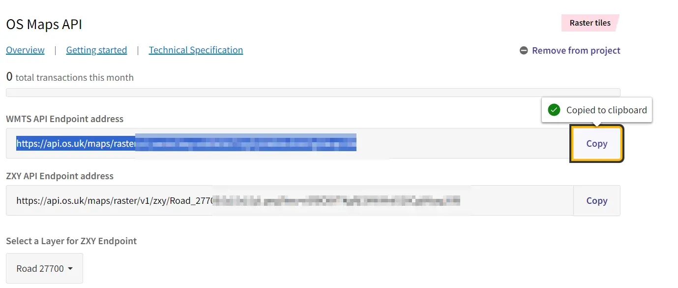
Pic. 11 Our Ordnance Survey WMTS URL link has been copied to the clipboard.
Next, paste the link into the place displayed in the Add Layer ArcGIS Online box (Pic. 9) and you should see the proposed default map layer type, which is WMTS (Pic. 12).

Pic. 12 Ordnance Survey WMTS layer map type proposed for ArcGIS Online.
Instead of WMTS, you have other options GeoRSS, CSV, or TileLayer. None of them are useful for your purpose, therefore the default one (WMTS) must stay.
The next part of your settings are Custom parameters without which the map cannot be run. Important is the API key, which must be copied in the same way as the WMTS address earlier (Pic. 13).
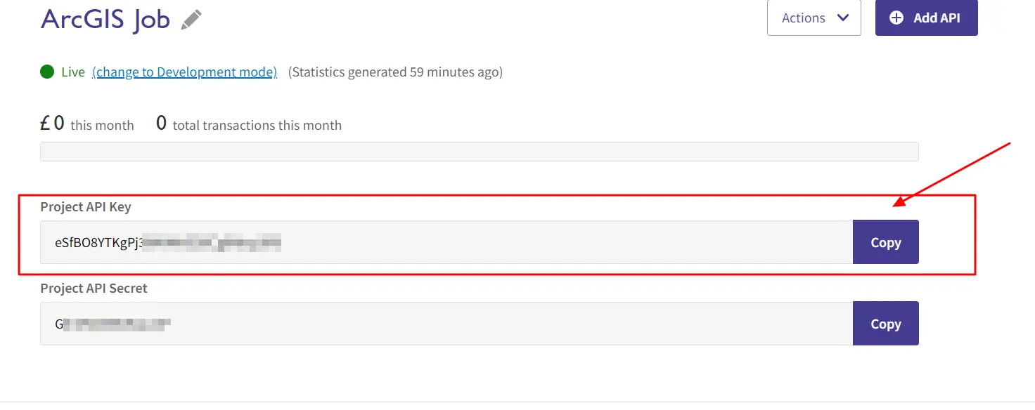
Pic. 13 Ordnance Survey map API key details.
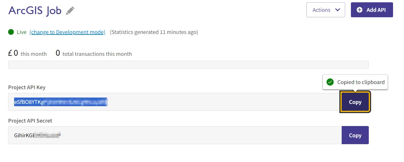
Pic. 14 Ordnance Survey map API key copied to the clipboard.
Finally, our URL layer details should look like the below (Pic. 15), where
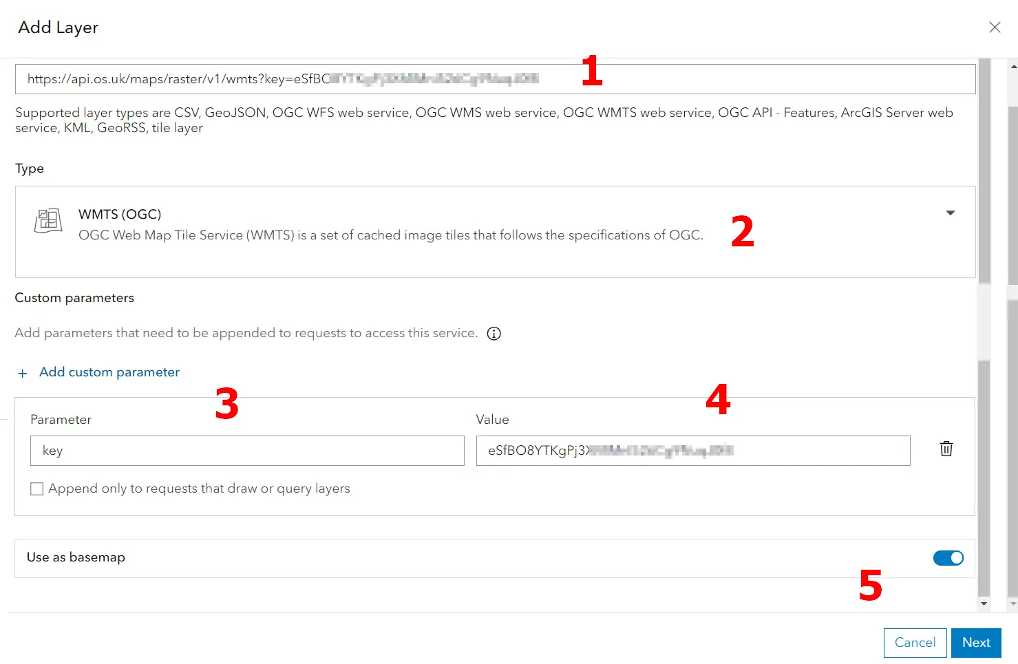
Pic. 15 ArcGIS Online map – add layer from URL details where: 1 – The WMTS layer copied from OS Data Hub portal; 2 – The default type of layer; 3 – The type of parameter; 4 – The value of parameter copied from OS Data Hub portal; 5 – The Use as basemap option.
you have the full URL WMTS layer copied from the OS Data Hub portal (1). It includes several types of layers discussed earlier, but the default WMTS (2) must stay for our purpose. The map cannot be utilized without the custom parameter, which in our case is the Project API Key (key) (3) and its value (4). At the last, you need to decide about the way of layer usage. It can participate as the individual layer or be used as the basemap (5). I would advise you to use it as a basemap.
The last step is the selection of the map type. You might notice the CRS type next to it. There are 2 types of CRS available EPSG 27700 and EPSG 3857 (Pic. 16). You can make your selection based on your needs, although for UK-based projects it’s better to stick with EPSG 27700.

Pic. 16 Ordnance Survey API map type selection.
For your purpose probably the best will be the Road type, but there are others available too (Pic. 16).
Finally, the Ordnance Survey API base map appears in our map and it looks great concerning the level of detail (Pic. 17).
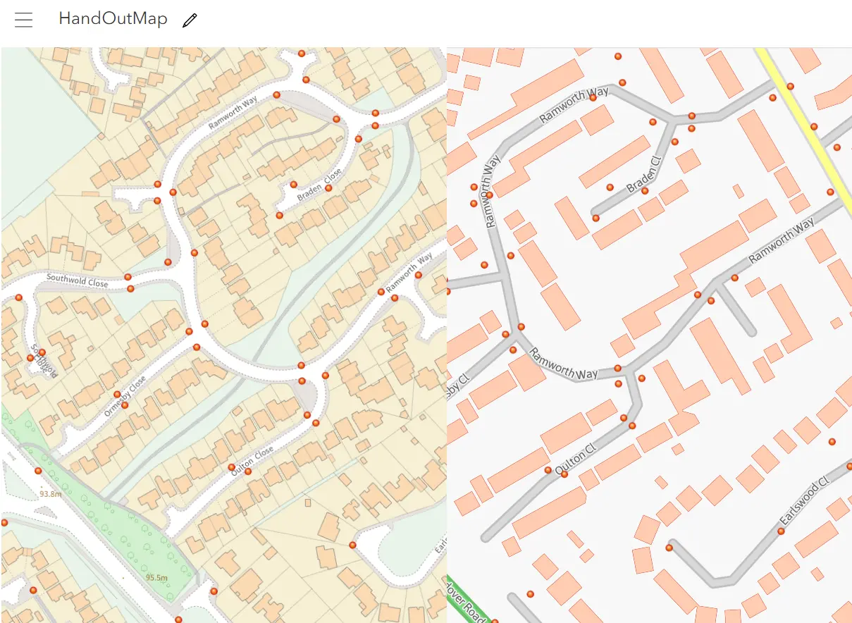
Pic. 17 Ordnance Survey vs GB cartographic basemap in ArcGIS Online.
The best comparison to the level of detail can be made with the GB cartographic basemap, which resembles the Ordnance Survey map but is rather useless when single plots of land or streets are considered.
The Ordnance Survey layer can be taken down anytime (Pic. 18), but you can’t add it again from the list. All the steps shown in this text must be repeated, unfortunately.
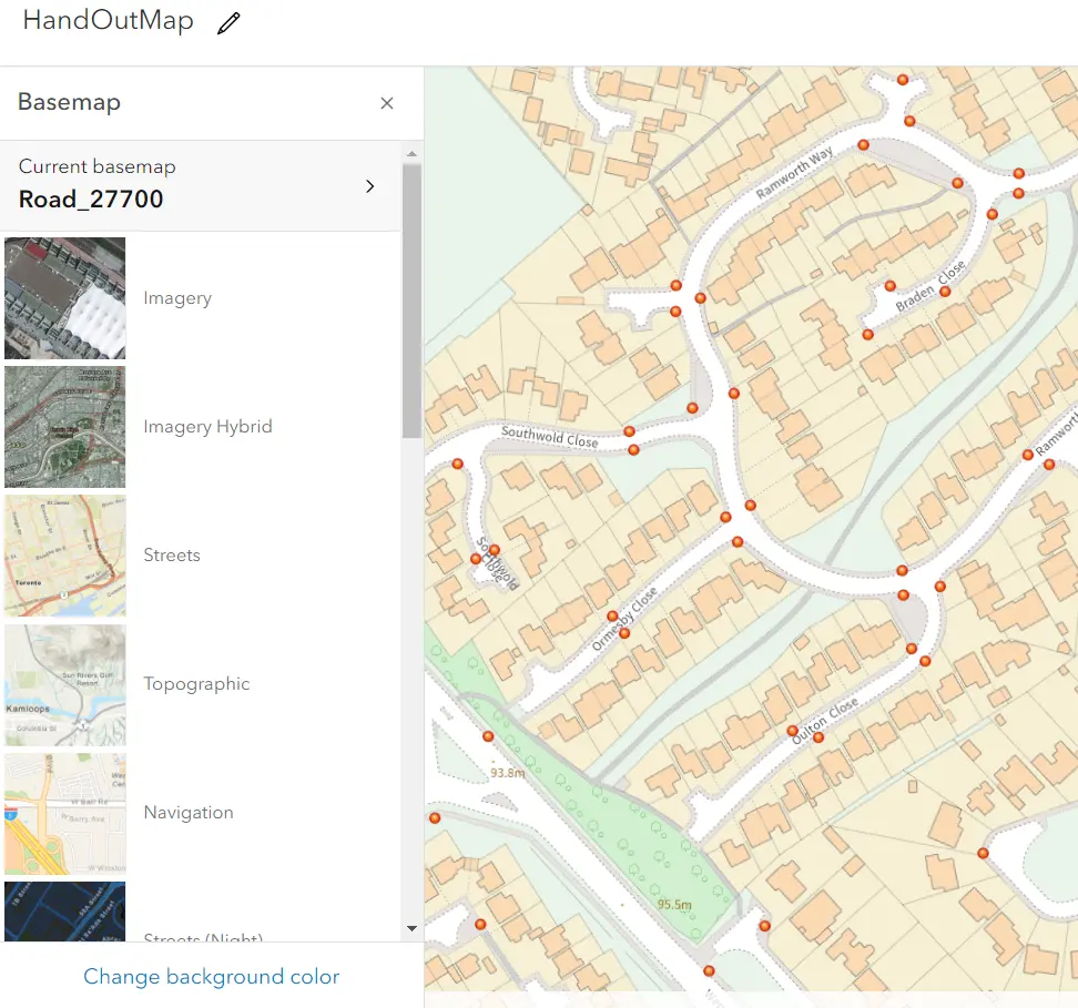
Pic. 18 The Basemap options in ArcGIS Online when the Ordnance Survey API map is in use.
Since you know how to use the Ordnance Survey maps in your ArcGIS Online project, you should understand how the OS Data Premium plan works. The £1000 monthly credit is displayed on the Dashboard (Pic. 19).
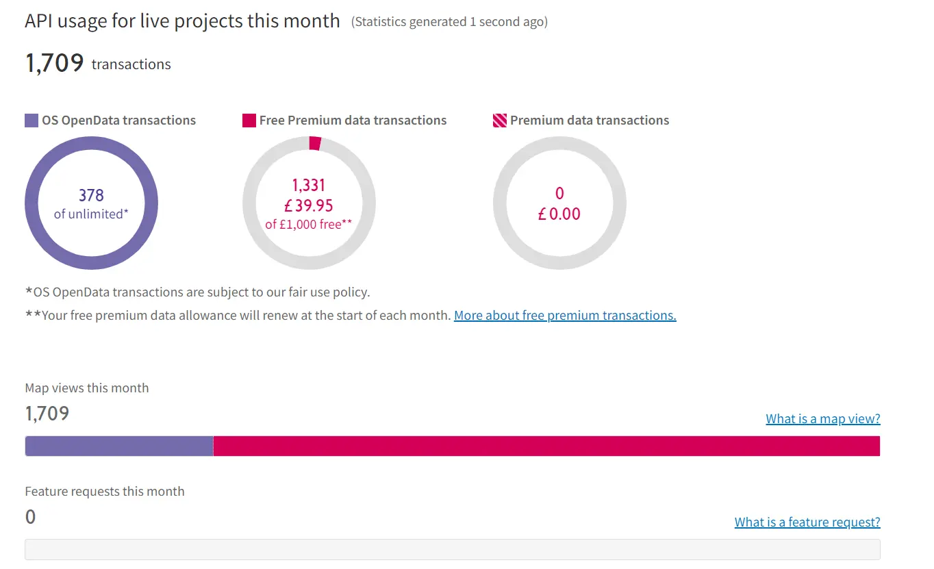
Pic. 19 The Ordnance Survey Premium plan usage.
Moreover, the live API usage with the detailed breakdown can be found also in the My projects section (Pic.20).
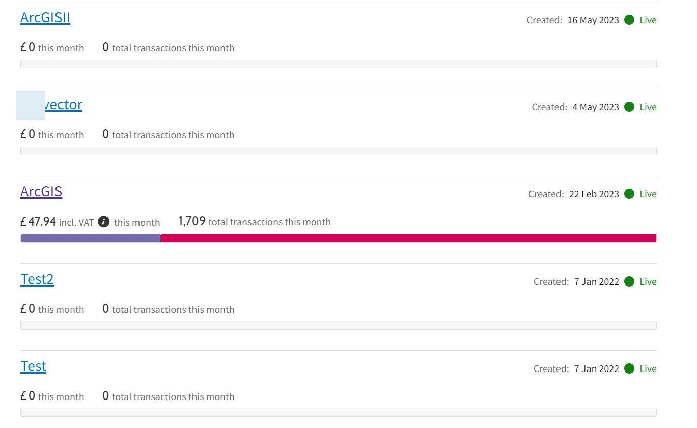
Pic. 20 The OS Data Hub premium plan usage with the breakdown of every single API project.
The transactions are calculated as a whole, which means, that the £1000 value is a result of the sum of all project usage not only 1. The transaction is counted as the 1 view of the map with 15 raster tiles loaded.
Now, since you shared your bank account details with the creation of your account you will be charged whenever your credits exceed £1000 in the given month. In the other situation, when the OS Data Hub doesn’t know your bank account details, your API key becomes inactive when you run out of credits. It means, that Ordnance Survey maps turn into blurry/pixelated appearance and are useless for high zoom levels. Everything is nullified as the new month approaches.
The OS Data premium plan allows you to use the high-detailed Ordnance Survey maps not only in ArcGIS Online but also in other platforms or applications like QGIS.
Mariusz Krukar
Links: