Displaying tourist trails on Google Satellite imagery in QGIS
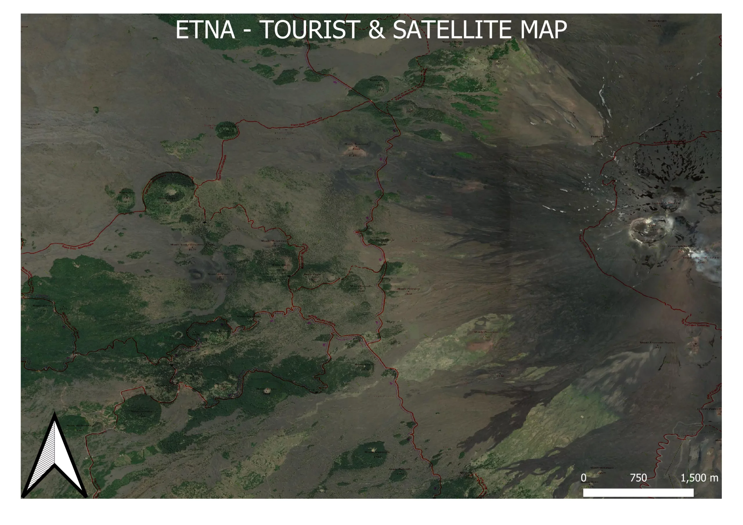
There is a way in QGIS, which allows us to display the tourist trails overlay on Google Satellite imagery. It wouldn’t be interesting that much if not for the fact, that it can be exported as an image or printable as a map in Print Layout. In the next few sentences, I will demonstrate to … Read more