The 49 brightest stars in the night sky – when and where can we see them?
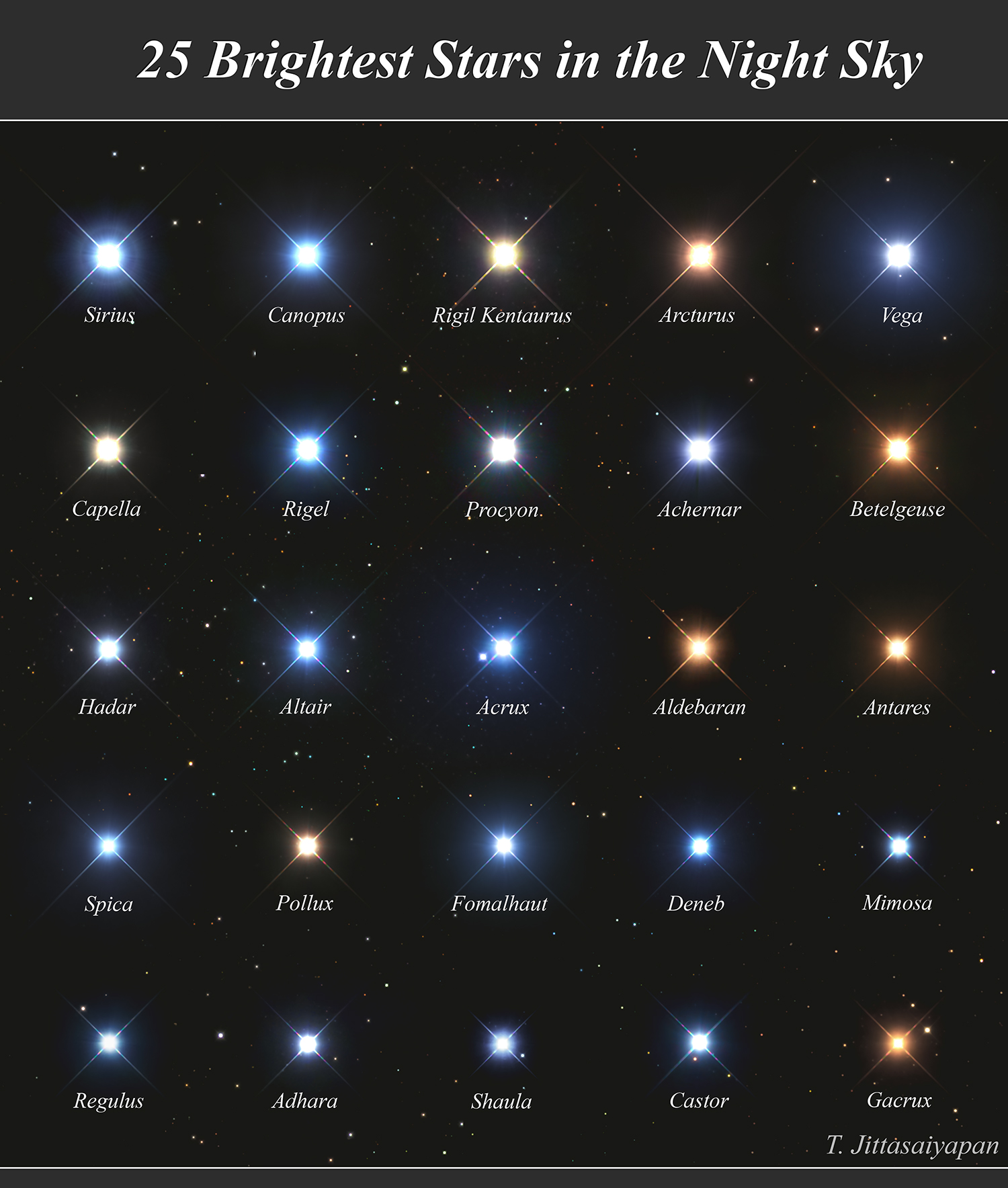
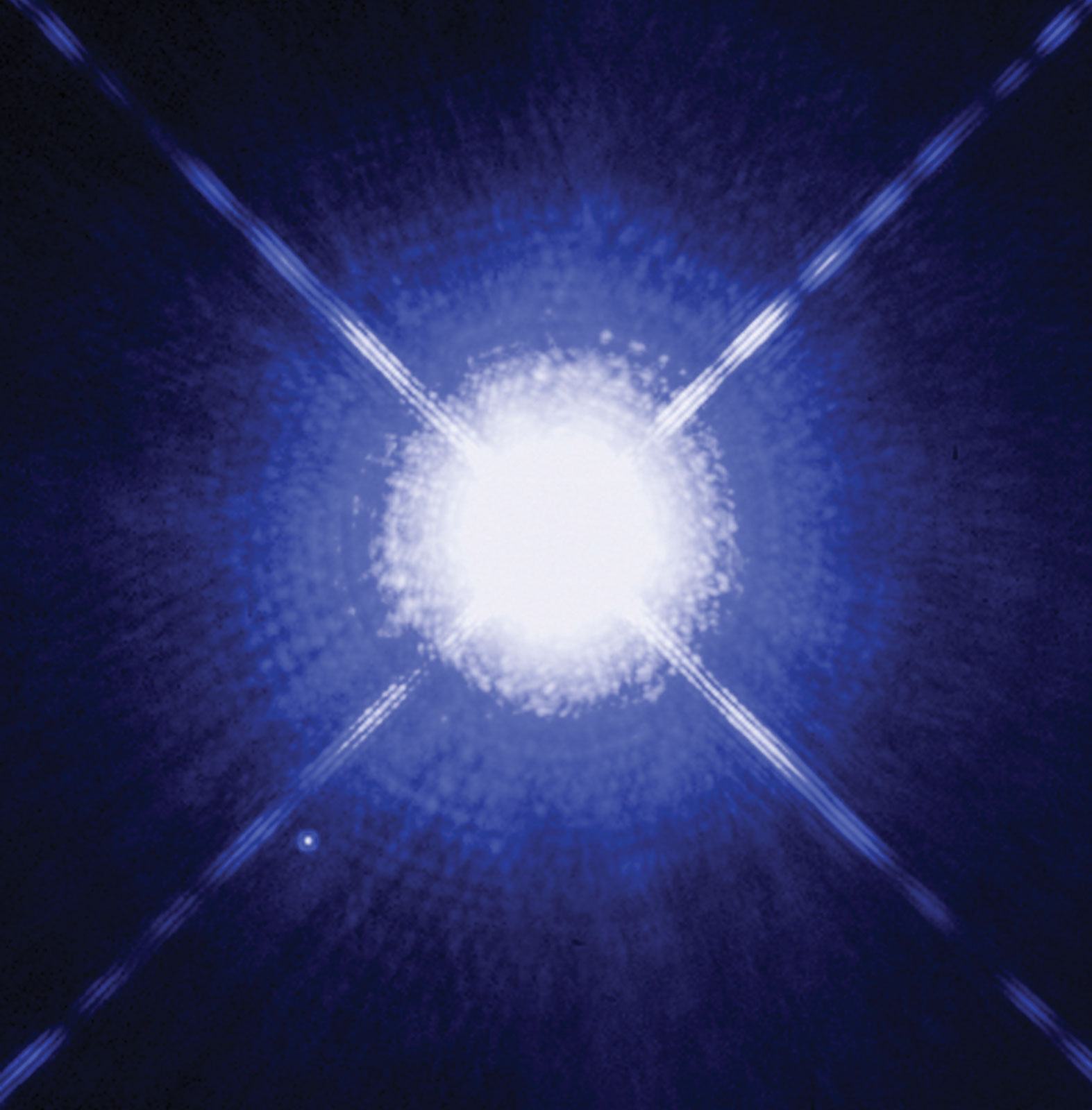
Since this amazing image (at the top) has been published, the articles about the 25 brightest stars in the night sky grew like weeds. Despite a multitude of similar texts presenting a brief description of the brightest stars, which can be seen in the night sky there is no complete information. I do not mean … Read more