
36 constructive tips & tricks for the Mapy.cz application
The Mapy.cz is probably the best tourist map (and app) worldwide. It has been created by the Seznam.cz – one of the main web portals and search engines operating in the Czech Republic. The very first steps of this map portal have been taken in 1998. For long years the Mapy.cz was covering the Czech Republic bounds only. This situation started to change in 2011 when the Mapy.cz expanded on the Slovakian territory. A breakthrough year was 2014. In late 2014 the Mapy.cz service started to collaborate with the OpenStreetMap project, which has led to expanding the maps services all over the world, as all the maps could be browsed globally. Since that time the number of users rose incredibly reaching over 2 billion in 2017. Nowadays the Mapy.cz service can firmly content with Google Maps and other maps platforms, because of a multitude of features available both in the desktop and Android versions.
The Mapy.cz is a well-prepared Czech equivalent for Google Maps, which comes out with quite a lot of extra features, like for instance the outdoor map. The service development is still in progress, which means, that some areas can be performed better than others. In fact, Czechia will have always the most details, as it’s the mother country of this fantastic application.
In this article I would like to describe all the practical and incredible things, which you can do having the Mapy.cz map platform opened a front of you. Some of them have been described already, but there is still a lack of description in English and if exists it’s quite lapidary.
I. WORLDWIDE MAP FEATURES
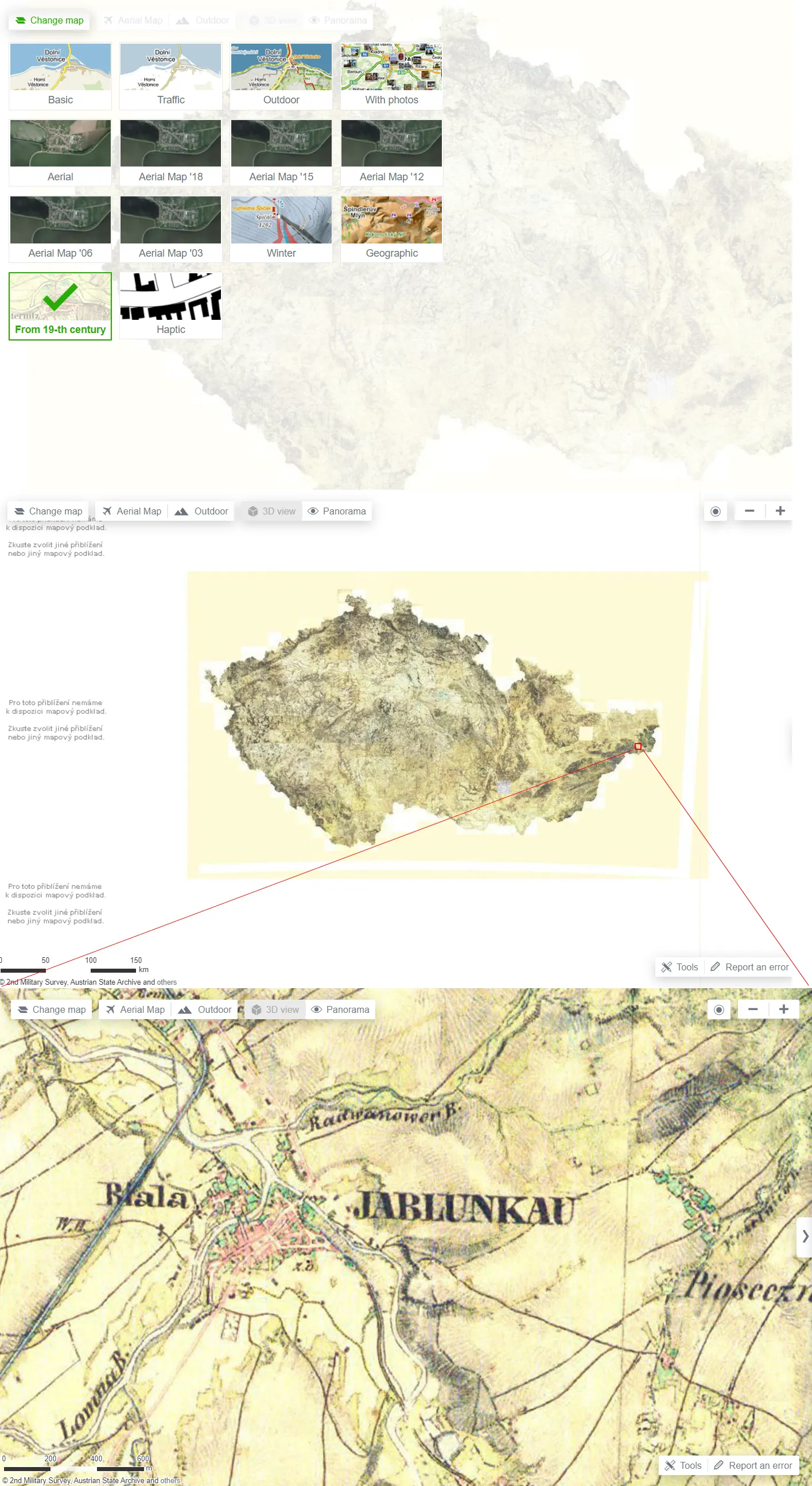
1. Check the historical satellite imagery – this is a cool option for comparing the satellite view in the span of nearly 20 years. It does work best for Czechia and Slovakia.

Pic. 1 The selection of satellite imagery with an example below.
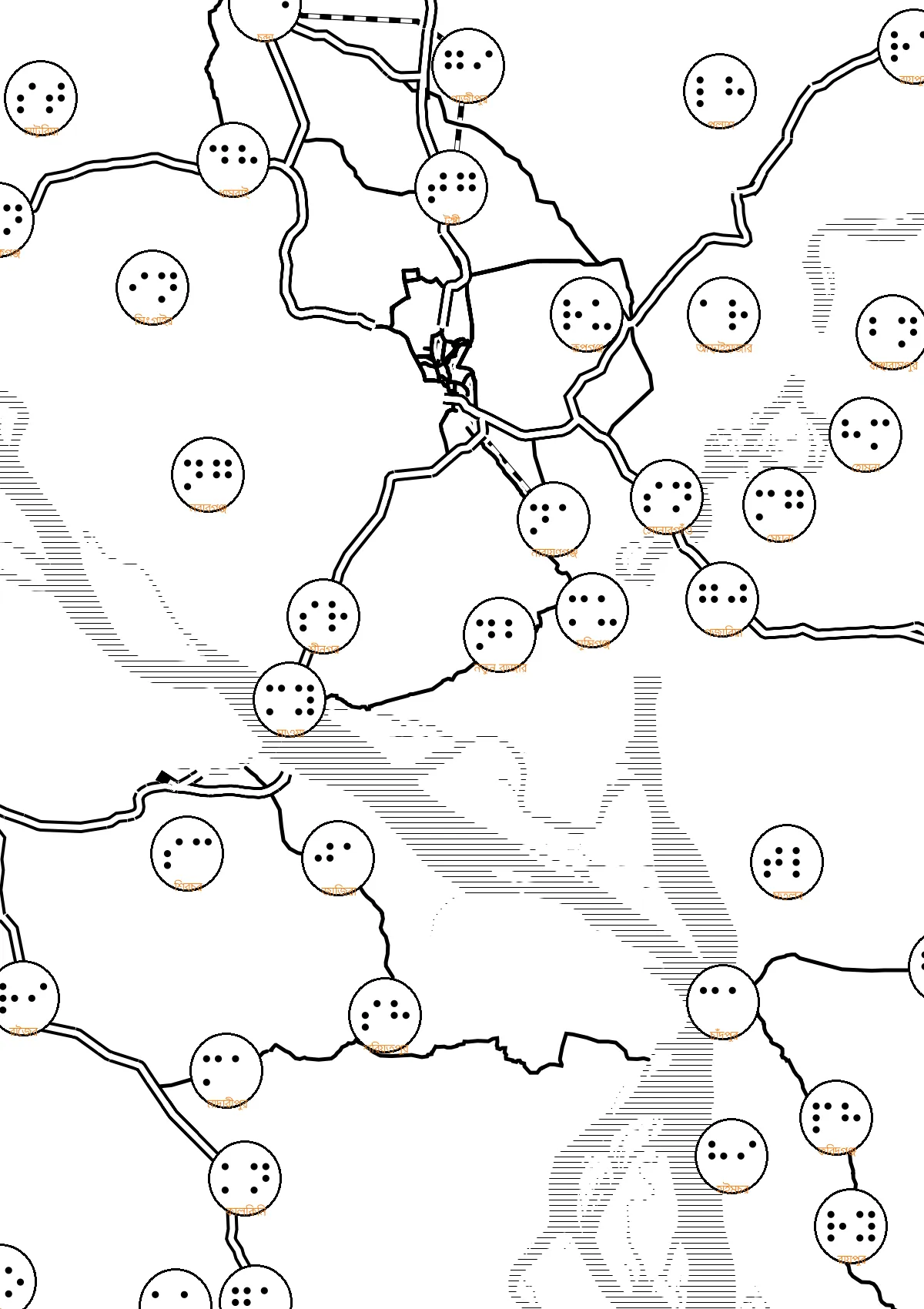
2. Best, Biggest, Highest, Oldest (…) places in the given country or worldwide (Records or Curiosities) – by using the “Geographic Map”, a user can check i.e. the highest peak in the specified country, the oldest landmark, and so forth. All of them have been marked by the specified signatures on the map. Surely, the Czech Republic is best prepared on this map, but as the project develops we should expect a similar level for other countries soon.
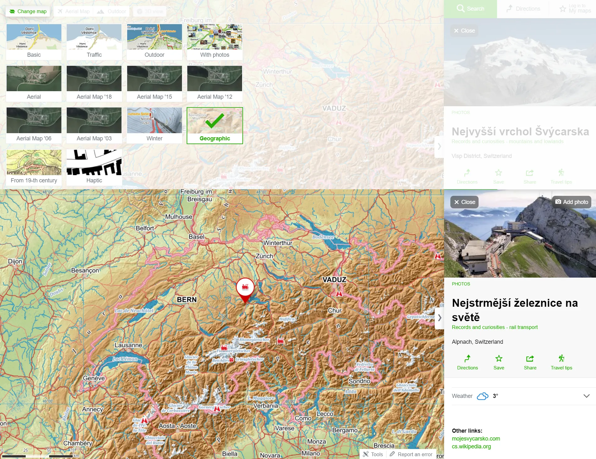
Pic. 2 The Geographic map includes all the best places in the given country or region.
3. Browse photos – the map “With photos” has been developed on the tourist background, so you can see all tourist trails underneath. This map works on the same basis as Yandex images or formerly Panoramio.com for Google.
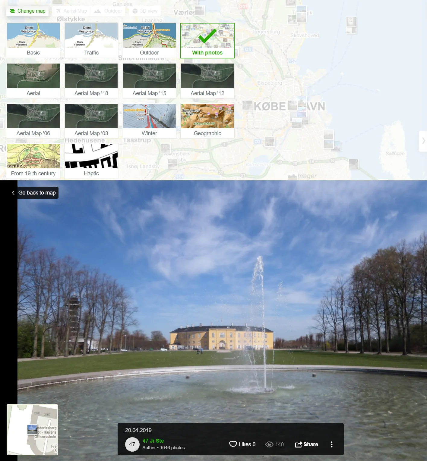
Pic. 3 Map with photos and examples of the uploaded photo.
4. Zoom by image – you have found some interesting image thumbnails on the map and opened them, but you don’t know roughly where it is, because you used the wrong zoom level. It’s not a problem, you can easily zoom to the image location by using the map thumbnail in the bottom-left corner.
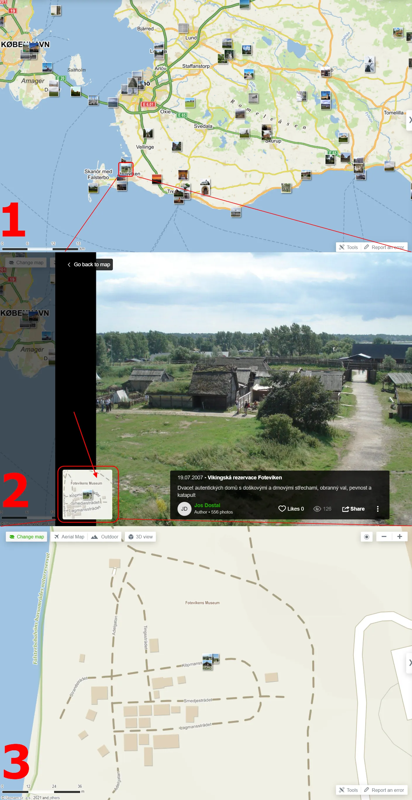
Pic. 4 Zoom option by the selected image on the map “With photos”.
5. Ski resort map – this is the Winter map, which includes all major ski resorts worldwide, marked with the blue sign of the skier
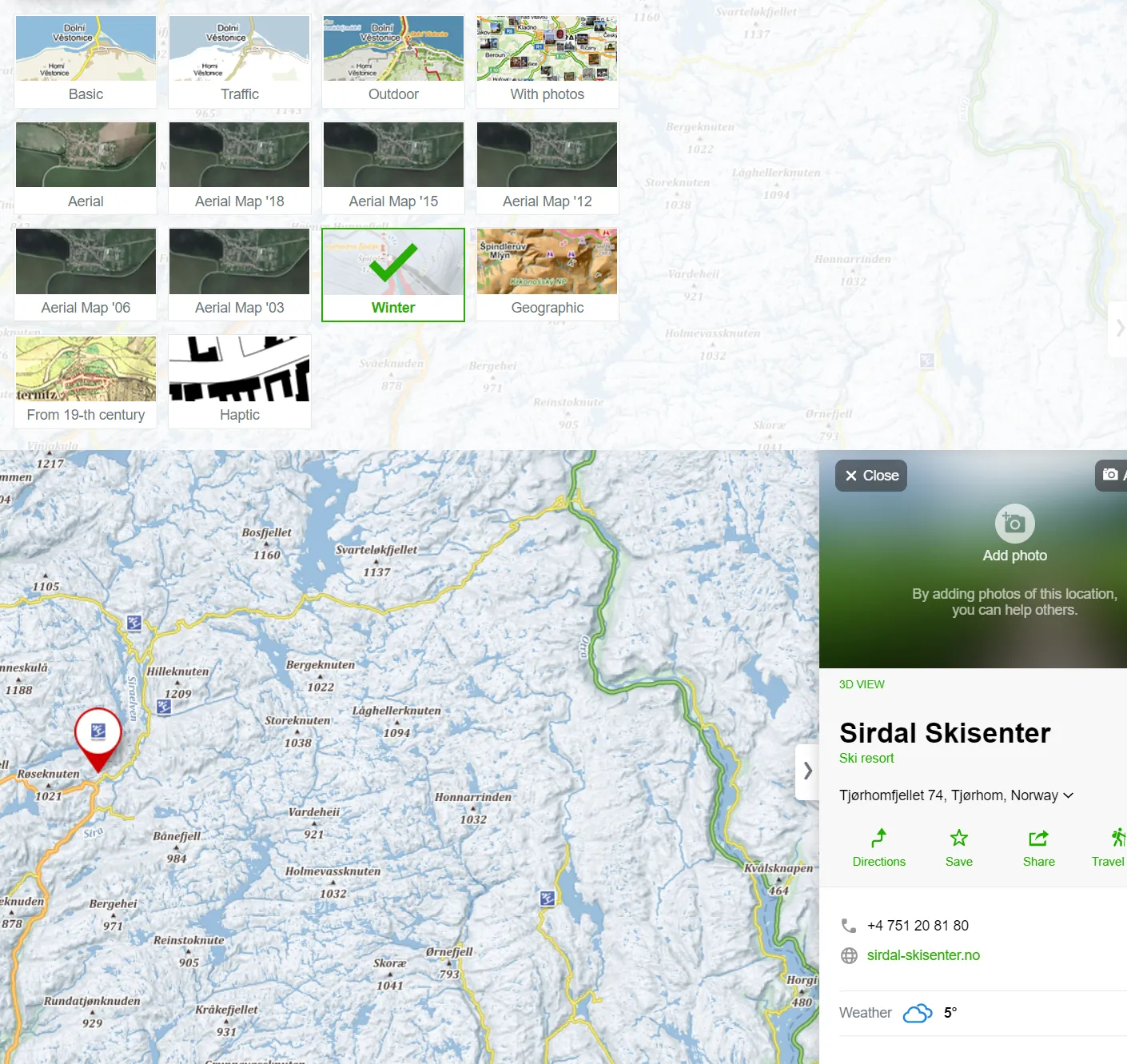
Pic. 5 The “Winter map” can be treated as the ski-resort map because it includes all major places for skiing worldwide.
Moreover, you are able to check what the ski trails look like after a close-up view of the map. This is very useful for planning winter sports with your family.
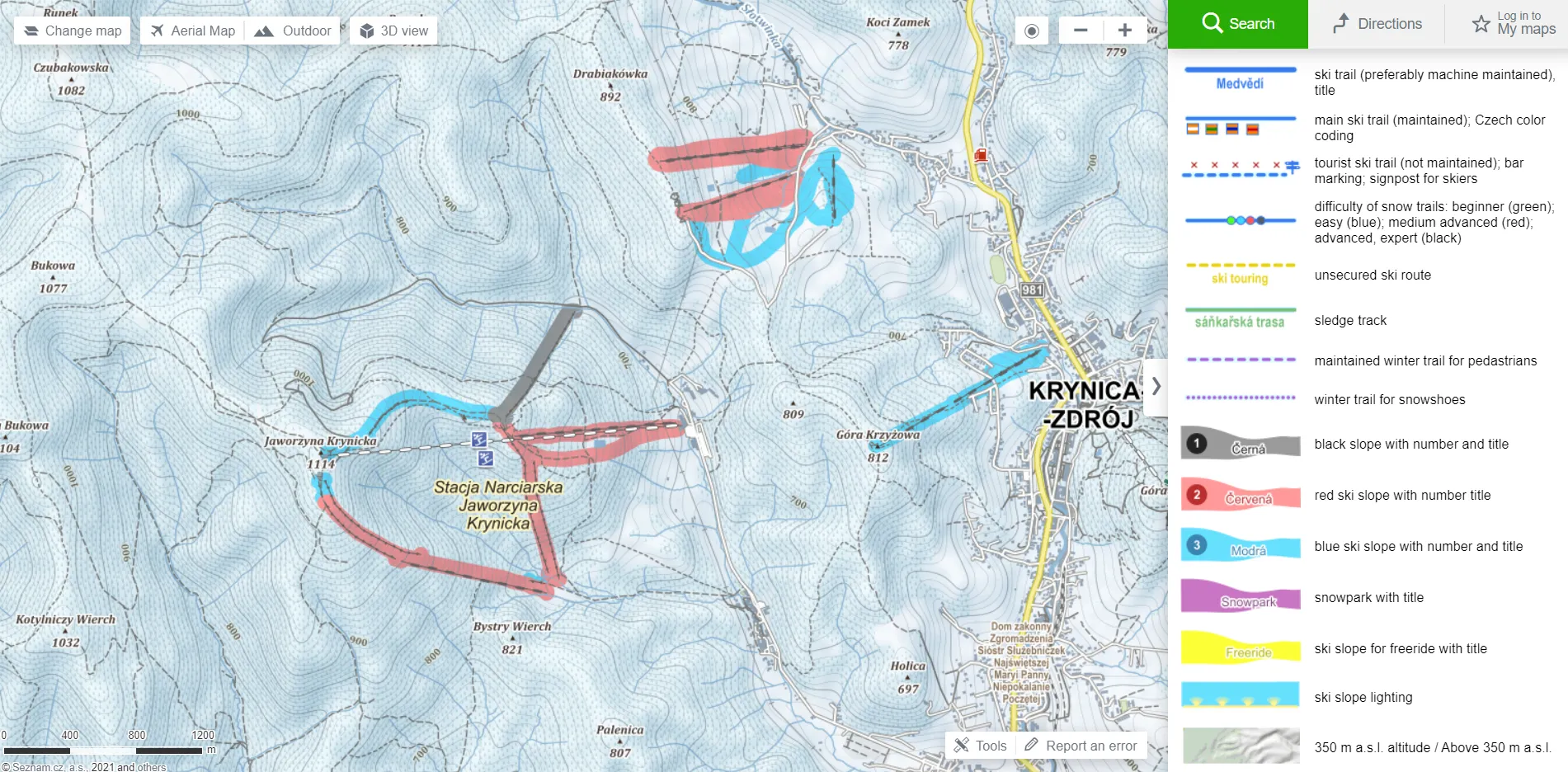
Pic. 6 Detailed views at ski resorts on “Winter map”, where we can see also the trails for skiing. The map legend is on your right.
6. Check the inclination of ski slopes – a good feature, which represents 3 types of ski slope inclination and works for both the “Winter” and “Outdoor” maps, although it’s much better visible for the “Winter” one. It’s a nice way to check which slopes are possibly too steep for normal winter sports, but looking at it from a different angle they can be good for the extreme kind of sport.
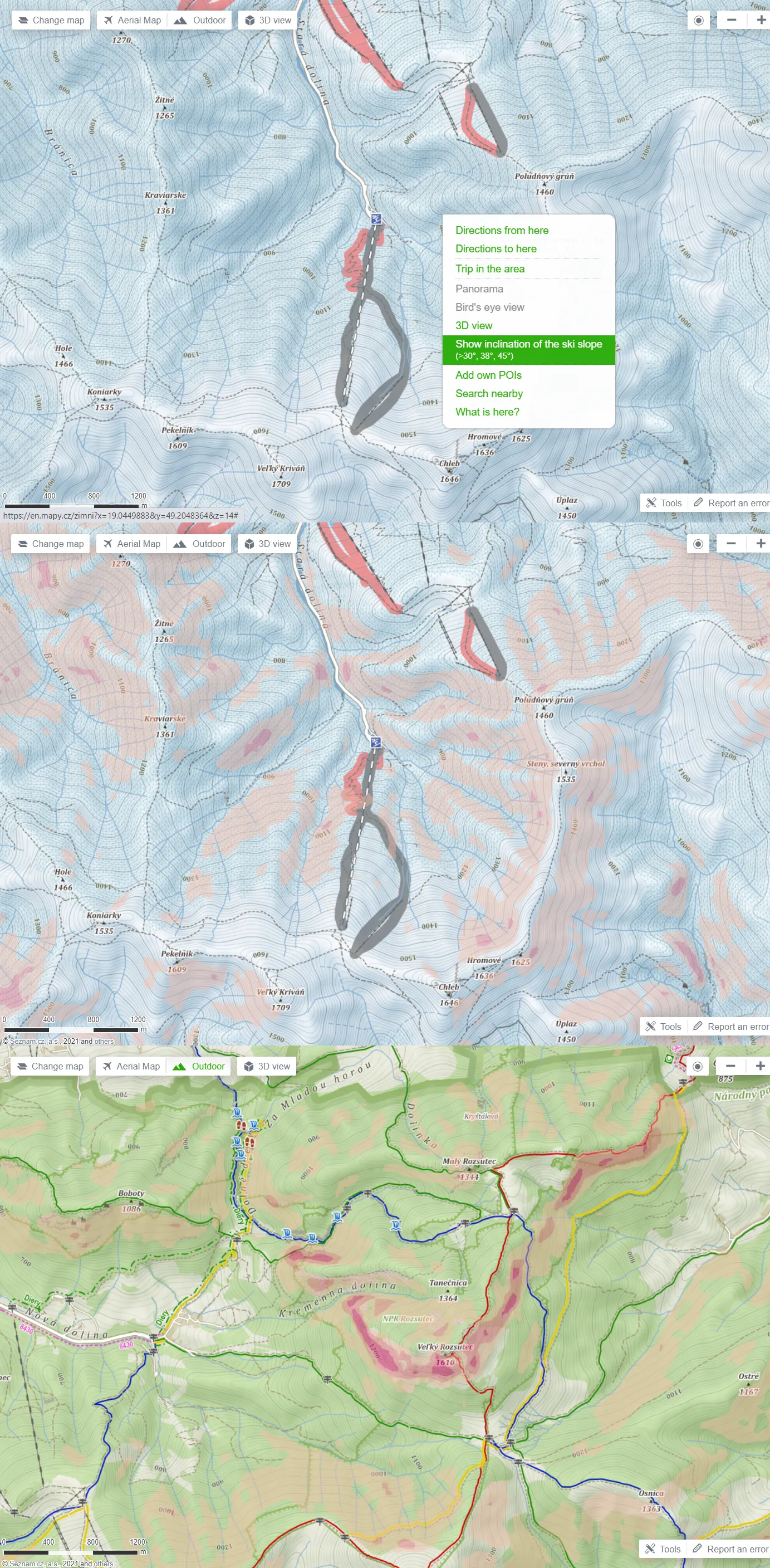
Pic. 7 The example of ski slope inclination both on the “Winter” and “Outdoor” maps.
7. Tactile (Haptic) maps – this is an option dedicated to blind or partially sighted people. The maps can be used by touch. Here you can find detailed instructions on how to use them. This type of map is far simplified with a lot of cartographic elements visually merged for easier touch perception. This link explains more about how to read the maps like these. These maps can be downloaded by box signatures.
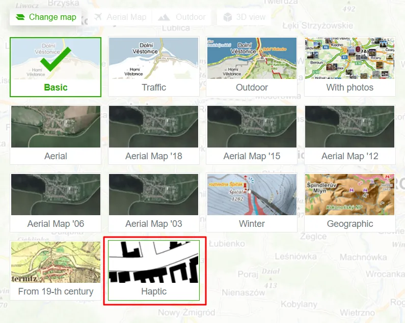
Pic. 8 Haptic maps selection from the main panel.
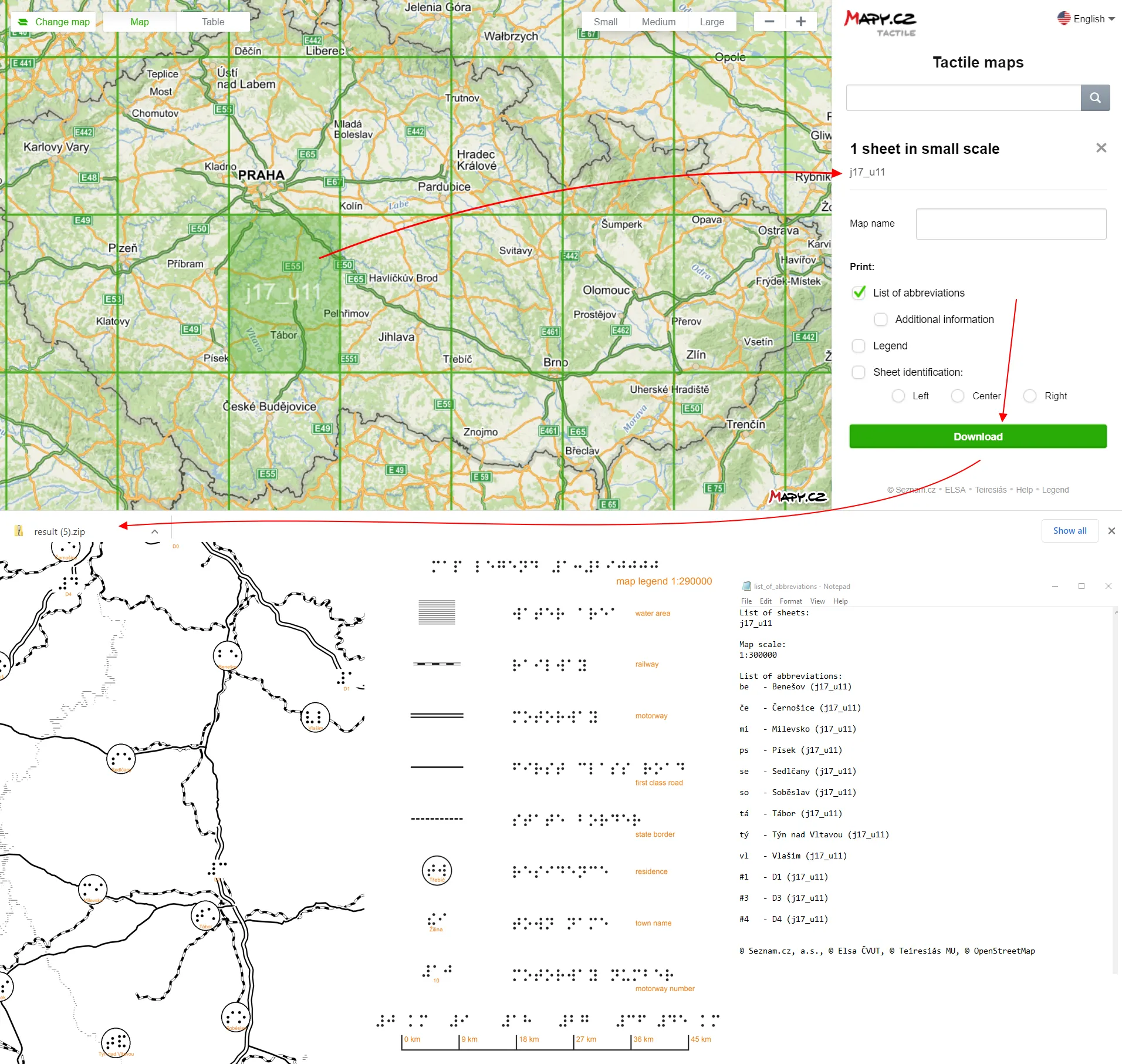
Pic. 9 An example of tactile maps. The user can download them as a zipped file, which includes the map for the area bounded in the selected box, the legend, and also the list of abbreviations.
The maps can be found under the following address: https://hapticke.mapy.cz/. They cover the whole world.
Pic. 10 The haptic (tactile) map of the Dhaka region.
8. Check your area in the 3D view – the nice option, which renders perfectly the terrain on the same basis as i.e. Google Earth does. The primary malady here is the lack of artificial features like skyscrapers, towers, etc. Therefore it doesn’t work really for cities. Only some big Czech cities are equipped with the 3-dimensional view, which looks pretty cool. Regardless of urban areas, this view is awesome in any mountainous area.
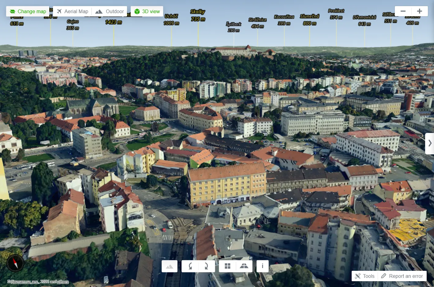
Pic. 11 The example of a 3-dimensional view of Brno – the second largest city in Czechia.
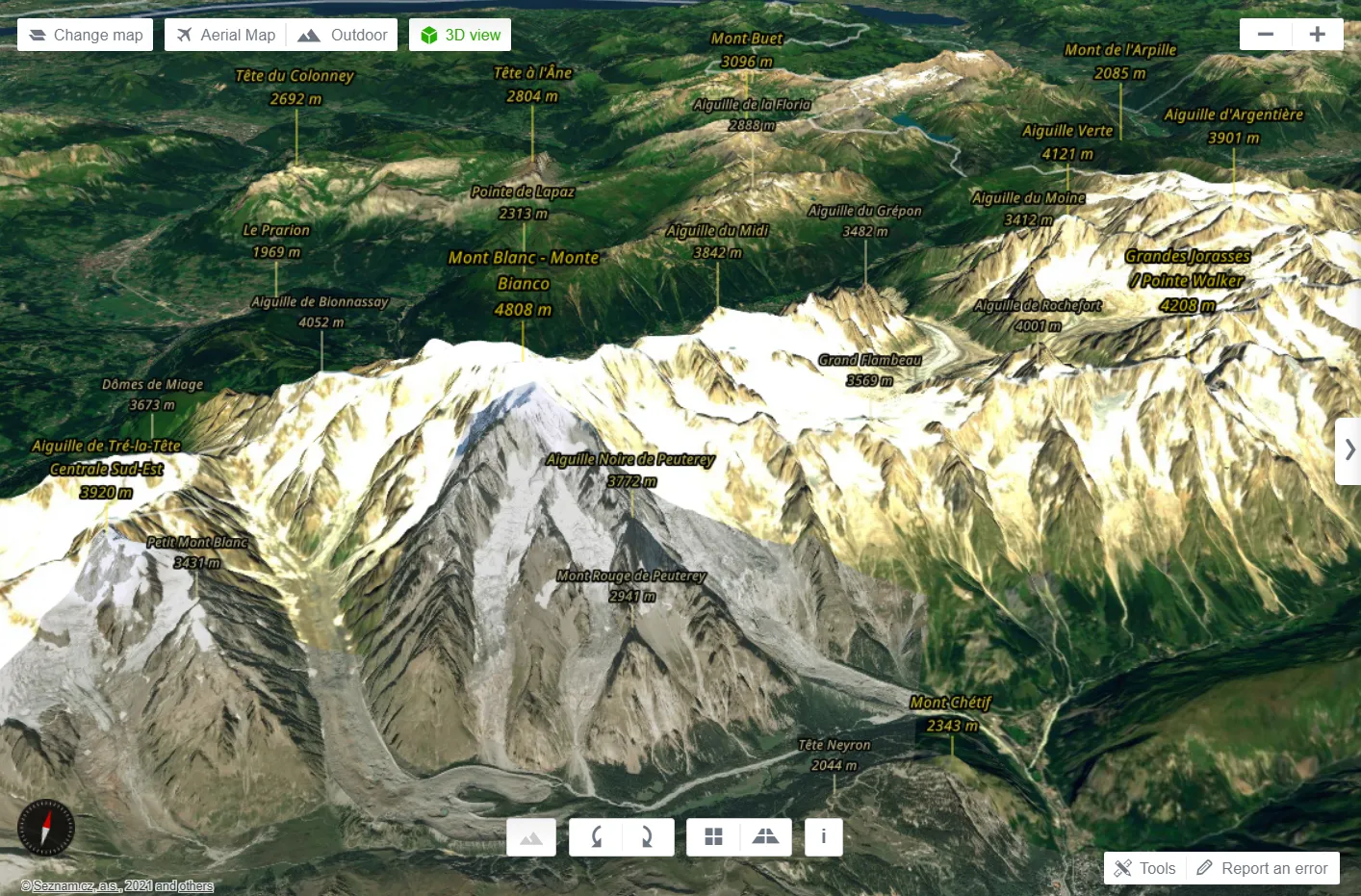
Pic. 12 The 3D view of the Alpine region.
A good hint is to use always the Aerial Map for this purpose. Then your terrain will be rendered nicely. You can switch this map off, which will be replaced by the Outdoor map, although the 3D view won’t be as perfect as you can see above, even if you keep the 1.25 exaggeration level on.
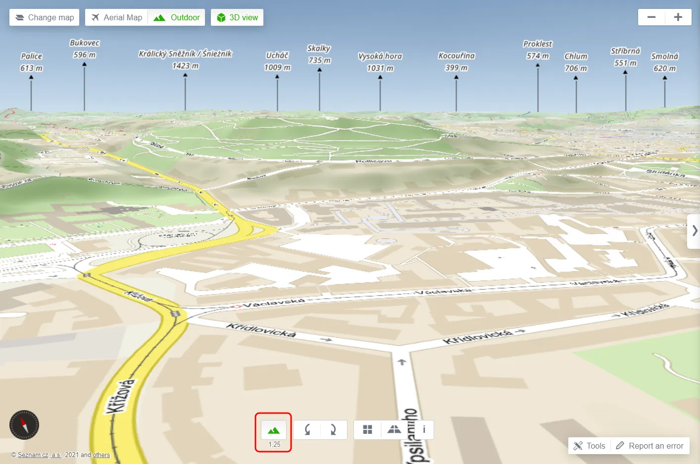
Pic. 13 The 3D view mode for Outdoor Map with the 1.25x vertical exaggeration option switched on (marked red) – the same view at Brno – the second largest city in Czechia.
The view above is similar to the one, which can be gained for Google Earth by overlaying various map canvases.
The biggest attitude of the 3D view is its compatibility with other features offered by this mapping platform. Recently Mapy.cz enabled the 3D view for the planning routes. We can also see our travel tips in this mode, which is simply fantastic!
Pic. 14 The 3D view with travel tips. Once you hover or select one of them it will be highlighted on the 3D map.
Pic. 15 Your calculated route in the 3D view.
The 3D view can be changed by the icons at the bottom or by using your mouse (check the information icon).
9. Search by and check if it’s open or closed – this is a very handy option, allowing you to find anything nearby. You can search by keyword or by categories dedicated roughly to tourism. Apart from a pure search tool, you can also filter the results by opening hours. I mean, at the moment you do research you can check if the object is opened or already closed. You should see on the right what time the building is open to the public.
The results will appear regardless of the zoom level. If you localize yourself, all the features will appear nearby for zoom level 14 (E-W – 7km, N-S – 4km) covering about 28 square kilometers of your area.
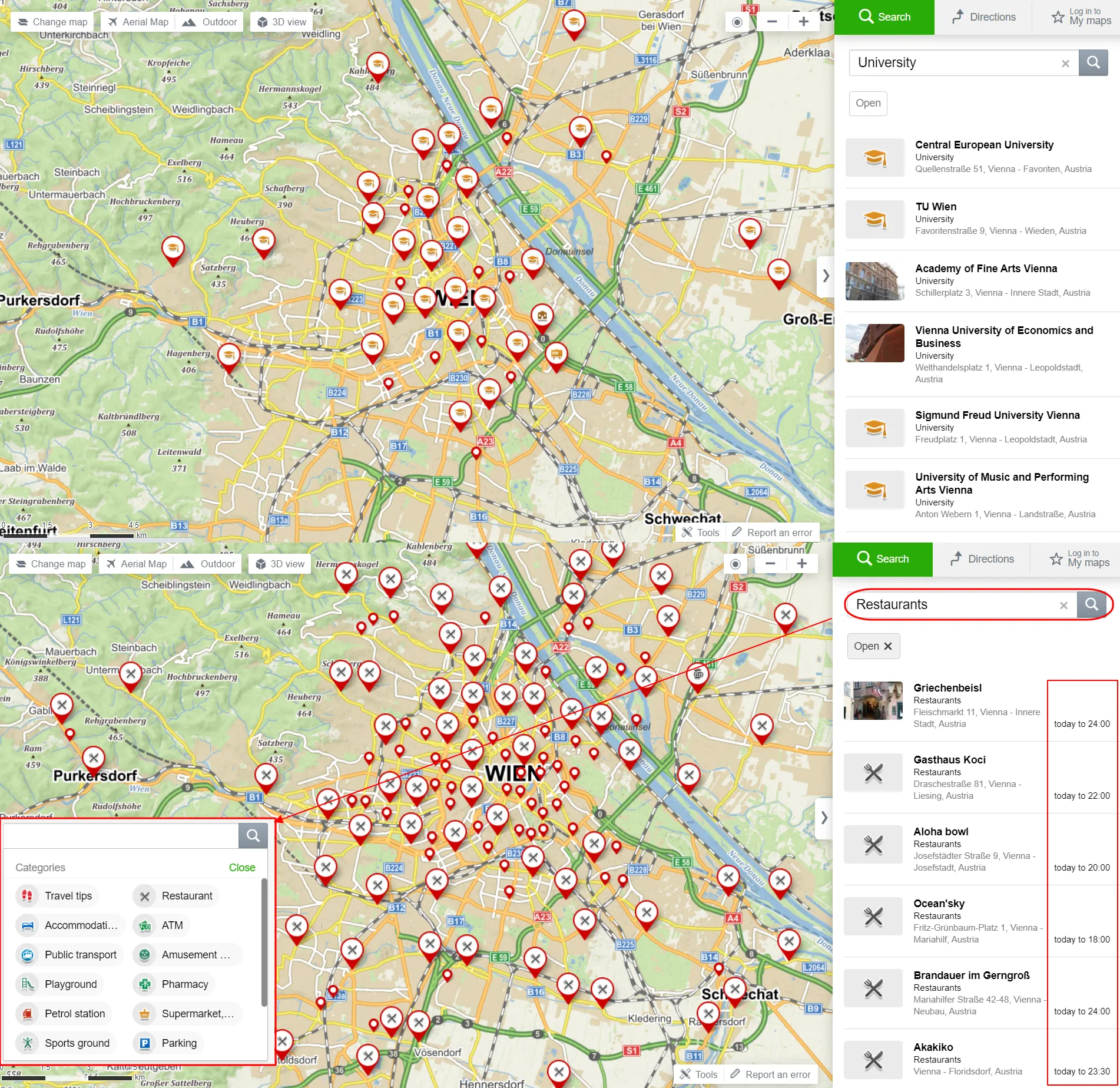
Pic. 16 The Search by feature combined with the “Open” filter, allows us to check what time the object is open for the public.
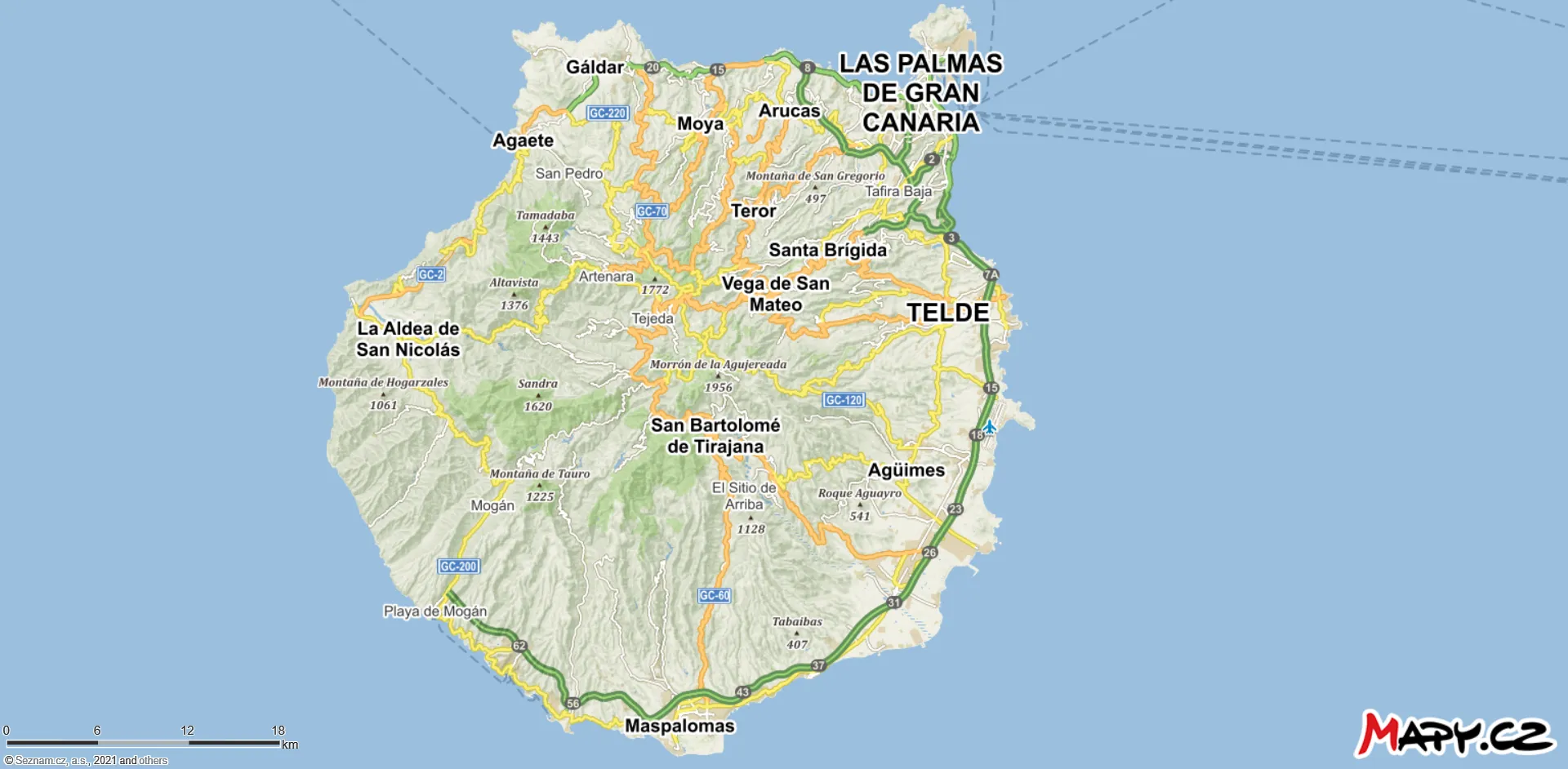
10. Browse tourist map – the most desired feature for all hitchhikers, mountaineers, cyclists, and any types of tourists. The map is displayed very well and includes all tourist trails, mountain peaks, mountain huts, and many interesting places from the tourist’s point of view. Interesting is also the contour line layer, which helps us to estimate the height of some hills quickly. In places, the tourist trails haven’t been marked correctly, as they are not continuous or accurate enough, but it’s a predominantly minor problem. The most important thing is, that these maps are downloadable and can be used offline in the Android version wherever you are. In the vast majority, the countries are divided by their administrative units. You can click on any object marked on the tourist map by signature and see it in detail. This thread is explained more later in this text.
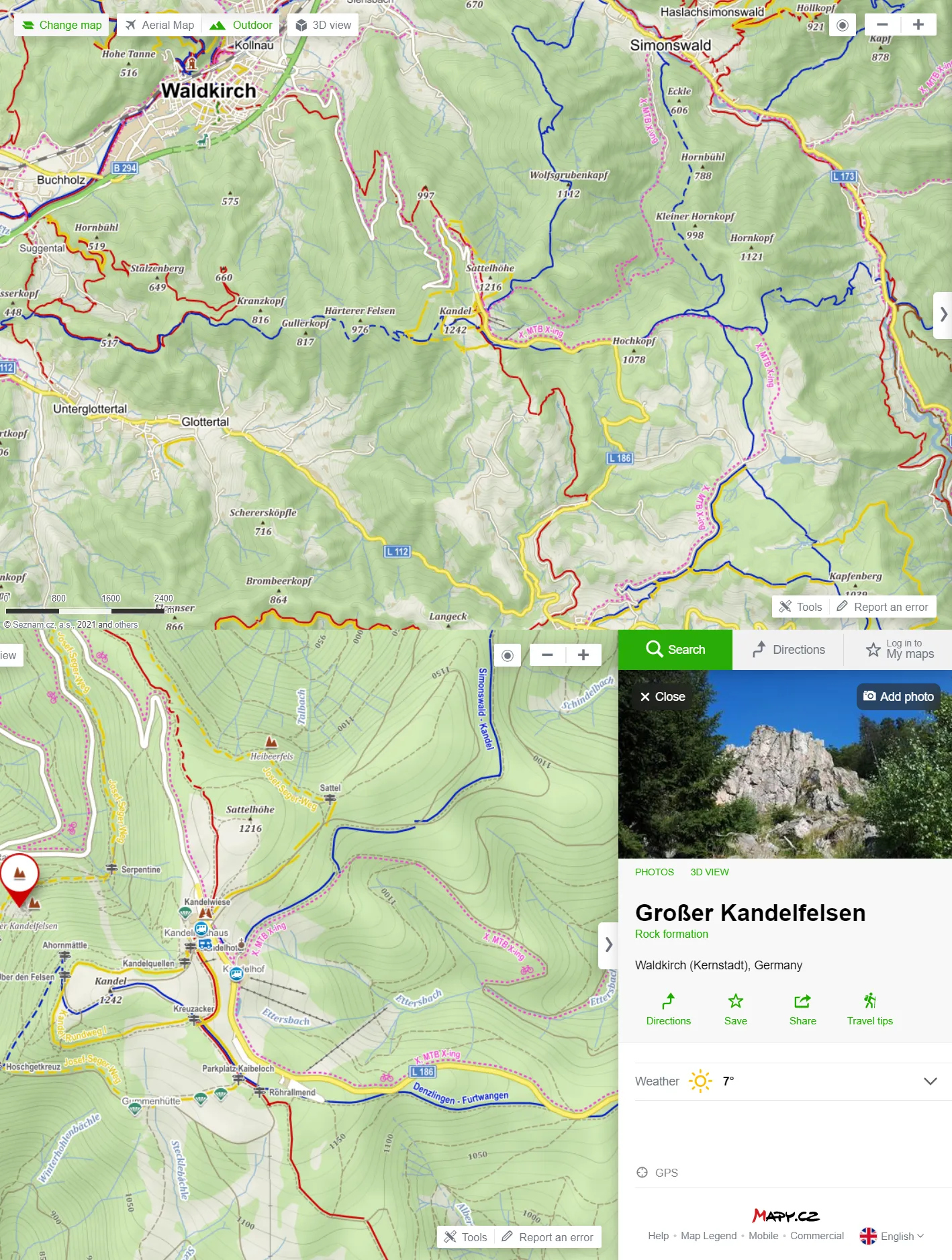
Pic. 17 The Outdoor map with tourist trails, contour lines, tourist infrastructure, and interesting objects. By clicking any of them we can see the pop-up with some details.
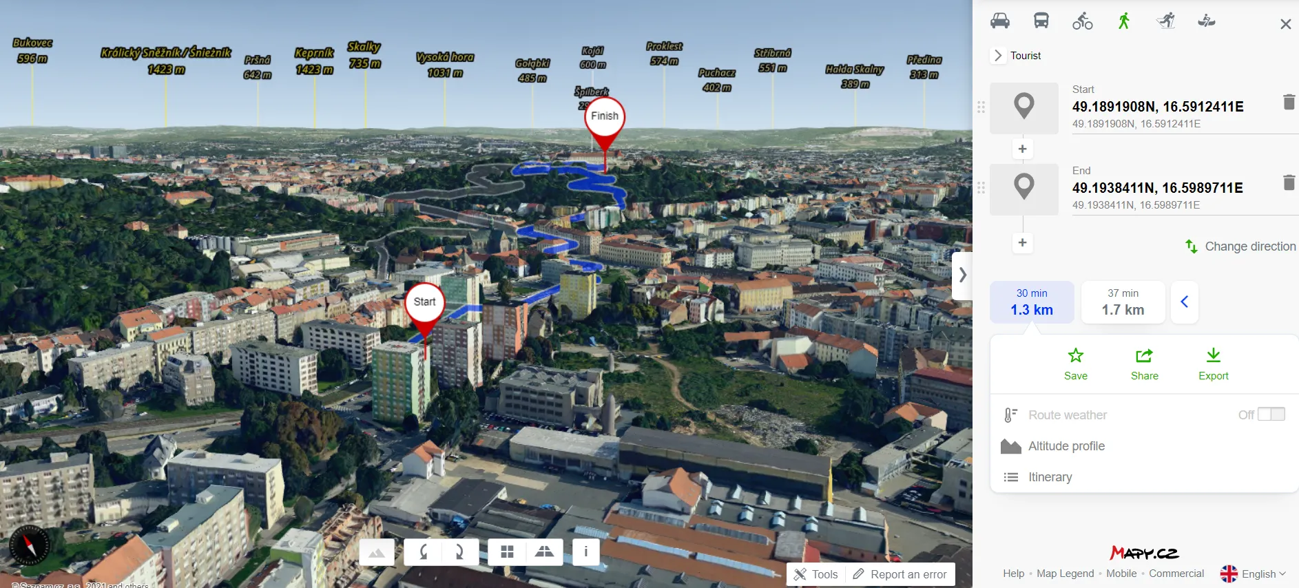
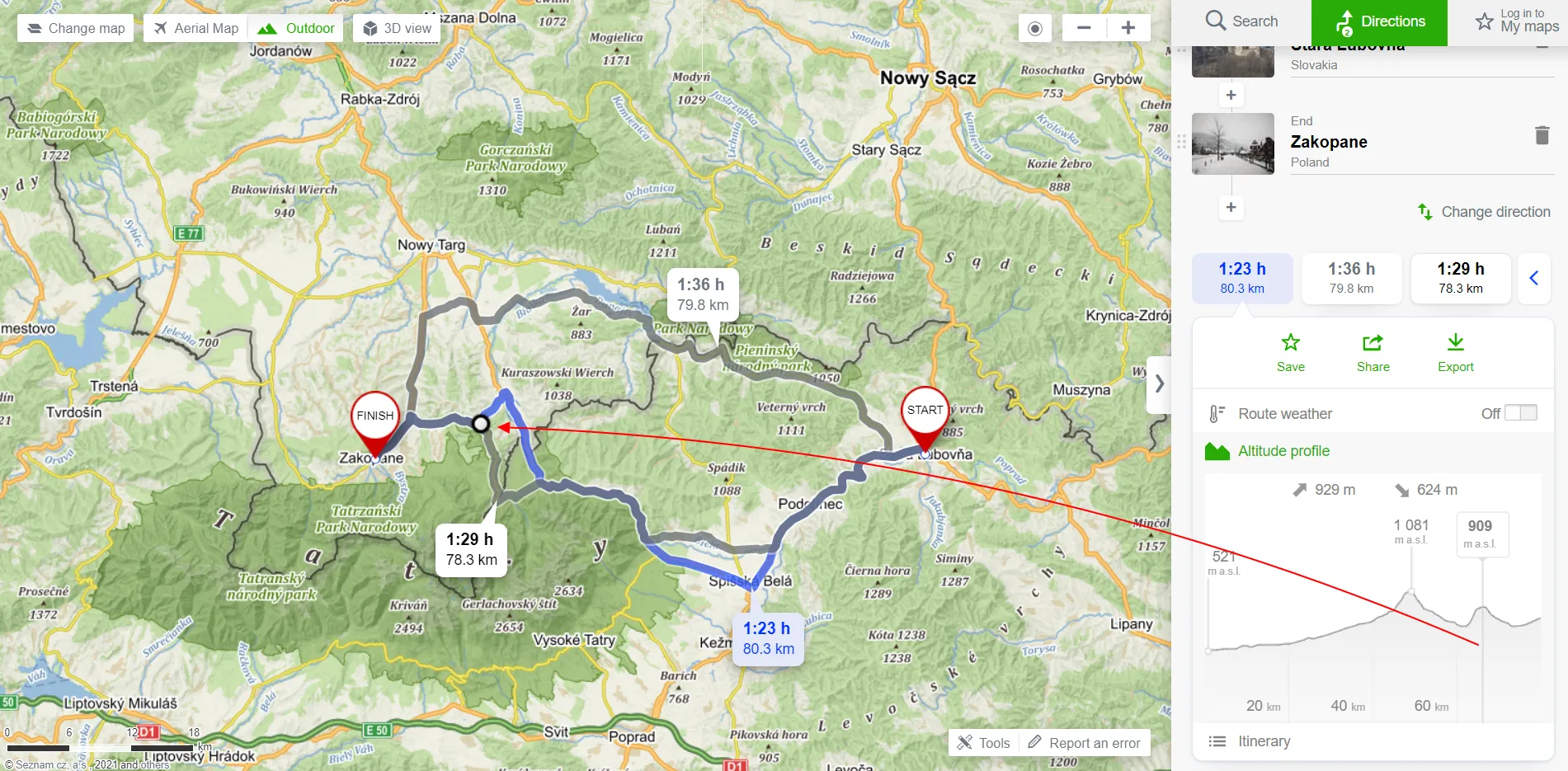
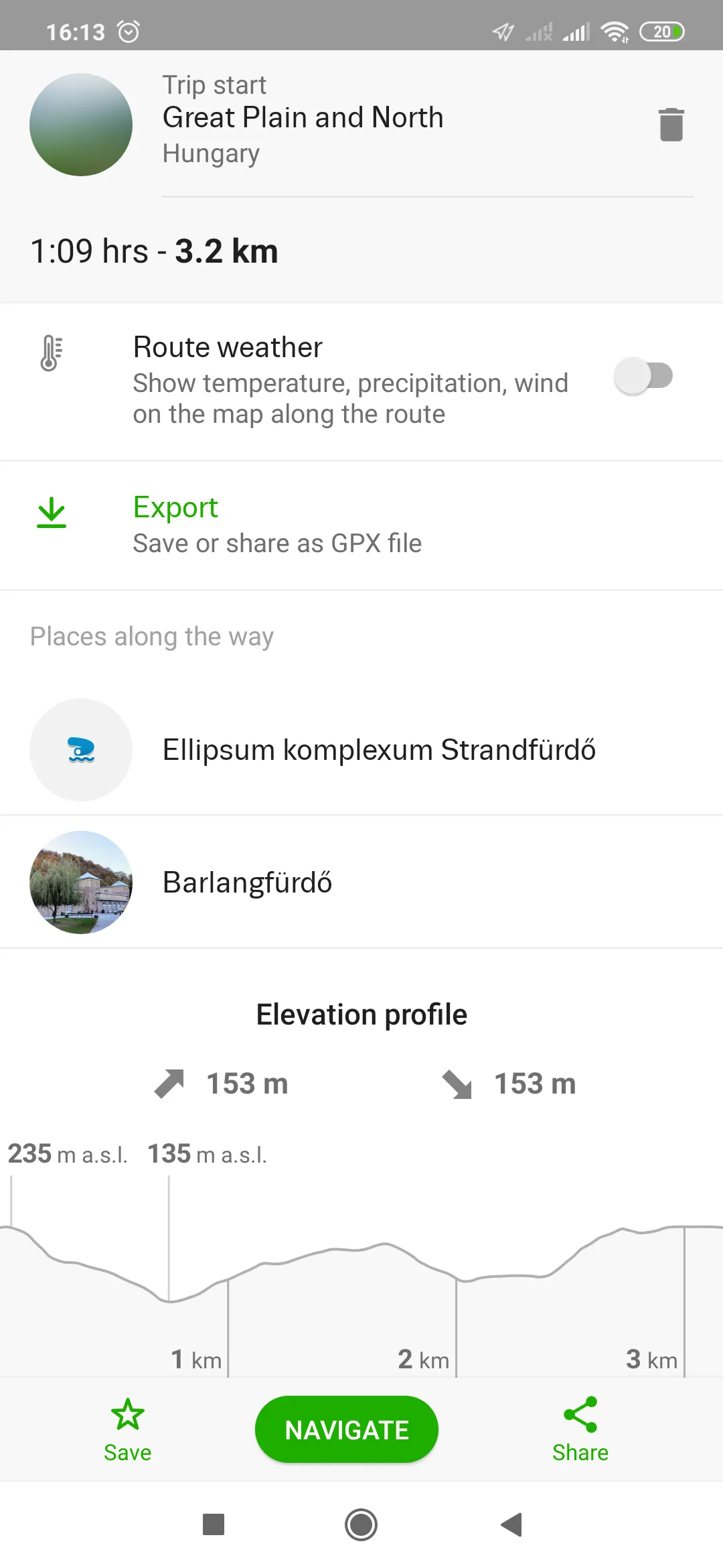
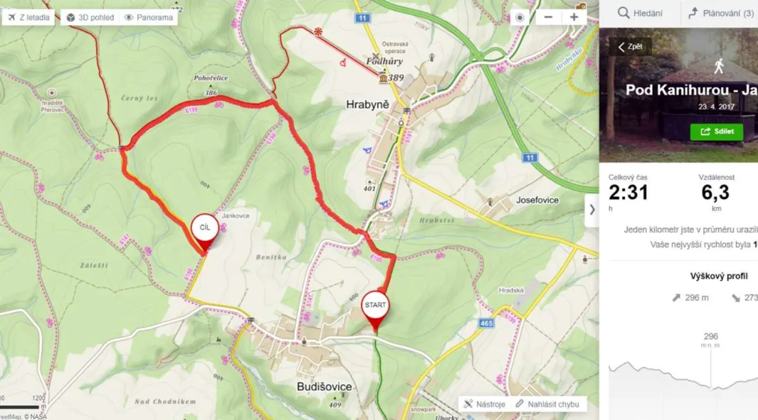
11. Plan your route & use navigation – there are several options for planning your route. Obviously some of them you know already from Google for sure, although there are some extra, which are quite unique. For example, we can calculate the route by “Cross-country skiing” or “By boat”. All the routes can be exported as the .gpx files. Calculation by car is only road-based, which shouldn’t wonder anyone, but public transport can be calculated both by roads and railways. Calculation by bike can be computed both from tourist trails and roads and finally, calculation By foot is based predominantly on tourist trails. The remaining two computations are season-based, where skiing can be computed only when toggling on the Winter map and sailing when considering rivers or canals. See the full explanation and specification here. All your routes will be described by terrain profile, which can be useful, especially for walking or cycling. Always on the top of your route details (just underneath the calculation), you will see the total length and estimated travel time. For mobile versions, the navigation uses voices (in English), which is really helpful.
12. Download tourist trail – this is a derivative option from calculating your route By foot. In this case, when we take into account some tourist trail instead of our private walk, we can set the starting point roughly at the beginning of the given trail route and set the termination of our route roughly where the trail ends. The platform will compute the route for us. In some cases, especially when the tourist trail is short enough, we don’t need to do anything. When the trail is longer or the area is crisscrossed by a lot of other trails, some additional points might be required. I have explained everything in the video attached at the very bottom.
We can save the tourist trail as the .gpx file and next convert it to some other GIS format.
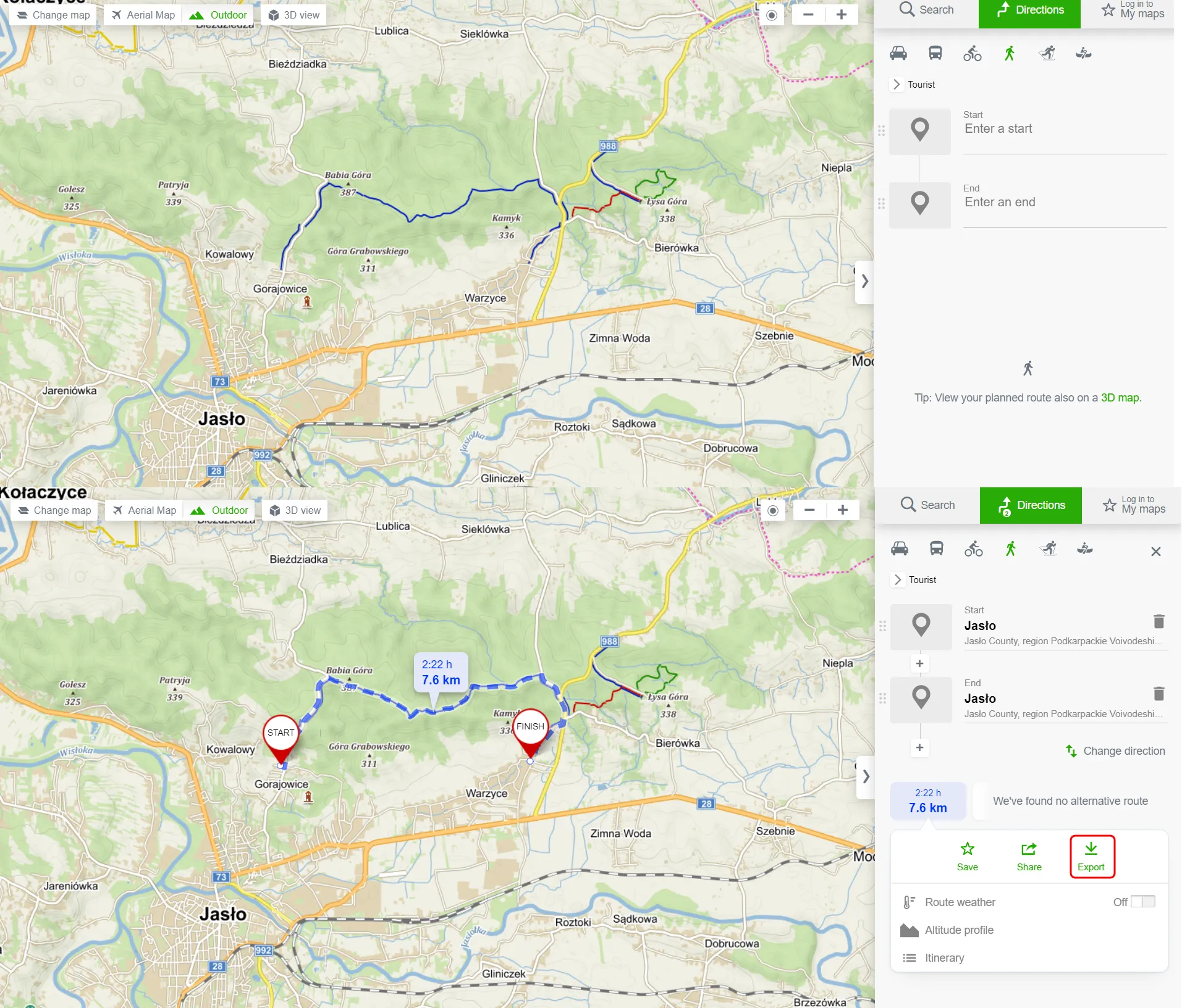
Pic. 18 The example of downloading a short tourist trail, which can be done by route calculation “By foot”. Next, you can click the “Export” button and get this route in the .gpx file.
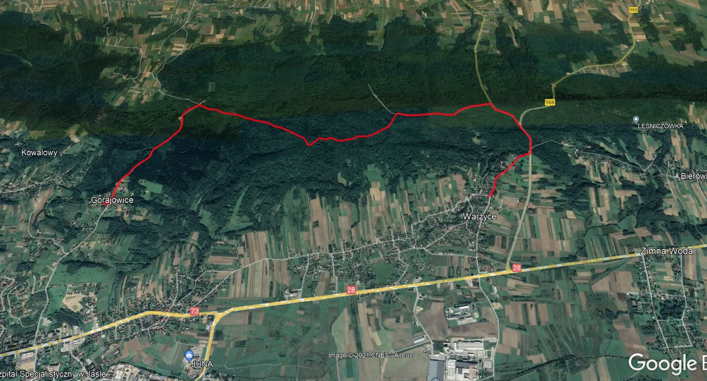
Pic. 19 The example of a short tourist trail downloaded as the .gpx file, next converted to the .kml file and displayed in Google Earth.
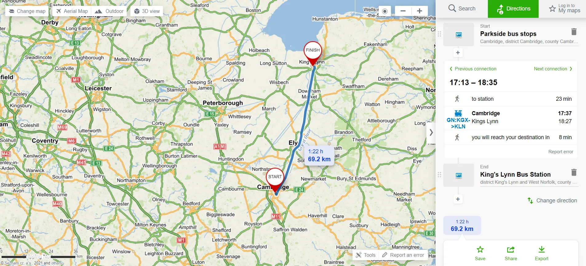
13. Check the train times & bus timetables – this is such a fantastic option, but regrettably not in full functionality yet. As the application keeps developing, the urban areas are prepared better than the rural ones and any outskirts. It can be seen especially within the train routes, which in many places cannot be calculated at all.
When we use the route calculation by “Public transport”, we can get the most up-to-date buses or train times between two specified locations. I showed it in the video attached at the very bottom. The first step to making this type of calculation successful is setting both the start and the end of our route at bus stops or train stations (or tram stops). The route calculation will be possibly simplified by reducing the frill distances from the start point to the nearest bus stop, although it is only a hint for now, as the Mapy.cz development is still in progress.
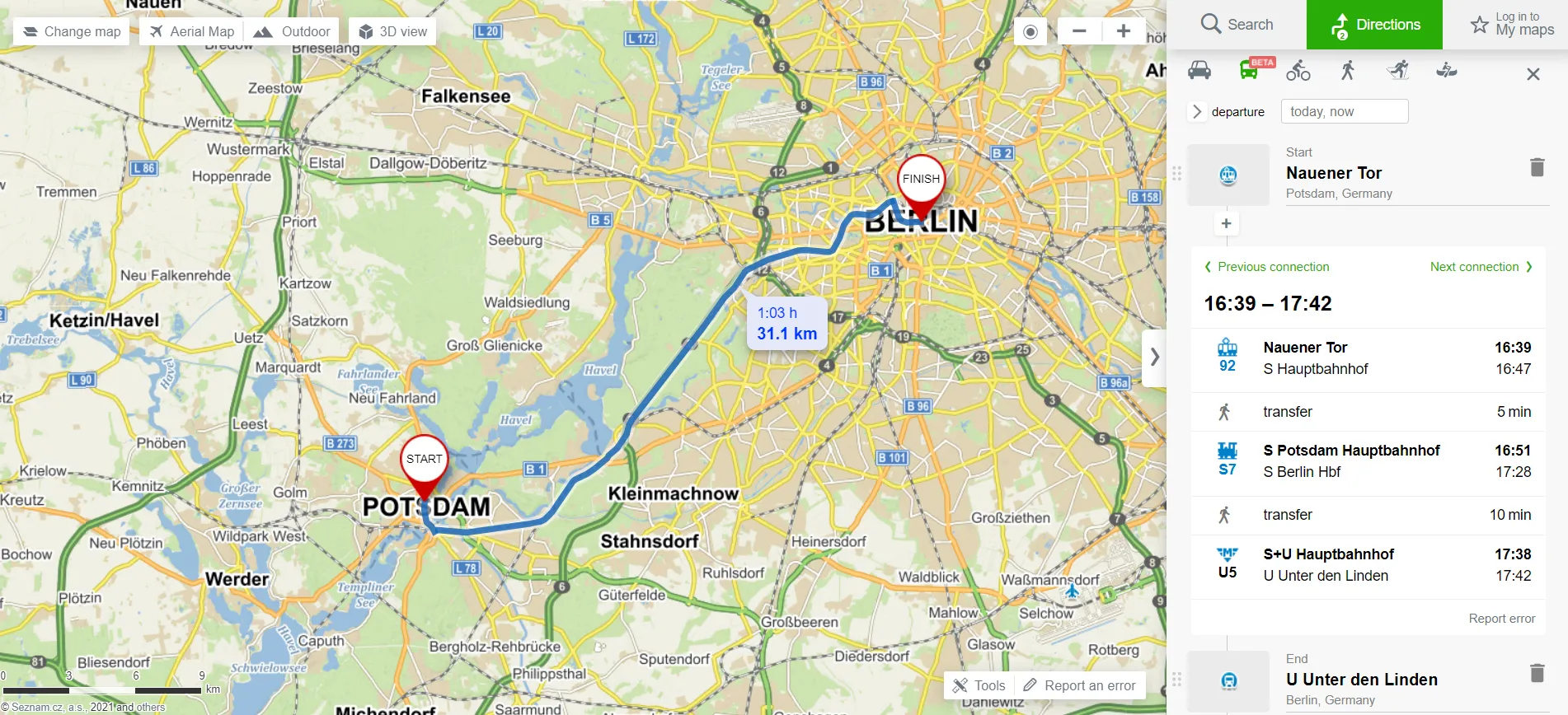
Pic. 20 Calculation of our route by train from Potsdam to Berlin at the time when this text is produced.
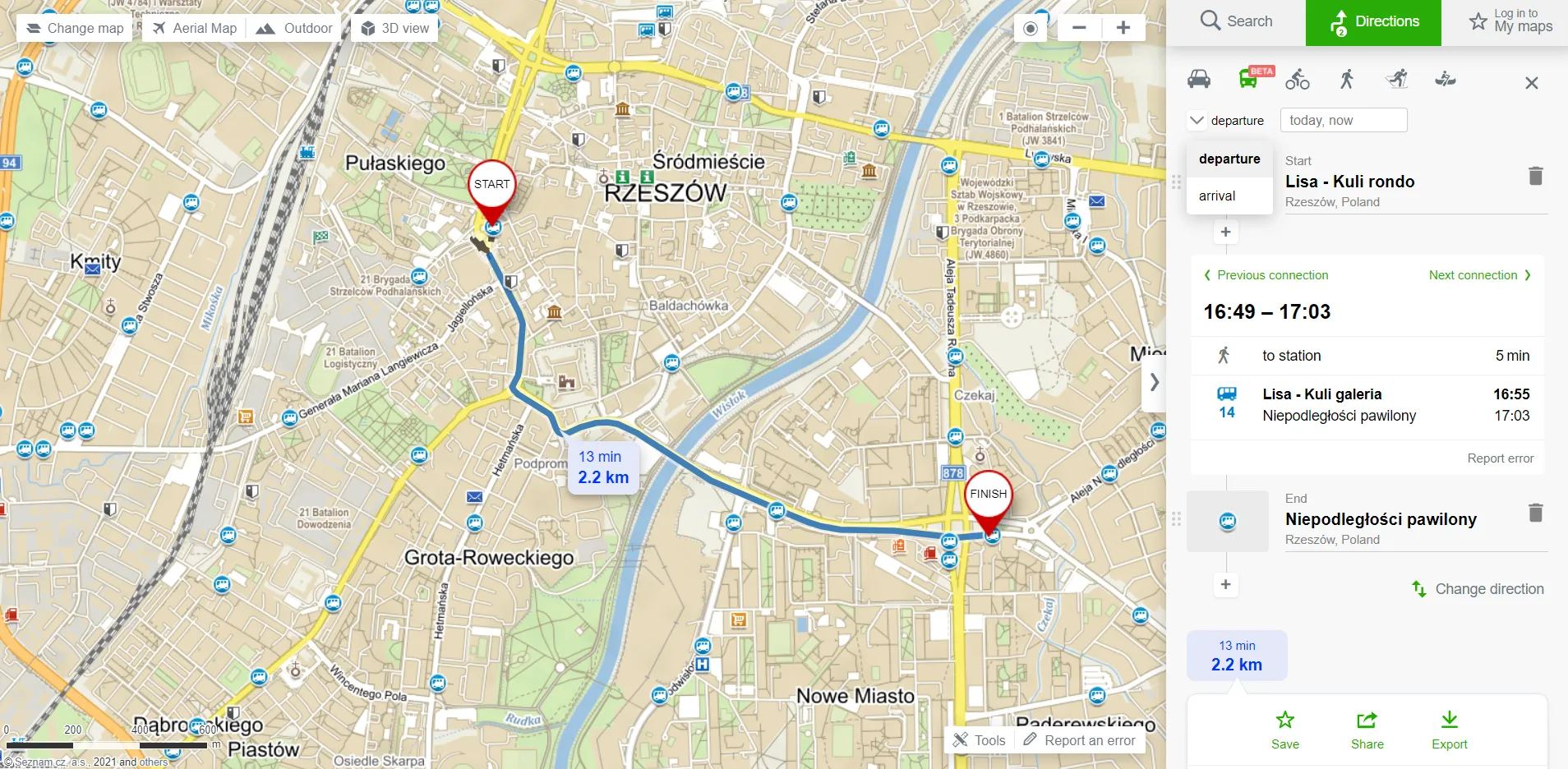
Pic. 21 The example of the bus route at the time when this text is produced. You can set the arrival or departure time other than the default.
As it was mentioned earlier, in some countries the public transport-based calculations are not complete enough. In the United Kingdom, instead of bus routes, we can get train connections.
Pic. 22 The example of a bus route converted to a train route. Both starting and ending points were defined at local bus stations.
But for Poland, we don’t have even train connections yet, but I am convinced that it will change in the near future!
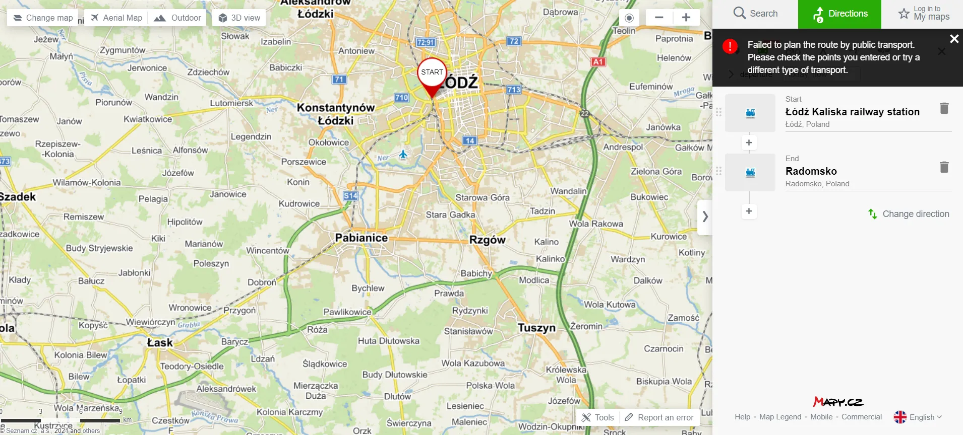
Pic. 23 The “Failed to calculate the route” error means, that there is rather no data provided yet to the service.
Frankly speaking, the most fantastic things here are well-prepared bus or train timetables! By clicking on the bus stop (or bus station), tram stop, or train station signatures you will be issued with the full timetable, the same as exists there! This is such a wonderful thing for planning your trips!
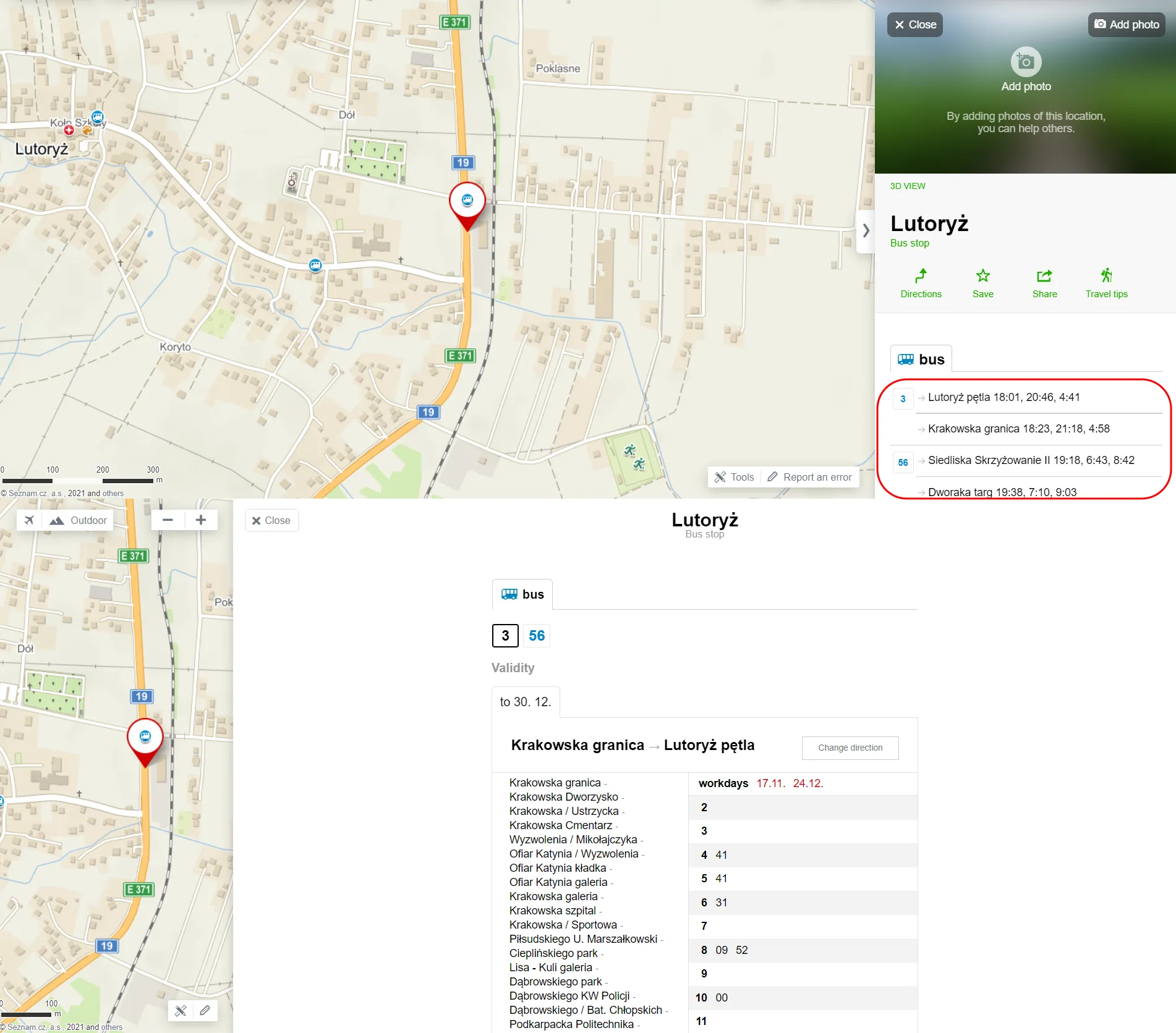
Pic. 24 The bus timetable example for one of the suburban villages in Poland.
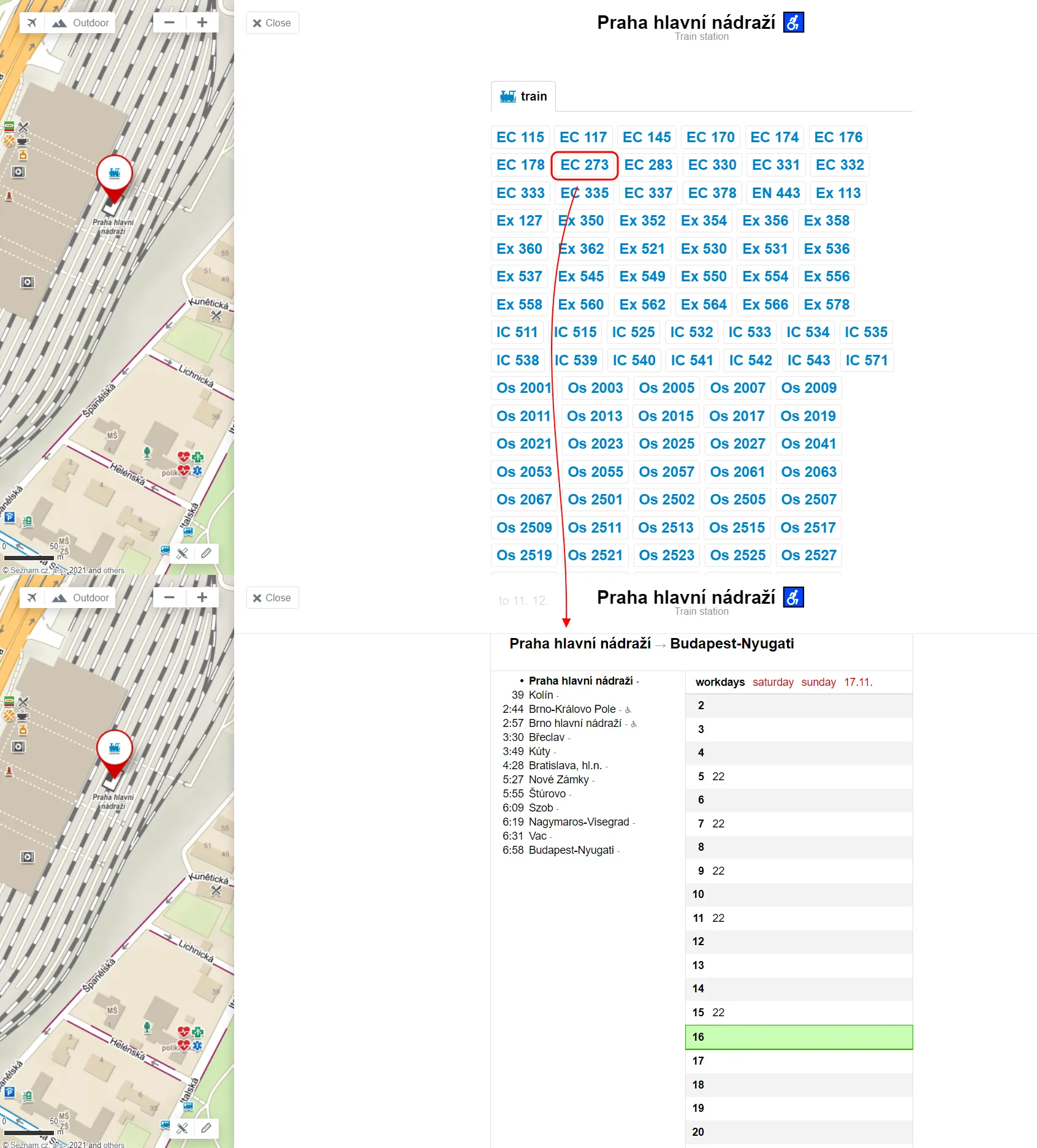
Pic. 25 The train times example for the main train station in Prague – this is the level of data I expect in the future for most cities worldwide!
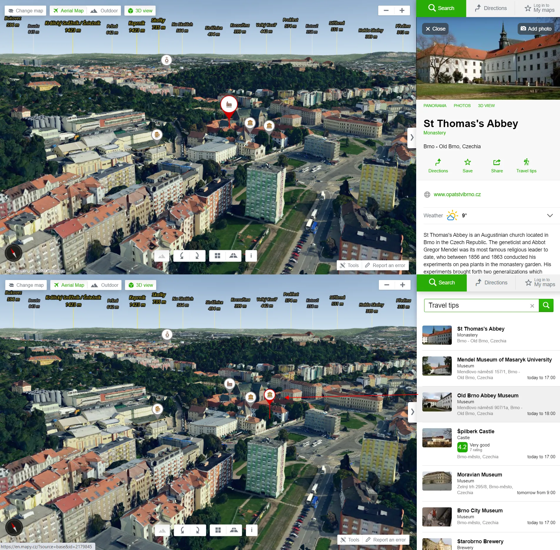
14. Travel tips for the local area – another brilliant option served by Mapy.cz service. There are at least 2 ways of access to this option. One is by selecting the categories from the “Search by” option, and another one is by selecting the “Travel tips” option from the pop-up of the different objects selected already. You will get all the tourist places within your area or specific address considered (based on the zoom level you set before) and any hovered from the list will be highlighted on the map turning other ones into grayscale.
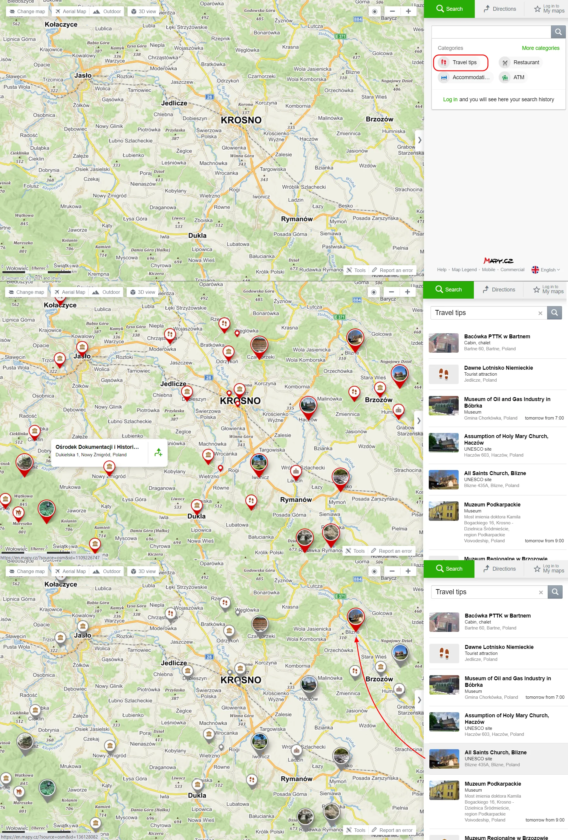
Pic. 26 Travel tips option for the area defined by location and zoom level. When you hover one of them from the list, it will be distinguished from others and turned into grayscale.
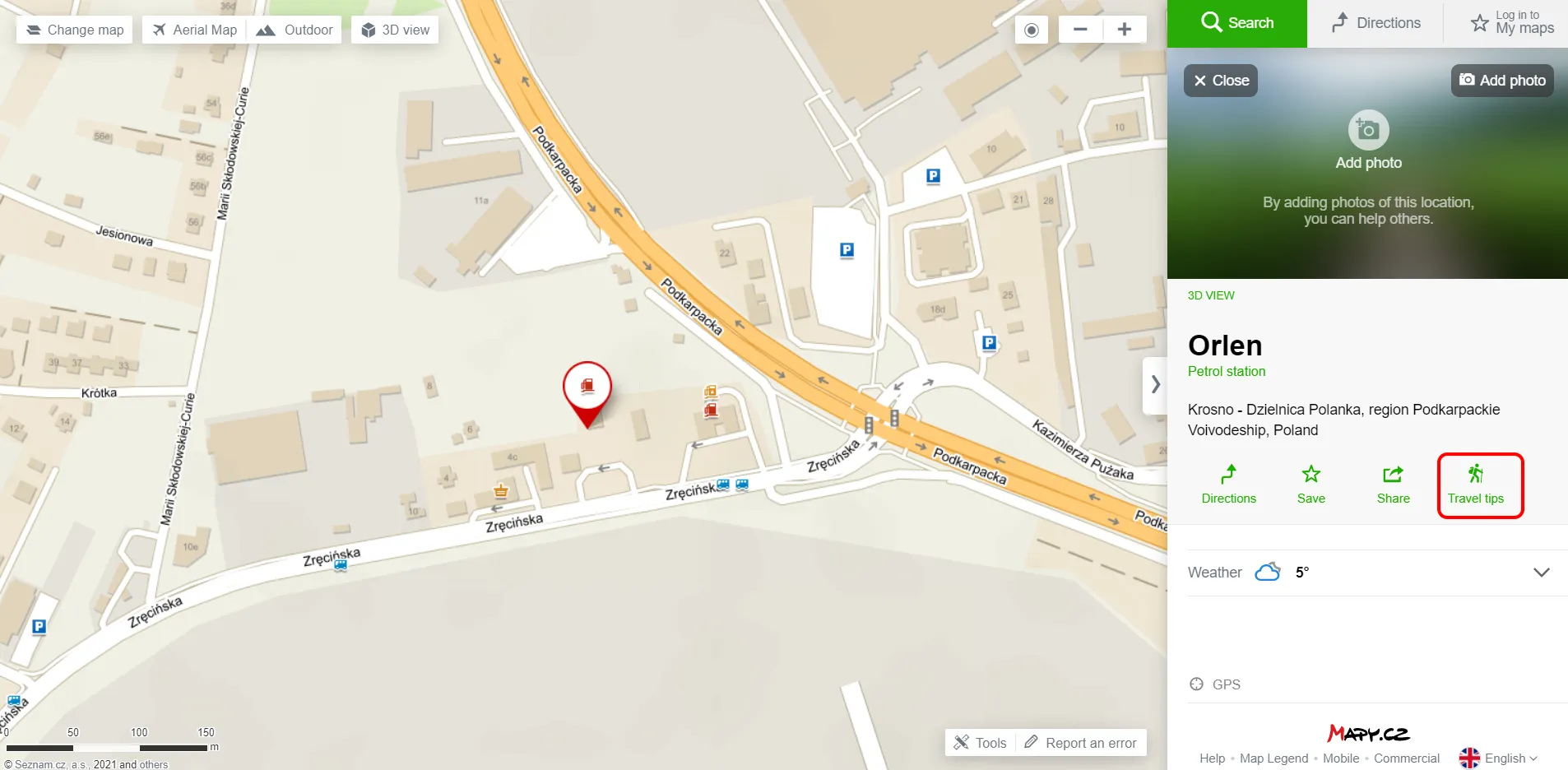
Pic. 27 Travel tips for any other object already selected.
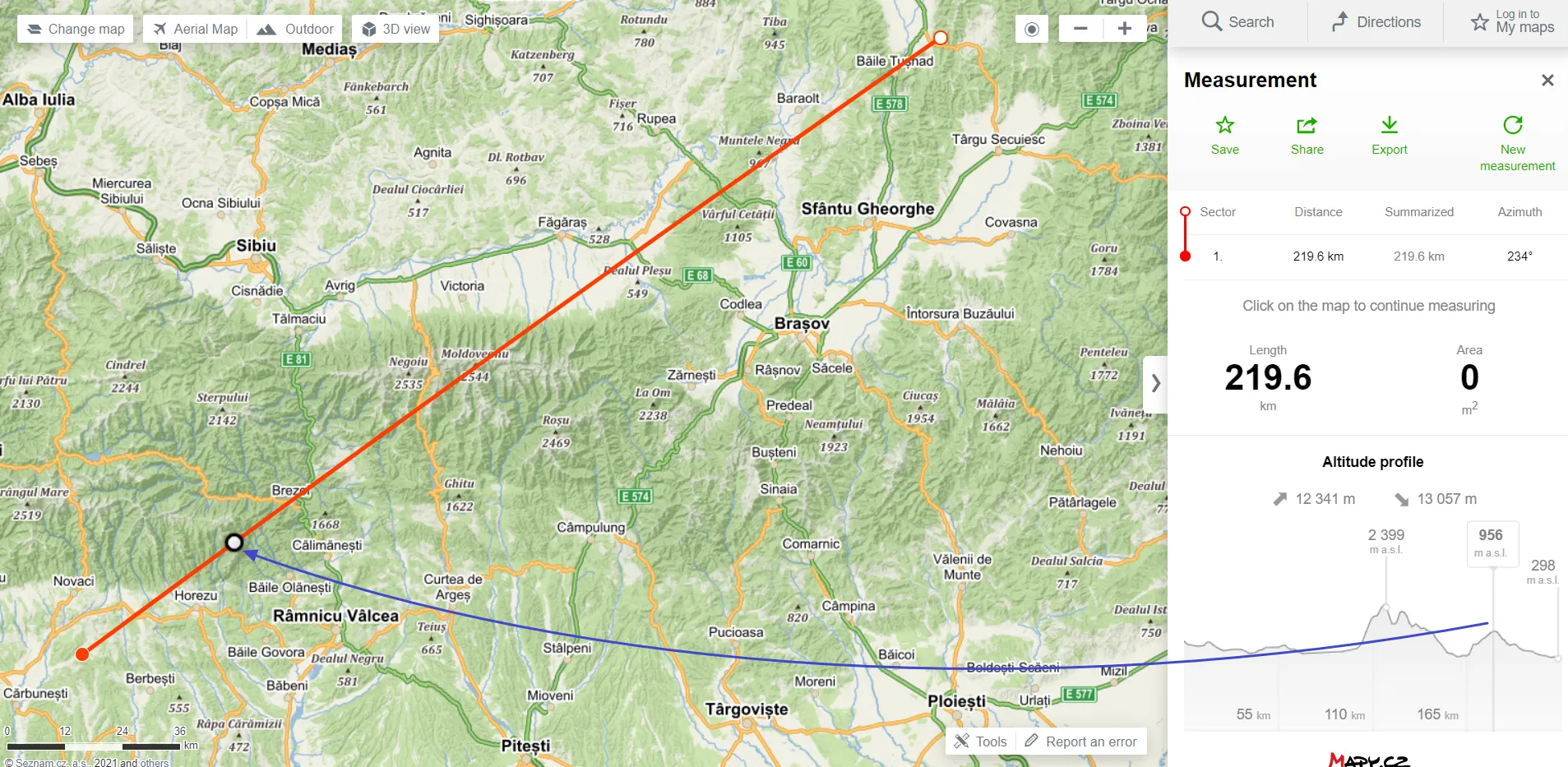
15. Check the terrain profile for your route or measurement – this is a nice outreach for any kind of route planning, but especially useful for hitchhikers, walkers, and cyclists. After calculating your route, you can see in which section you will have to go up and down. With this analysis, you can plan your route more efficiently, and arrange some stops, breaks, etc. The vertical line with the altitude box as well as the white circle with a black border will help you to do so. This terrain profile works also for the measurement tool, which is described later in this text.
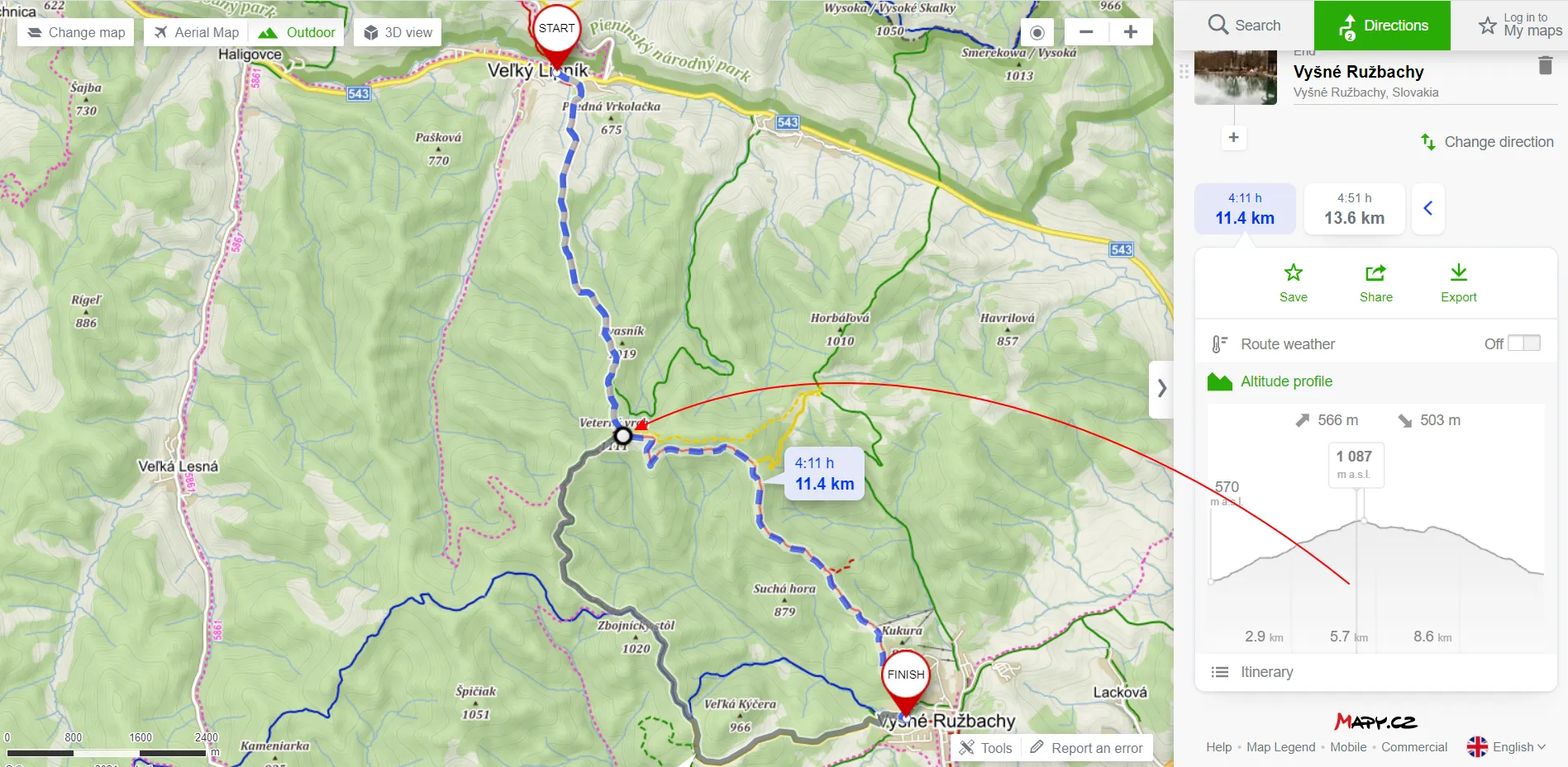
Pic. 28 Terrain profile for a walking route. Analysis can be done by hovering over some parts of the profile, where you can see the altitude (m.a.s.l.) combined with the circle showing this place on the map.
Pic. 29 Terrain profile for the driving route. You can check the altitude in any place across your route (profile) and see its correspondence on the map by the white, black bounded circle.
16. Local trip proposal – by right-clicking on any location, we can see the local trip proposal by the Mapy.cz application. The option is pretty cool because it often computes your route with some interesting things to see nearby. Every place will be highlighted on the map by an image thumbnail or signature when hovered on the list. You can change the total length of your route as well as the transport type.
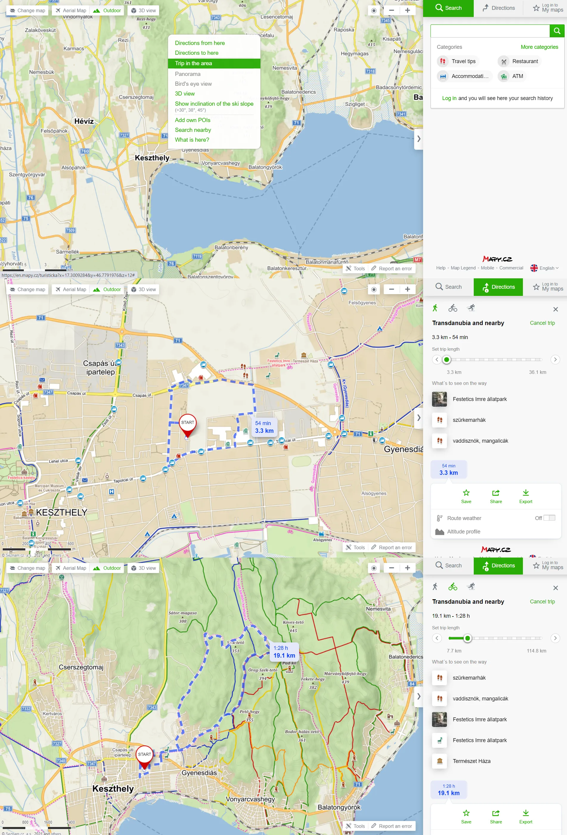
Pic. 30 Local trip proposals from the current location can be found in the list populated by the right-click. Next, you can adjust it by changing the transport type and length of the trip. All interesting places will be populated in the panel on your right.
Obviously, the same options still apply for these tracks as normal, we can see the terrain profile and the weather across our whole route.
17. Weather forecast for selected place or route – another good feature, which can be recommended. You can examine the weather for the next 5 days in the hourly forecast displayed. You can get to know weather conditions across your travel route too by selecting the specified time (up to 4 days in advance) of departure and the weather element (temperature & general, precipitation, wind). Once we have set it up, we must remember to click on the “Show on map” button.
Pic. 31 The 5-day weather forecast for the specified location.
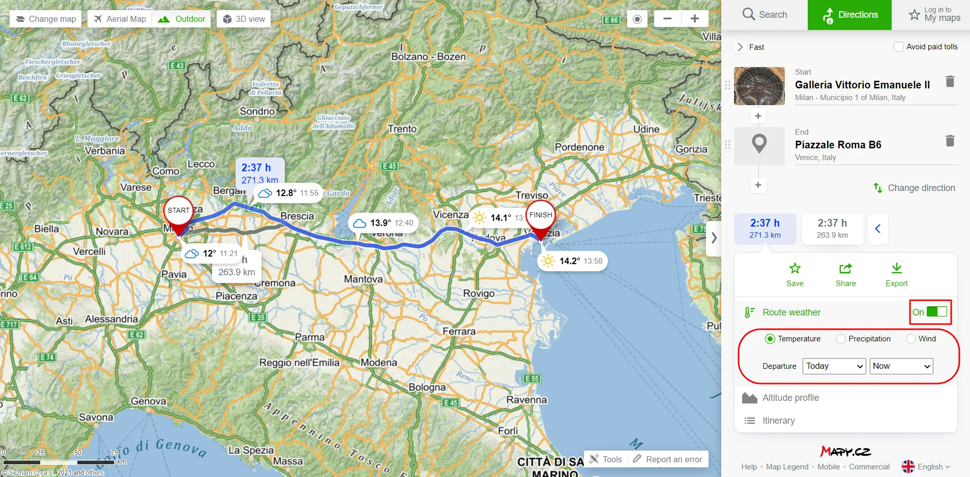
Pic. 32 The example of the weather forecast for our calculated route. We should remember to toggle this option on and select of proper time and weather type.
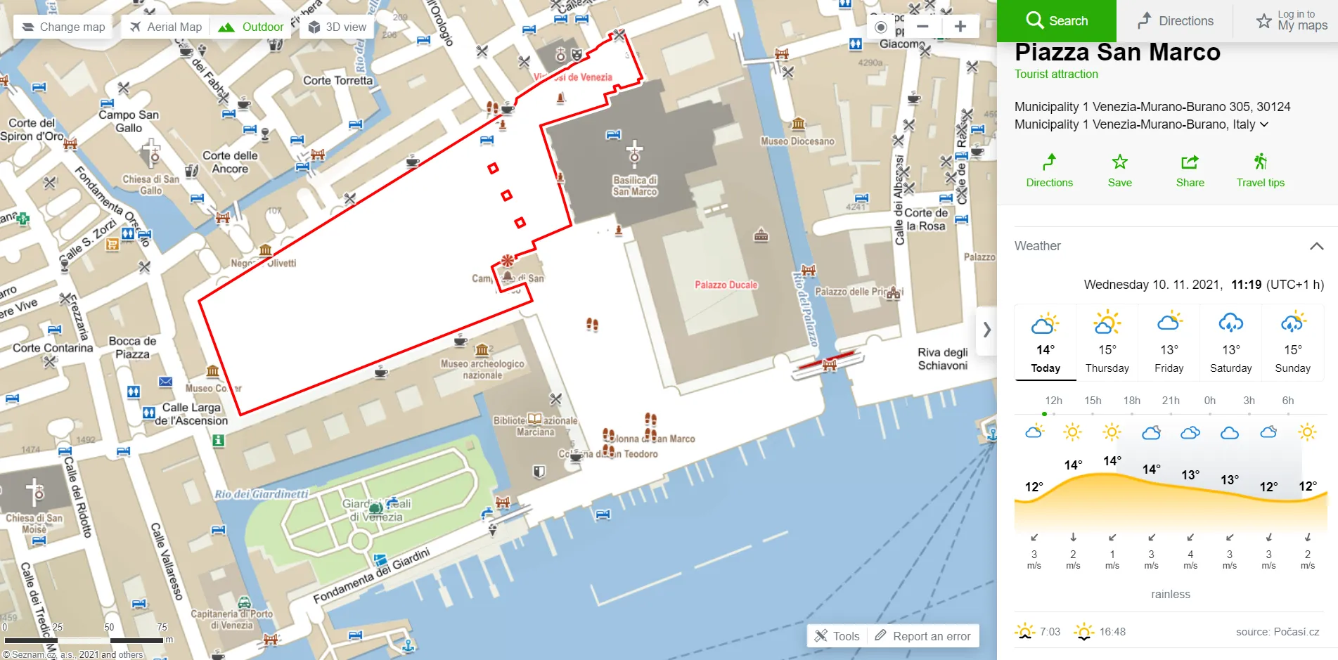
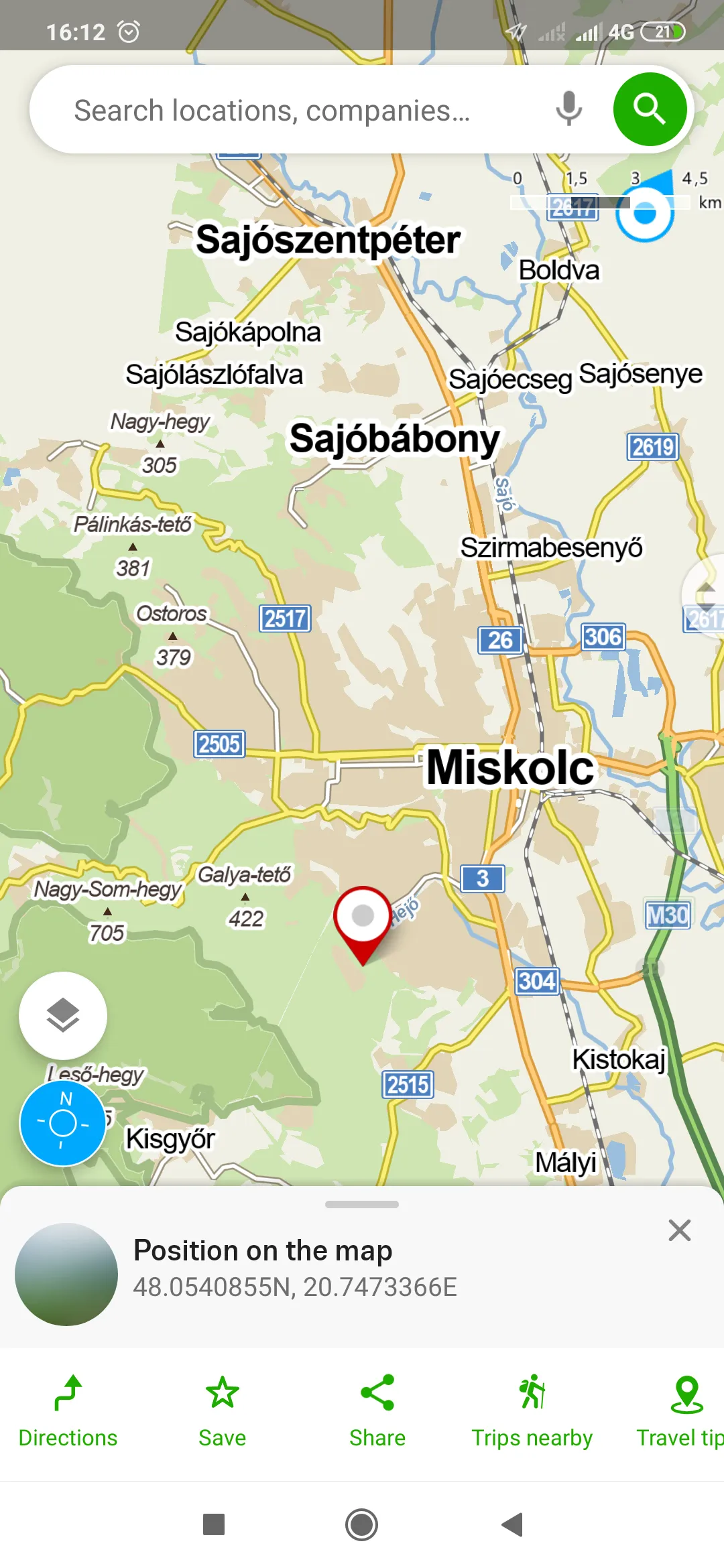
18. Get the GPS coordinates for your place – this option can be found at the bottom of the information panel of the place you selected. By clicking it, the field with exact WGS84 coordinates will be populated with an instant copy option to your clipboard.
Pic. 33 The exact GPS coordinates for our selected place (WGS 84) with a copy to our clipboard option on the right.
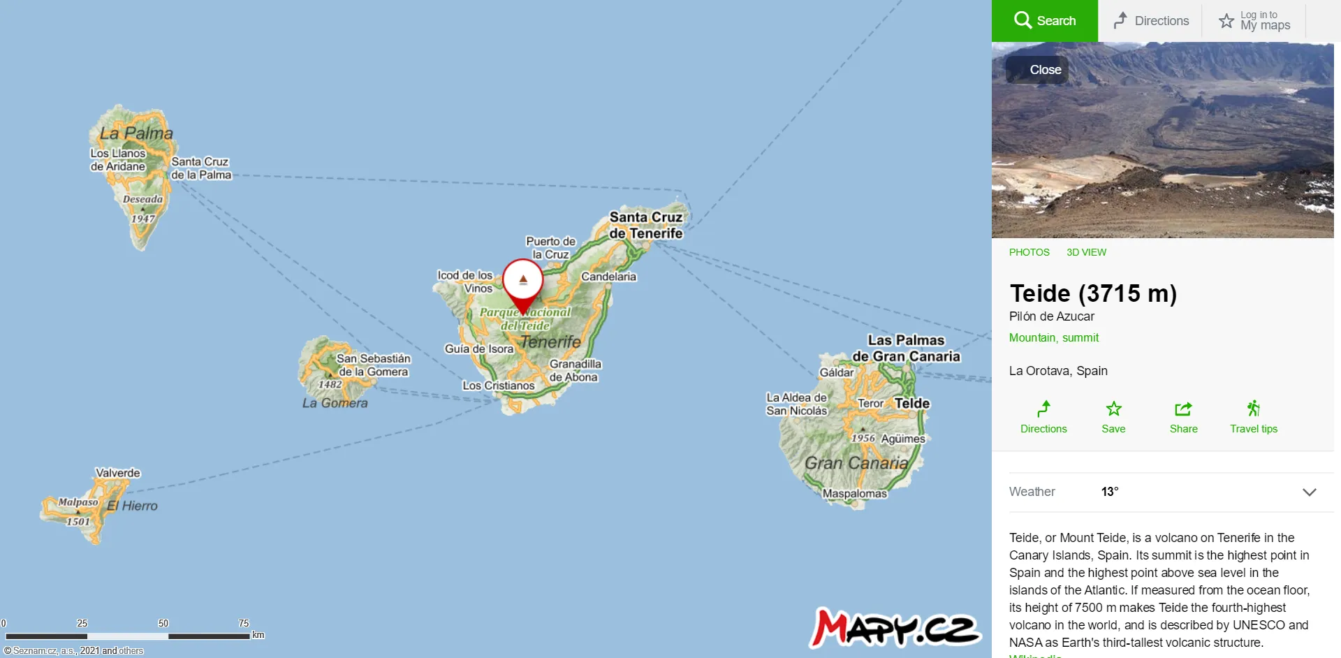
19. Get the info about the place – this option can be very useful for people who want to know a bit more about the selected place or landmark they want to go to. These mostly Wikipedia-based details are quite scant, but you always have the link to the main Wikipedia article, which is usually much longer. Apart from that, you can find the links to the main websites, where you can find more information for sure. Because Wikipedia’s coverage varies significantly across random types of places, we should expect some lack of information for some places. That doesn’t change the fact, that instant access to Wikipedia’s bunch of information can be really handy. On top of that is language-based. It means, that if you select the Czech version of your map, the Wikipedia page will open in the Czech language too.
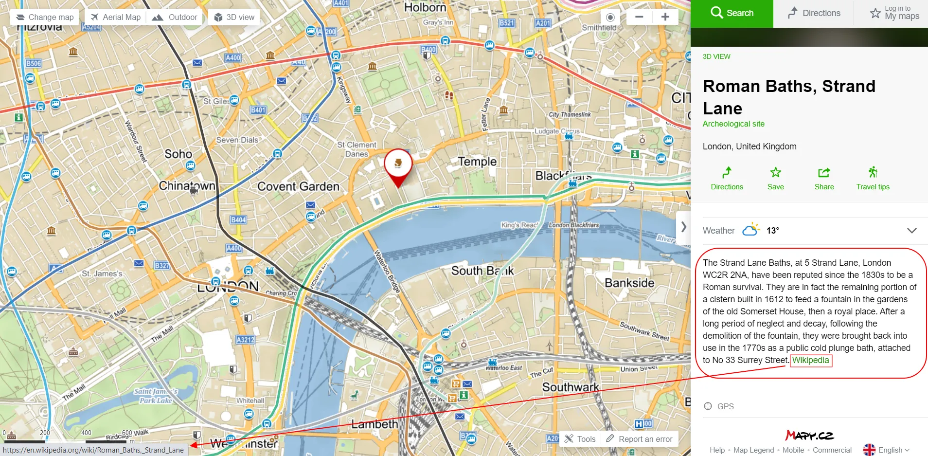
Pic. 34 The Wikipedia-based place description with the link to the full article (pointed red).
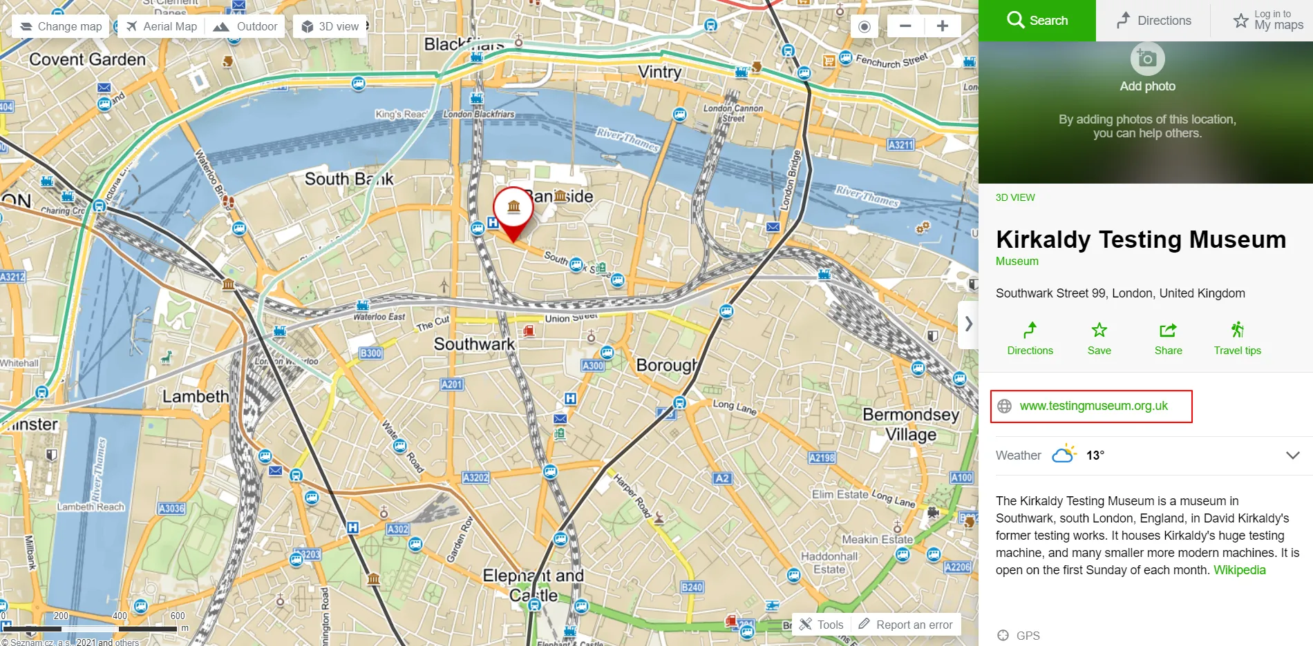
Pic. 35 The example of an external link to the main website of the selected place. A brief description and link to the full Wikipedia article are below.
20. Browse the image gallery of your interesting place – it can be accessed also via the “Map with photos”. Not all the places have been equipped with the images yet, but I believe it will change in the near future, as this app platform becomes very popular. There are a lot of tourist sites, where a user can simply take a look at the images available. Access to them is very simple. You just need to head your cursor on the main image, which appears on the top of the information bar on your right. Next, you can sort your image gallery by popularity or date. These images are downloadable by right-clicking and selecting the “Save image as” option. Each image has the detailed EXIF data provided.
On the other hand, you can also upload your own images by clicking the “Add photo” option.
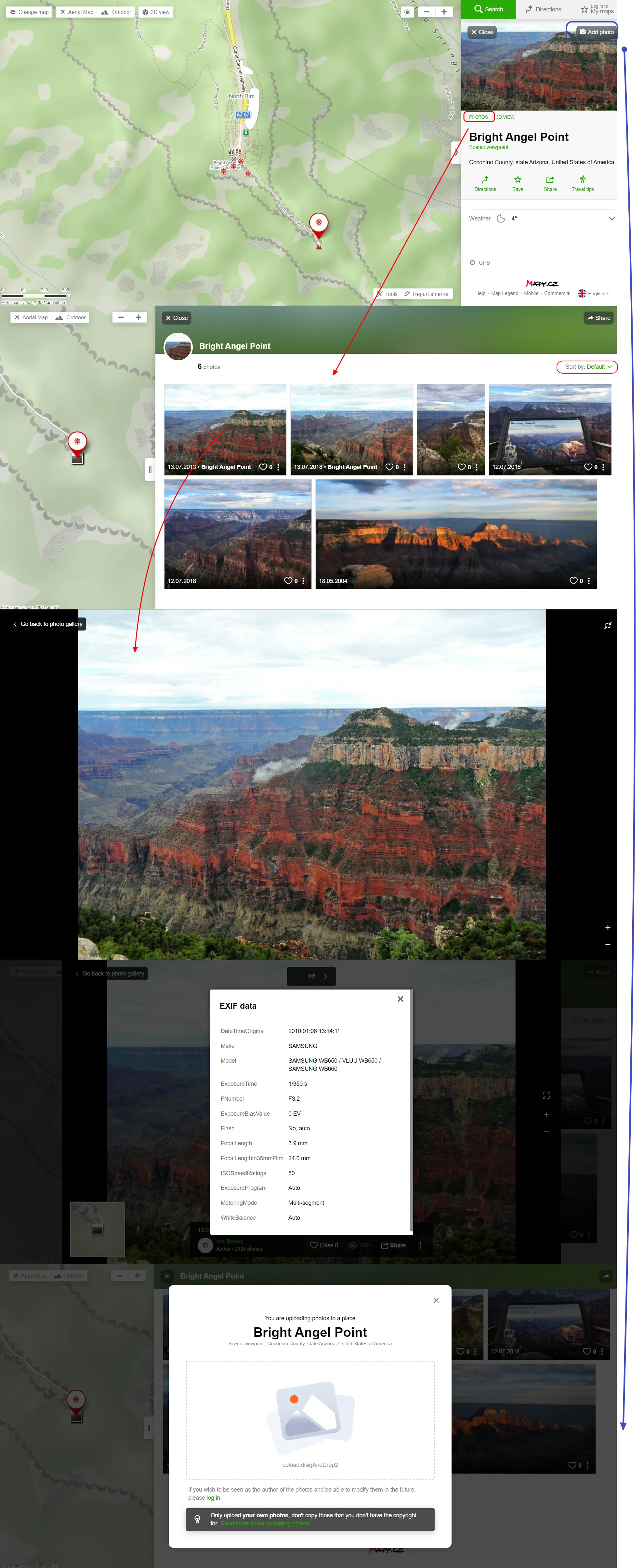
Pic. 36 Browsing and adding our own images to the selected place. By clicking on the vertical three dots symbol, we can select the “Show EXIF” option and see the EXIF data of our image. Every image is downloadable.
21. Check the opening hours, telephone number, and other information – besides the nice description of the object, we can also check the opening hours or copy the telephone number available in the information panel. I have mentioned it above. The level of this information varies across the types of areas and objects. Sometimes we might have no information at all, however, in other cases, it will be presented well. The best, for sure, the Czech Republic is prepared. By clicking on any petrol station here you can even check the fuel prices.
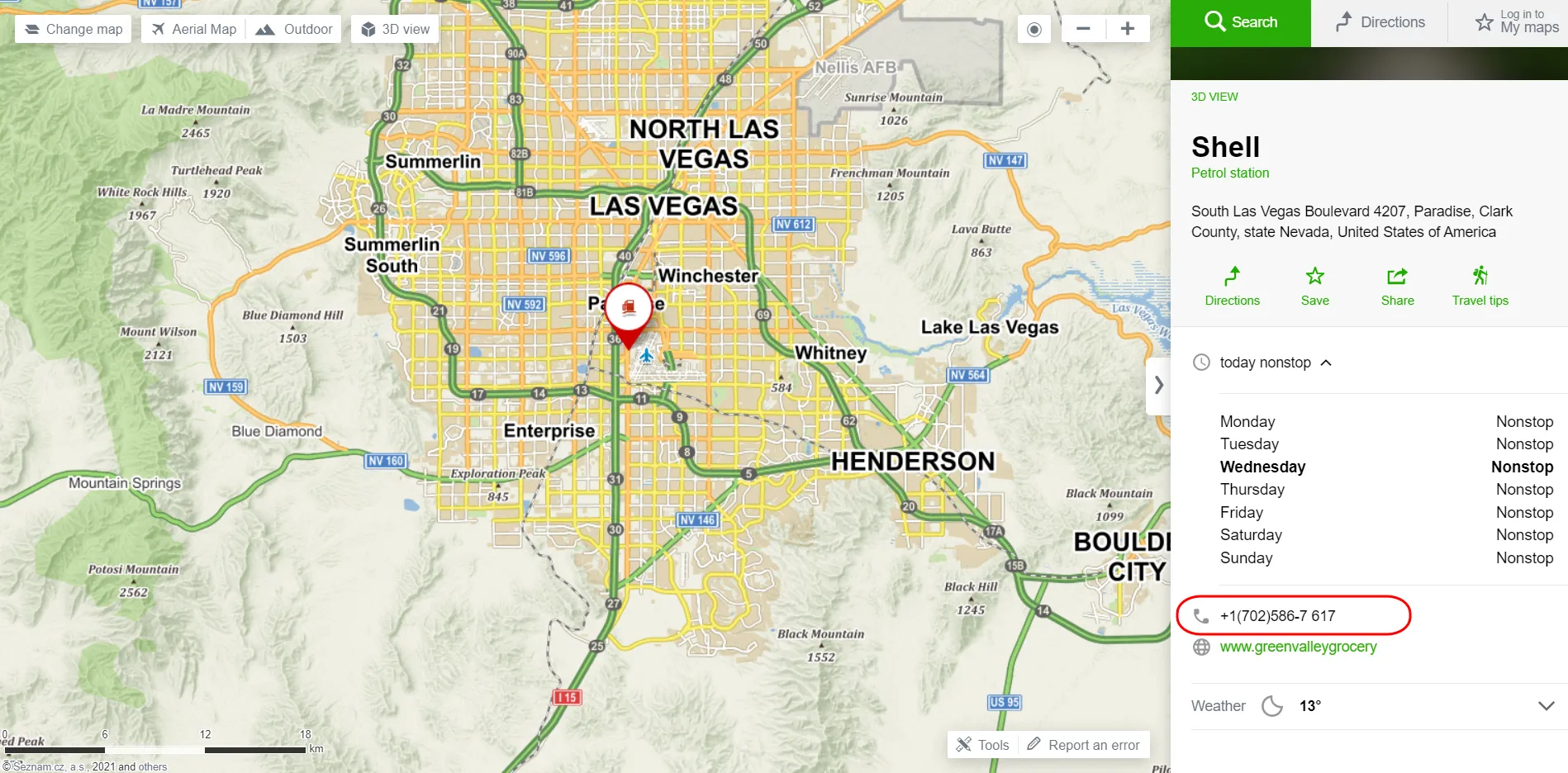
Pic. 37 The content of a random information panel, which includes stuff like the telephone number.
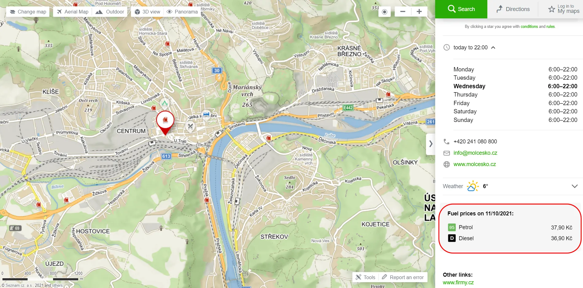
Pic. 38 The example with a more detailed information panel including i.e. fuel prices. It works only for the Czech Republic now.
22. Embed the map (with selected object) on your website – another cool option available in Mapy.cz service. We should click on the “Share” option and instead of “Copy link” toggle the “Insert map in my website”.

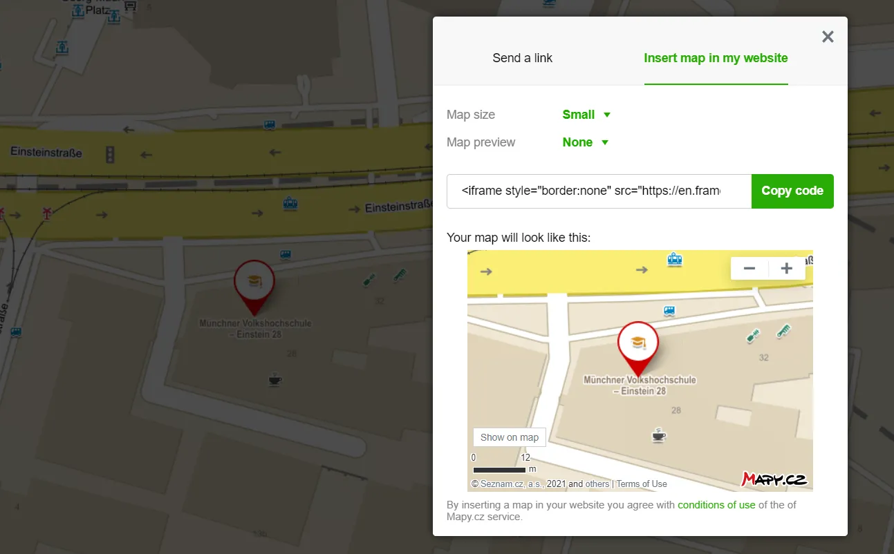
Pic. 39, 40 The “Embed map in your website” option with the selected object, is included already in the link.
There are 4 options for defining your map size. Interesting is also the map preview, which appears in the top-left corner after toggling on.
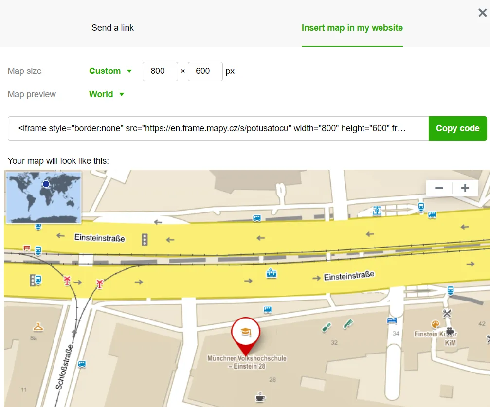
Pic. 41 Additional options for embedding the map in our website.
23. Save & Share your map – it’s a trivial option, that appears in most interactive maps nowadays. Just to mention, it exists, although for saving the current map view signing in is required. In order to share your map, you can access it by selecting the “Share your map” option from the information panel of the selected object. Your map can be saved under a custom name.
24. Defining your current location – another common option, which helps you to define your current location. It becomes very handy when you are in the middle of nowhere between some mountains. You can then calculate your route, find the nearest place, etc.
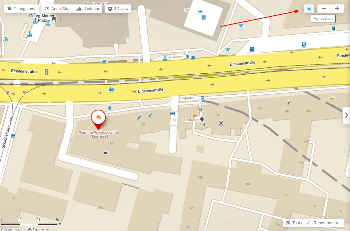
Pic. 42 Finding your location.
25. Print & Capture screenshots of your map – another quite mundane option provided by this service, but it’s good to have it for sure. It grows into functionality, especially in the situation when we need to have the map scale. If you want to have your map good-looking remember to hide the information panel on your right!

Pic. 43, 44 Export map as an image with the information panel visible on the right. It, unfortunately, comes through as you can see in the lower image attached.
Pic. 45 The screenshot map was taken when the information panel was hidden. Now it looks good, doesn’t it?
26. Add your own Points Of Interest (POI) – a useful option for someone, who wants to define his own locations on the map. We can define at least several points of our private interests. By adding them to the map canvas, we will see also detailed WGS84 coordinates of each point. They’re exportable to the .gpx format at roughly the same basis as transport routes and mountain trails described earlier.
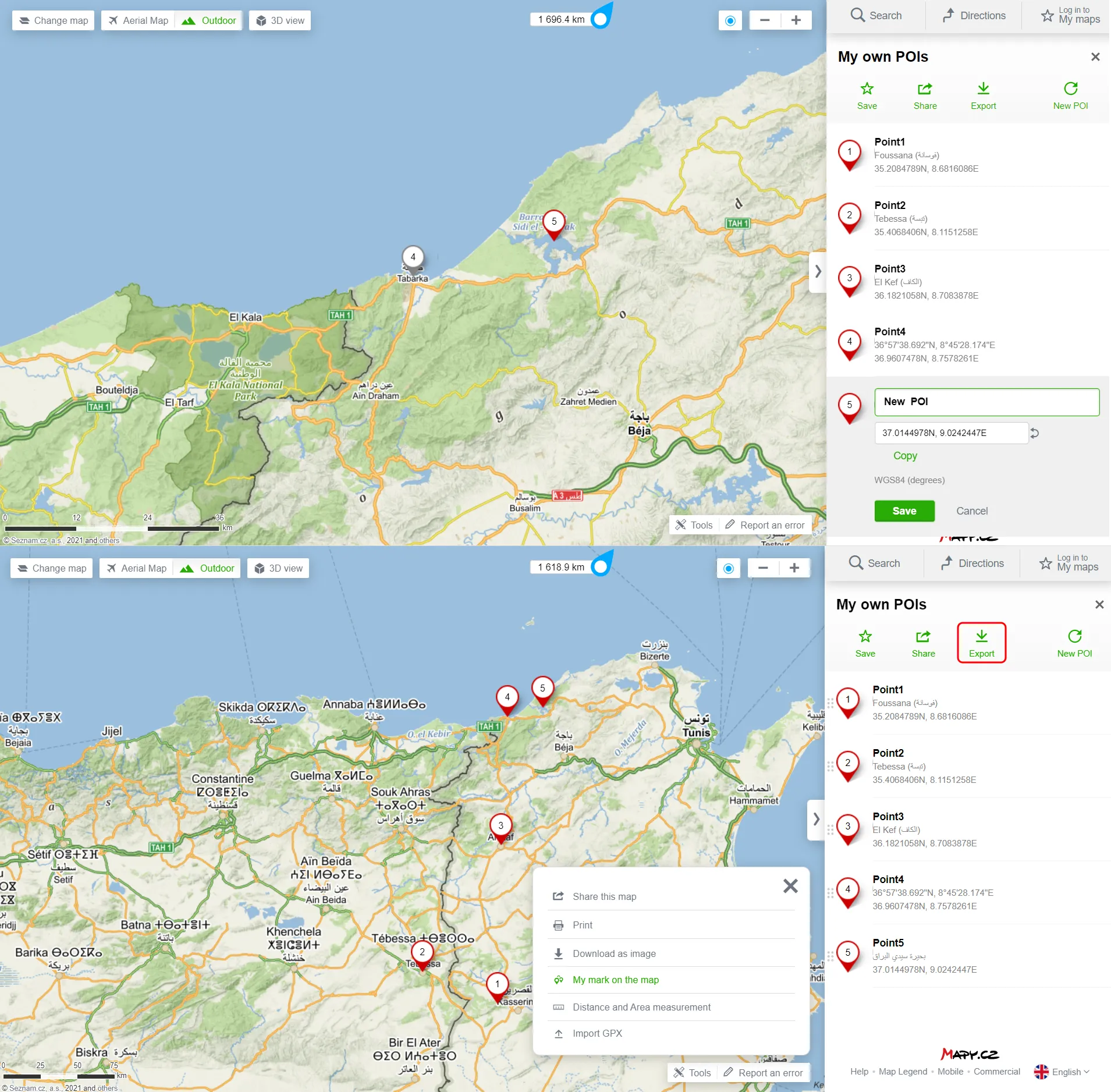
Pic. 46 Adding your own Points of Interests (POII) with their rough GPS coordinates (WGS 84) and export option bounded red.
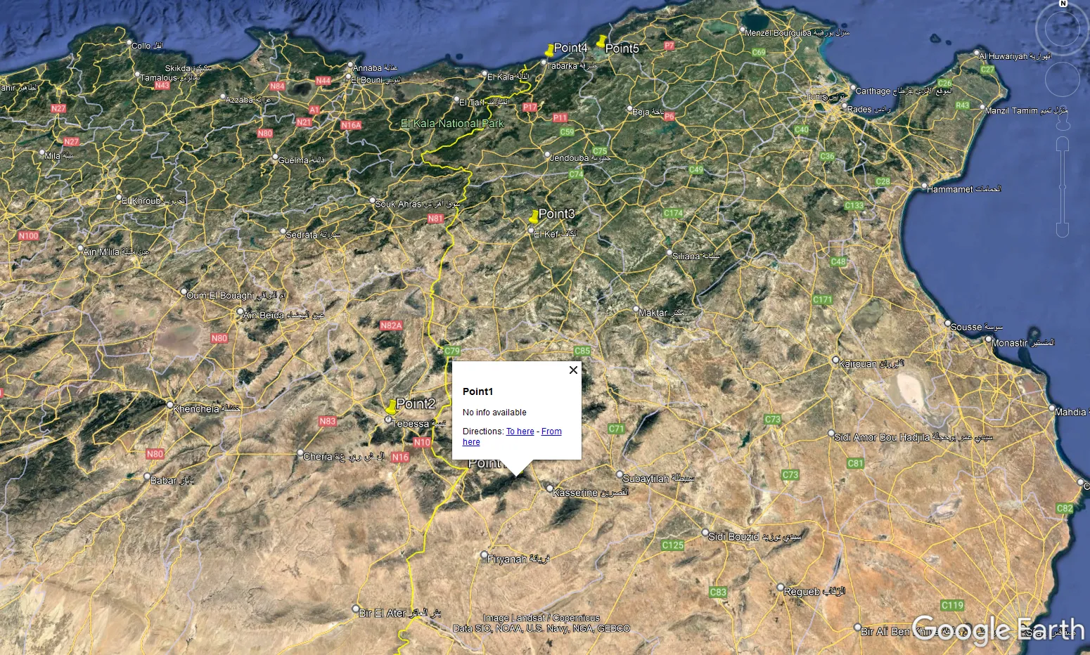
Pic. 47 Our Points of Interest (POI) were uploaded to Google Earth after conversion from .gpx to .kml.
27. Measure distance or area – another excellent option to try, all the more that simultaneously we can analyze the terrain profile of our measurement at exactly the same basis as for route calculation. The same applies to the downloading option, which is also available for our measurement tool.
Pic. 48 The exemplar measurement with its terrain profile.

Pic. 49 Measurement tool in action with all options visible on the right.
Pic. 50 The measured area was converted to a .kml file and imported to Google Earth.
All the options presented above don’t require setting up your account on this mapping platform. It means, that you can use them incognito. There are only a few features, which will work from your profile only. The setup is awkward because you cannot do it from your Gmail account. You have to create the other account on the Seznam.cz portal, but I hope it will change in the future.
II FEATURES WITH SIGN-IN REQUIREMENT
28. Import your own GPX file – a perfect option for someone, who wants to display his route on the map. These routes usually come from other web applications used for cycling, walking, etc., like Endomondo. We can add the .gpx file with our route by selecting the “Tools” and choosing the “Import GPX” option.
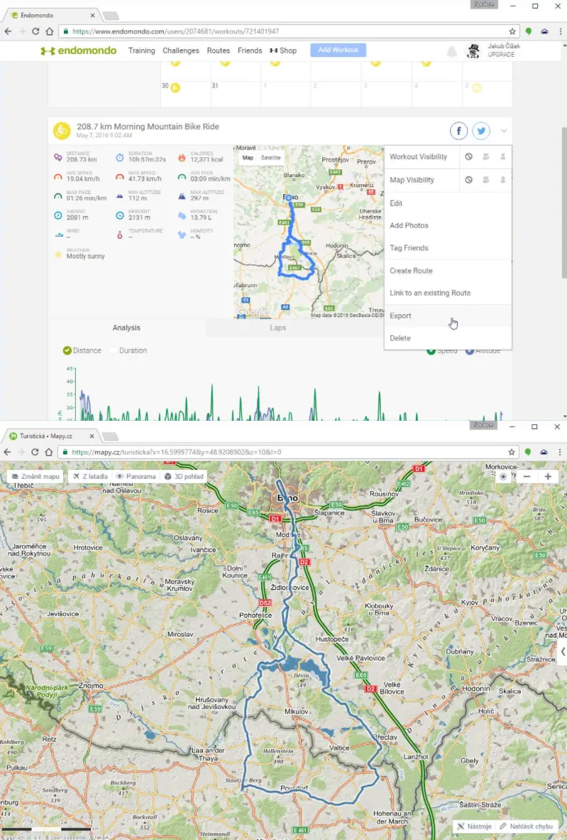
Pic. 51 Uploading your own .gpx files (Zive.cz).
29. Mark already visited places – if you travel a lot, not necessarily around the world but even within a small region, you can mark all the places you visited.
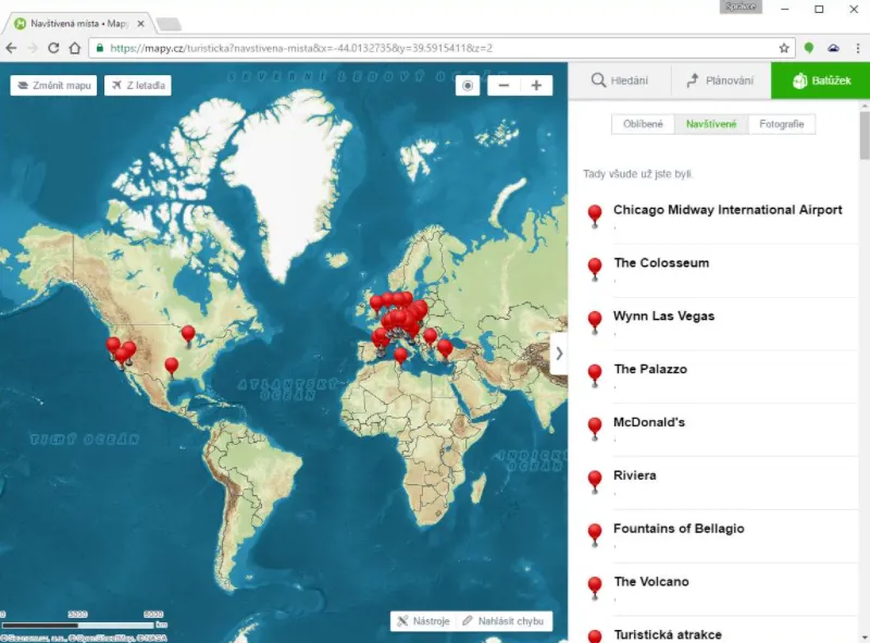
Pic. 52 An example of visited places marked by one of the users (Zive.cz).
III FEATURES WITHIN THE CZECH REPUBLIC ONLY
Czechia is the mother country for this mapping application. You shouldn’t wonder about (sometimes) a significant difference in the information level between this country and the rest of the world. Most of the options described here are available worldwide, although some of them can be used only within the Czech Republic boundaries.
30. Browse maps from the XIX century – an ideal option for someone, who is interested in history. The coverage of the XIXth century maps includes the Czech Republic as it was at that time under Austro-Hungarian rule.
Pic. 53 XIXth century maps coverage.
31. Use local street view – maybe you didn’t know, but Seznam.cz has launched its own street view, which covers the whole Czech Republic. Images aren’t the best in quality, but there are a lot of roads covered, even the dirt ones, which is pretty cool!
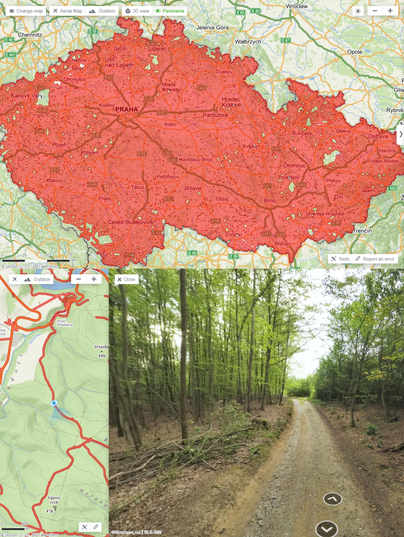
Pic. 54 The Street View option, which often includes also various dirty roads.
The “Panorama”, which is the official name of the Czech street view can be toggled just right of the 3D view or from the information panel. It disappears when you move out of the Czech Republic borders. The “Panorama” imagery is 4-8 years old. All images are going to be updated in the near future.
32. Bird’s eye view – the satellite view by the bird’s eye, which is going to supersede the 3D view gradually. In my point of view, it should remain a separate function, as it’s not as perfect as the 3D view. Moreover, by now only the Czech Republic is covered.
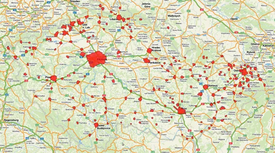
Pic. 55 The Bird’s eye view coverage (Napoveda.Seznam.cz).
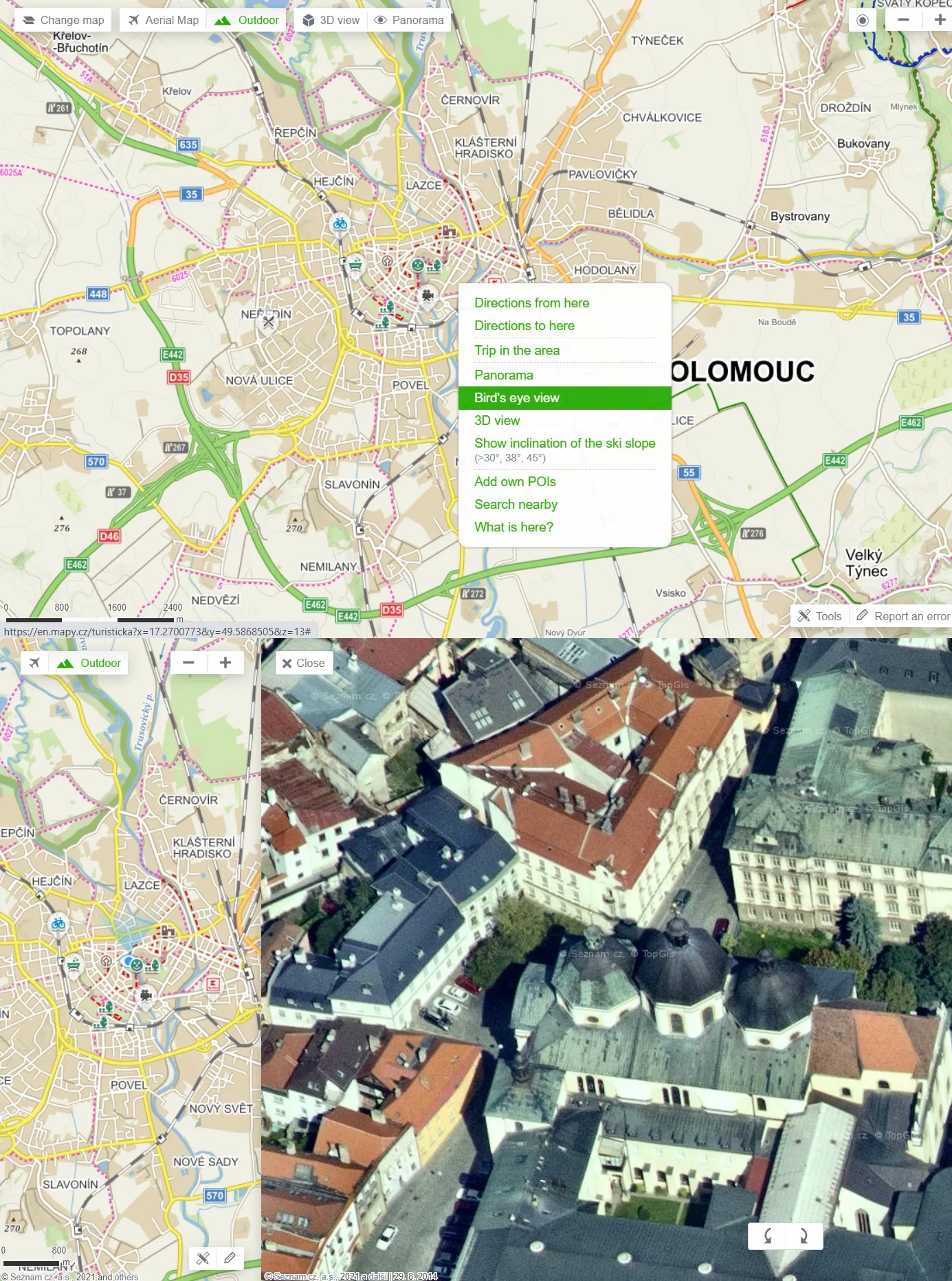
Pic. 56 The Bird’s Eye view in action.
More information about the development of the Bird’s Eye view you can find here.
33. Share your experience & View ratings – the useful option, which can help you to choose for example the place to stay or visit. Beneath the general information, you can find the option of sharing your experience by giving the number of stars. In the case of accommodation, Seznam.cz took care of fetching the rating directly from Booking.com, which is really handy. Some people’s feedback you can see down later.
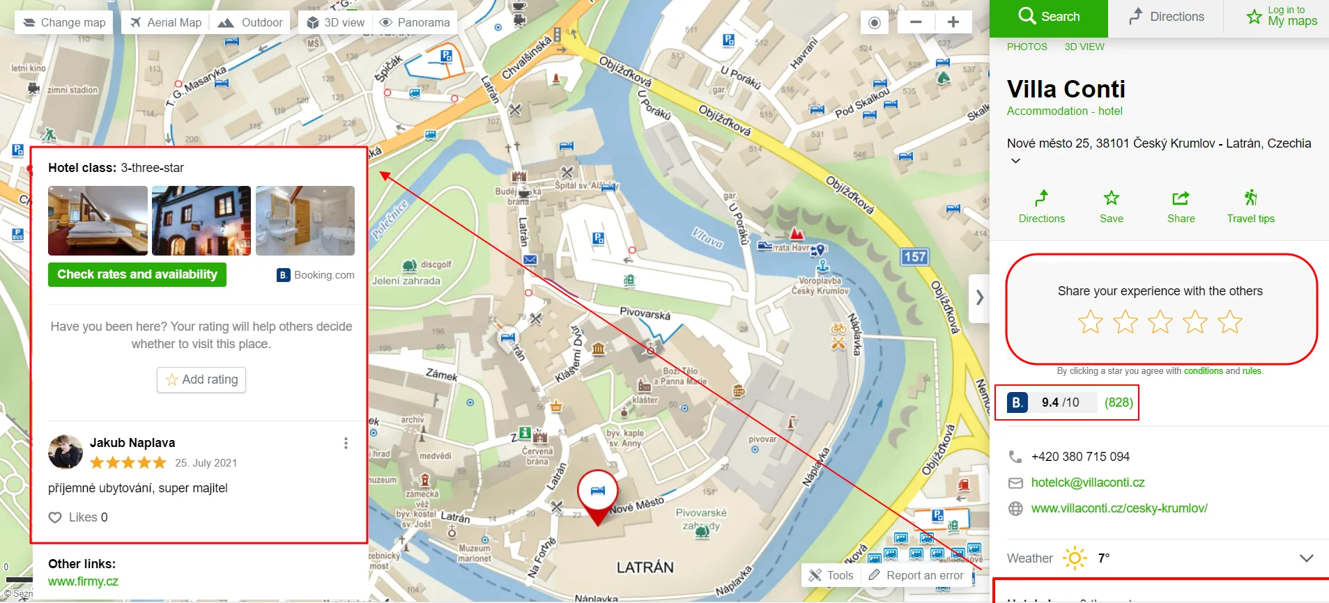
Pic. 57 The “Share your experience” option and Booking.com ratings in the information panel.
34. Browse related places (points) – the feature available for the most remarkable sights across the country. By clicking one of them you will be instantly redirected to the place, which will be selected exactly on the same basis as the current one.
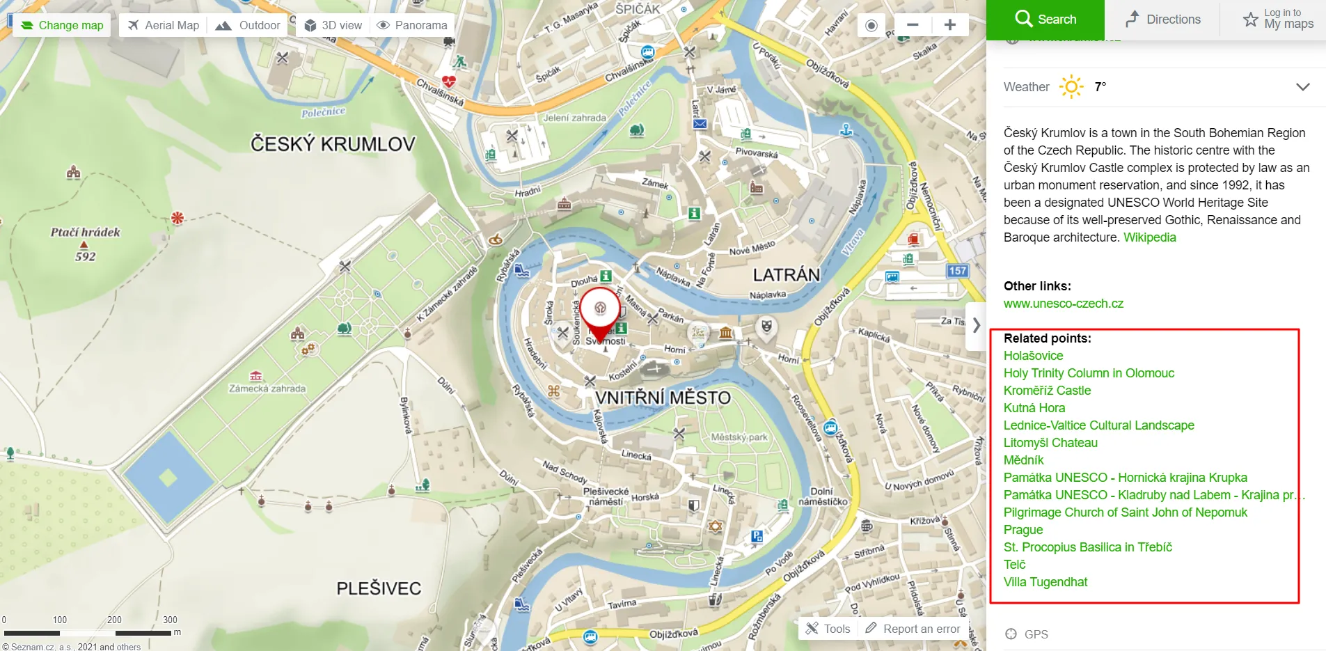
Pic. 58 The “Related points” options available for remarkable objects in Czechia.
IV MOBILE APPLICATION FEATURES
The mobile version seems to be the most important. We can take the maps away from our computers and use them in the field. Unfortunately, quite a lot of features are available on desktop only. The producers equipped the application with absolutely the most needed options and rightly so.
Pic. 59,60 Mobile version options and map settings.
The biggest feature of the mobile version is its offline capability. A user can download maps divided by administrative regions worldwide. All the maps are vectorized, which means, that they don’t change resolution on different zoom levels.
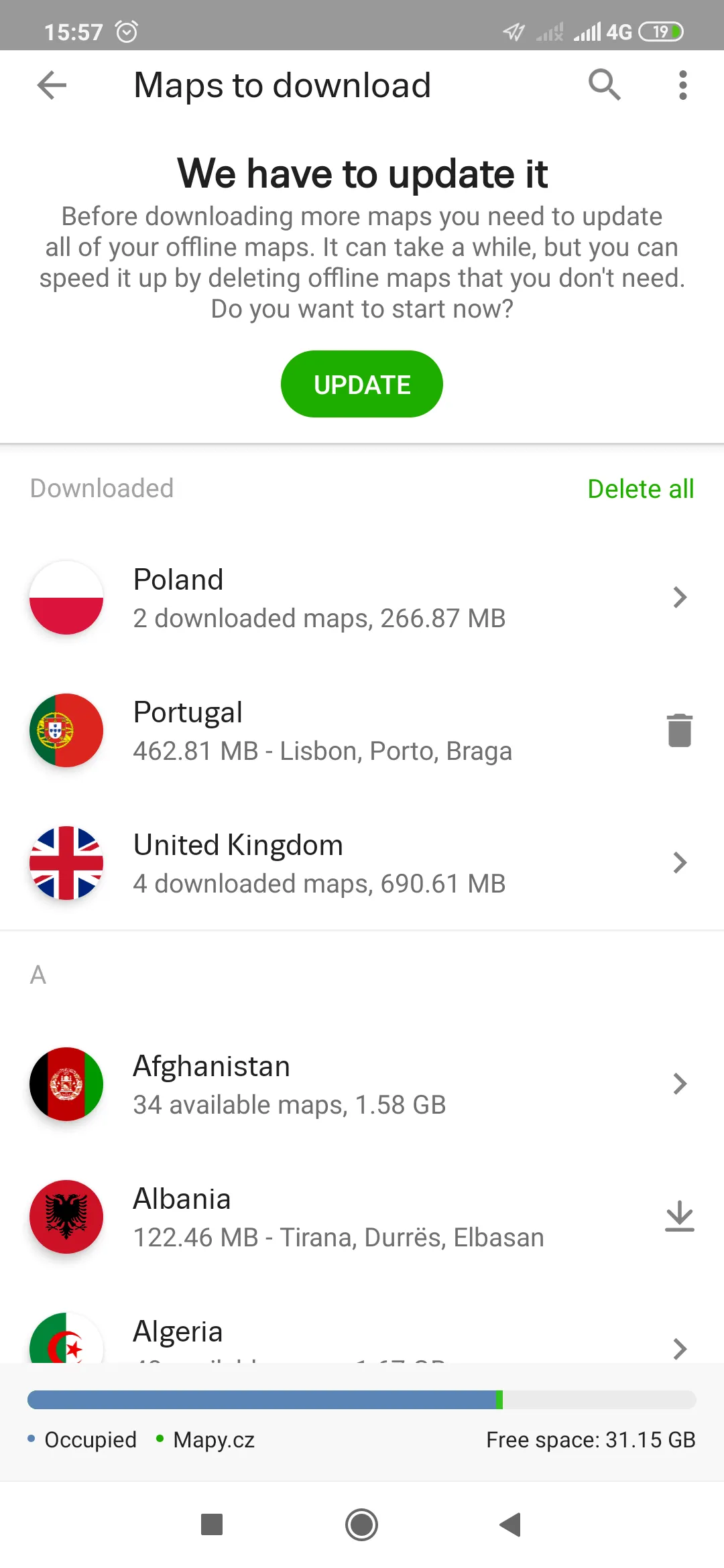
Pic. 61 Updating and downloading maps for offline usage.
Thanks to this the map can be a fantastic alternative to our paper maps used for mountain trips. Be aware, that they will be still needed, as the paper doesn’t need the current one! Moreover, there are still some noticeable mismatches in trail routes, which is an example you can see by watching my video below.
The maps render quickly, unlike other OSM products and every feature is easily accessible because of the friendly interface. Other good options are:
– day & night modes in navigation mode,
– three different map layers (outdoor, satellite, and winter),
– displaying ski slope inclinations,
– displaying hillshades,
– instant distance calculation,
– one finger zoom,
When you hold your finger for a few seconds you can switch on the information panel of your point, which includes:
– GPS coordinates,
– route planner,
– weather checking
– description (if available) with external links,
– other options (the same as in the desktop version)
Pic. 62, 63 The information panel of the clicked point in the mobile version.
35. Track your activity – this is the option, which appears only in the mobile version. The user can track his activity on the route calculated previously.
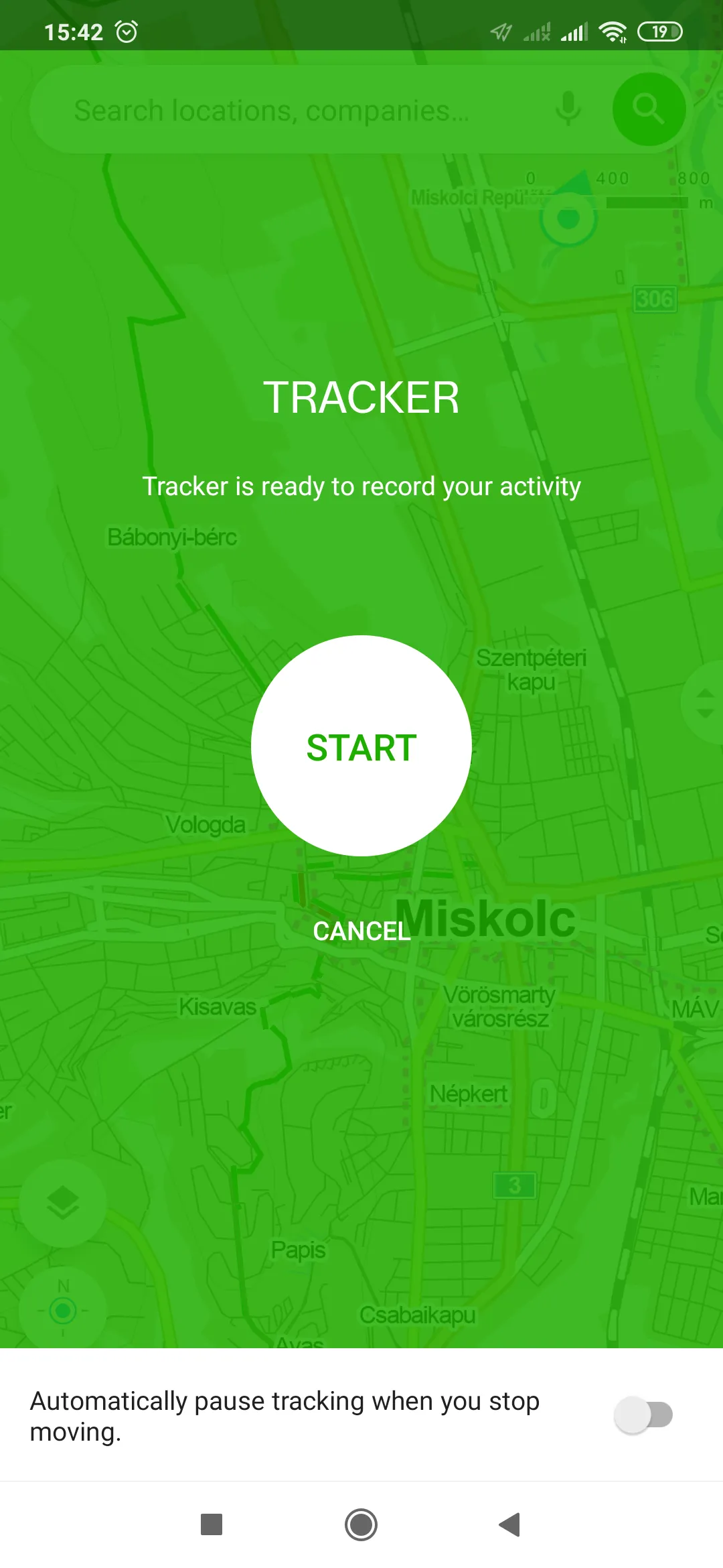
Pic. 64 Tracker ready to record your activity.
Pic. 65 Activity tracker in action (Zive.cz).
By using an activity tracker we can learn about time spent during our walking, and so forth.
36. Alternative source to find the cadastre – it can be done in a mobile version by populating the information panel. Sometimes we can find information about the owner of a given building or land. It’s not everything we can get. Additional information will apply to the relevant municipality, cadastral area, and acreage.
V. SUMMARY
I have come across this brilliant map platform in detail, which I hope will help you. At this moment I can’t see a better place, where I could plan my trip so smoothly. As it has been told several times, the level of detail remains subject to discussion across the different types of areas. The highest one is to be found in Czech, but I am convinced, that the same level will be met in any place worldwide in the future. Some things are still “fresh” and not all users know them. They will be developed in the future. We should treat this Seznam.cz product not only as a pure mapping tool for activities or traveling but also as a beautiful, practical pack and a fantastic source for any information about tourist places and infrastructure. It has grown up as a fantastic platform, which I am going to recommend highly to everyone.
Mariusz Krukar
Links:
- Play.google.com: Mapy.cz application
- Tekdeeps.com: 9 tips & tricks for the Mapy.cz application
- https://newsbeezer.com/czechrepubliceng/13-practical-tips-and-tricks-for-mapy-cz-you-may-not-know-zive-cz/
- https://www.drupal.org/project/mapycz
- Mapy.cz – FAQ
- Mapy.cz – brief description
- 13 practical tips for the Mapy.cz service (Czech)
- https://archive.md/20200816150207/https://czasopismo.legeartis.org/2017/10/aplikacja-mapy-cz-test/ (Polish)
- http://api.mapy.cz/ (Czech)
- Mapy.cz – adding to your website – terms of use and violation
- https://napoveda.seznam.cz/en/maps/what-are-tactile-maps/
- Mapotic.com: Add new routes to Mapy.cz service
- Using Google Street View with Mapy.cz
- https://starpath.com/gpx/ – convert a Google Earth path to a GPX route
- Import GPX routes to Mapy.cz (Czech)
- Mapy.cz – route planner
- https://justuseapp.com/cancel/411411020/mapy-cz-navigation-maps
- https://www.saashub.com/compare-mapy-cz-vs-maps-me
- https://www.active24.cz/en/how-to-website-creation/wordpress/jak-vlozit-mapy-na-webove-stranky
- https://cc.cz/tag/mapy-cz/ (Czech)
- 12 tips for Mapy.cz (Czech)
- Tourister.ru: Mapy.cz – Nezamenimij pomocnik dlja puteszestwij po Czechi (Russian)
- Street View for Mapy.cz (Czech)
- https://gpx2kml.com/
- https://miconv.com/convert-gpx-to-kml/
- Jsfiddle.net: Mapy.cz – various code examples
- https://napoveda.seznam.cz/en/birds-eye-view/
- Import your own GPX file to Mapy.cz
Forums:
- Mapy.cz WMTS layer for QGIS (Czech)
- https://www.reddit.com/r/OsmAnd/comments/gpgxmp/osmand_map_sources_and_mapycz/
Wiki:
Read also:
Youtube: