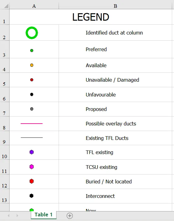
Making fibre FTTx schematics in QGIS
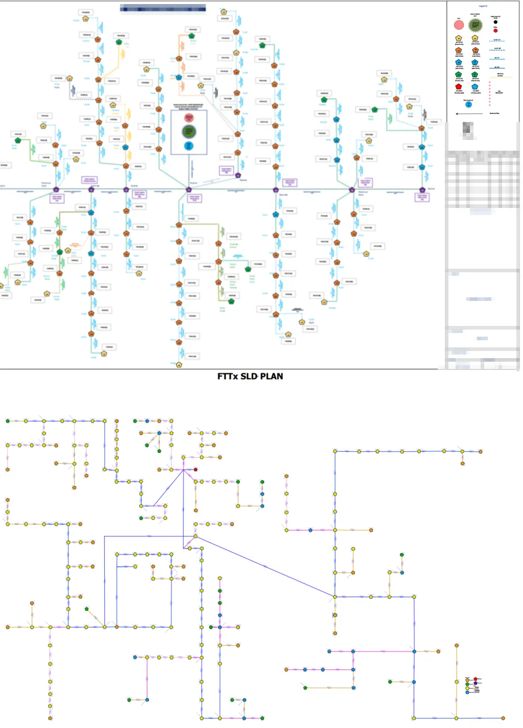
This article is dedicated to anyone, who works in the telecom industry and struggles with creating the FTTx schematics. We have several nice ways to combat our day-to-day work, although not all of them are for free – this is one reason. Another one refers to our particular project, which does not always fit with … Read more