
Total solar eclipse 2020 – remote chasing the umbra and a brief explanation how do the webcams work
The total solar eclipse on December 14, 2020, was the last one in the 2nd decade and obviously the first “Twenty Years Solar Eclipse Path Tables” of the XXI century. Most people call this eclipse the COVID eclipse, due to omnipresent travel restrictions, which kept a lot of eclipse chasers in their homes. They could use the standard streaming platforms and watch this fantastic event via their devices. Not to mention, that particularly for this eclipse a bit more live streams were available than usual. Another issue was the weather in Chile – the only eclipse destination possible. A lot of spectators defied the local COVID restrictions and flocked anywhere within the path of totality, but due to the overcast sky and sparked heavy rains the overall results were poor. Some people could only see partially the eclipsed Sun through the parted clouds. Combining the COVID restrictions, which confined all eclipse chasers to Chile only, and very poor weather in the eclipse strip we can conclude, that the best way to experience the total eclipse adventure was remote, at home.
Traditionally, my observation was predominantly umbra-centered. I focused on the lunar shadow. This is the element, which I used to watch before under partial, annular, and below-the-horizon eclipse circumstances. This time I somewhat combined all these circumstances, except the annular one, which was replaced by total here. I saw the fleeting umbra from space, watched it from cloudy Chile, and finally after sunset in Namibia. Everything has made my writing so informative and pushed forward my study about the optical response of the Earth’s atmosphere at its perfect alignment with the Moon and Sun.
1. METHODS OF OBSERVATION
At the very beginning, I would like to say something about the methodology of my remote observation. For the purpose of shadow chasing from Space, I used Zoom.earth platform, which appears to be the best worldwide, except for Sat24.com available for Europe and Africa. Capturing the shadow from Chile wasn’t a big deal really, as I used quite a poor webcam and saw how it gets darker and brighter later. The major goal of my observation was undeniably the observation of the solar eclipse’s impact on twilight in Namibia, where the crescent Sun performed shortly after sunset. Moreover, the path of totality finished about 370km west of Namibia’s landfall, making a good occasion to intercept the sky brightness and color changes above this African country. I’ve significantly improved the method regarding the before-after comparison. All the cameras used for solar eclipse below the horizon observation in Namibia featured the same vistas roughly 24 hours after the event took place. I would like also to add, that all webcams in Namibia operated by Namibia Weather with HD resolution were working at the time of the eclipse. It’s the first situation such as this since I started to use webcams for solar eclipse observations. All the webcams in Namibia feature refresh every 15-30s on average.
For a comparison of my results, I used the Darktable 3.2 Opensource software, where I enhanced the screenshot coloration, adding up the Velvia and vibrance modules. Because webcams operated by Namibia Weather provider turn into grayscale under low light conditions, I used the MyHeritage web application to add simple colors for my screenshots gained during the nautical twilight occurrence. I’ve analyzed all 17 webcams in Namibia separately despite different weather conditions across the country. Most of them were used for a simple GIF animation showing the comparison between the eclipse and non-eclipse conditions as well as the greatest eclipse moment at the given webcam location. The smallish difference in sunset ephemeris driven mostly by the equation of time between the eclipse day and the day after has been omitted.
2. AUTOMATIC LIGHT ADJUSTING BY WEBCAMS
In the beginning, we must know, what certainly the webcam is. The Webcam is a digital camera hooked up i.e. by the USB port to some device, which has an Internet connection and some camera software. The camera software can collect the frame instantly at the interval defined randomly by producing a single still image or making a streaming video. The cameras dedicated to streaming require a high frame rate, indicating a multitude of pictures the software can collect and transfer to another location for viewing within one second. Apart from this feature also the high speed of internet connection is required. The basic role of camera software is to broadcast the image over the internet connection, which can be done with a few methods. Considering the most common method, our software turns the camera into a downloadable .jpeg file.
The staff, which is presented on the Internet is basically the product of the digital camera quality, which should be explained here.
The digital camera captures the light through a small lens at the front by a smallish system of microscopic light detectors. These light detectors comprise an image-sensing microchip, which can be the CCD (Charged Couple Device), especially in older types of cameras or a CMOS (Complementary Metal–Oxide–Semiconductor) image sensor nowadays. The basic difference between CCD and CMOS is the way, how the vista is captured. The CCD captures the frame at the same time exactly, whereas the CMOS captures each pixel one by one. This difference is being translated into the readout features of both types. As the CCD captures a whole frame at once, it has only one or two or at most 4 readouts located at the corners. The CMOS sensor might have even millions since they correspond to a single pixel (Pic. 1).
Pic. 1 The simple graphic difference between the CCD and CMOS sensors (Diffractionlimited.com).
The digital camera sensor is a semiconductor chip, made of millions of tiny and light-sensitive squares, called pixels, which are arranged in a grid pattern. They record light electronically. Having the 3Mpx digital camera we can take a higher-resolution picture than most computer monitors can display.
All the webcams work broadly in the same way, namely, they use the image sensor chip to record images and stream them immediately to the computer or internet. The image chip sensor, as the heart of each webcam, contains the lens mounted directly to the tiny electronic circuit board. The lens can crew in and out in order to adjust the focal length and control the camera focus. The CMOS or CCD sensor is located just underneath the camera lens. From our observation point of view, one of the most important things is the camera resolution, which has been gradually increasing from 320×420 to 1920x1080px (FullHD). Usually, the webcam captures the frame with a much lower resolution, resulting in sometimes blurry or “pixelated” images. It’s explained by the speed of uploading this data into the internet. The KB-size file can be sorted very quickly unlike the heavy several MB image. Besides the camera resolution, a very important role plays the frame rate (or refresh rate). The frame rate is the number of frames per second, that a webcam can cope with. The fps amount varies throughout the camera types between 24 and even 60. However, the final amount of frames per second is firmly related to the light level of the frame. This direct relationship between the frame rate and image exposure means, that in order to get a pretty well-lighted image, the framerate must drop under lower light conditions.
It explains why a lot of cameras stream dark frames overnight then. Each provider can control exposure or choose the priority between the exposure and framerate admittedly. Putting the exposure at the top, the supplier can suffer from a choppy video under low light conditions. Hence, especially in the cameras aimed at the live stream, there is no visual information in the frame overnight until someone changes the issues mentioned above. Another situation can occur when the webcam captures still images. It’s a bigger chance to make it useful during the night then, although is not a rule. It can also depend on the other technical conditions like The fps drop from i.e 50 to 30 or even 20 won’t be noticeable really in the video fluency. In turn, we can see increasing noisiness until the camera switches to the grayscale or even infrared light mode. Among the majority of digital cameras, useful in daylight conditions only, there is a group of high-sensitivity cameras, which can be utilized at night. These cameras are capable of producing a high dynamic range from a few light photons only. The low light camera is typically designated with large pixels, which means, that they have a larger area to gather the light. The low light cameras have revolutionized amateur imaging of the planets and lunar details (Roth, 1994). Because the fast streams of shore exposures can be recorded, we can select the very best from many hundreds and stack them. The common drawback of all webcams is, that they aren’t as light-sensitive as i.e DSLR cameras, though they can be used for the observation of bright objects only. They can be ideal for taking videos of the Moon and planets (Gater, Vamplew, 2017). The strength of webcams lies in their high rate of data capture (Arditti, 2008). The wide selection of digital cameras, especially those, that are dedicated to night vision purposes combined with broad options for uploading their data to the Internet led to a new realm within the observation astronomy field, which is webcam astronomy. The webcam astronomy includes all celestial observations made by the digital camera predominantly during low light conditions. My eclipse observations are exemptions because they include the events, which happen during the daylight and twilight when the level of illuminance is relatively much higher than overnight. The webcam astronomy issue combined with a full explanation of the digital camera working mechanism will be definitely a good topic for future writing.
3. LUNAR SHADOW SEEN FROM SPACE (SATELLITE IMAGERY)
The best satellite imagery, from where the fleeting lunar shadow could be gained was the zoom.earth platform. It was roughly the same view as via NOAA Satellite Imagery as they are based on GOES and NESDIS image viewers. I prepared the general outlook of the whole southern hemisphere and also the zoomed view of the “Southern Cone” region. Both examples show how the lunar shadow makes a significant impact on the whole satellite product. In practice, the solar eclipse causes significant visual changes in VIS satellite imagery, especially clouds, whose structure and texture can’t be distinguished properly. It leads to deteriorating the analyzing and applying the information of the satellite VIS imagery in this situation. For purposes such as this important is to eliminate the eclipse shadow from this imagery, which can be done i.e. by the radiant revisal function (Zhang, et al. 2004, 2007). This is obviously more like an interesting fact here, because my current work doesn’t advance the analysis like this.
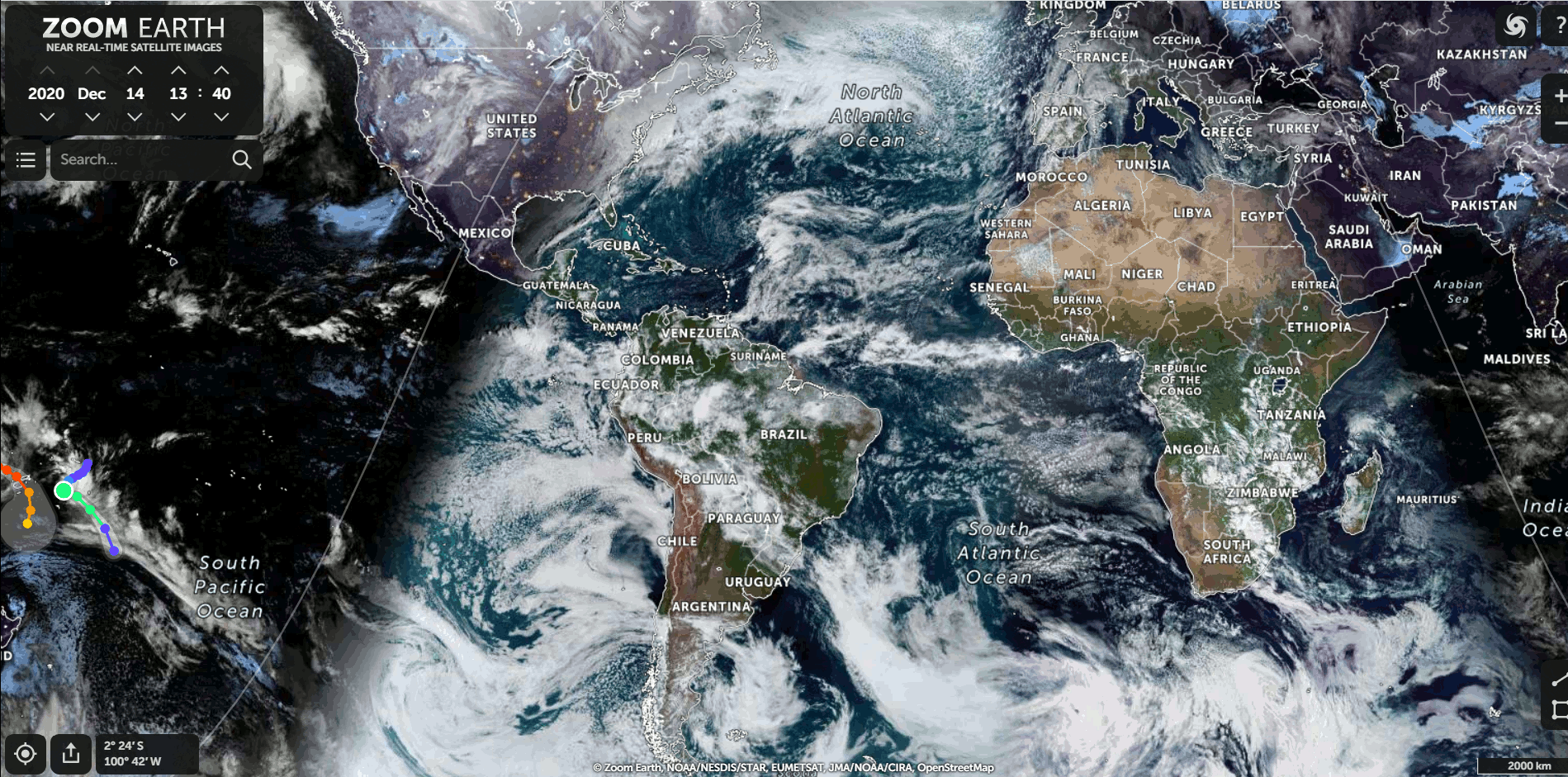
Pic. 2 Total solar eclipse 2020 as seen from Space (Zoom.earth/NOAA/GOES/NESDIS)
Pic. 3 Total solar eclipse 2020 in the Southern Cone as seen from Space (Zoom.earth/NOAA/GOES/NESDIS).
The umbral movement looks great from the satellite imagery. The similar view I could get over 4 years ago, watching the African Ring of Fire.
4. TOTAL SOLAR ECLIPSE CAPTURED IN RAINY CHILE
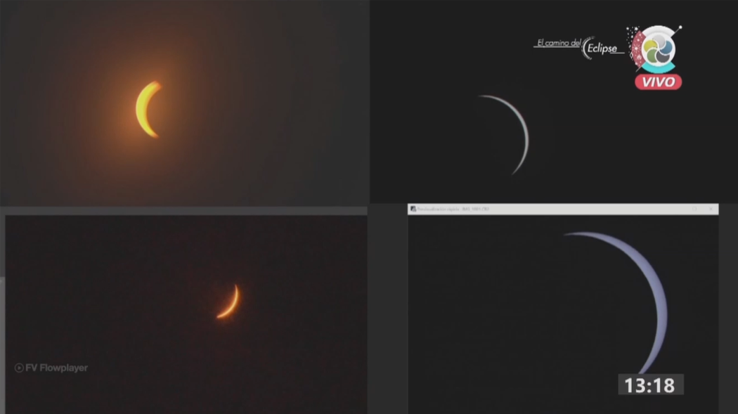
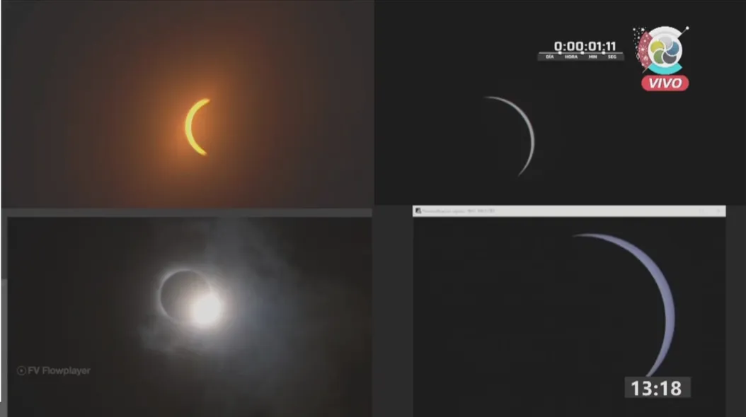
The only place, where the umbral shadow was intercepted in Chile was located near the northern limit of totality at the Universidad de la Frontera of Temuco. The webcam led me to get a simple image of the visual light level changes. They look amazing, as the vista gets completely dark around the moment of totality (Pic. 4).
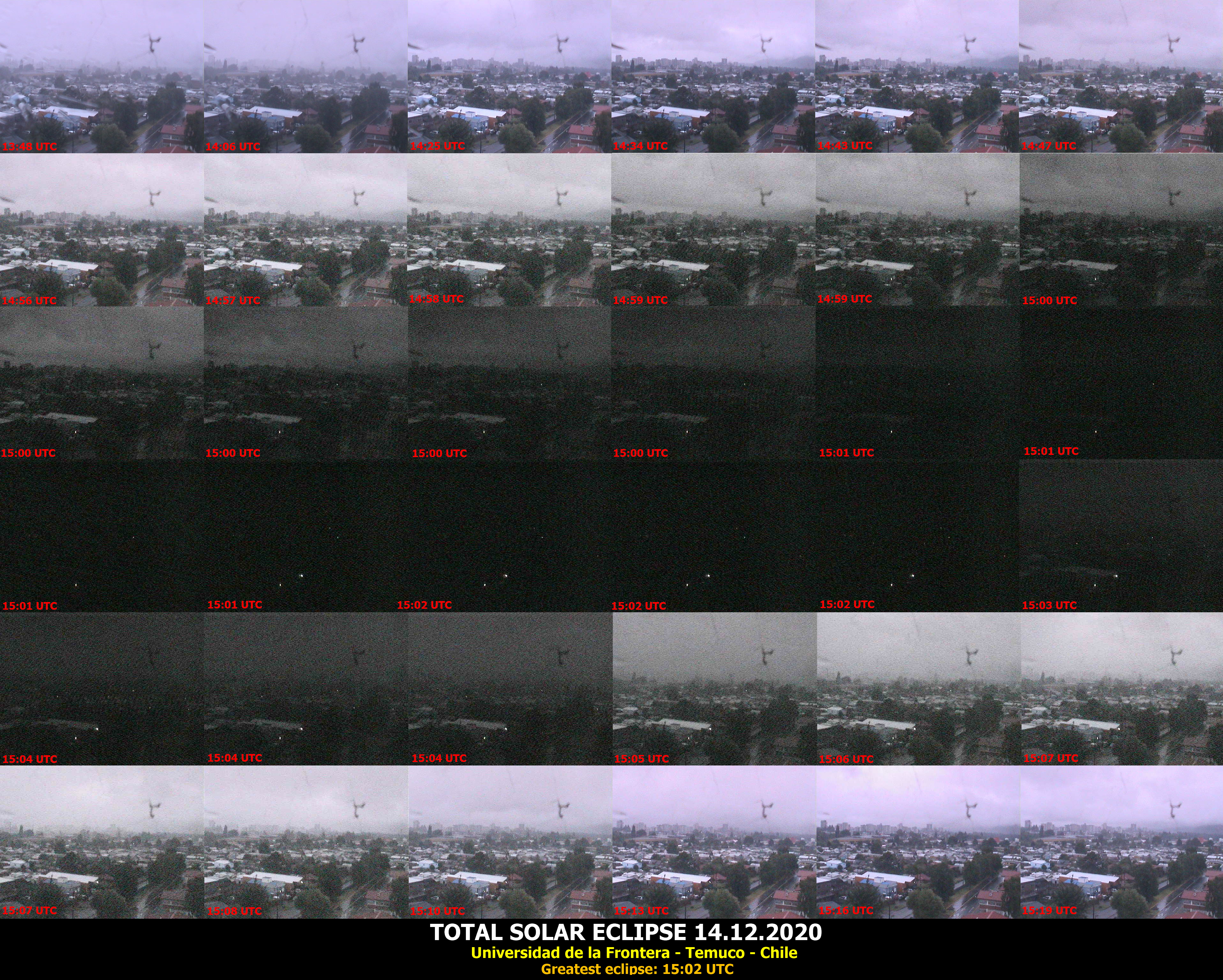
Pic. 4 The light level changes sequence produced from the webcam located at the Universidad de la Frontiera of Temuco in Chile, near the northern limit of totality. The greatest phase of the eclipse occurred shortly before 15:02 UTC. The camera showed perfectly how the landscape changed over the eclipse period (Opentopia.com/Universidad de la Frontiera ). Click to enlarge.
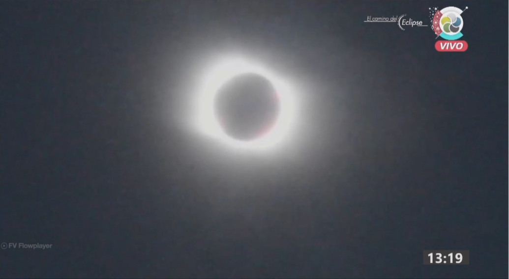
I also captured some data from the live streams located across this country. Overcast sky prevailed within the string of totality, alas the results are really poor.
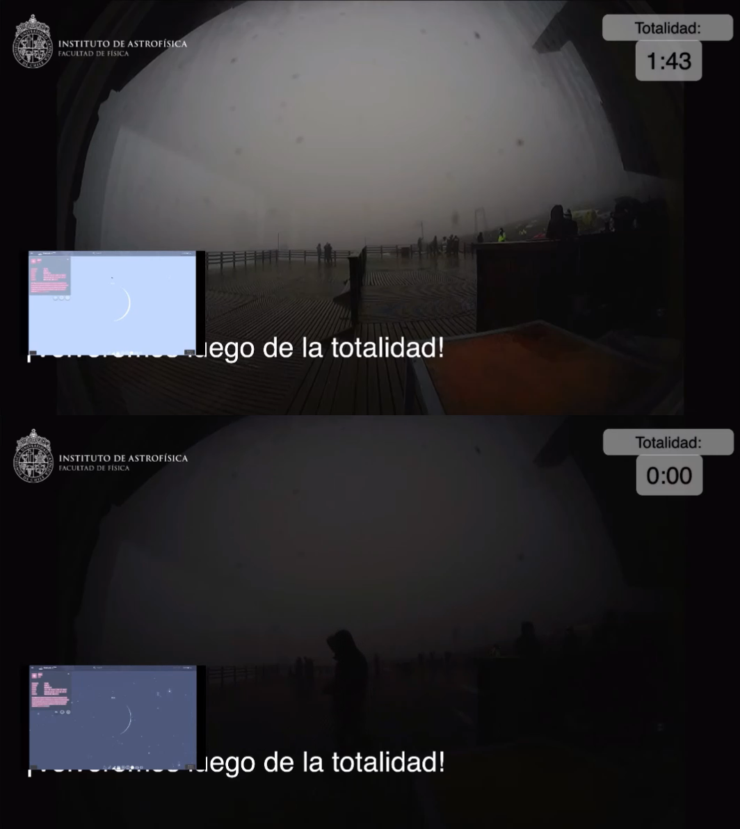
Pic. 5 Very poor observation results from Villarica, where the live stream took place (credits: Instituto de Astrofisica).
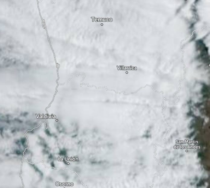
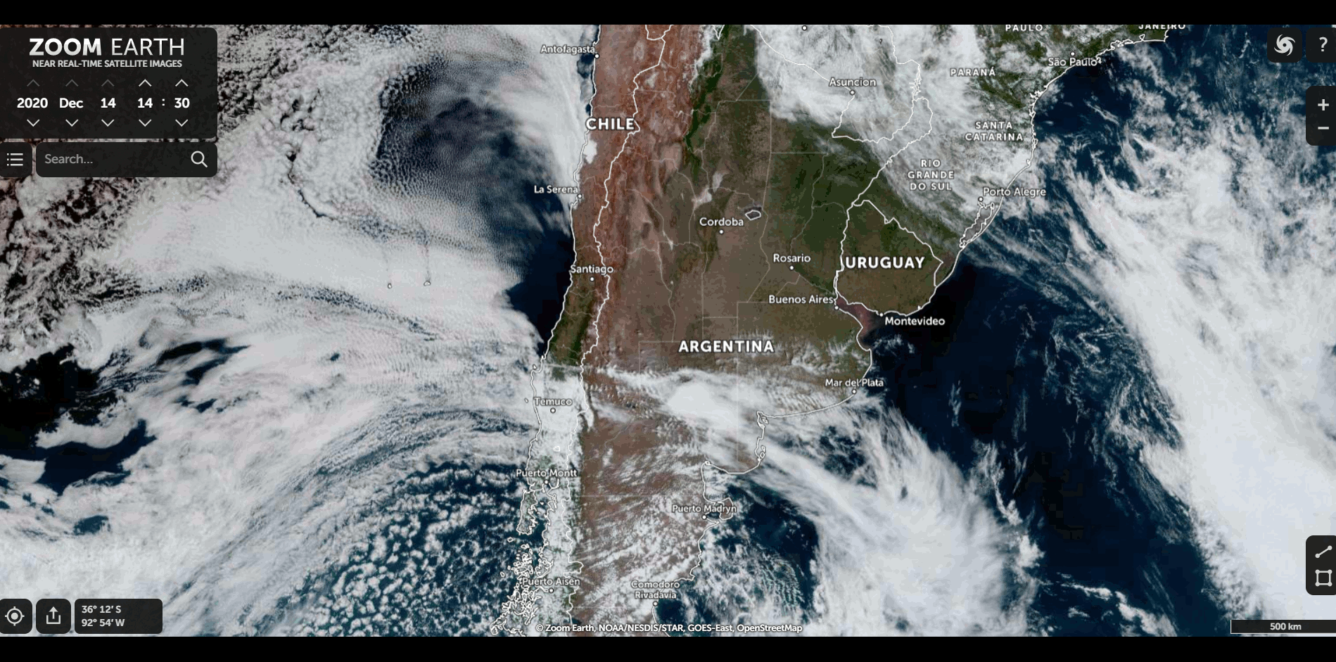
Pic. 6 The cloud coverage along the path of totality in Chile at 13:40 UTC (Zoom.earth).
5. A NICE REPORT FROM ARGENTINA. NAMIBIA BEFORE THE ECLIPSE EVENT
Much better weather was on the other side of the Andes, where usually the clear sky takes hold in this part of the year. In Neuquén – a small city in Argentina, the eclipse was almost fully visible, just veiled by thin clouds from time to time.
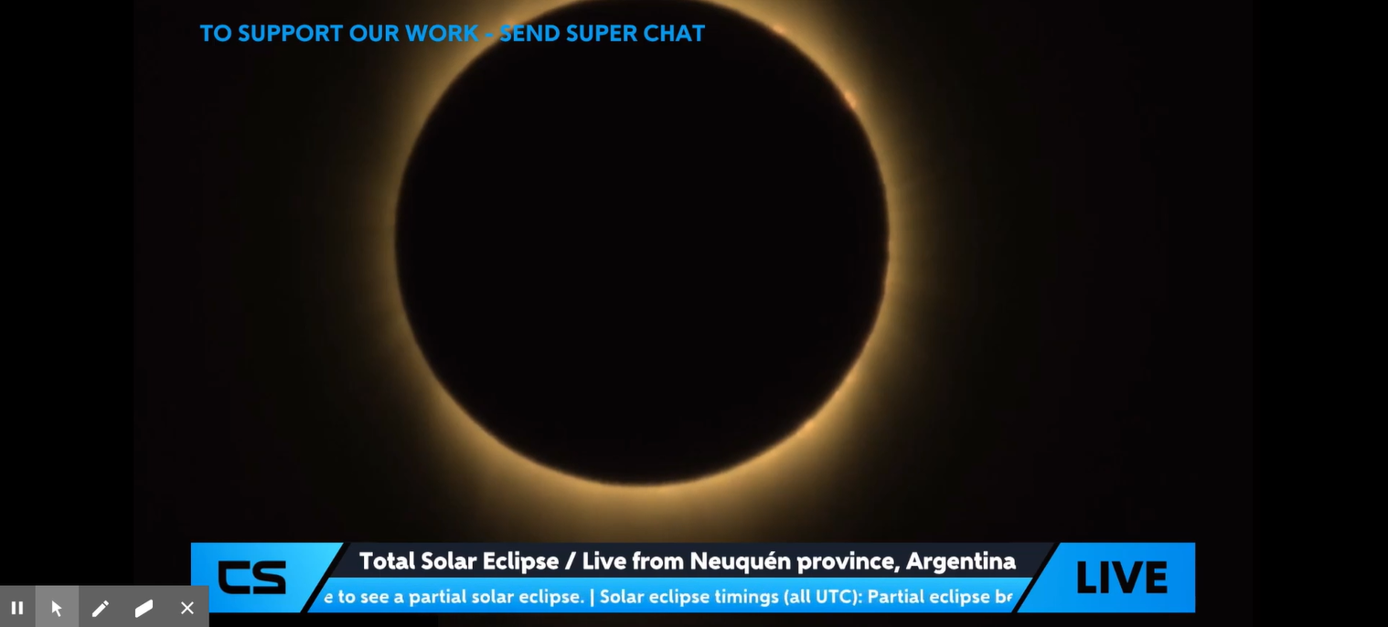
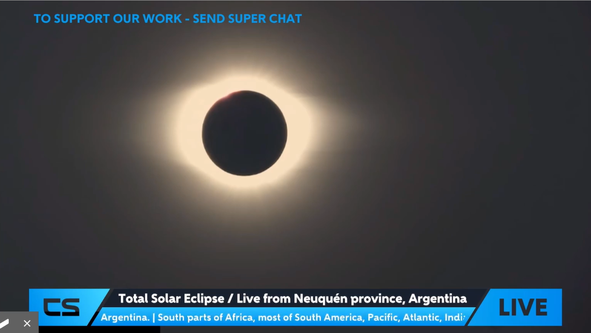

Pic. 7 – 9 The total solar eclipse live stream from Neuquen in Argentina (CS Live).
The Neuquén province as well as other places located within the path was also the place of live transmission for Argentinian Canal 10. The transmission combined a few live streams in one place. The eclipse was visible great.
Pic. 10 – 12 The total solar eclipse transmission by Canal 10 en Vivo from random places in Argentina (Credits: Canal 10).
The most renowned live stream platform, which deals with events like this – Slooh, gathered the footage from at least a few other providers, while Canal 10 and CS Iive were also included.
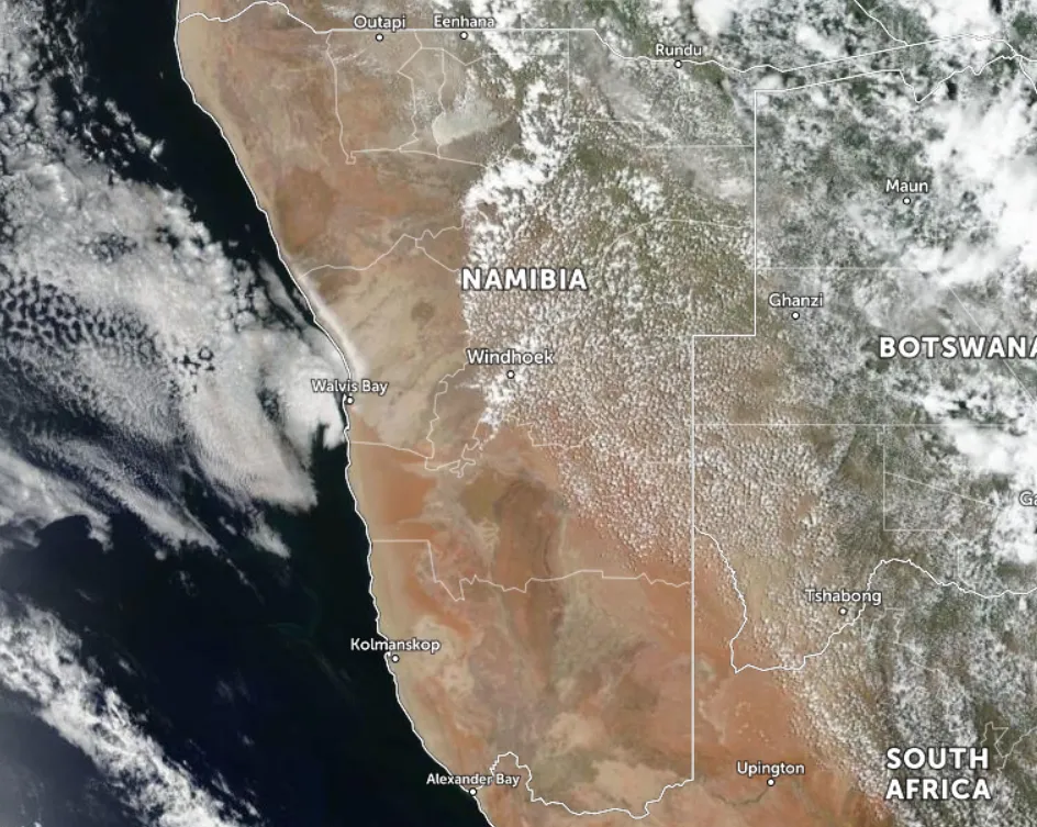
In the meantime, the weather background in Namibia was various across the country. Surprisingly the clouds were forming above Windhoek – the capital city. I wasn’t surprised to see the overcast sky in the extreme easternmost part of the country located in the humid subtropical climate characterized by hot and humid summers. The Okavango Basin, where the north-easternmost part of Namibia lies is characterized by regular rainfalls during the summer, which lasts between December and February. These rainfalls occur as thunderstorms mostly in the afternoon and evening time. The clouds come from the northeast as per typical wind direction during the summer period. In turn, the north and central part of the country lies within the semi-arid climate, where up to 300 days of sunshine is reported yearly on average. The bad weather is confined to the summer months only with its peak in January and February. Regrettably December sometimes also is not the best month for astronomical observations. This time usually the first rain arrives. The wet season usually starts with regular vertical-developed clouds bringing thunderstorms and rain in places. The eastern part of Namibia, where the Kalahari Desert is located, features about 4 months of the wet season with some rainfalls occurring sparkly and significant cloudiness. West Namibia regions belong to the Namib Desert, which is drier than the Kalahari Desert. The problem of the western part of Namibia especially along the coast lies in cloudiness. The cold Benguela current causes a frequent low-level cloud deck appearance as well as thick fogs occurring sparkly across the Namib Desert even up to 6 months per year. At the coast, low-level clouds are present, especially overnight.
Below you can see the weather conditions in Namibia at 2 pm local time, about 5 hours before umbra arrived.
Pic. 12. The weather situation in Namibia captured in the afternoon on the eclipse day (Zoom.earth).
The eclipse day in Namibia featured different weather across the country. The Namib and Kalahari deserts were mostly sunny, unlike the Okavango Basin and Zambezi region, where thundery conditions occurred from the early hours. The most interesting part of the shore – Walvis Bay region was overcast, although the large cloud body was moving northwards.

Pic. 13 – 17 The weather situation in random places across Namibia at 1-2 pm local time on the eclipse day: 13 – Namib Desert Lodge; 14 – Kalahari Anib Lodge; 15 – Windhoek; 16 – Palmwag; 17 – Swakopmund Jetty (Namibiaweather.info).
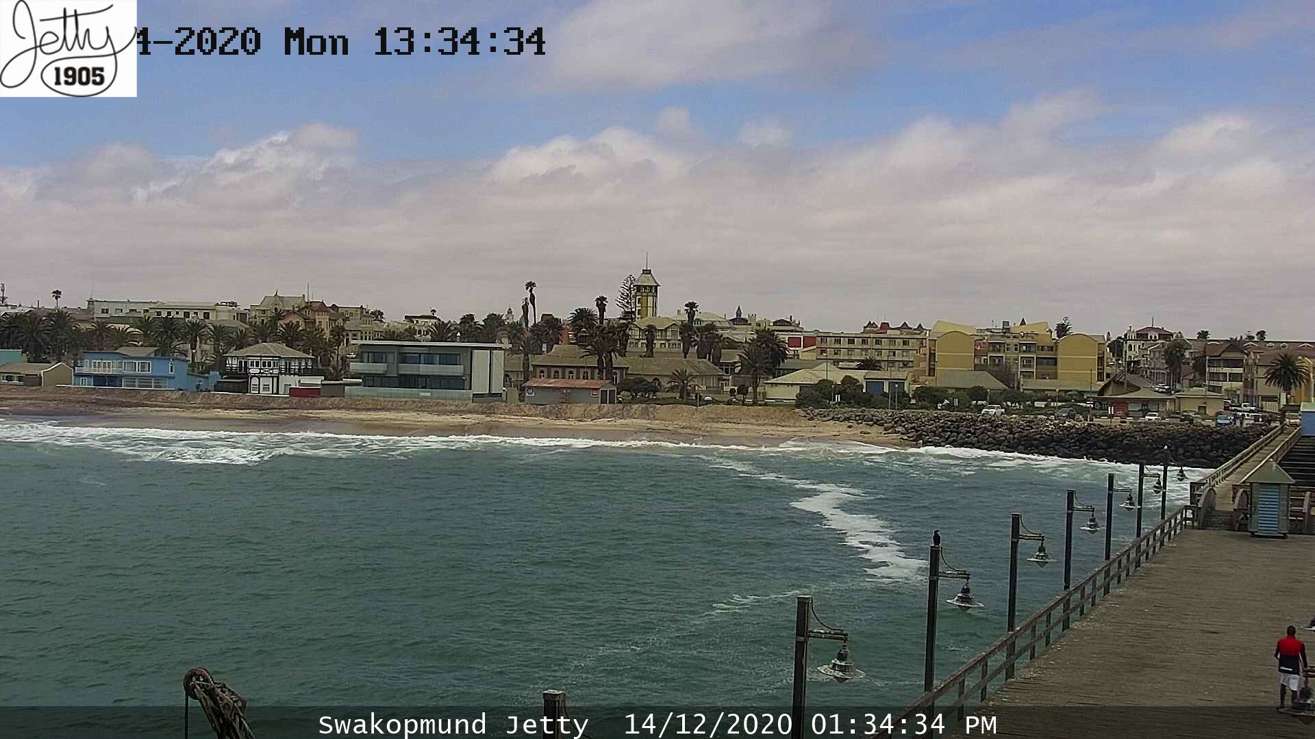
The most important place to watch the eclipse – Swakopmund pier remained overcast till about 7 pm local time. Partially clear skies swept above this coastal town only between 1 and 2.30 pm.
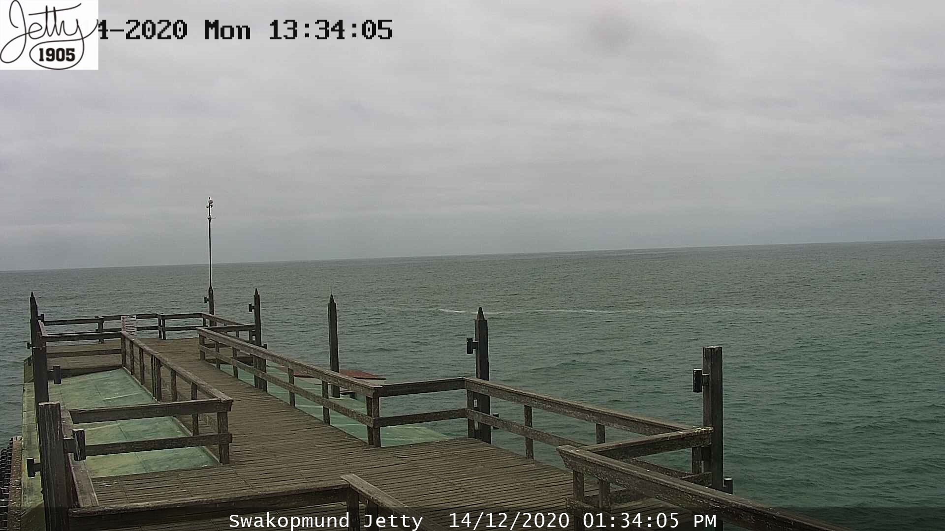

Pic. 18, 19 – The overcast sky above Swakopmund on the eclipse day (Namibiaweather.info).
Unfortunately, the rain arrived in Windhoek, making the sky totally cloudy.
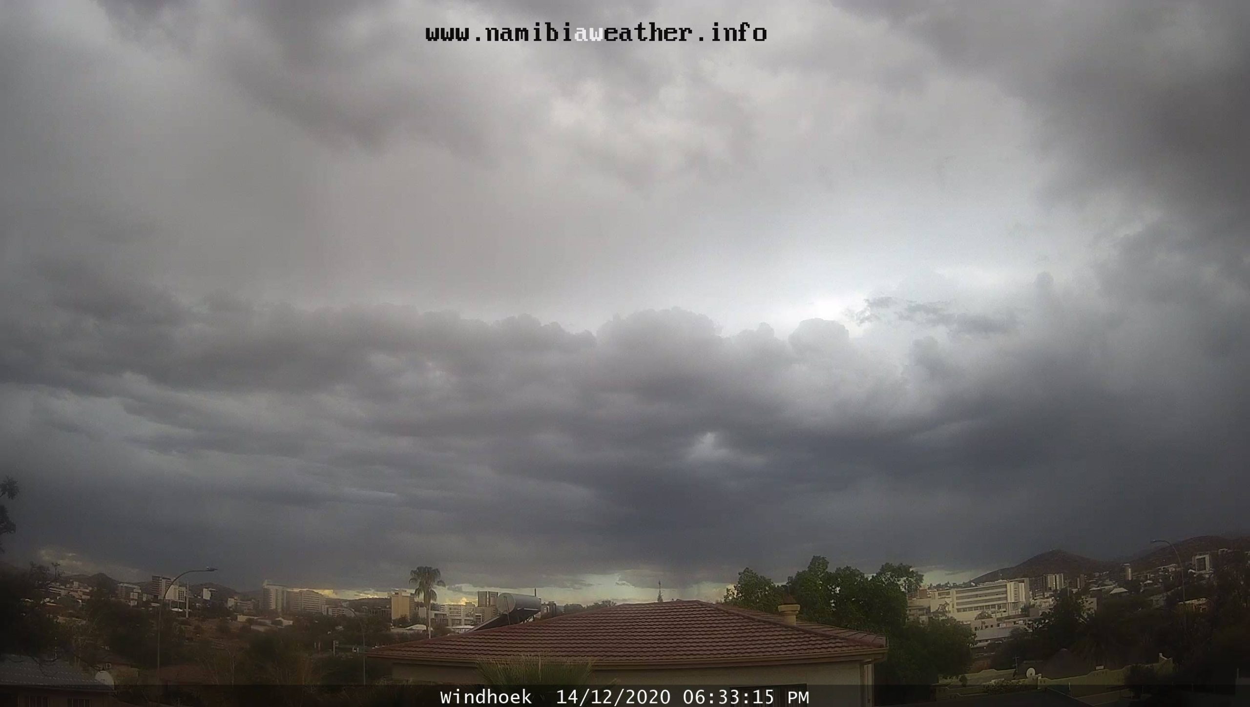
Pic. 20 Not good weather situation in Windhoek, about half an hour before the eclipse, was about to begin (Namibiaweather.info).
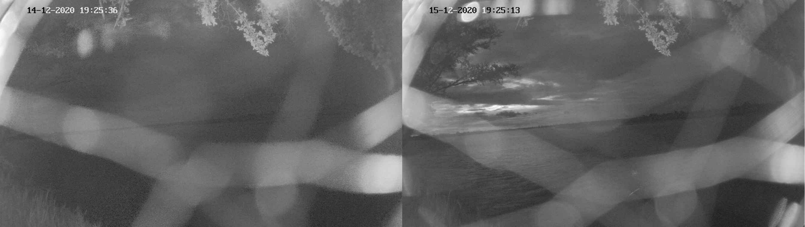
Worst than usual (at least a day or two before) weather conditions were also observed at the Zambezi Muala Camp, excluding this webcam totally from the observation.
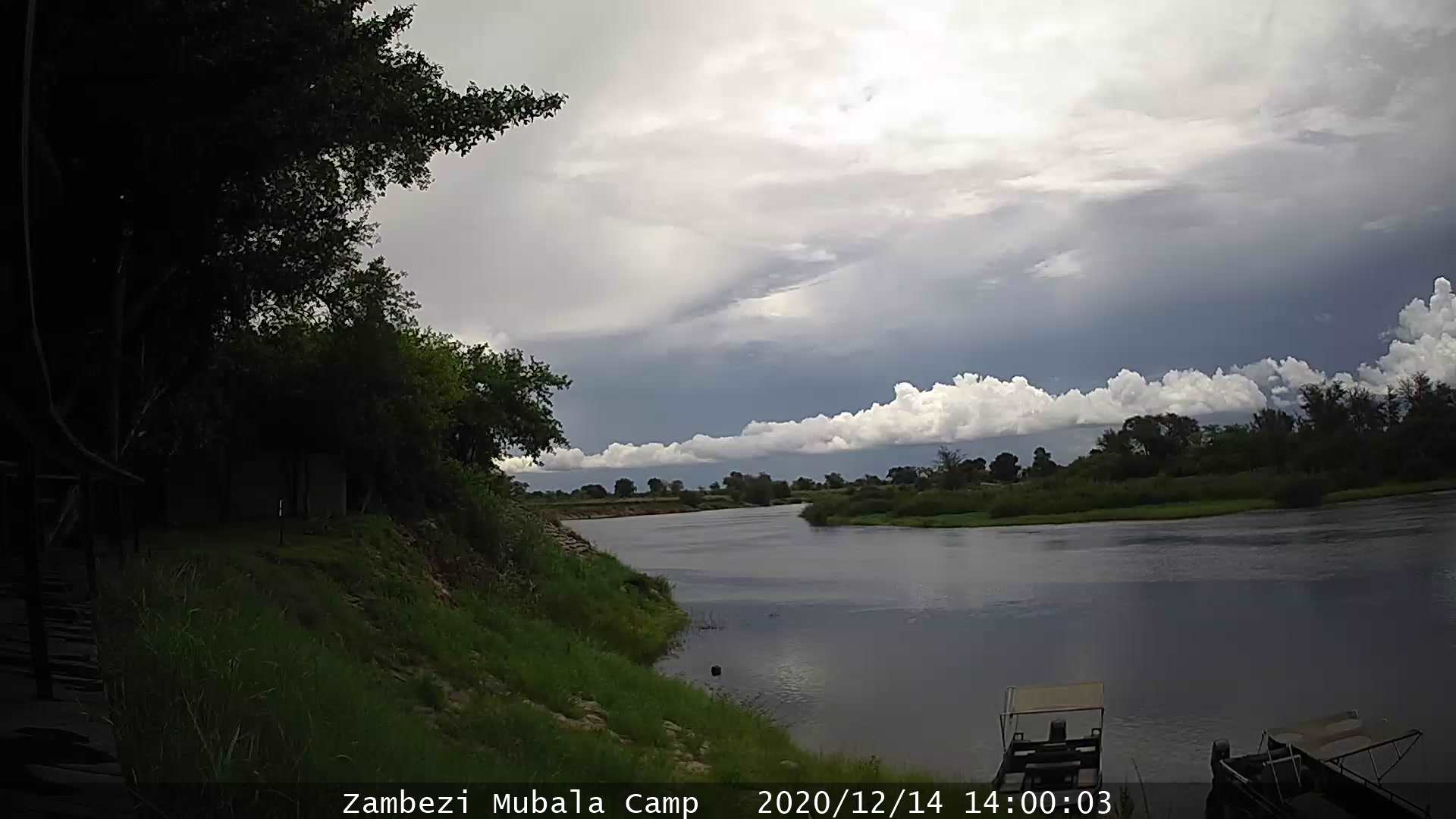
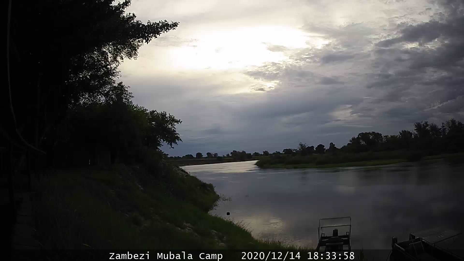
Pic. 21, 22 – Overcast sky above Zambezi Muala Camp at the eclipse day (Namibiaweather.info).
Unfortunately, I had to exclude some of the webcams considered for the solar eclipse observation due to poor weather conditions. In the next chapter, you will find the map, where the most important webcams have been marked. You will understand, why have I actively monitored the situation via the webcams mentioned above.
6. SOLAR ECLIPSE BELOW THE HORIZON IN NAMIBIA
The 2020 total solar eclipse geometrical path ended around 370km before reaching Namibia’s coastline near Henties Bay (Hentiesbaai). Taking into account the refraction issues, this distance could be reduced to around 250km. In practice, at the moment of the greatest eclipse near Henties Bay the Sun was about 3 degrees below the horizon (Pic. 23). The Swakopmund Jetty webcam was the closest one to this place, located only 40km outside of the extended umbral path. The situation was then very similar to Pinamar webcams.
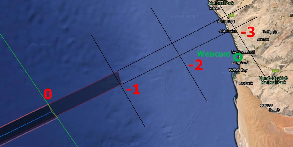
Pic. 23 The extended path of totality in Namibia near Henties Bai against the closest webcam available at Swakopmund Jetty. (Xjubier.free.fr).
The geometrical end of the umbral path means, the greatest eclipse roughly at sunset. However, the 22-second phenomenon started a bit earlier, so it was believed to be visible beyond the terminator line. Moreover, the refraction should have lifted up the solar disk about 35 arcminutes. By adding the angular size of the solar disk, we should have it visible down to -0deg51′ below the horizon at the greatest phase of the eclipse. Because it started about 11 sec earlier, the very top solar limb with the corona visible should have advanced the place, where it geometrically was about 1 degree below the horizon making a very similar view to San Clemente del Tuyu in 2019.
Next, the umbra continued in the atmosphere as per the pattern explained before.
Henties Bay (Hentiesbaai) wasn’t the closest place to the greatest eclipse in Namibia. The peak of the partial eclipse with obscuration over 80% could be observed in the southern part of the shore in the Karas region south of Elizabeth Bay. The maximum eclipse occurred there with Sun being a bit just a bit lower than 1 degree below the horizon. On the contrary, the latest event was observed in the Okavango and Zambezi regions, where the Sun was 10 degrees and more below the horizon, so the maximum phase took place around and after the end of nautical twilight. The sketch below shows the location of all webcams available in Namibia, provided by Namibiaweather.info service. All the cameras were working during the event, which happened for the first time since I started watching eclipses this way in 2016. Unfortunately, the weather didn’t cooperate with me at some locations and I had to exclude some of them. On the other hand, fortunately, in some places, the sky was clearer than expected.

Pic. 24 All webcams available in Namibia and their location against the extended path of totality above Namibia. The red-marked dots indicate the most important webcams, located quite close to the path with proper bearing towards the west section of the sky. Camera 16 was down a day earlier, but available on eclipse day (Xjubier.free.fr/Namibiaweather.info).
Below I am going to show you the full report of my observation, following the webcam numeration displayed on the map above.
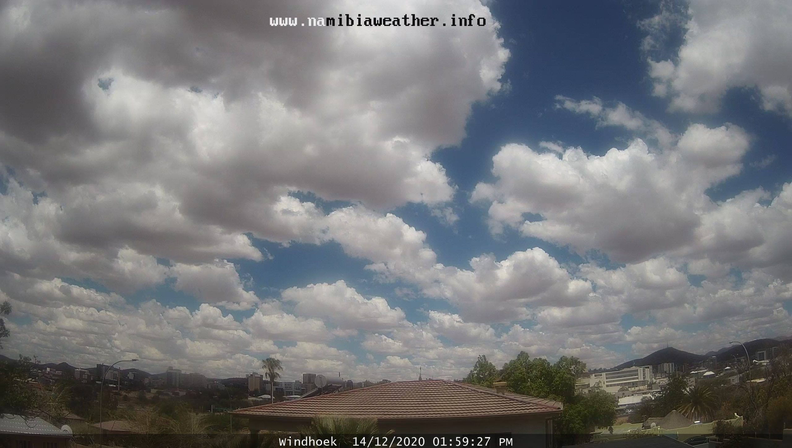
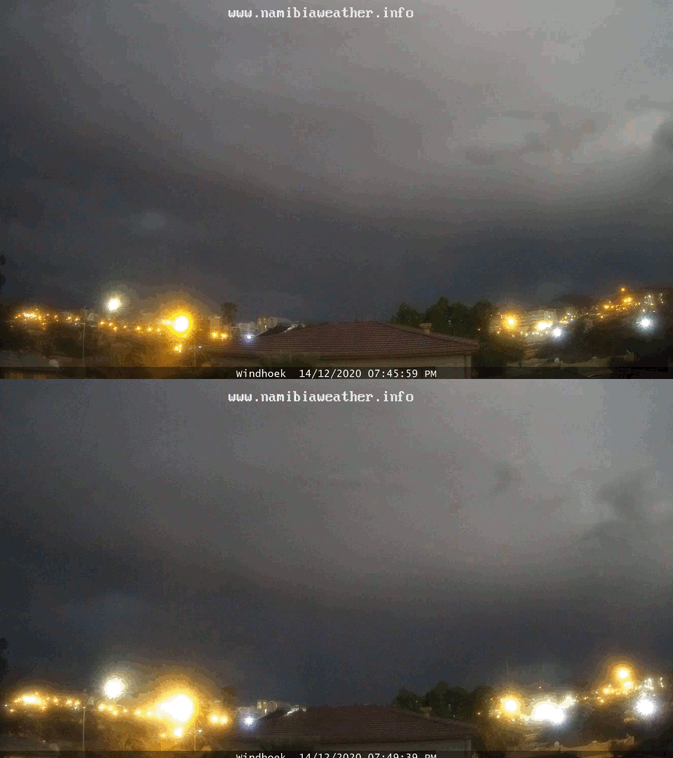
1,2 – Windhoek webcams – the bad weather excluded this webcam from any deeper analysis. The one noticeable fact here is significant darkness occurring from about 7:45 pm local time. This is particularly evidenced by dazzling streetlamps. However, we definitely should take into account the cloudiness. Because the sky was overcast in total, there was a significant diminishing of light regardless of the eclipse.
Pic. 25 Deep partial solar eclipses occurring below the horizon in Windhoek on Dec 14, 2020 (Namibiaweather.info). Click to enlarge.
Pic. 26 The eclipse and non-eclipse comparison for Windhoek between exactly 24 hours (Namibiaweather.info).
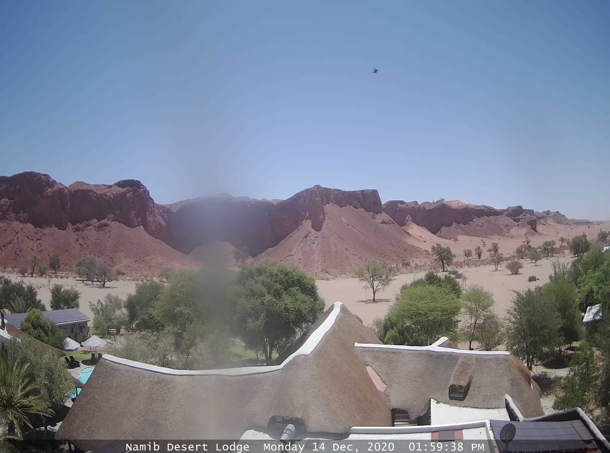
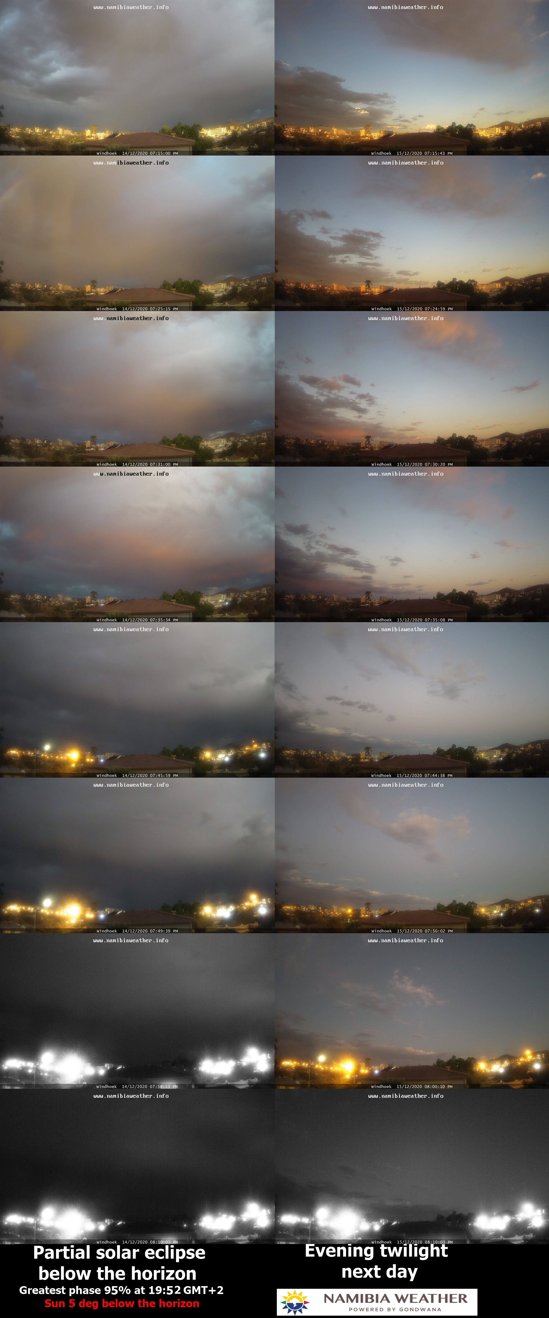
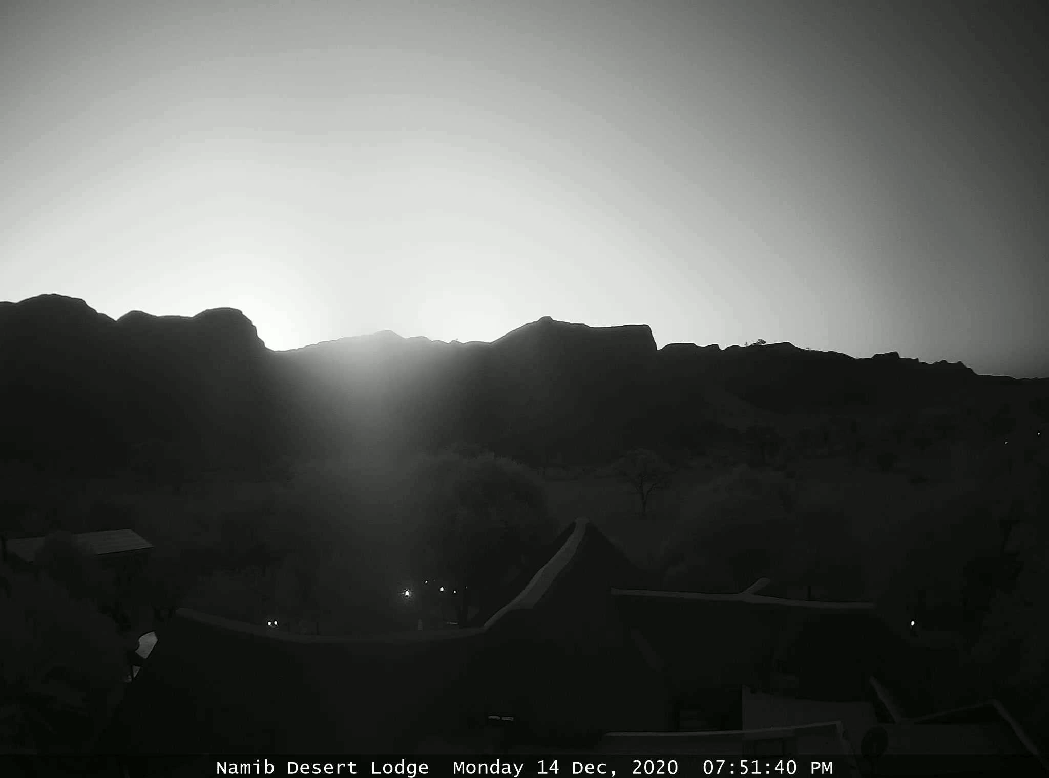
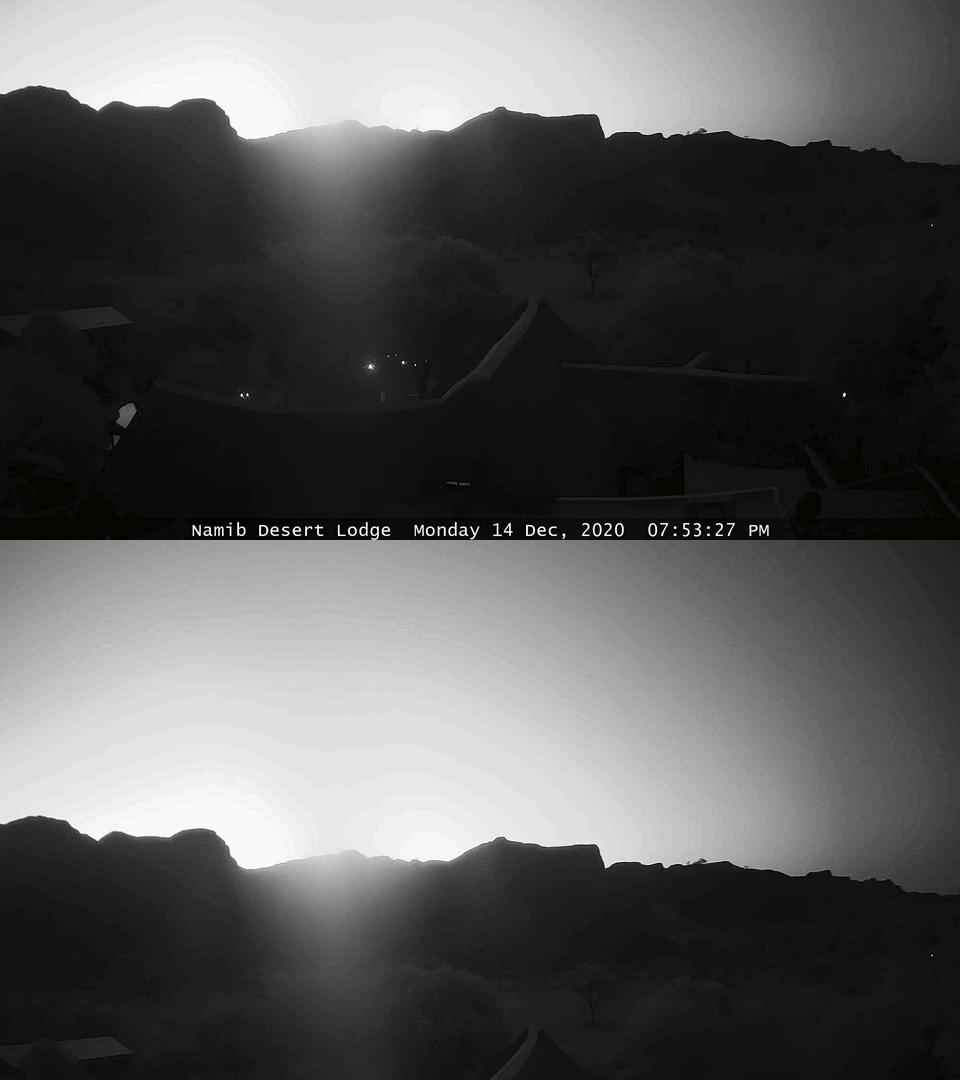
3 – Namib Desert Lodge – This webcam was located about 270-275km from the extended path of totality. One of them, headed WSW intercepted a piece of fleeting shadow on its right edge. As a result, this camera made the longest distance of umbra visibility by the ground-based apparatus by myself. Obviously, these favorable conditions were driven by seriously reduced sunlight scattering in the atmosphere. As we know from previous articles, direct sunlight scattering wasn’t present anymore, because the lowest part of the atmosphere was in the Earth’s shadow already. It works analogically to the sunset transition, making a significant contrast between the horizon and the still illuminated sky. Straight after the ground, as the Sun goes deeper below the horizon, this phenomenon occurs at the planetary boundary layer level, making this hazy coat darker and prone to light extinction. After the planetary boundary layer, the whole troposphere plunges into the Earth’s shadow consequently. It’s fair enough when the lower part of the troposphere is shadowed. In the bright sky, we can clearly see any changes in the light level caused by the deep penumbra and umbra. If the Sun were above the horizon, probably this distance would be achievable under the weather conditions at the eclipse moment in this part of Namibia. The Namib Desert likewise other areas with dry climates feature quite a high level of haziness unless the rain period occurs, dropping the dust particles to the ground and clearing up the air. The distance, from where I could spot the umbra this time is, in my opinion, a tad longer, than I could see in Scotland, watching the eclipse under clear polar maritime air mass conditions. On the other hand, I am convinced, that the umbra fleeting across the twilight sky would be visible from a bit longer distance if this webcam could be located further south and born properly. Notwithstanding, the webcam considered was one of the most useful during this remote eclipse observation. Another matter lies in the webcam settings. Most webcams provided by the Namibia Weather Service turn off their coloration when the Sun is about 5 – 6 degrees below the horizon. It coincides pretty much with the end of civil twilight and it’s somewhat a good element for the twilight progress comparison between the eclipsed day and normal day at the given location. The webcam located at the Namib Desert Lodge was also dirty in the middle of the frame, although fortunately, it didn’t impact the observation result.
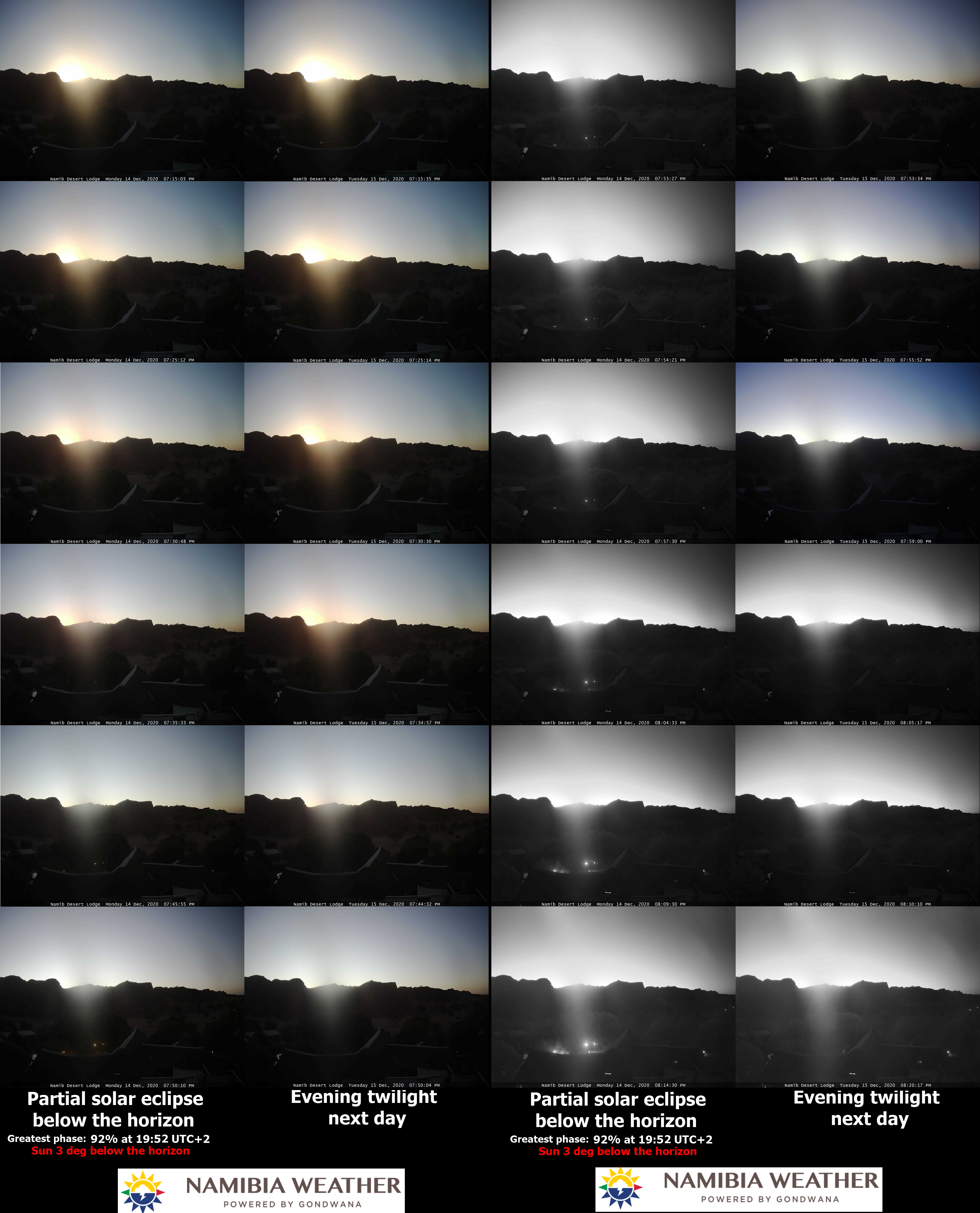
Pic. 27 The comparison of twilight during the eclipse and non-eclipse conditions in the webcam shots captured at Namib Desert Lodge (NamibiaWeather.info).
The deep partial eclipse phase impact is clearly visible in the webcam sequence above. The important element is the umbra caught on the right side of the frame. Below I colorized the image gained during the greatest phase of the eclipse from that place. We can clearly see, how the haze body compressed within the atmosphere boundary layer becomes significantly darker towards the right.
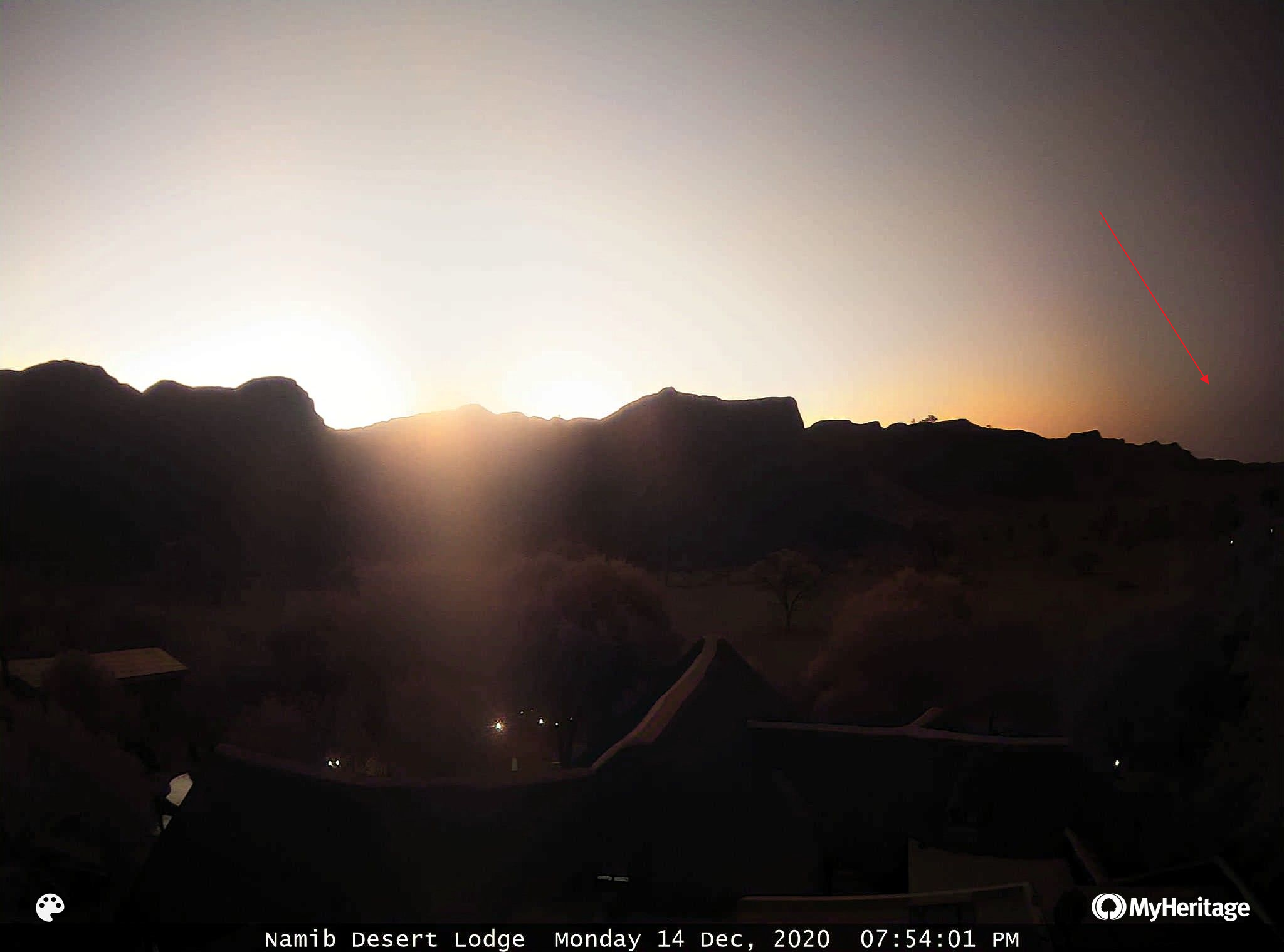
Pic. 28 The umbra intercepted by Namib Desert Lodge webcam at the greatest phase of the eclipse (Namibiaweather.info/MyHeritage).
This sudden darkening was noticeable for about 2 minutes, with the significant peak lasting about 20 sec.
Pic. 29 The animation showing the presence of the umbra in the Namib Desert Lodge webcam frame (Namibiaweather.info).
According to the webcam response on the light, I can estimate, that the eclipse twilight was about 2 degrees ahead of the normal one observed from this place.
Pic. 30 The eclipse and non-eclipse comparison for Windhoek between exactly 24 hours (Namibiaweather.info).
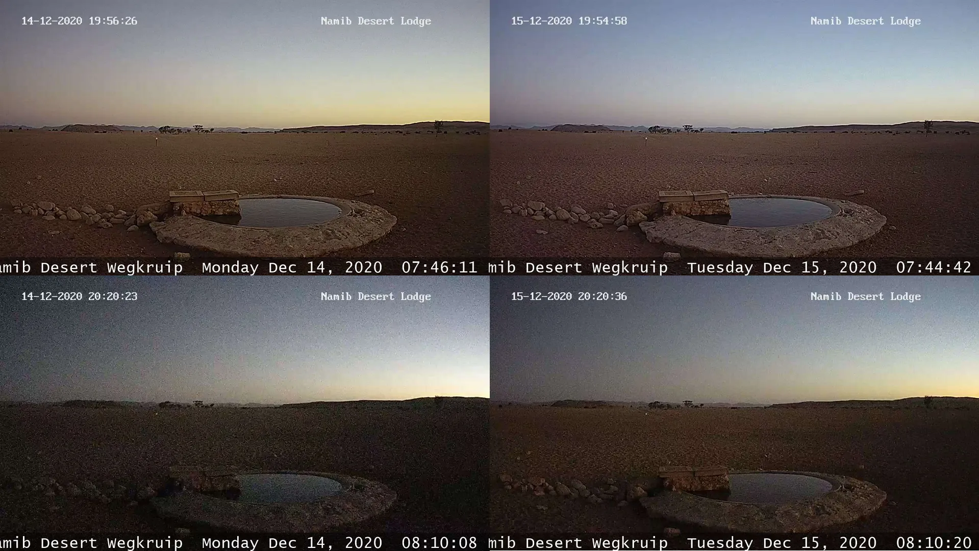
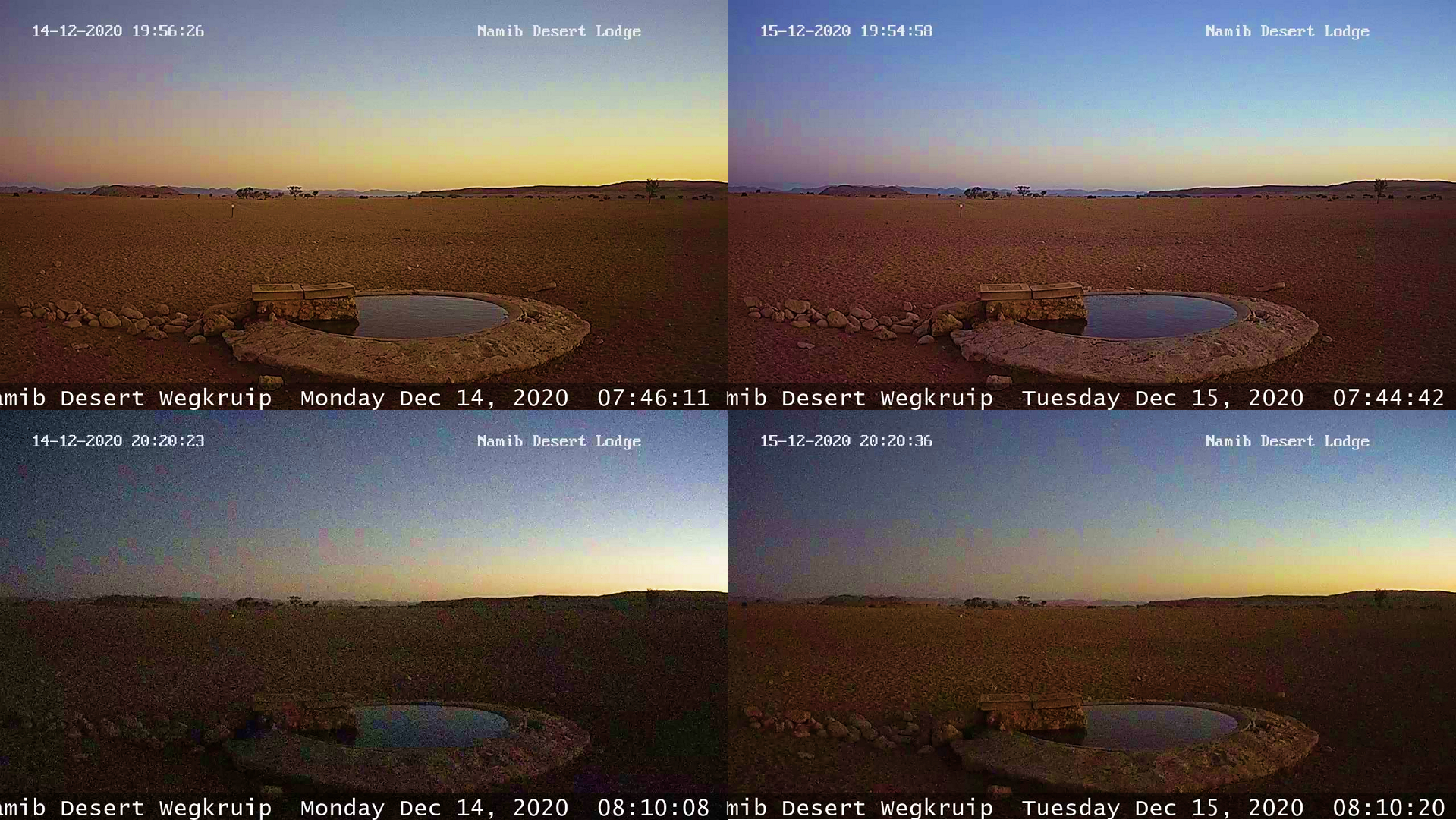
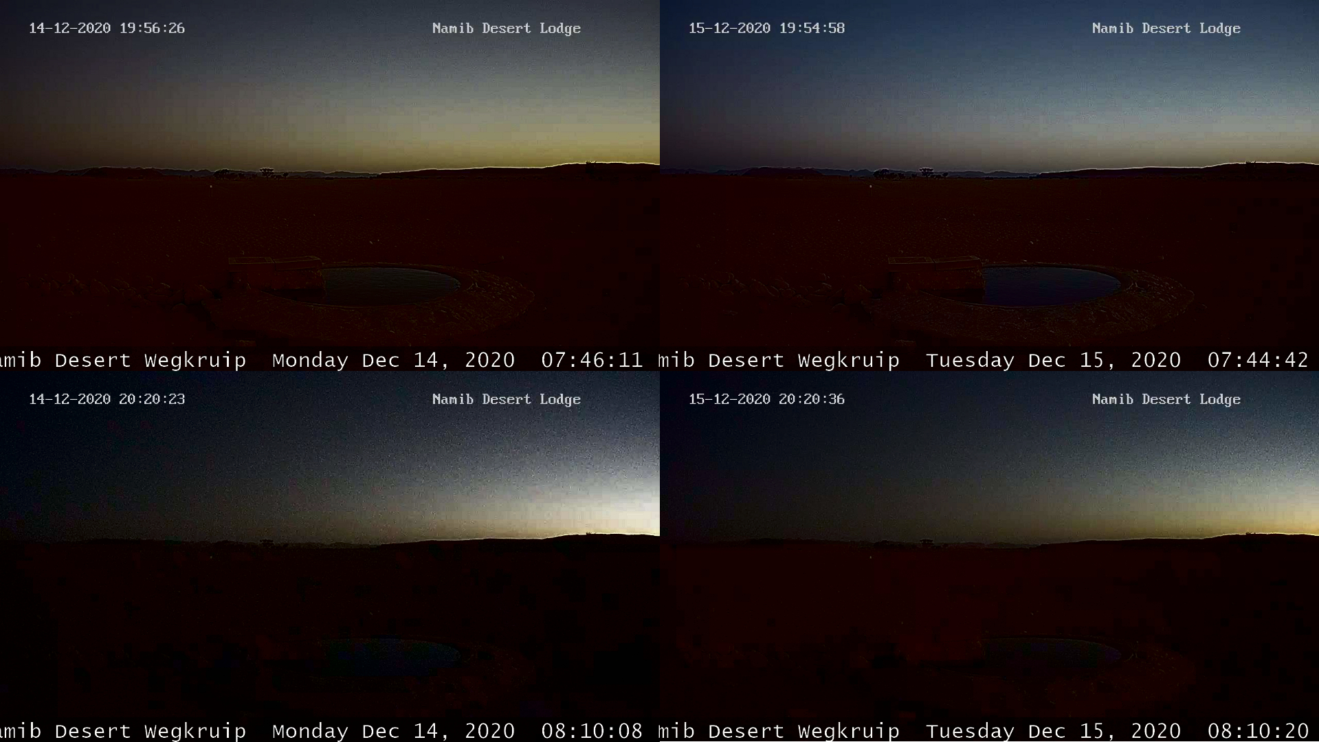
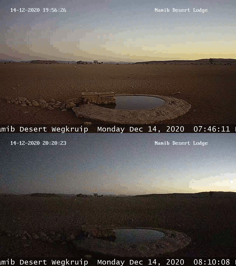
4. Namib Desert Wegkruip – is located in the same place, near the Namib Desert Lodge. This camera is headed southeast, so there is only a little information about passing the eclipse. The one thing, that is well noticeable is the sky coloration with an intensified orange hint around the maximum phase. It’s driven mostly by solar limb darkening, which is emphasized when a deep partial eclipse takes place. The webcam noticed also the difference in illumination. The same moment during the eclipse day remains a quite deep twilight.
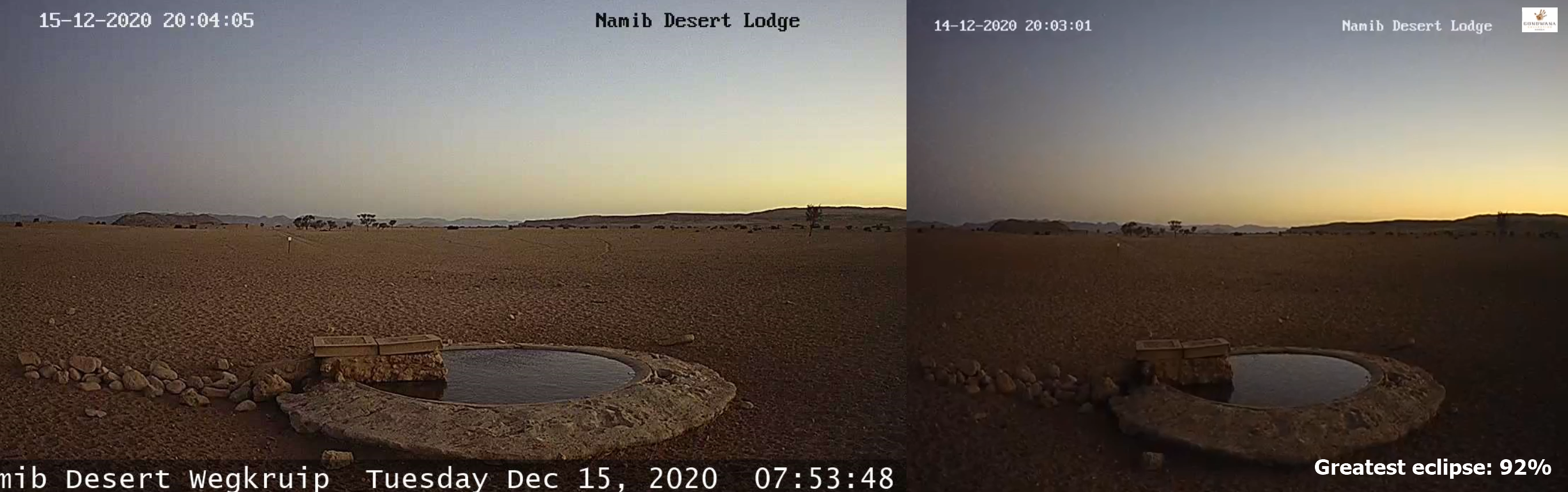
Pic. 31 The same moment of twilight captured by Namib Desert Wegkruip webcam during the partial solar eclipse and non-eclipse conditions a day after. We can see the significant darkness of the horizon and the red shift in the sky (Namibiaweather.info).
This webcam is an exception in a whole webcam pack provided by the Namibia Weather service. Because it’s a stream, it changes the coloration much later than other webcams. Thanks to this I could see all the changes in the natural colors.
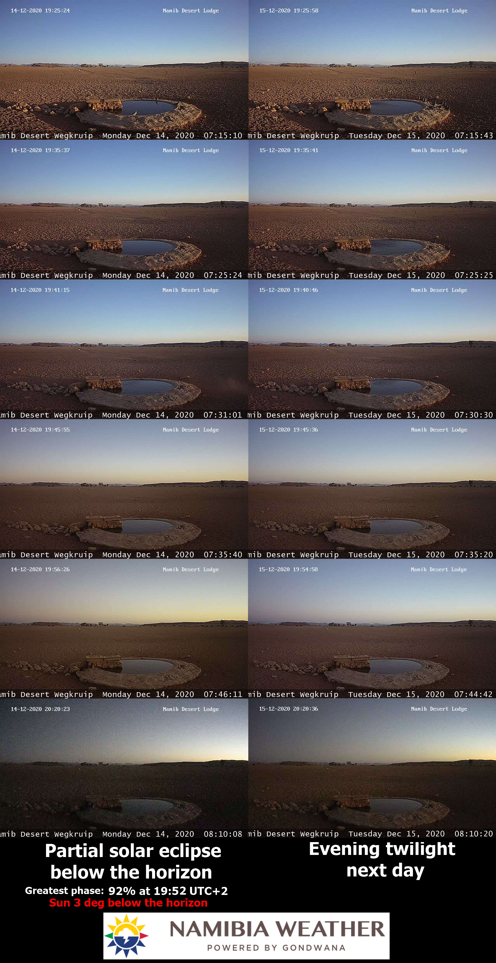
Pic. 32 The comparison of twilight during the eclipse and non-eclipse conditions in the webcam shots captured at Namib Desert Lodge (Namib Desert Wegkruip) (NamibiaWeather.info).
The changes for this place are significant. Visually is something like 2 degrees difference, but detailed measurements in the future are required. Another concern here is the asymmetry of the visual illumination difference. Since the contrast between the eclipse twilight and normal twilight the day after is less pronounced before the greatest phase, it’s much bigger afterward, as the twilight progresses. This is probably the optical confusion caused by the specific webcam response to a certain amount of light reaching the sensor. Another thing, that comes to mind here is the proportion between the light taken out by the penumbra and the remaining light coming from the shining solar crescent and consequently the atmosphere. The “eclipsed” amount of light remains pretty much the same for the symmetrical moments of the eclipse, but the total amount of light drops, as the Sun goes deeper below the horizon.
Pic. 33 – 35 The comparison of the symmetrical moments of the Dec 14, 2020, partial solar eclipse at Namib Desert Wegkruip with the identical twilight moment a day after, where: 33 – normal comparison; 34 – coloration enhanced; 35 – contrast & brightness changed.
The significant reddish appearance is visible on the scene around the greatest phase. The lower image from the eclipse day has a fairly overexposed sky against the same moment a day after. It’s an example of a big light proportion between eclipsed and non-eclipsed nautical twilight explained above.
Pic. 36 The eclipse and non-eclipse comparison for Namib Desert Wegkruip between exactly 24 hours (Namibiaweather.info).
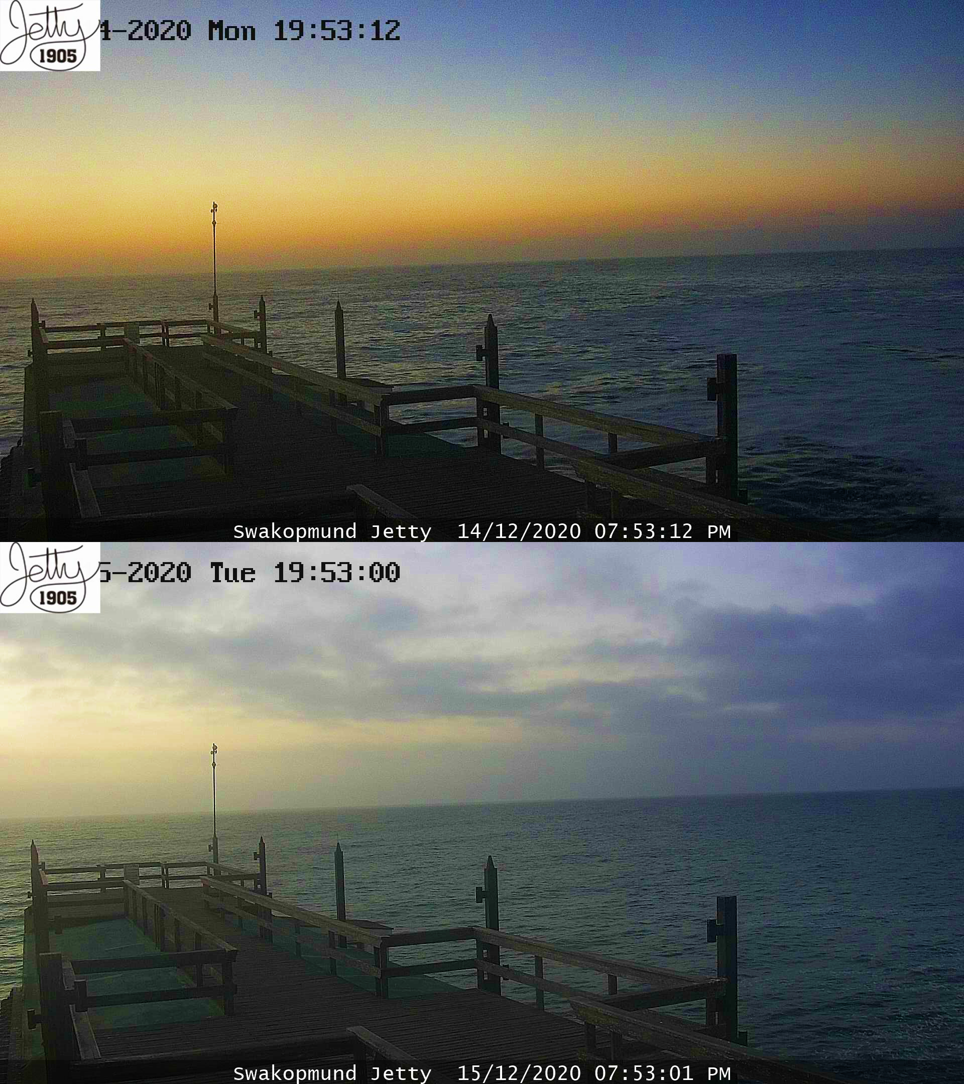
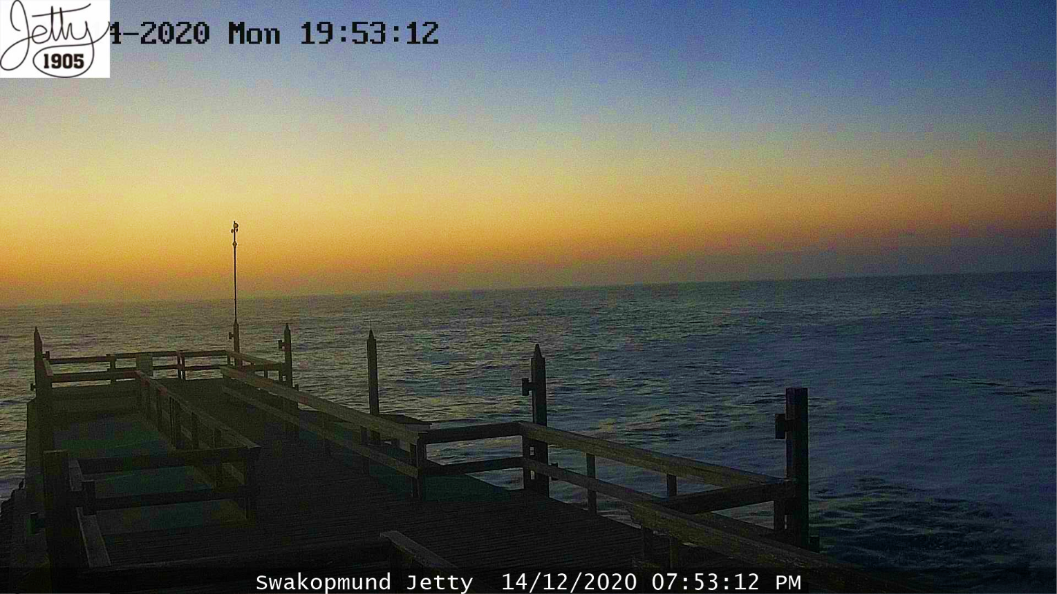
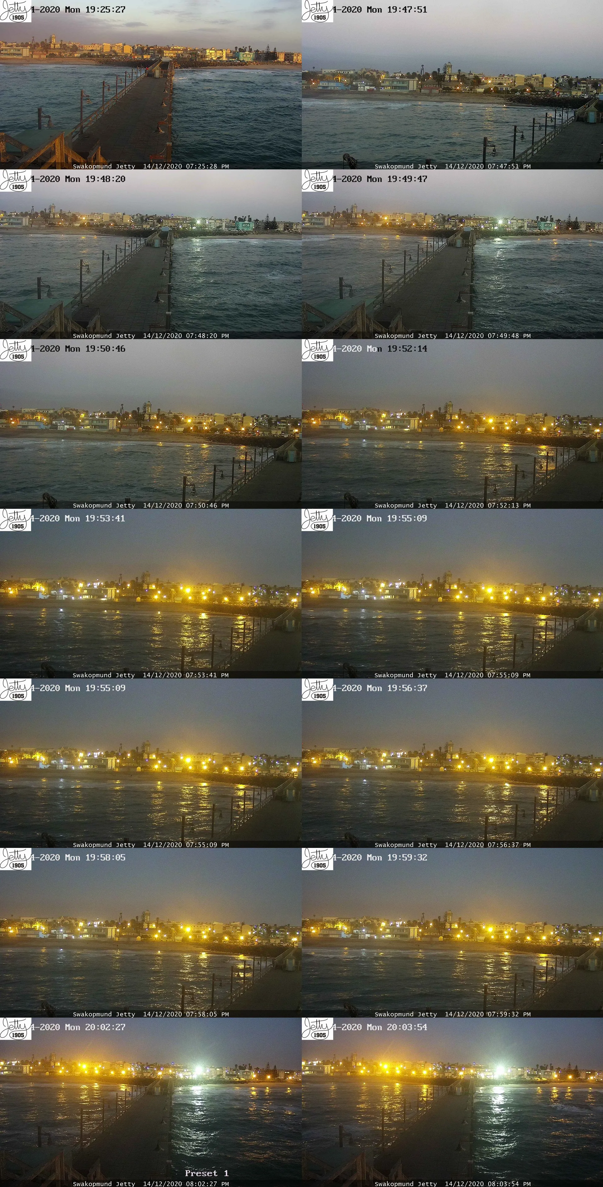
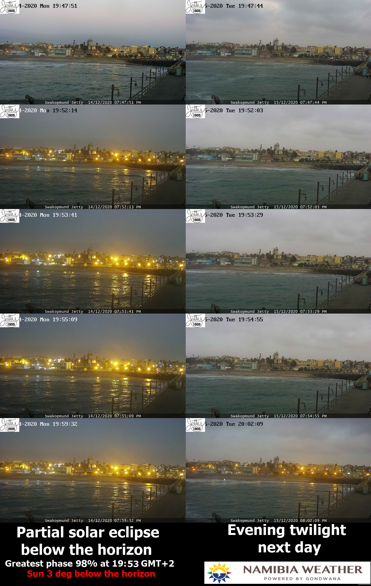
5. Swakopmund Jetty – the most important webcam from the eclipse path point of view. It was located just about 40km from the southern limit of the extended eclipse strip. I was really fortunate to have clear skies there, as the weather isn’t favorable during this period there. The cold Benguela current causes the low deck cloud presence in the evening when the sun is below the horizon. The clouds gradually hid the sky, making it fully overcast around the end of civil twilight. It usually happens during stable weather. Fortunately, the situation on December 14 was different. A low-pressure area moving northward brought rain earlier, and just before the eclipse started it moved away from Swakopmund. The clouds were still visible above the horizon around the greatest phase, so I can guess, that people in Hentiesbaai weren’t so successful. The 40km distance is quite long for a low cloud deck. The clear skies would appear at most 20km away north.
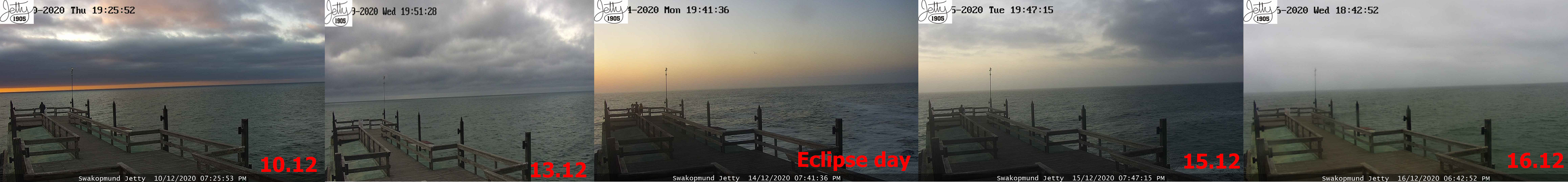
Pic. 37 The weather (cloudiness) conditions observed at the Swakopmund pier at a similar time to the Dec 14, 2020, solar eclipse. I was extremely lucky to have completely clear skies on the eclipse day (Namibiaweather.info). Click to enlarge.
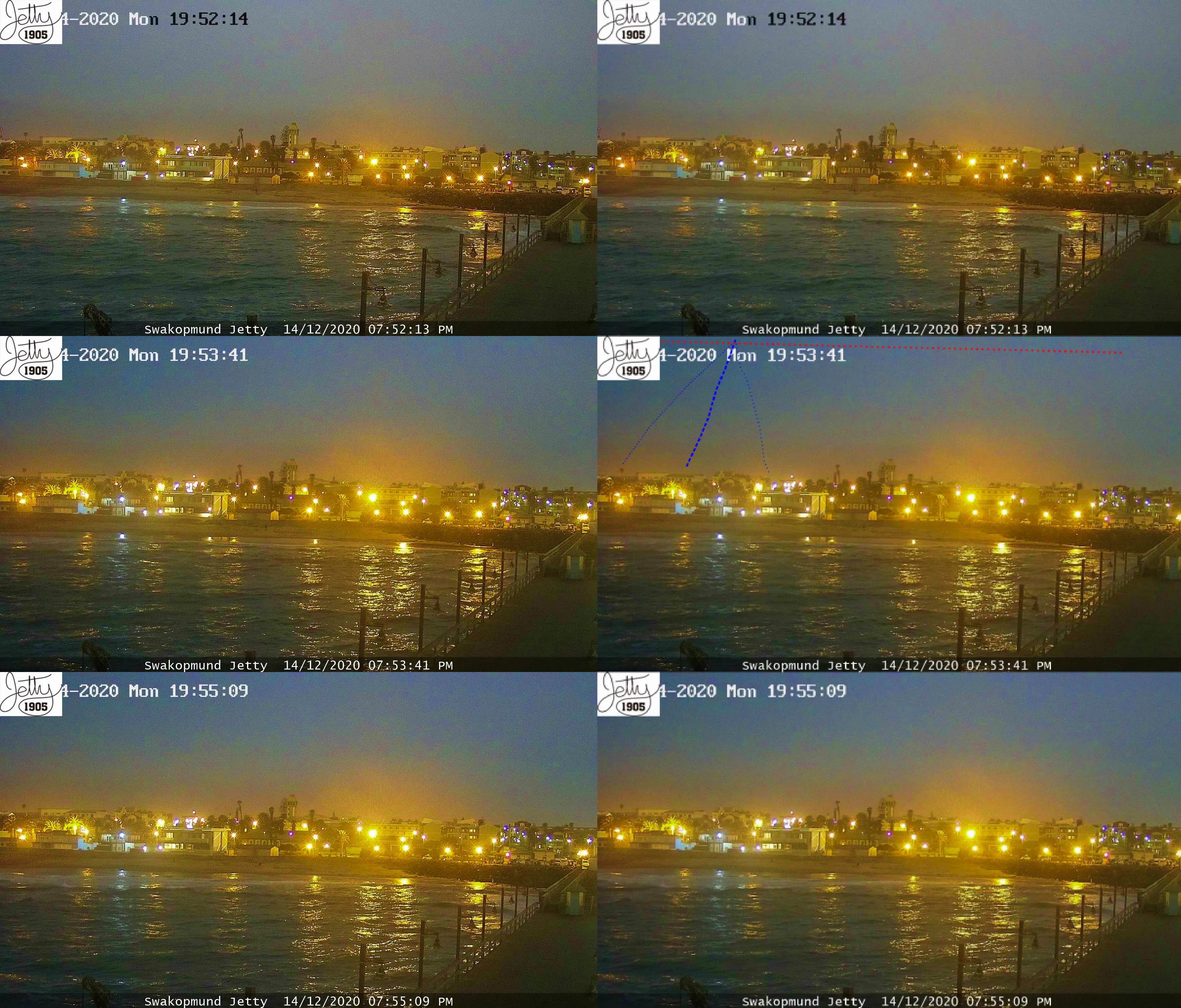
I was extremely lucky because the eclipse evening was the clearest of all days. The clear weather led me to watch how the event progressed. The Swakopmund Jetty webcam is the only one, which rotates capturing the vista from 3 – 4 directions on average (because sometimes is stuck for a while). The analysis covered the view in 3 major directions: east (towards the downtown), north (towards Hentiesbai), and west (toward the ocean). Each direction gave some result, however, lack of stream and a quite rare camera refresh could let the major event be missed. The Swakopmund Jetty webcam refreshes every 15 seconds, but its rotation makes eventually 45 seconds towards the given direction. It’s a far too rare frequency not only for this particular eclipse but all the events such as this. In order to remain, the total phase below the horizon was estimated to last about 22 seconds from Hentiesbaai. It means that fleeting umbra could be visible at most in one shoot. Fortunately, it was, although the camera caught it not perfectly. It’s still something, and the Swakopmund result is definitely the best as it could be achieved because of the not favorable weather conditions in general. I am starting the analysis from the west, the solar direction. The sunset was observed in the left part of the frame.
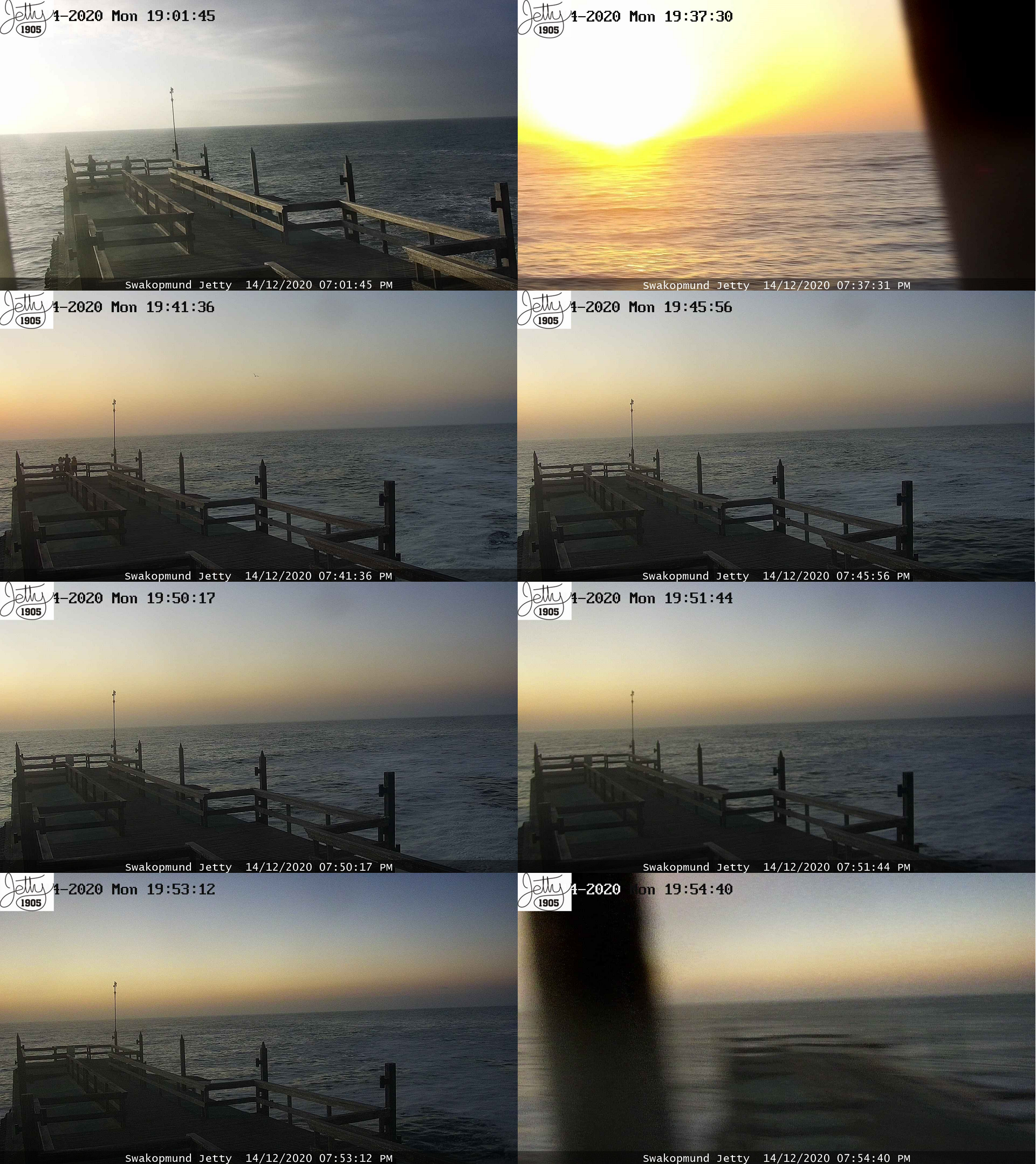
Pic. 38 The deep partial eclipse below the horizon progresses as seen from Swakopmund pier towards the west (Namibiaweather.info).
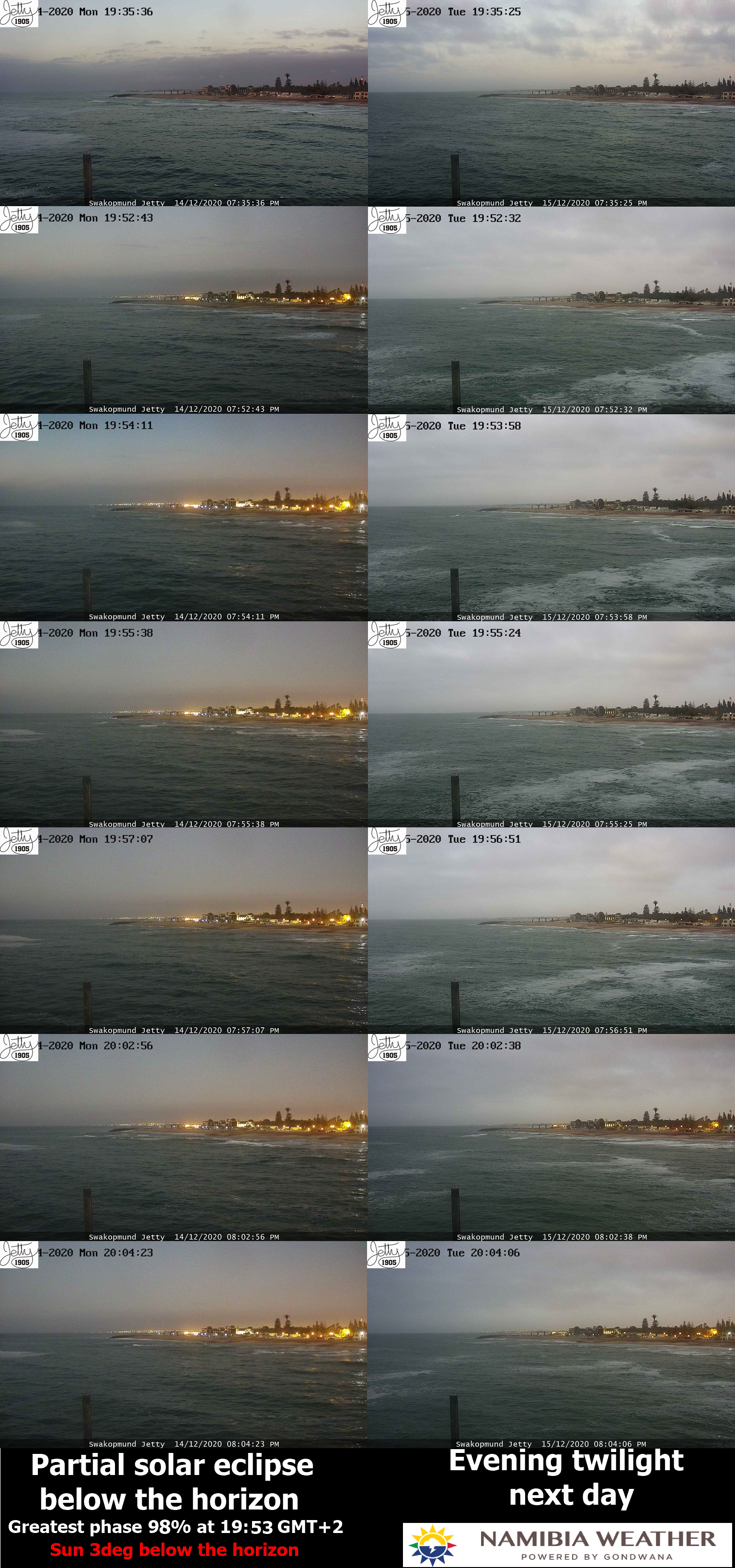
The webcam coped perfectly with the exposure, hence the light level differences are barely noticeable here. We must refer this situation to the vista gained a day after.

Pic. 39 The comparison of twilight during the eclipse and non-eclipse conditions in the webcam shots captured at Swakopmund Jetty towards the west (Namibiaweather.info).
The difference between a deep partial eclipse and non-eclipse conditions is streaking here. The moment near the greatest eclipse is displayed by the navy blue sky on top of the frame and quite an intensive orange-reddish tint near the horizon. After 24 hours exactly the sky was rather a pale blue with a bright yellow section just above the horizon. Unfortunately, the presence of clouds worsened the sky’s appearance, so I can’t compare the atmosphere boundary layer visibility between these 2 identical moments of twilight. During the eclipse day, the haze is significantly darker towards the right, where the fleeting umbra was observed, but this situation overlaps also with the solar azimuth issue. It has been told above, that the sunset occurred near the left side of the frame, hence the right side will be understood by definition. The eclipse evening does look much better when coloration is enhanced.
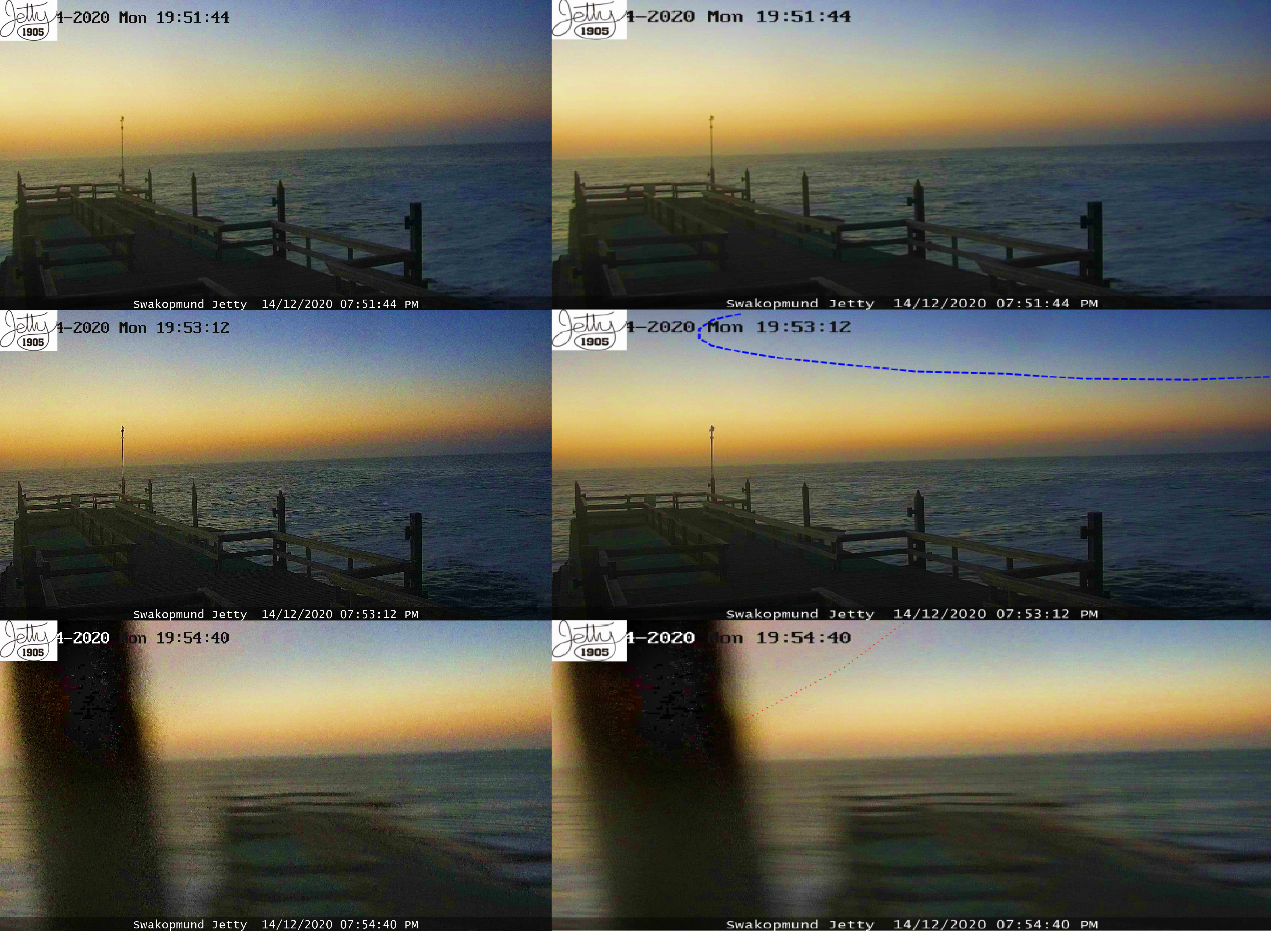
Pic. 40 The deep partial eclipse below the horizon progresses as seen from Swakopmund pier with enhanced colors and umbral borders marked (Namibiaweather.info).
The enhanced colors show roughly what happened in the sky around the maximum eclipse. The navy blue color comes out of the umbra’s presence. Its border is clearly expressed and beyond the blue line marked, the sky color changes abruptly making it azure with an orange-reddish tint, typical for deep partial eclipse conditions. The most interesting moment occurs about 90 seconds later when suddenly the red section of the sky emerges from the left (probably to the right). It can be the same phenomenon, as reported recently in Argentina. The lunar limb uncovers the Sun from the bottom when seen from the observer’s perspective. The lowest part of the solar disk is deeper in the atmosphere and scatters red light more intensively than its upper part. The appearance of the aforementioned red light, as seen in the camera frame means, that the totality is definitely gone, not only from the observer’s position but also from the geometrical point of view umbra doesn’t touch Earth’s surface, and consequently the troposphere anymore.
Pic. 42 The deep partial eclipse below the horizon progresses as seen from Swakopmund pier with enhanced colors. Comparison of the moment of the greatest eclipse between the same time a day after (Namibiaweather.info).
Enhanced colors also show a significant difference in vista between the moment of the greatest eclipse and at the same time a day after. The pale blue sky and yellowish planetary boundary layer beyond are typical for misty conditions, typical for the maritime climate. The Sun after set has made a yellow (up) and orange color (bottom), but it’s partially covered by clouds. The colors gained during the eclipse day show what roughly happened and how the atmosphere reacted in the optical sense.
Pic. 42 The Swakopmund pier was captured near the maximum phase of the solar eclipse when Sun was about 3 degrees below the horizon (Namibiaweather.info).
A similar lunar shadow appearance could be spotted when the webcam was headed north. Unfortunately, quite strong light pollution is visible on the right contrasted with a quite clear sky above the Atlantic Ocean on the left. This difference excluded analysis of the sky on the right side of the frame, which is a shame because the Earth’s shadow could be visible there. Unlike the west, solar direction, the north view was clearer regarding the eclipse occurrence. The sudden sky darkening is to be noticed throughout the sequence. Next, the sky remains quite dull, which is driven by progressing twilight and light pollution.
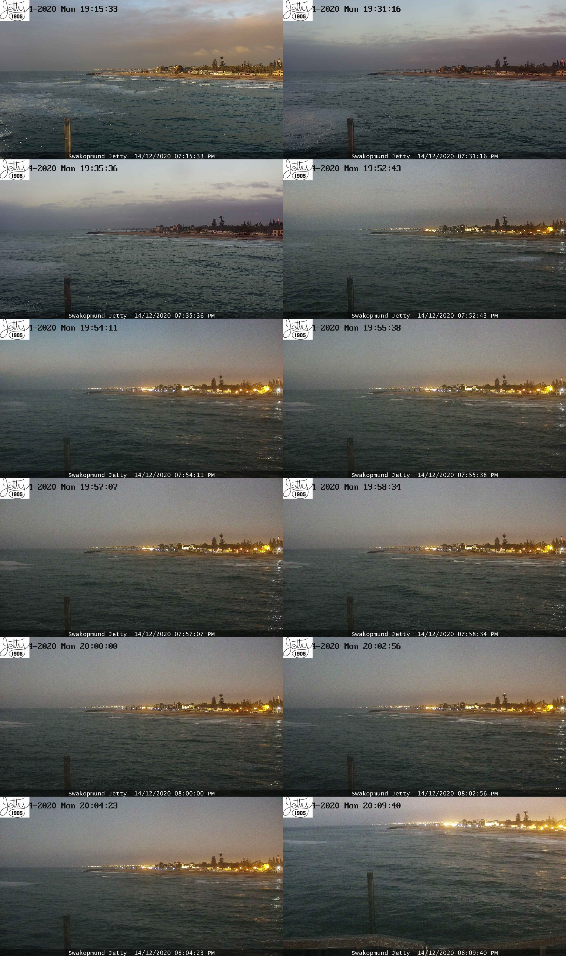
Pic. 43 The deep partial eclipse below the horizon progresses as seen from Swakopmund pier towards the north (Namibiaweather.info).
The difference between the eclipse day and the day after is also serious, as we are looking toward the area of the extended path of totality. Regrettably, in two cases the low-level cloud deck occurs. On the eclipse day, the compacted cloud layer was moving northward, clearing out the north sky gradually, but being visible throughout the entire eclipse period. 24 hours later the cloud coverage was increasing as twilight progressed. Despite the almost completely overcast sky roughly 24 hours after the greatest eclipse, the scene was still much brighter than during the eclipse moment. The best proofs of it are the lights being still turned off 24 hours later at this time.
Pic. 44 The comparison of twilight during the eclipse and non-eclipse conditions in the webcam shots captured at Swakopmund Jetty towards the north(Namibiaweather.info).
The moment of the greatest eclipse was captured around 7:54 pm local time. We can use color enhancement in order to show roughly what the sky was looking like.
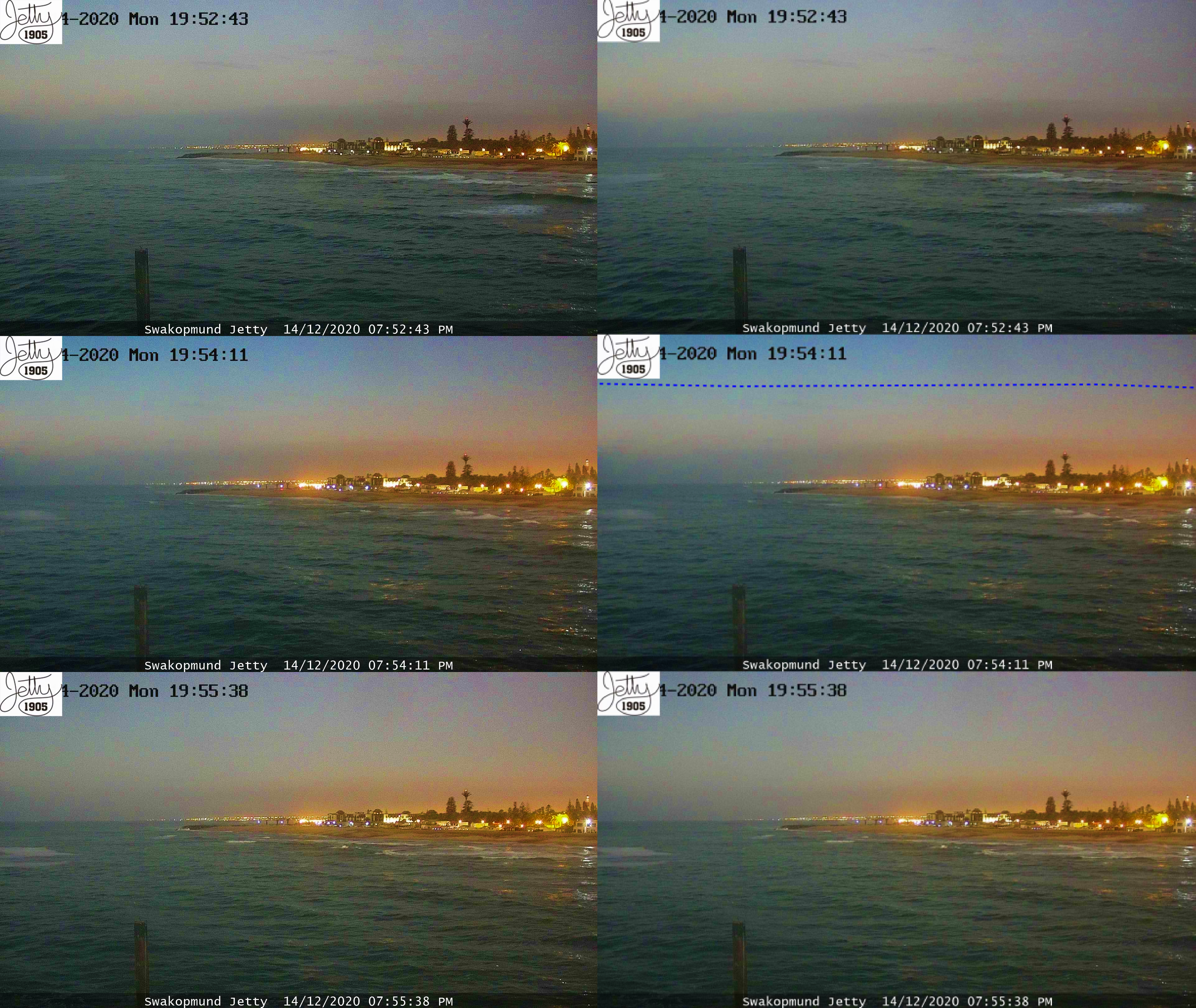
Pic. 45 The greatest phase of solar eclipse below the horizon as seen from Swakopmund pier towards the north with enhanced colors and umbral borders marked (Namibiaweather.info).
The darkest sky appears in the middle images. This is the moment when the umbra was intercepted by this web camera. The border between the intensively blue and the faint blue with a greenish hue is visible well. It’s also marked with the blue dotted line on the right. Going forward and looking at the pictures underneath, this sky coloration doesn’t appear anymore. Despite the twilight progression, the sky looks a bit brighter and also includes some crimson appearance, especially on the right. Sadly, light pollution takes hold in this part of the image, so we can’t see what certainly happened there at that moment. Another difference is made by artificial lights, which seem to be slightly weaker below than in the middle row, where the greatest eclipse was captured.
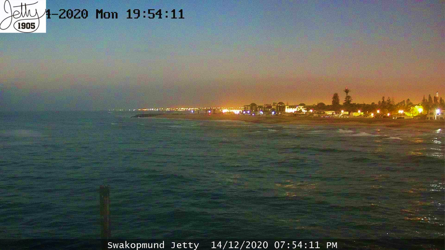
Pic. 46 The Swakopmund pier was captured near the maximum phase of the solar eclipse when the Sun was about 3 degrees below the horizon. View towards the north (Namibiaweather.info).
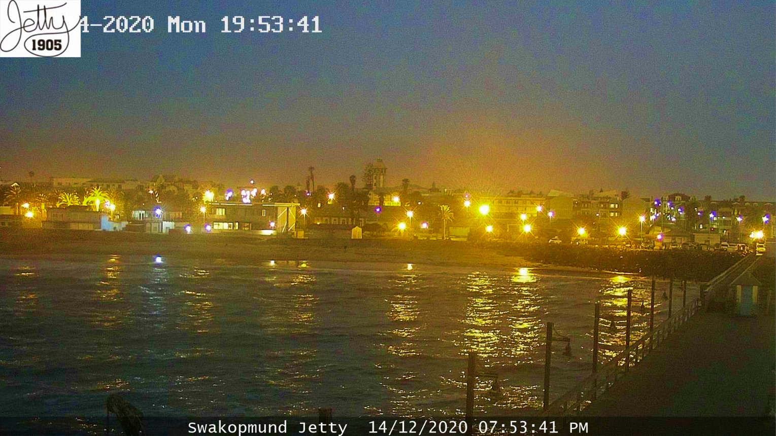
The most interesting direction was towards downtown, the east. I was curious about the interaction of the umbra with the Earth’s shadow. Unfortunately, the webcam was born too low, making the sky visible in half and a half with the ground only. In turn, the Belt of Venus preceding the Earth’s shadow wasn’t well visible at the greatest phase, because it was almost out of the frame. Despite this inconvenience, the accelerated twilight is visible well here likewise in the north direction.
Pic. 47 The deep partial eclipse below the horizon progresses as seen from Swakopmund pier towards the east (Namibiaweather.info).
The antisolar direction is sufficiently interesting due to the Earth’s shadow presence. In order to see better what was happening that day in the antisolar direction, we should see the comparison between the eclipse day and the following day.
Pic. 48 The comparison of twilight during the eclipse and non-eclipse conditions in the webcam shots captured at Swakopmund Jetty towards the west (Namibiaweather.info).
The same as previously, towards the north, the east direction also shows appreciable changes between the eclipse day and normal twilight 24 hours later. The umbra is not expressed here as clearly as previously when watching it north and west. The explanation for it is very simple. Everything we see here happens inside of the Earth’s shadow. The umbral border cannot be sharp here, because it’s already a part of the Earth’s shadow. In my previous articles, I considered briefly the essence of Earth’s shadow appearance. It’s strongly related to the Ozone layer. An analog phenomenon occurs when the umbra is present in the atmosphere. The total eclipse conditions remain somewhat the twilight conditions and fleeting umbra marks the border between illuminated and shaded sky. The analog border is marked by Earth’s terminator about 25-30km above sea level. When the umbra hits the Earth’s shadow, it just breaks the pinkish Belt of Venus and gets away inside the shaded atmosphere finally, as considered recently for the Argentinian case. Even if we enhance the coloration, the umbral border won’t be clearly readable.
Pic. 49 The deep partial eclipse below the horizon progresses as seen from Swakopmund pier towards the east with enhanced colors and umbral borders marked (Namibiaweather.info).
Looking at the image above, presenting the eclipse conditions in the antisolar direction, we can see (analogically to the previous view) the umbral presence in the middle row. It has been marked by three blue dotted lines. Why three instead of one? Because the umbral border is not sharp unlike previously considered. It can’t be sharp, because now the umbra is a part of Earth’s shadow. The faint darkness visible towards the left marks a very soft border between partially and totally eclipsed Earth’s shadow. How to understand this? If an observer could be hung in the place, where the blue was marked (exactly left to this line). He could see the shadowed sky towards the solar direction, as considered recently. This shadow obviously divides the atmosphere into three pieces, whereas the middle one is plunged into the darkness, and relies only on scattered sunlight, as shown here. On the contrary, the remaining two “pieces of the sky” are illuminated directly by the crescent sun. However, because they are outside of the major solar azimuth, they are not able to scatter as much light as this middle one could do not being currently shaded by Moon. In turn, everything shaded by Earth beyond (inside the Earth’s shadow) receives less sunlight scattered directly by the atmosphere placed still within the daylight area. In effect, the Earth’s shadow at the rough extension of the umbra should be darker. Moving gradually out of the aforementioned extension, the Earth’s shadow should become gently brighter up to normal-looking conditions within the penumbral zone, as per the pattern below.
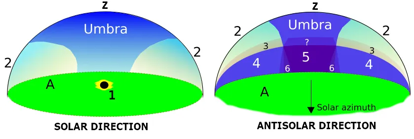
Pic. 50 The simplified pattern of the solar eclipse below the horizon occurrence and its optical impact on the Earth’s atmosphere during the twilight, where: 1 -fully eclipsed Sun below the horizon; 2 – the bright sky (Earth’s atmosphere shone by the crescent sun); 3 – the Belt of Venus; 4 – Earth’s shadow; 5 – an umbra plunged into the Earth’s shadow, making the atmosphere double-shaded. It is believed to fade when moving far beyond the Earth’s shadow; 6 – the soft transition between double-shaded Earth’s atmosphere and the Earth’s shadow;? – the umbra presumably gets darker within the Belt of Venus zone, where the Solar beams are strongly affected by the Earth’s atmosphere. The bottom part of the Belt of Venus corresponds to the situation, where Sun gradually goes below the horizon; A – the ground.; Z – zenith.
It will make the border of the double-shaded atmosphere very soft, as seen in the image above. Watching phenomena such as this we have to investigate the vignetting issue of our webcam because it can misrepresent our observation results. In my case, fortunately, the light-fall wasn’t so big, as you can see throughout this sequence above. The middle row definitely shows the umbra appearance, although it’s expressed only a little against the other images.
Moreover, all the things considered here should be repeated for longer eclipses. The 22-second period of time is too short and produces a too narrow path of the shadow across the sphere.
Pic. 51 The Swakopmund city captured near the maximum phase of the solar eclipse when the Sun was about 3 degrees below the horizon (Namibiaweather.info).
This double-shaded atmosphere should eventually peter out as the Sun is deeper below the horizon, and the considered “piece of atmosphere” further from the Earth’s shadow line. It’s still a mystery what could have happened beyond the place, where this eclipse impact was observed. In order to a quick recap of the situation in Swakopmund, I stacked the panorama-like image including all the major directions of the Swakopmund Jetty webcam imagery. All relevant elements accompanying this vista were marked.
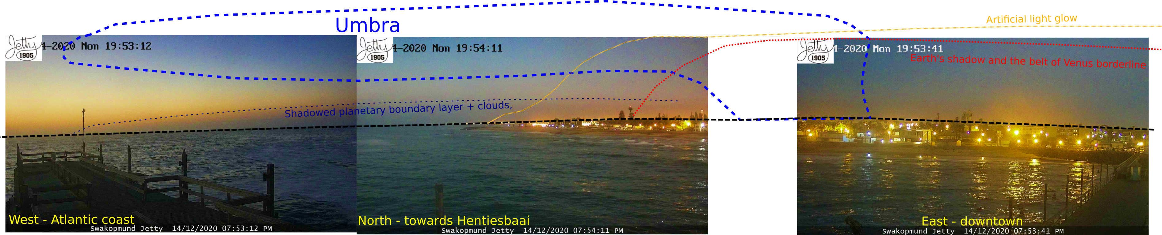
Pic. 52 The stacked panorama was created by an image captured by the Swakopmund Jetty webcam in 3 major directions with all the eclipse elements included, where the black dotted line marks the local horizon (Namibiaweather.info). Click to enlarge.
The panoramic webcam image above clarifies the eclipse situation in Swakopmund, especially in the north direction. The planetary boundary layer, which traps a vast majority of the haze and mist is considerably darker when looking along the coastline, and next, it faints because of light pollution. This light pollution also makes the Belt of Venus invisible. It presumably appears right off the coastline. The blue dotted line shapes the estimated position of the lunar shadow fleeting away into the atmosphere.
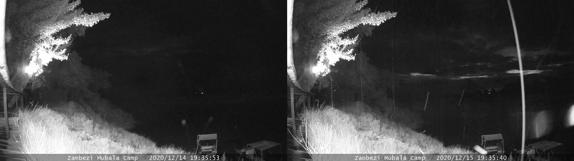
6,7- Zambezi Mubala Camp – Three cameras headed accordingly north and west. The webcam covering the vista northwards wasn’t useful. It was driven by unfavorable weather conditions and the direction itself. Because the sunset occurred in the WSW direction from that place in December, there was no possibility to chase the nautical twilight glow. It could be maybe barely possible in the left frame if the sky wasn’t overcast.
The west webcams show how bad were conditions during the eclipse below the horizon. As it worse, a day after it was slightly better.
Pic. 53 The comparison of twilight during the eclipse and non-eclipse conditions in the webcam shots captured by a west-born webcam at Zambezi Mubala Camp (Namibiaweather.info).
The scene looks slightly darker, but it’s driven by quite thick cloudiness and a lack of clear gaps, which could let some scattered light in. The shots were taken at 7:25 pm local time, so about half an hour before the greatest phase. The eclipse impact was a little then.
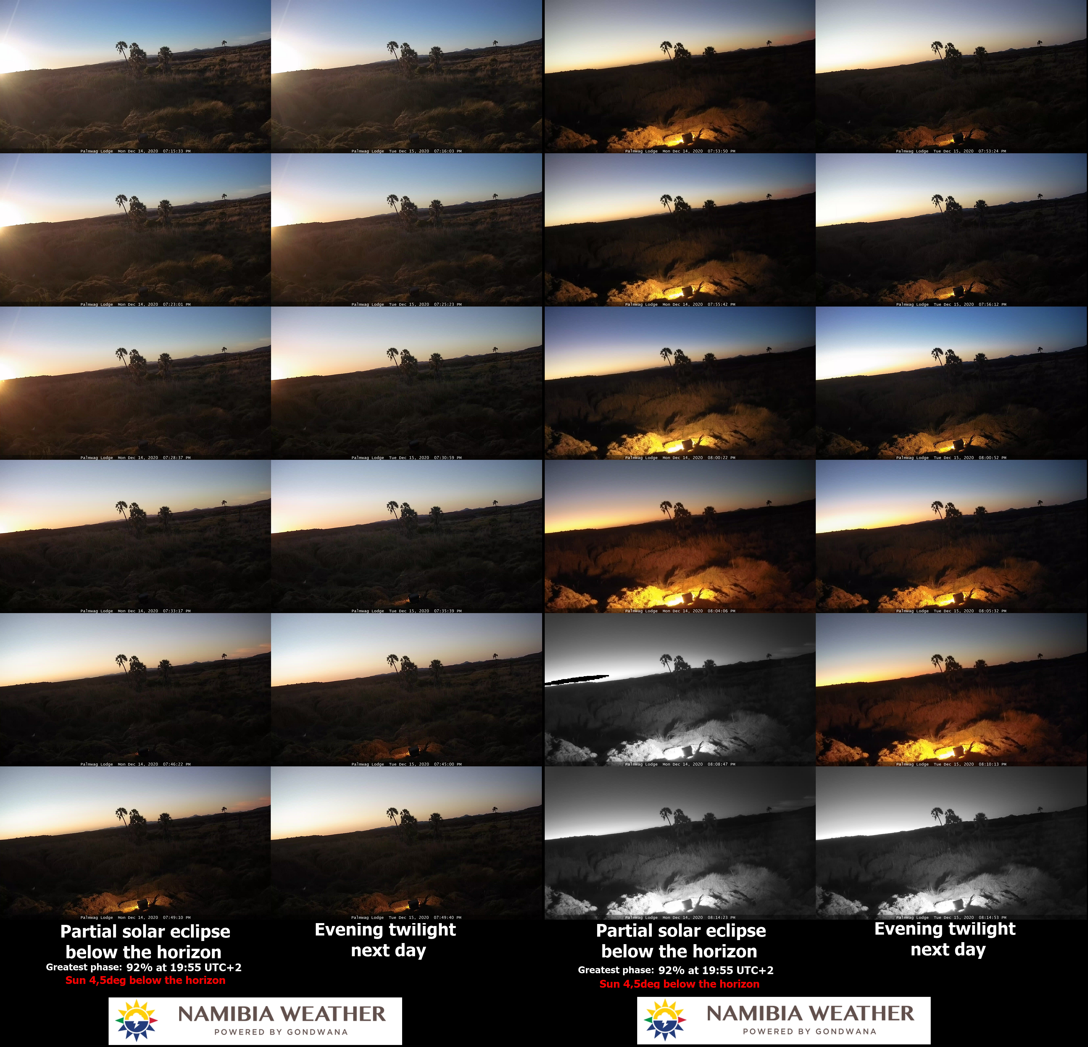
8 – Zambezi Mubala Lodge – another webcam with a good view towards the west, covering a horizon very close to solar azimuth. Moreover, this webcam likewise the two described above was in the vicinity of the extended path of totality. Here the totality occurred when the Sun was about 13-14 degrees below the horizon. It could bring fantastic results if the sky is clear enough. We shouldn’t expect clear skies near the middle of the wet season but at most some clear gaps. The weather conditions, which occurred in the eclipse evening remained somewhat the worst-case scenario. It was admittedly one elongated gap, which eventually petered out between the clouds. Nevertheless, the weather and the eclipse impact were visible about 15-20min before the greatest phase.
Pic. 54 The comparison of twilight during the eclipse and non-eclipse conditions in the webcam shots captured by the west-born webcam at Zambezi Mubala Lodge (Namibiaweather.info).
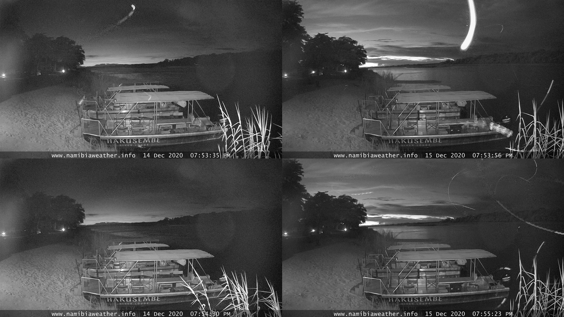
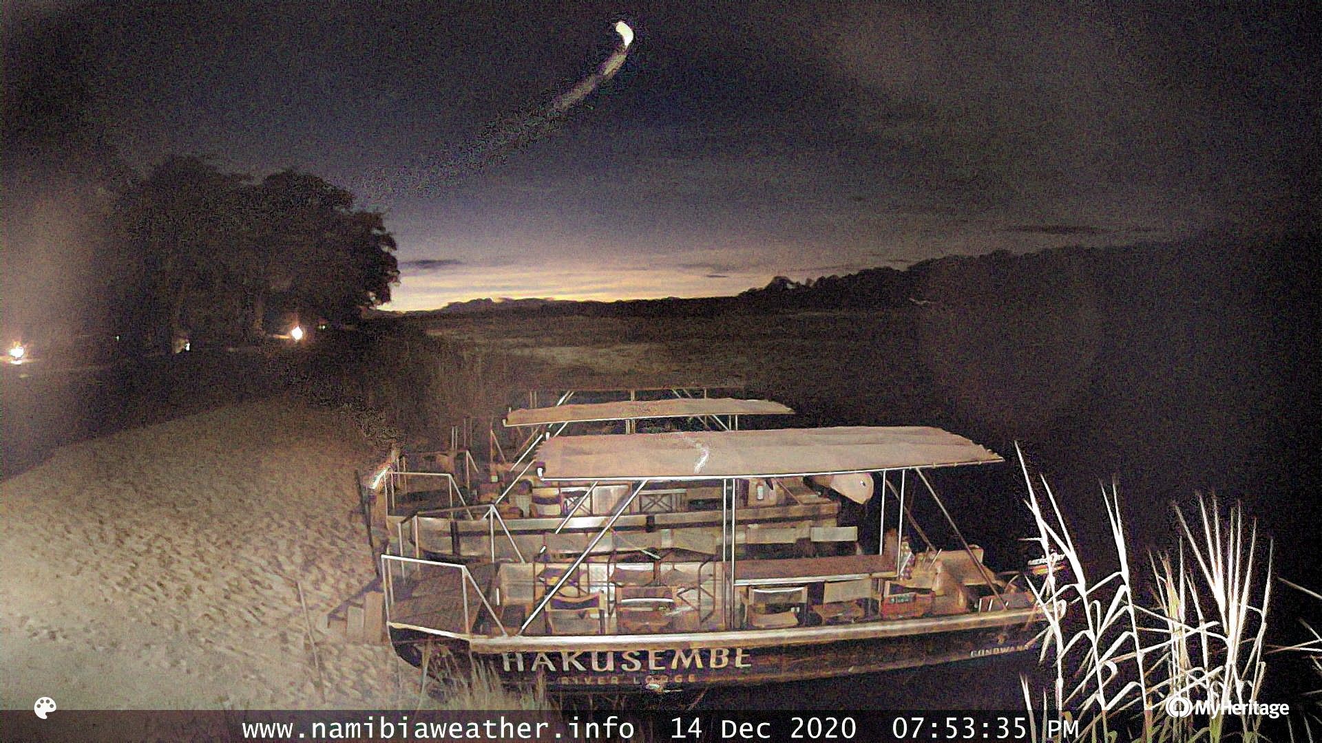
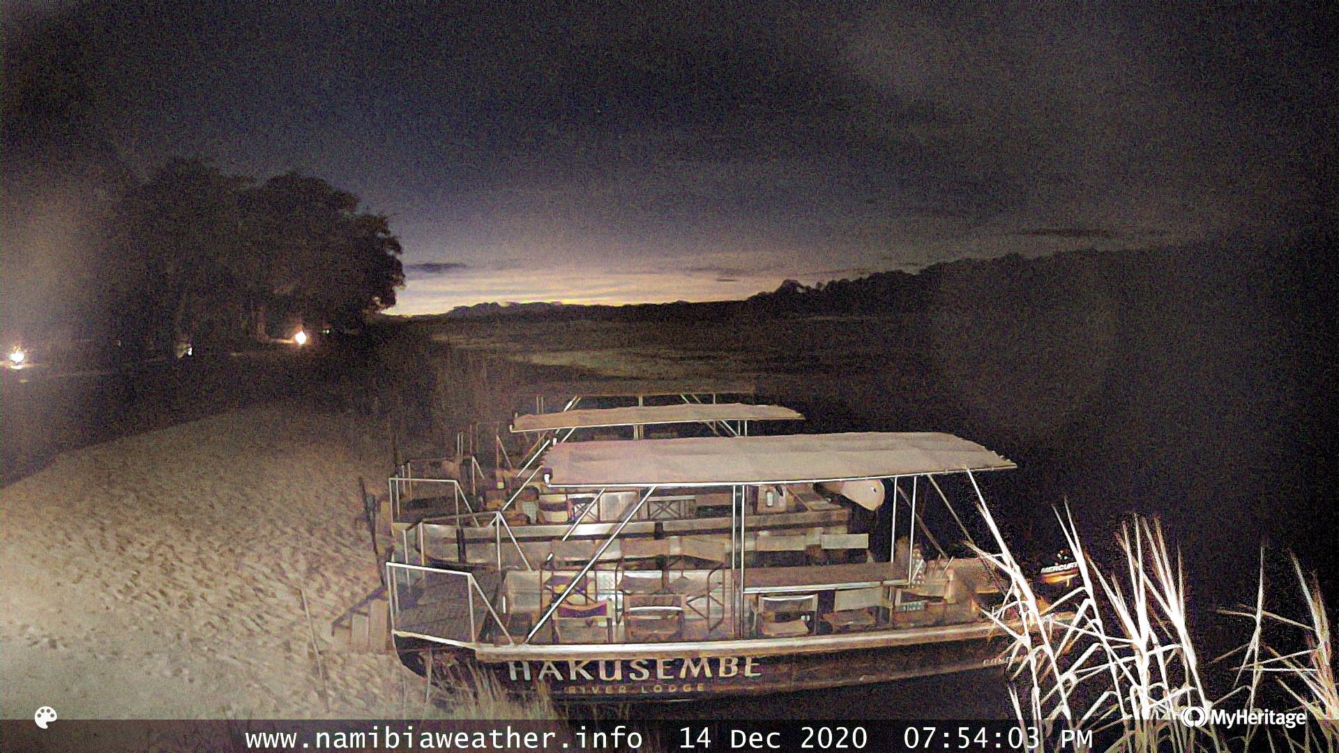
9 – Hakusembe River Lodge webcam – gathered a good result, because the weather conditions were surprisingly good at this location. The biggest downside is, that this location was far north of the extended path of totality. Despite a quite proper bearing towards the west, chasing the umbra would be a challenge here. Another thing is the nearest landscape around. The most interesting camera frame was occupied by trees, which wasn’t helpful at all.
The eclipse’s impact on twilight looks really well here. At this position, the eclipse started roughly when sunset began, peaking when the Sun was about 10 degrees below the horizon. It’s something similar to see in Northern Spain on April 9, 2024, although the webcam position was on the opposite side of it, against the situation which is going to happen on the Spanish Galician coast in 2024, whereas the distance between both places from the extended umbral path seems to be similar.
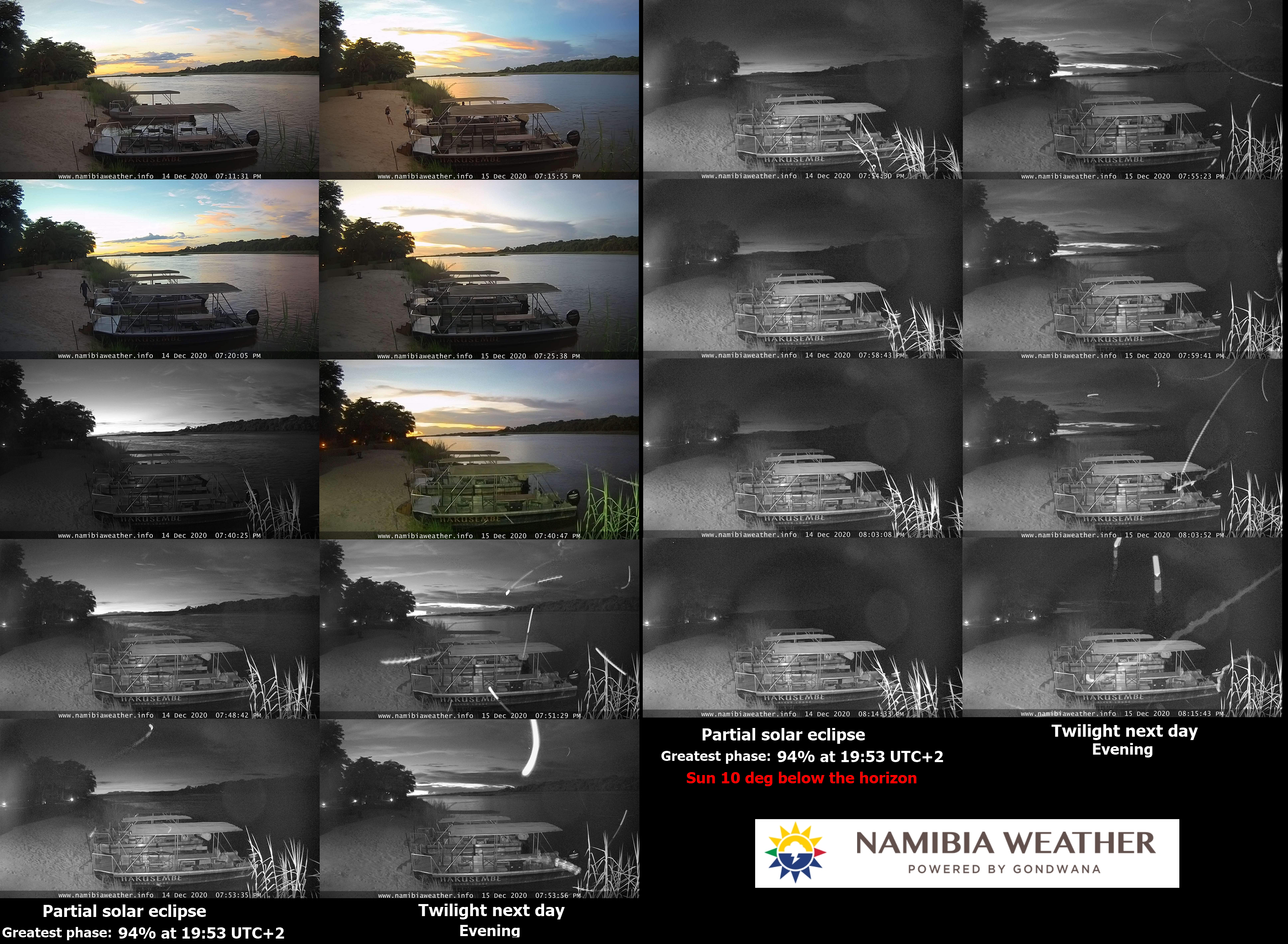
Pic. 55 The comparison of twilight during the eclipse and non-eclipse conditions in the webcam shots captured at Hakusembe River Lodge (NamibiaWeather.info).
The attached image above shows clearly the significant impact of the solar eclipse on twilight. The nautical twilight was fairly accelerated to the moment when the Sun was about 9-10 degrees below the horizon. However, the most important thing to spot should be the umbral column extended across the sky above the solar azimuth. It’s not visible regrettably.
Pic. 56 The greatest phase of a deep partial eclipse below the horizon is seen from Hakusembe River Lodge. Comparison with the same moment 24 hours later (Namibiaweather.info).
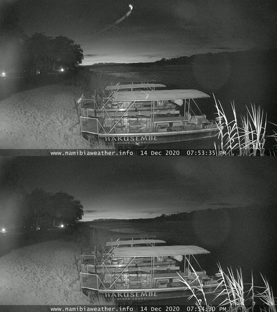
Pic. 57 The animation comparing the greatest solar eclipse below the horizon conditions on Dec 14, 2020, with the same moment of twilight 24 hours later at Hakusembe River Lodge (Namibiaweather.info).
The webcam catches a lot of artifacts, which are illuminated under low light conditions. Some of them are also reflected in the camera vision, which makes detailed observation difficult. I tried to gain something more after coloration.
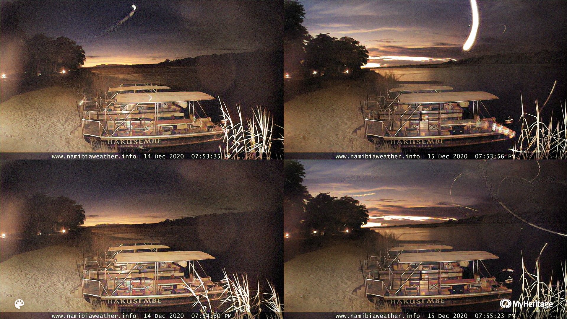
Pic. 58 The greatest phase of a deep partial eclipse below the horizon is seen from Hakusembe River Lodge. Image colorized (Namibiaweather.info/MyHeritage).
The colorized images show the comparison much better, although still no chance to spot the umbra. Unfortunately, the trees hide this part of the horizon, where some eclipse effects could be visible. The one region in the frame worth attention to is the top left corner, where the sky seems to be darker. This section of the screenshot is not free of artifacts regrettably.

Pic. 59 The greatest phase of deep partial eclipse below the horizon as seen from Hakusembe River Lodge. Image colorized with colors enhanced(Namibiaweather.info/MyHeritage).
The enhanced colors don’t tell much either about the umbra’s presence. Only the artifacts are emphasized. We are also able to distinguish the major types of clouds visible in the sky at that moment.
As the summary of this place, I would like to show 2 separate screenshots captured around the maximum phase of the eclipse.
Pic. 60, 61 The webcam shots around the greatest phase of the solar eclipse, when the Sun was around 10 degrees below the horizon at the position of Hakusembe River Lodge (Namibiaweather.info/MyHeritage).
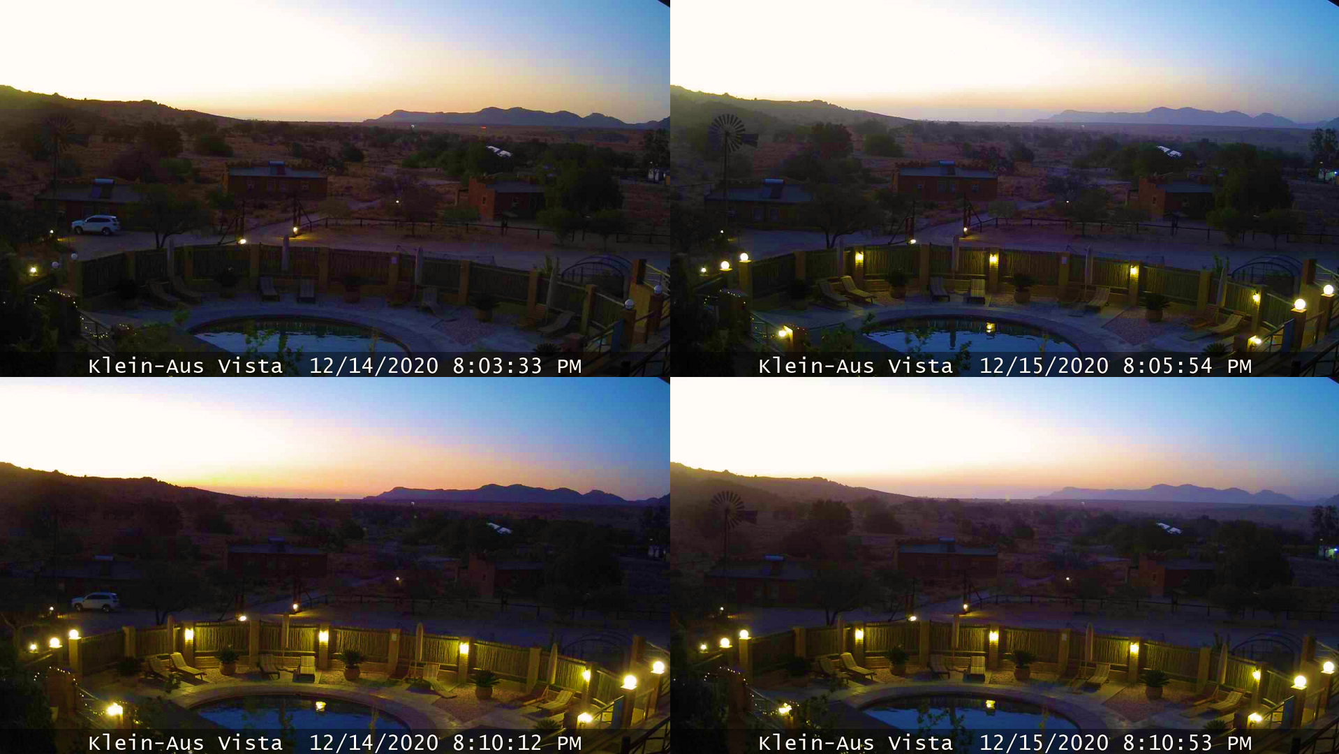
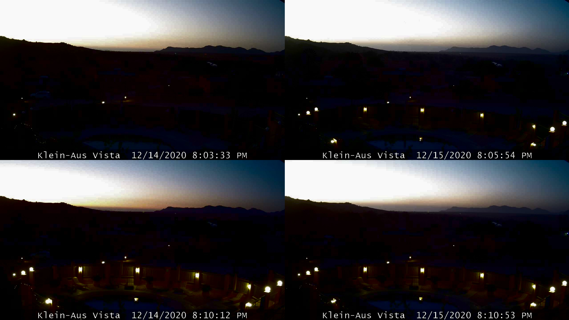
10 – Klein Aus Vista – another webcam located in the heart of Namib Desert, but far south from Namib Desert Lodge. Because of the location, the eclipse impact was not big, which fairly can be seen on the webcam. Moreover, a big role played the various haze concentrations here between the eclipse day and the day after. The next day, after the eclipse was hazier. Finally, the sky looks more pale-yellowish, and distant hills more faded.
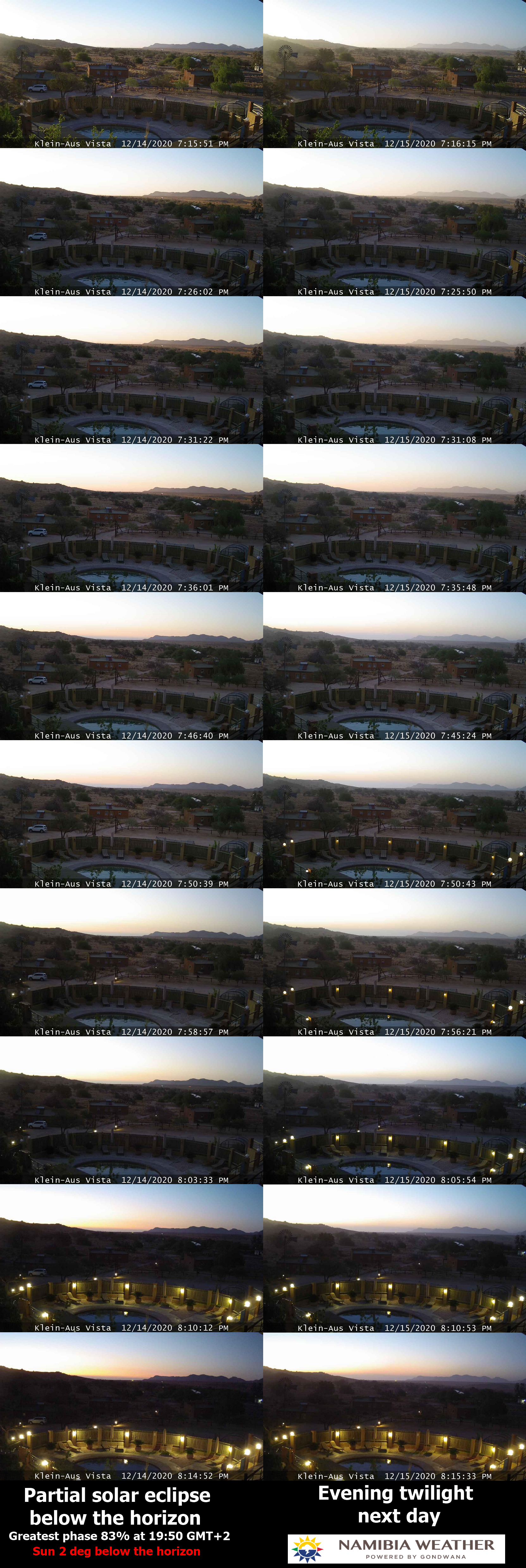
Pic. 62 The comparison of twilight during the eclipse and non-eclipse conditions in the webcam shots captured at Klein Aus Vista (NamibiaWeather.info).
The eclipse impact starts to be visible in the second part of the event when the Sun is deeper below the horizon. The greatest phase features almost no difference here. What is the most fun here, the lights were turned on roughly 24 hours after the maximum phase, but not during the eclipse event. It means, that the light level difference was practically not noticeable and the lights were turned by someone manually. The webcam screenshot from the greatest eclipse phase looks slightly overexposed when looking at the ground. The sky in fact is also even brighter. Another fact, which explains this situation is a shallow solar position against the horizon line at the eclipse peak. The Aus region was one of them, where the greatest phase almost coincided with sunset.
The detailed look comes from the second part of the eclipse phenomenon when the Sun was deeper below the horizon. The twilight seems to be a bit accelerated in all images, especially these further processed.
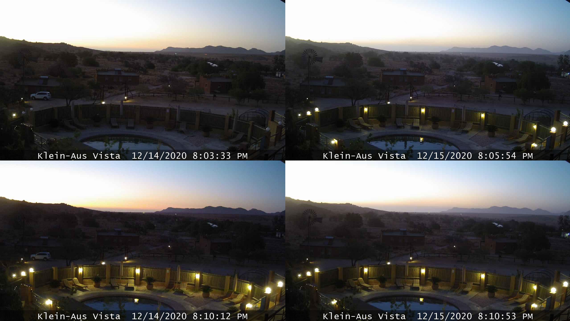
Pic. 64 – 66 The partial eclipse below the horizon as seen by webcam located at Klein Aus Vista and comparison with the exact moment 24 hours later, where: 64 – Normal screenshot; 65 – Colours enhanced; 66 – Brightness and contrast modified (Namibiaweather.info).
The screenshots taken at 8:10 pm local time show the best how the eclipse was looking like that day. The curious thing is, that it was more than 15min after the greatest phase. We can see here clearly, that the sky near the horizon is redder, and in general, the whole sky is darker. The lights also seem to look a bit stronger. The thick haze layer compacted in the lower troposphere can be also noticed on the right. Its thickness could make the twilight light extinct, which eventually equalized with the level observed during the eclipse. There’s only one reasonable way for the explanation so far. We need to investigate similar situations like this and see, what roughly happens, that the impact of the eclipse with a phase bigger than 80% is not visible enough. As a summary, see the final animation below.
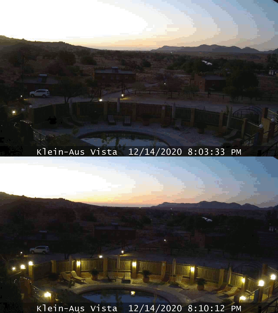
Pic. 67 The simple animation showing the difference in the twilight between the eclipse day (the second part of the eclipse, after the greatest phase) and the same moment a day after as seen by webcam located at Klein Aus Vista (Namibiaweather.info).
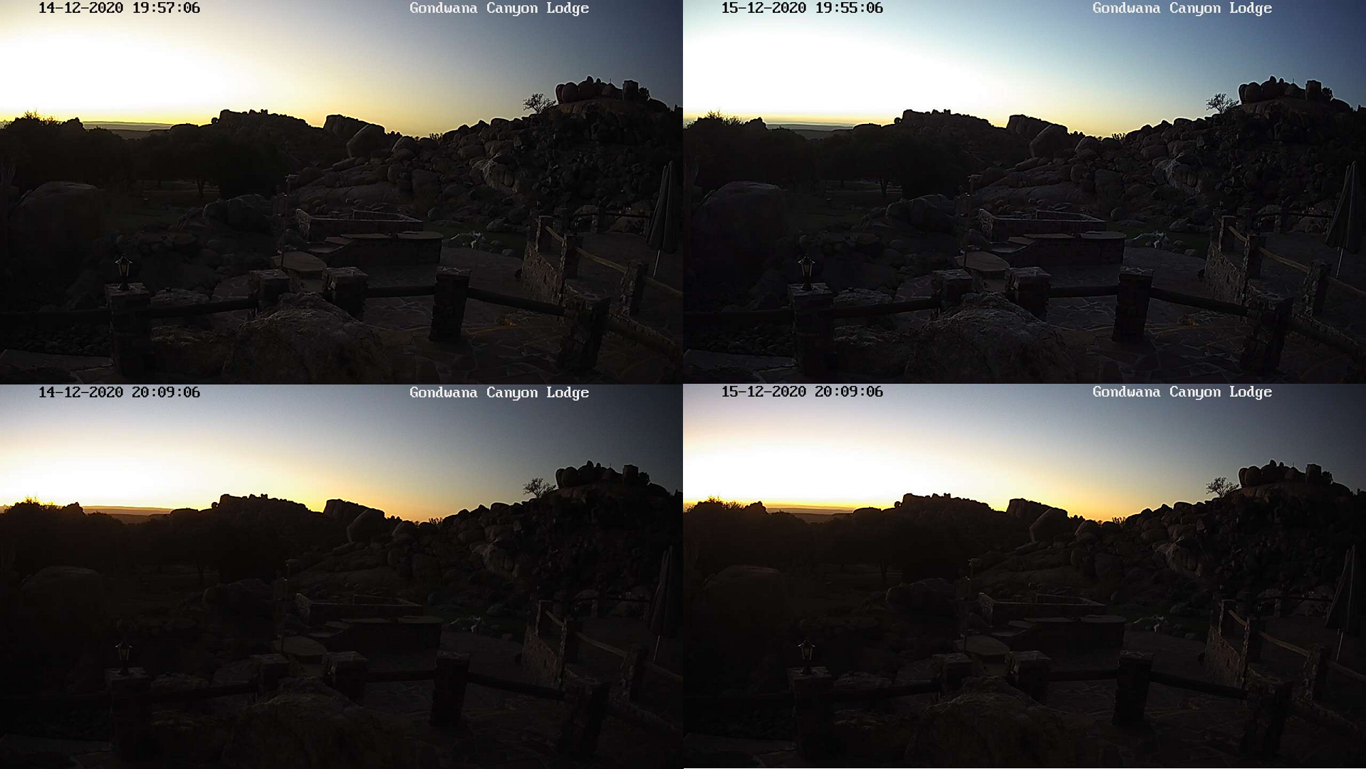
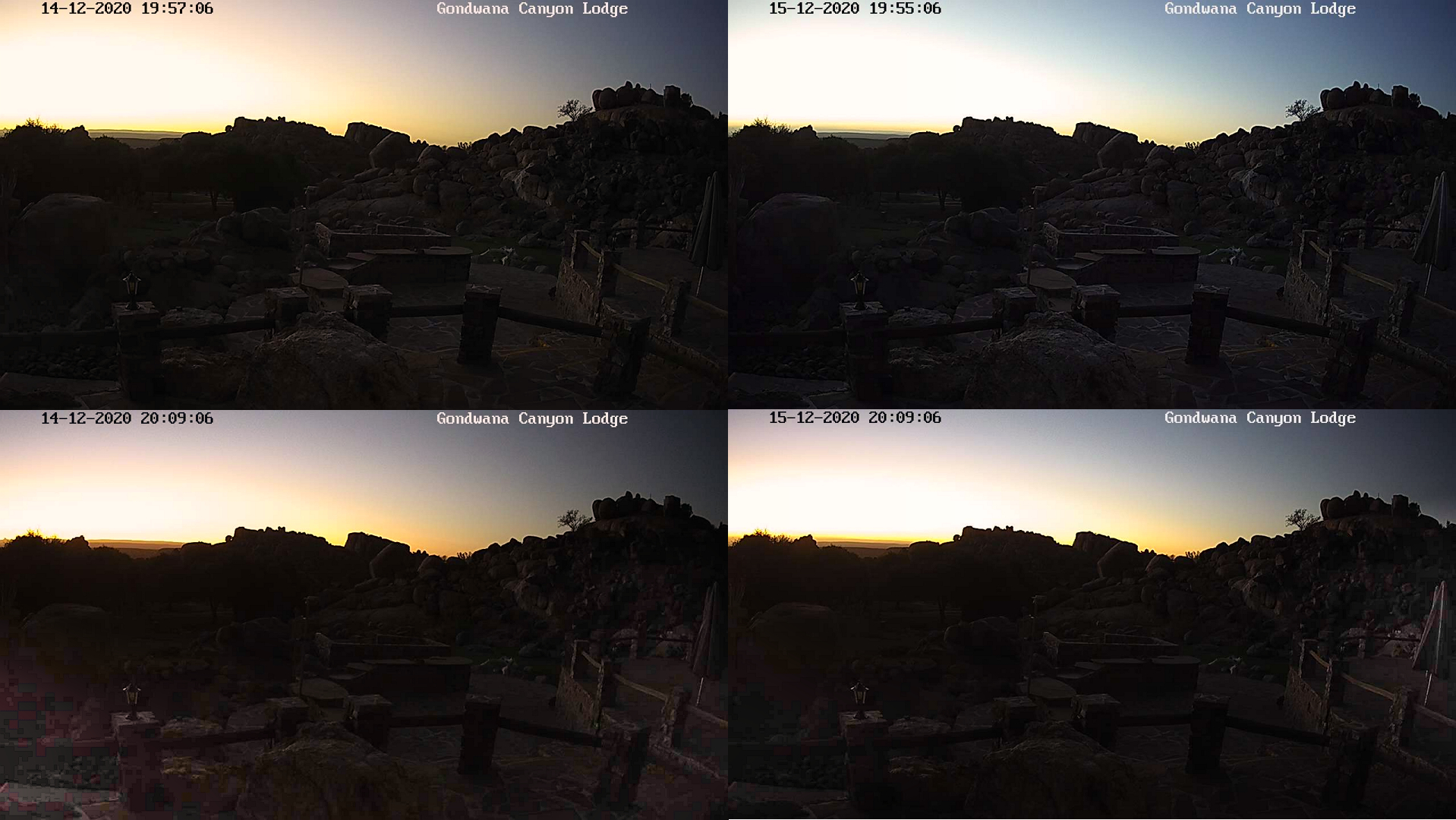
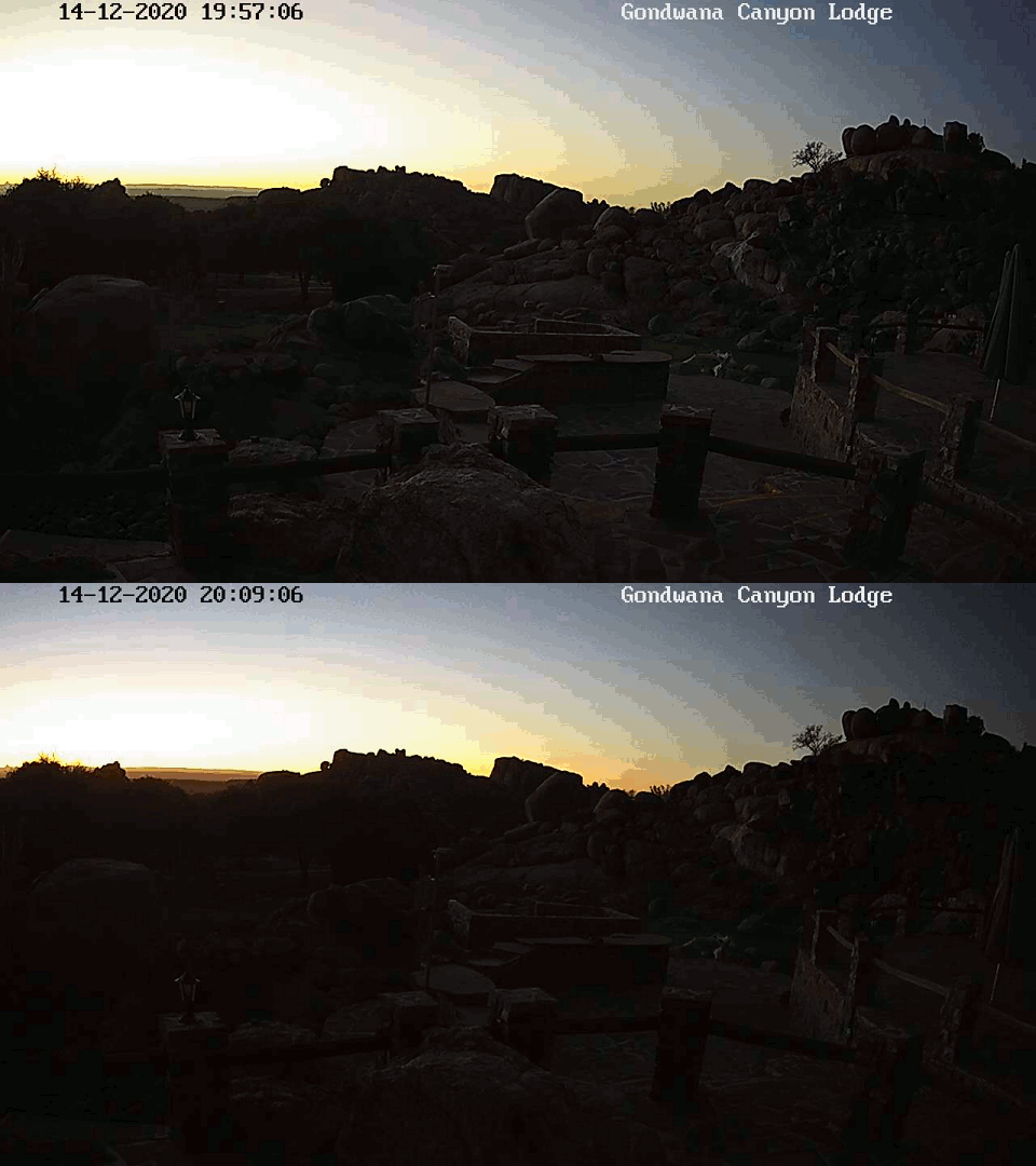
11 – Gondwana Canyon Lodge – the webcam headed west brought slightly better results, than the previous one. The southernmost part of the Namib Desert was less hazy, although the dust still deteriorated the observation. Unlike the Klein Aus Vista, the eclipse impact was visible a tad earlier, just before the greatest phase. The biggest difference between the rough 24 hours concerned fell about 10 – 15 minutes after the greatest phase.
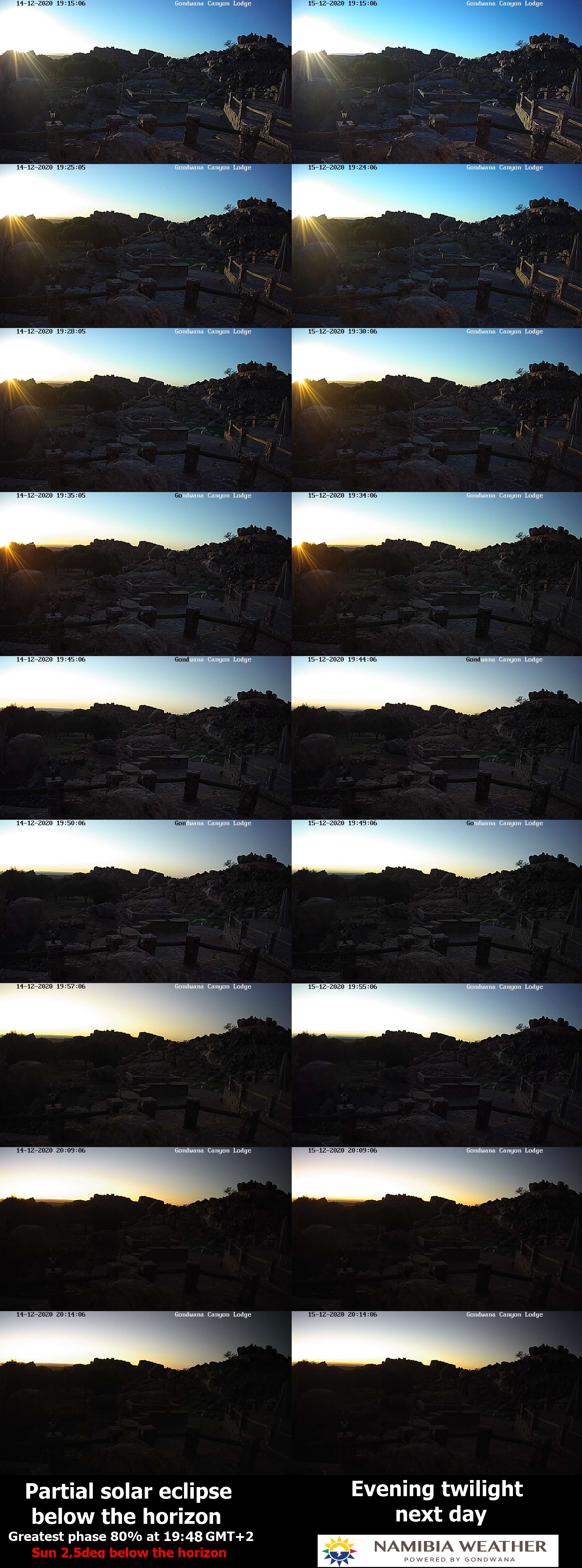
Pic. 68 The comparison of twilight during the eclipse and non-eclipse conditions in the webcam shots captured at Klein Aus Vista (NamibiaWeather.info).
At this moment, the reddening of the sky was enhanced perfectly. It was the moment of coincidence of the sunset and the limb darkening influence in the upper troposphere when the Sun was about 4 – 5 degrees below the horizon. It’s seen better in the processed pictures below:
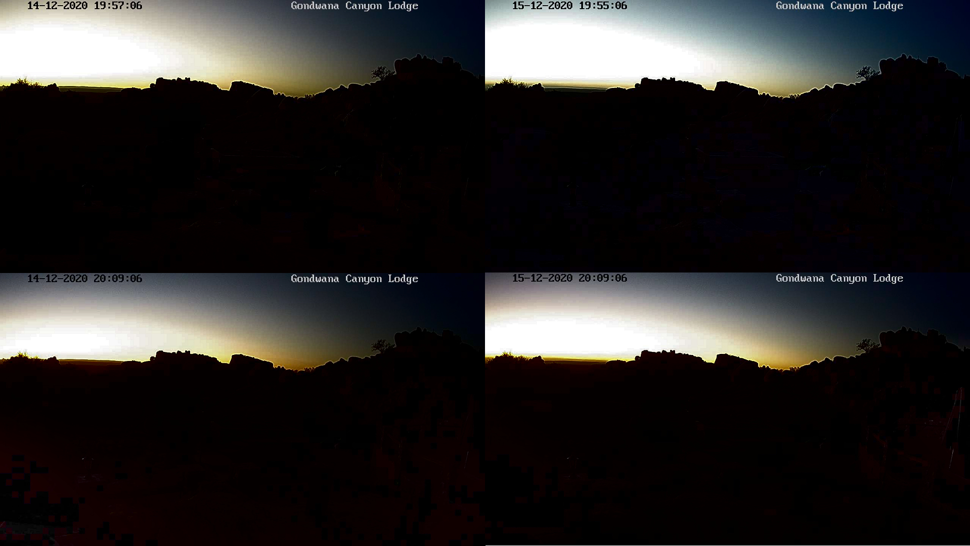
Pic. 69 – 71 The partial eclipse below the horizon as seen by webcam located at Gondwana Canyon Lodge and comparison with the exact moment 24 hours later, where: 69 – Normal screenshot; 70 – Colours enhanced; 71 – Brightness and contrast modified (Namibiaweather.info).
At the finish, traditionally the animation displays the biggest difference in the scene between the eclipse day and the same moment 24 hours later.
Pic. 72 The simple animation showing the difference in the twilight between the eclipse day (the second part of the eclipse, after the greatest phase) and the same moment a day after as seen by webcam located at Gondwana Canyon Lodge (Namibiaweather.info).
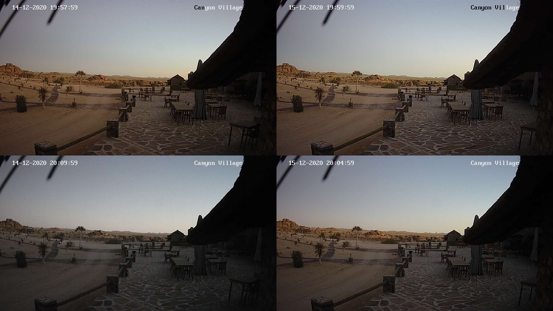
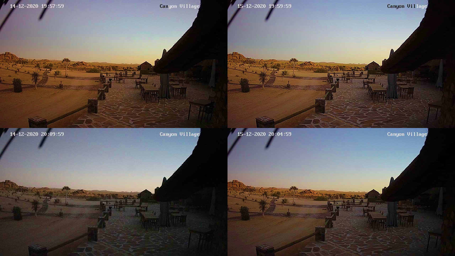
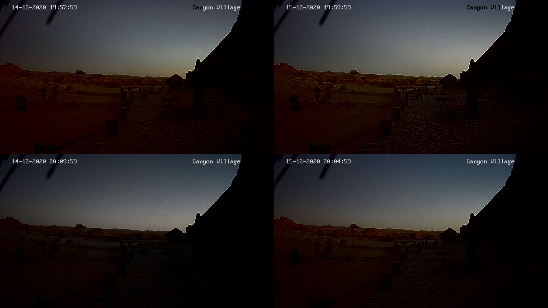
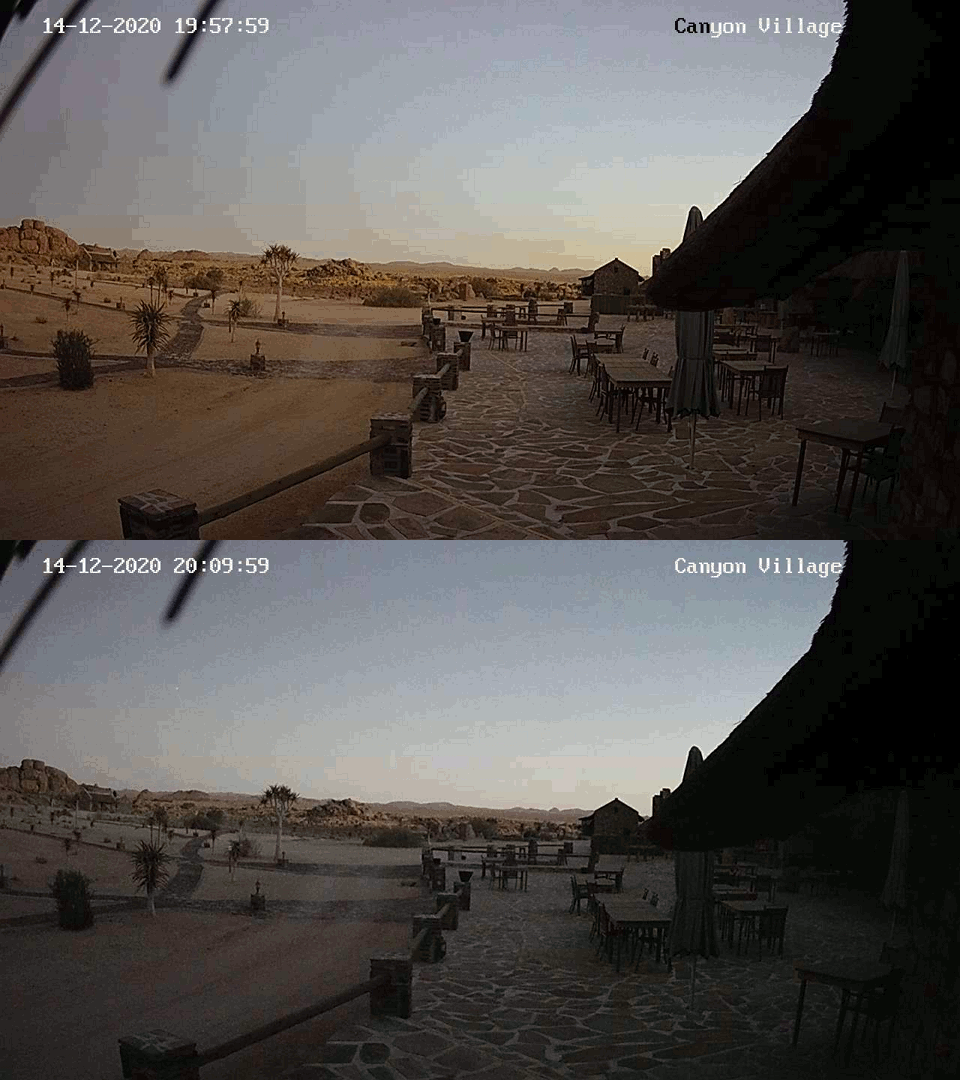
12 – Gondwana Canyon Village – another webcam nearby, which covers the southeast direction. The view was quite interesting during the eclipse, as it displayed the movement of the Belt of Venus and Earth’s shadow. Both Gondwana Canyon Lodge and Gondwana Canyon Village webcams were located the furthest from the extended path of totality. It means that the eclipse magnitude here was the lowest captured. The solar obscuration was around 80%. Overall, the twilight was accelerated by about 1 – 1,5 degrees according to the webcam records.
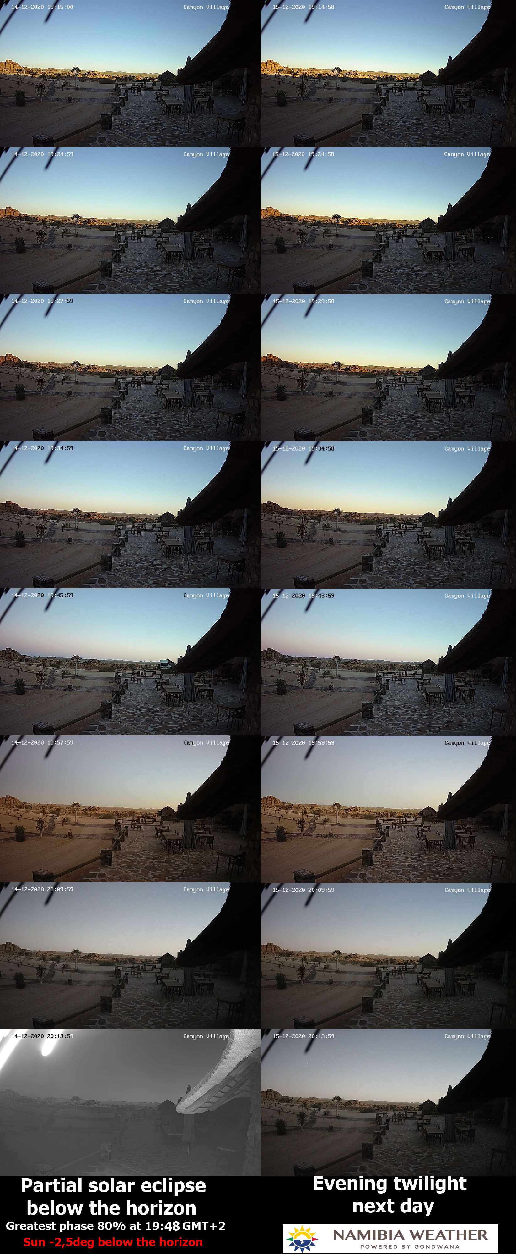
Pic. 73 The comparison of twilight during the eclipse and non-eclipse conditions in the webcam shots captured at Gondwana Village (NamibiaWeather.info).
The southeast direction was more than 90 degrees away from sunset azimuth. The data gathered here are still quite valuable because we can see the optical atmosphere response on the other side. There are only a few webcams in Namibia, which provide data such as this. In the case of this particular place, the reddening of the sky is less expressed. The sky is a bit more navy blue and eventually dull instead. The reddish tint is omnipresent in the frame anyway, engulfing a whole scene, especially on the deserticolous ground. A piece of the Belt of Venus is visible in the top-left frame. It looks redder due to deep partial eclipse conditions. You can see it better in the processed images.
Pic. 74 – 76 The partial eclipse below the horizon as seen by webcam located at Gondwana Canyon Village and comparison with the exact moment 24 hours later, where: 74 – Normal screenshot; 75 – Colours enhanced; 76 – Brightness and contrast modified (Namibiaweather.info).
The visible difference in the illumination is not so big, which is explained away by a relatively low eclipse magnitude. The animation below shows clearly a whole comparison of this place.
Pic. 77 The simple animation showing the difference in the twilight between the eclipse day (second part Gondwana Canyon Village (Namibiaweather.info).
13 – Palmwag – a good webcam born west, which could probably catch the fleeting umbra. Unfortunately, the frame rate was too low for it probably. In the comparison between the eclipse day and the day after we can see a bit of change in the color of the sky and gloomy scene.
Pic. 78 The comparison of twilight during the eclipse and non-eclipse conditions in the webcam shots captured at Klein Aus Vista (NamibiaWeather.info).
The interesting is the view near the greatest phase. Compared with the moment 24 hours later it looks so gloomy. Moreover, the sky has a significant reddish appearance. It does look better in modified images.

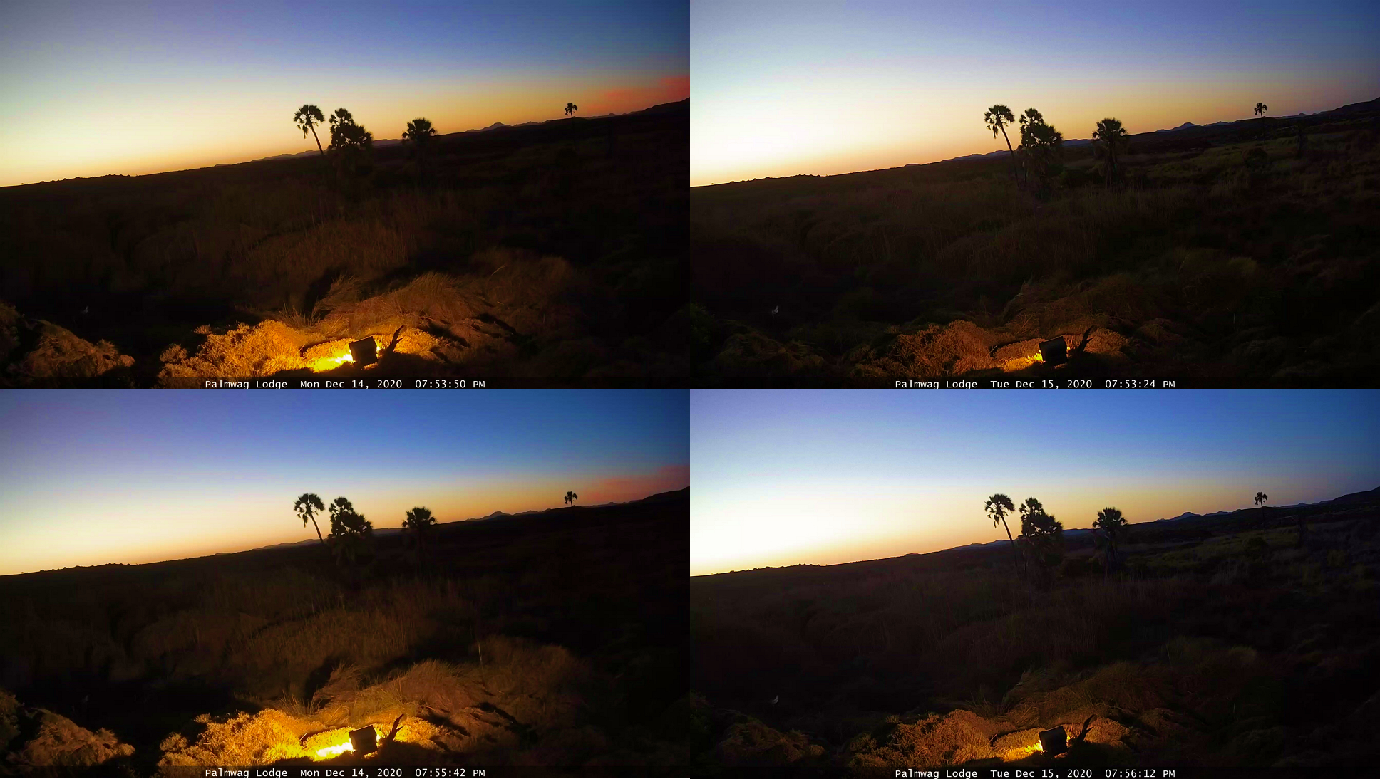
Pic. 79 – 81 The partial eclipse below the horizon as seen by webcam located at Palmwag and comparison with the exact moment 24 hours later, where: 79 – Normal screenshot; 80 – Colours enhanced; 81 – Brightness and contrast modified (Namibiaweather.info).
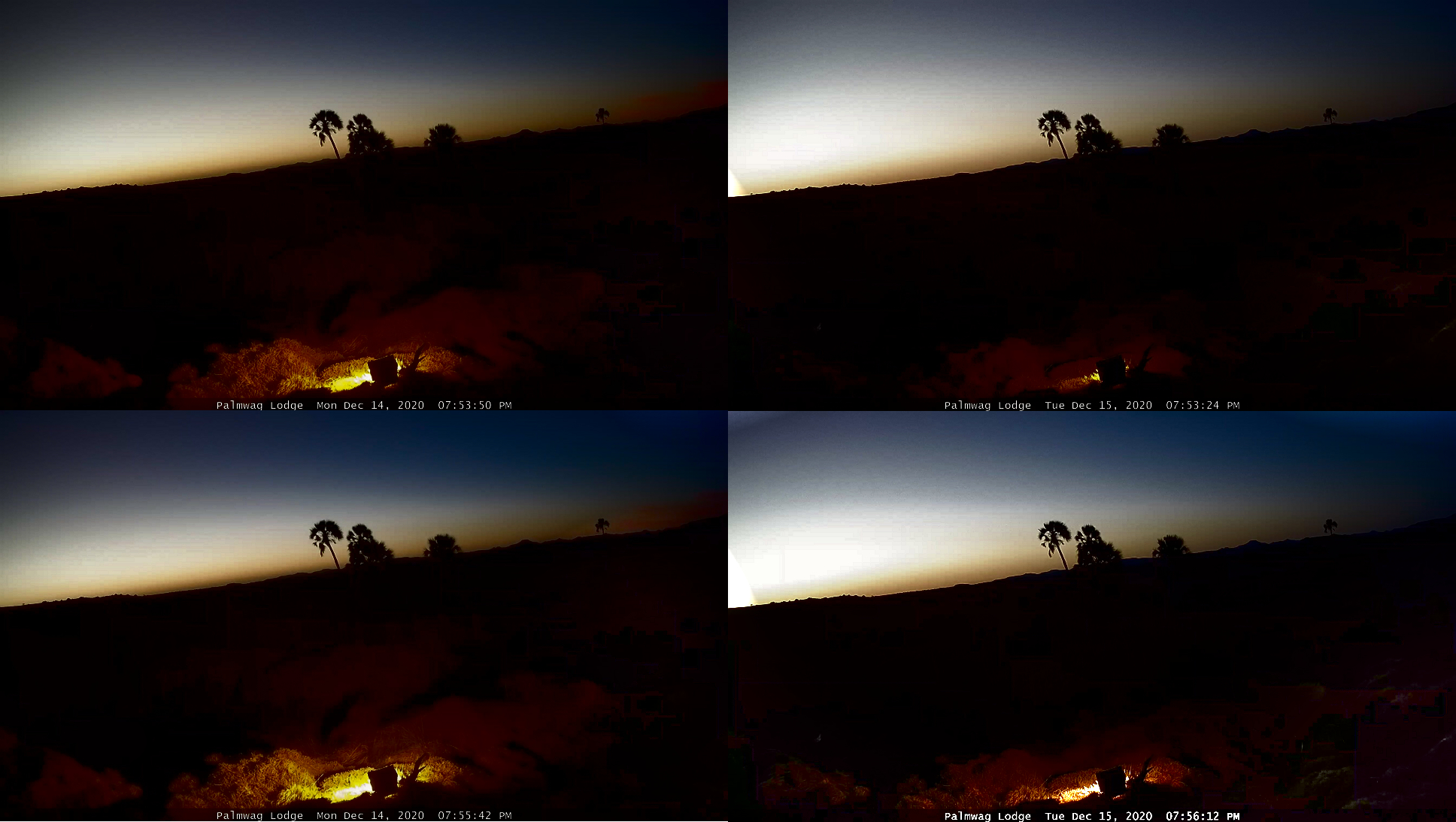
Presumably, the umbra could be visible in the top left part of the frame. All the images both normal and processed ones clearly show the sudden darkness in the corner, which is preceded by a vast increment of a reddish tint. It has been marked in the processed images below, where the colors have been enhanced.
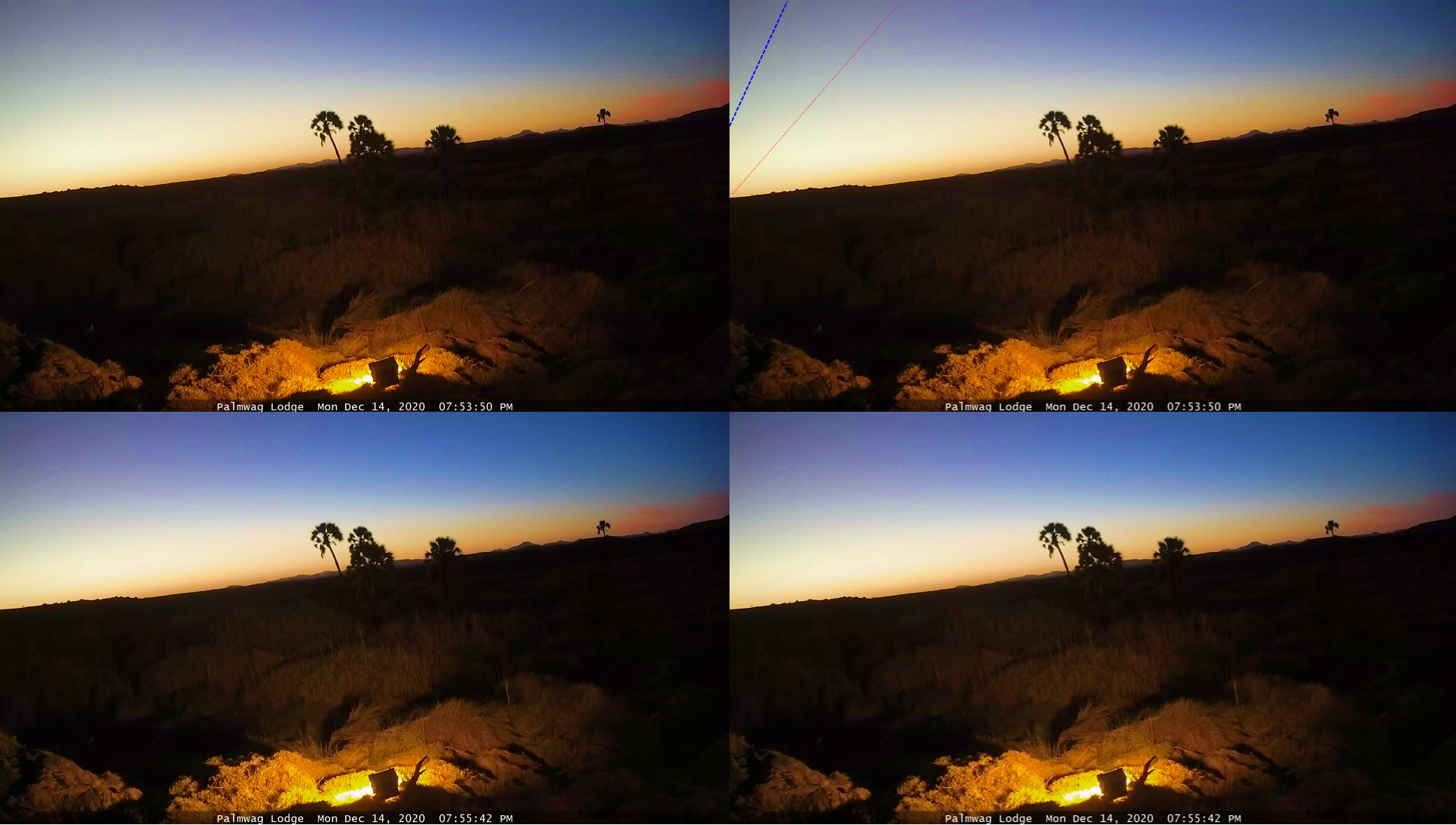
Pic. 82 The moment of the greatest eclipse below the horizon as seen in the webcam located at Palmwag. The blue dotted line indicates a presumed north umbral edge and the red dotted line marks the zone with high participation of red light. Colors have been enhanced (Namibiaweather.info).
The significant participation of red tint arises out of the situation when the Earth’s atmosphere is illuminated by sunlight restricted to the solar limb only, featuring considerably lower radiating temperature (about 4000K). This limb reddening largely accounts for color (Gedzelman, 2020). As a result, the second-order scattering can produce the salmon-brown appearance of the clouds, ice sheets, or other bright surfaces illuminated by the thin crescent sun in the vicinity of the umbra limit. The high-level clouds visible in the frame on the right don’t provide the described situation, because they’re quite far from the umbra. They reflect intense red light related to sunset and deep penumbral conditions. The appearance described above is at least partially expressed in the sky, captured by the Palmwag webcam in its top-left corner. You can see it better when comparing the greatest eclipse moment with the time 24 hours later. On the other hand, the big darkness is also expressed in the image, at least by a bigger range of artificial light visible in the frame.

Pic. 83 The simple animation showing the difference in twilight between the eclipse day (around the greatest phase) and the same moment a day after as seen by the webcam located at Palmwag (Namibiaweather.info).
14 – Namushasha River Lodge – due to poor weather conditions this webcam has been excluded from the observation. That’s a pity because it was located near the extension of the eclipse path with the greatest phase at the beginning of the nautical twilight.
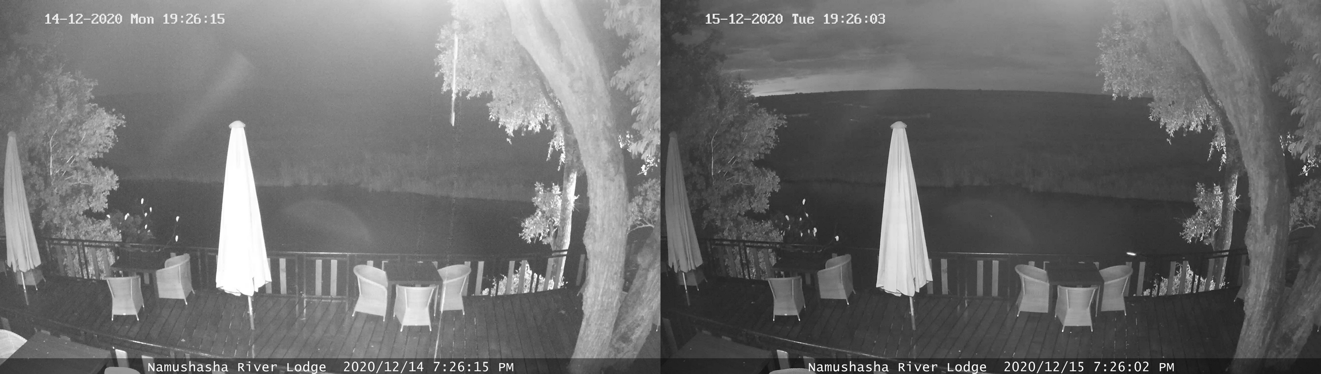
Pic. 84 The comparison of twilight during the eclipse and non-eclipse conditions in the webcam shots captured by Namushasha River Lodge (Namibiaweather.info).
The images above come from quite an early phase of the eclipse. It was about halfway to the greatest phase. Despite the totally clouded sky on the eclipse day, the scene seems to look significantly darker than 24 hours later. The distant horizon is barely visible. It’s hard to say about the eclipse’s impact here due to poor weather conditions. The rainfall can seriously deteriorate visibility and reduce the scattered sunlight during the twilight period.
15 – Chobe River Cam Webcam – was also excluded because of the bad weather and wrong bearing. This webcam is headed north, so the nautical twilight glow couldn’t be visible with these camera settings.
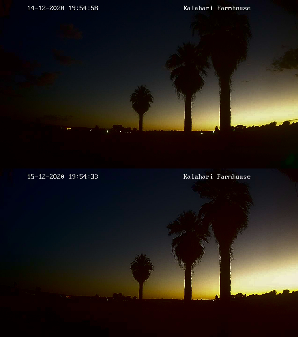
16 – Kalahari Farmhouse – this webcam was not working just a day before the eclipse event. Luckily it became alive again a few hours before the eclipse started. The camera is born southwards, so it caught quite a lot of the twilight glow as well as the fleeting Earth’s shadow a bit later. The greatest phase reached 88% at that position, so the changes are visible well in the scene.

Pic. 85 The comparison of twilight during the eclipse and non-eclipse conditions in the webcam shots captured at Klein Aus Vista (NamibiaWeather.info).
The visual twilight acceleration can be estimated at about 2 degrees. In practice, the civil twilight would end when the Sun was 4 degrees below the horizon only. This estimation is valid for the time shortly before the greatest phase and afterward. The light level asymmetry explained above is visible well here till about 8:10 pm local time when the penultimate shot was captured. The image compilation below shows better how it was looking like.
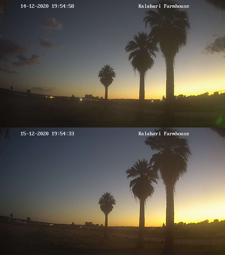
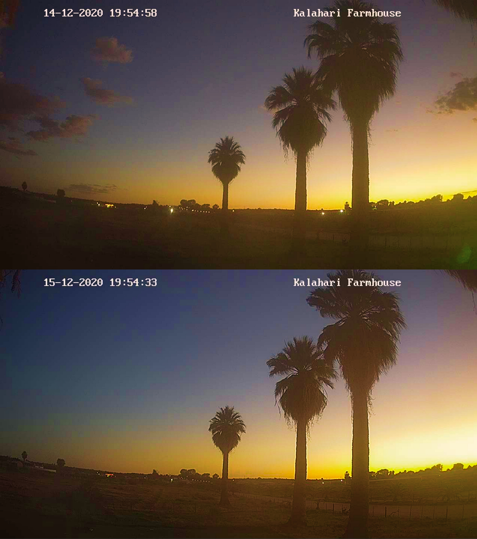
Pic. 86 – 88 The partial eclipse below the horizon as seen by webcam located at Kalahari Farmhouse and comparison with the exact moment 24 hours later, where: 86 – Normal screenshot; 87 – Colours enhanced; 88 – Brightness and contrast modified (Namibiaweather.info).
What is most interesting here, the twilight glow looks redder a day after the eclipse. It’s driven by a higher haze concentration, which reflected the sunset light on small dust particles. Apart from a faint light drop, there is no big difference between the eclipse evening and non-eclipse conditions 24 hours later.
Pic. 89 The simple animation showing the difference in the twilight between the eclipse day (the second part of the eclipse, after the greatest phase) and the same moment a day after as seen by webcam located at Klein Aus Vista lodge (Namibiaweather.info).
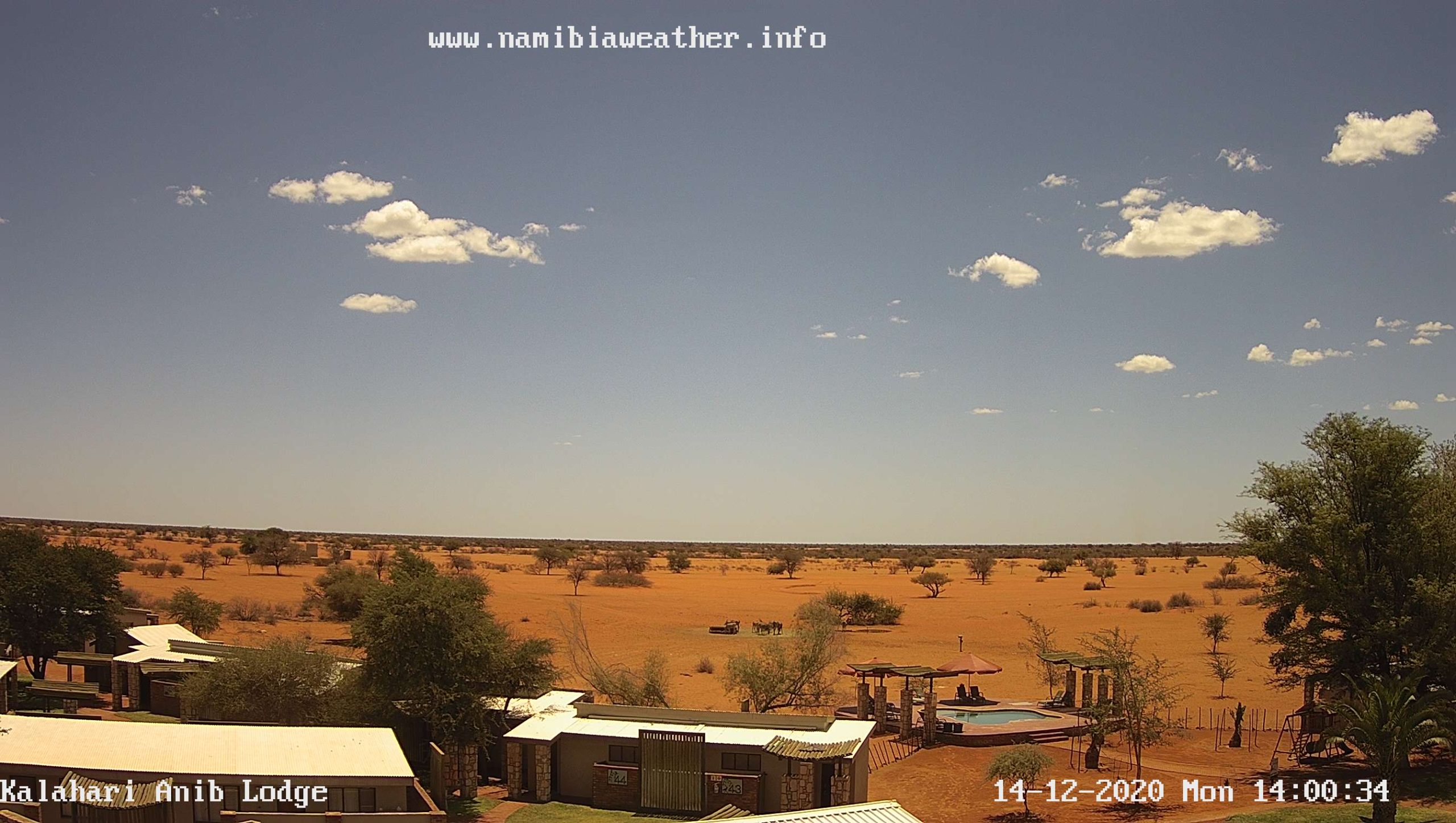
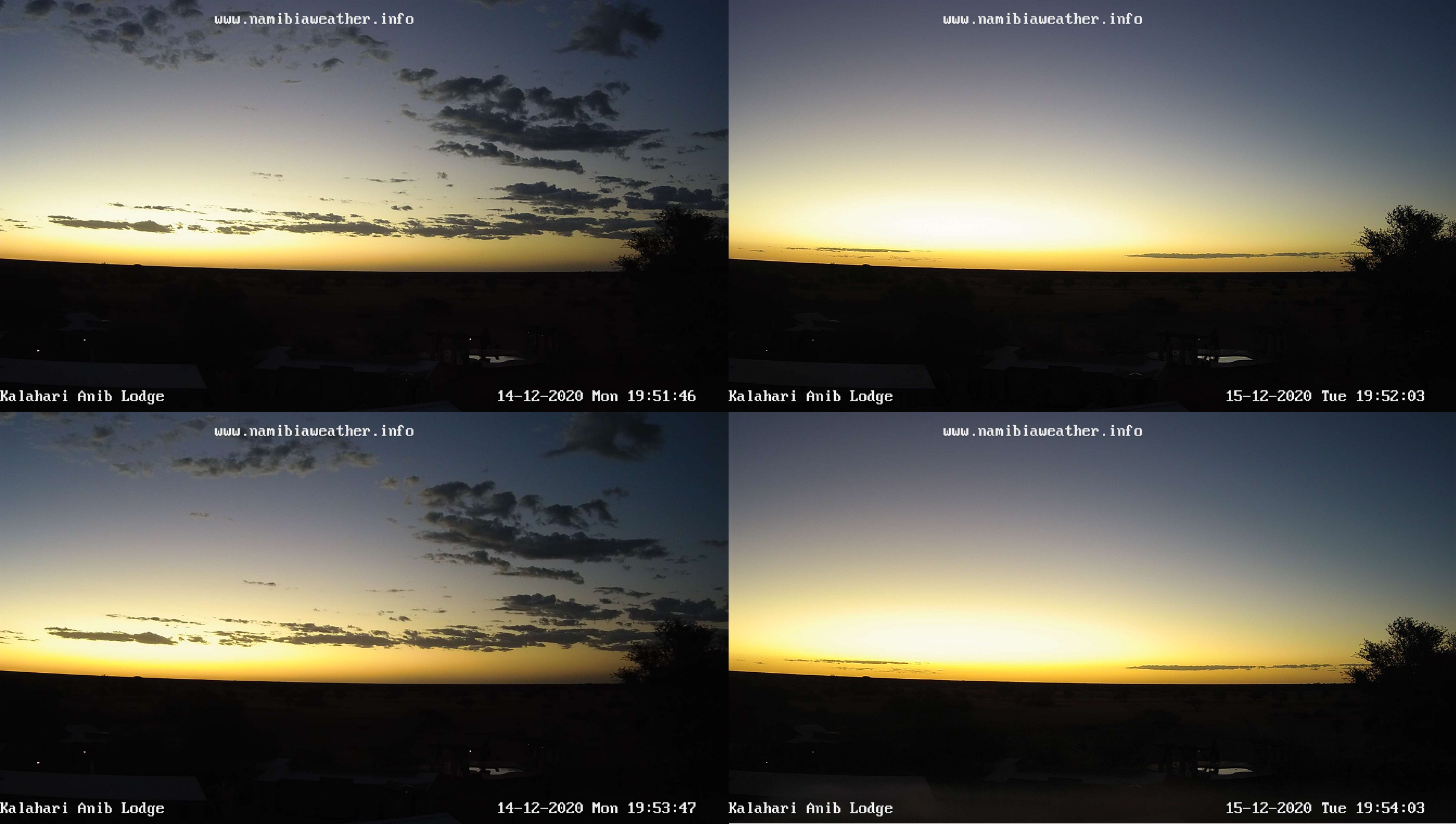
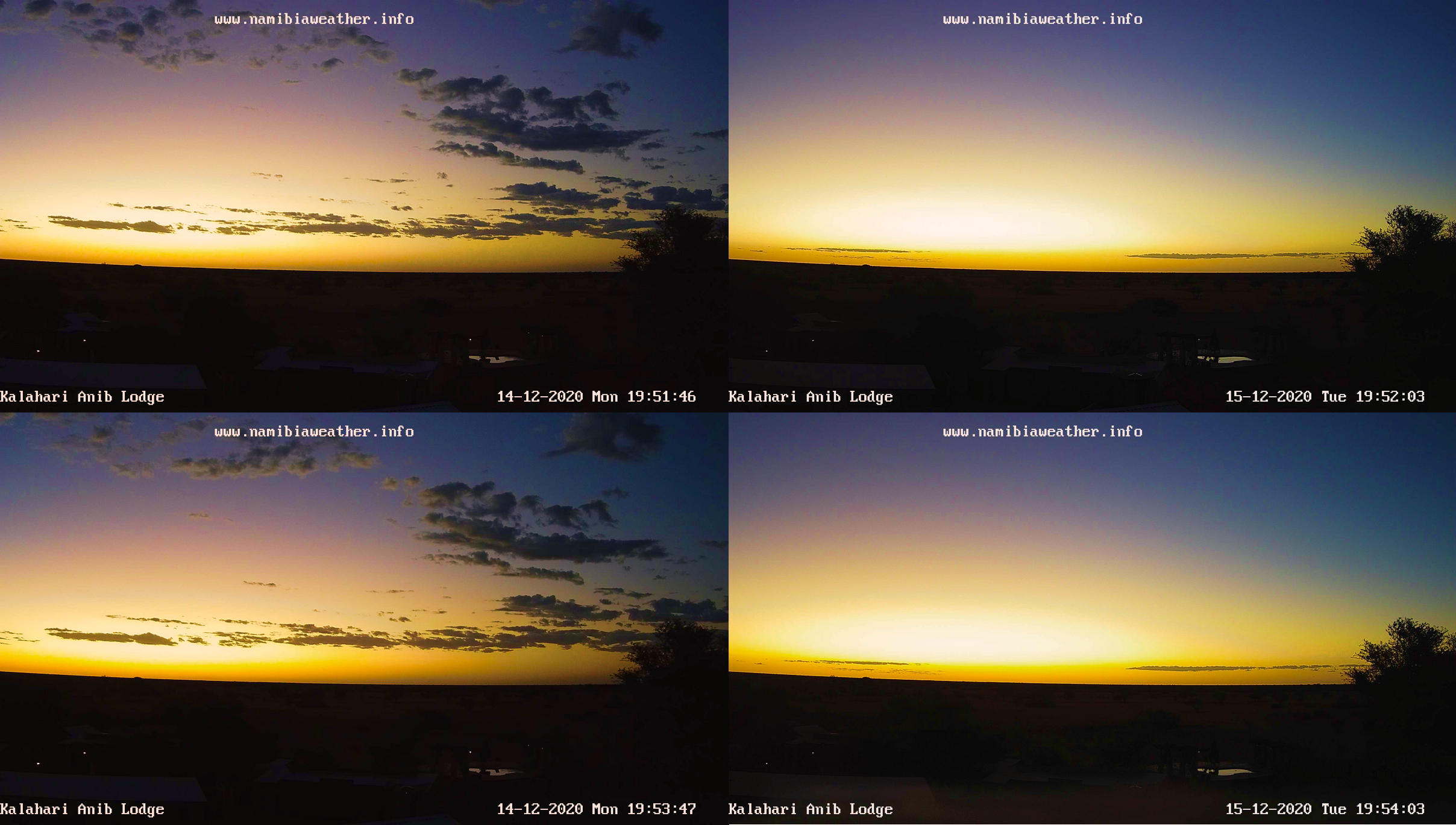
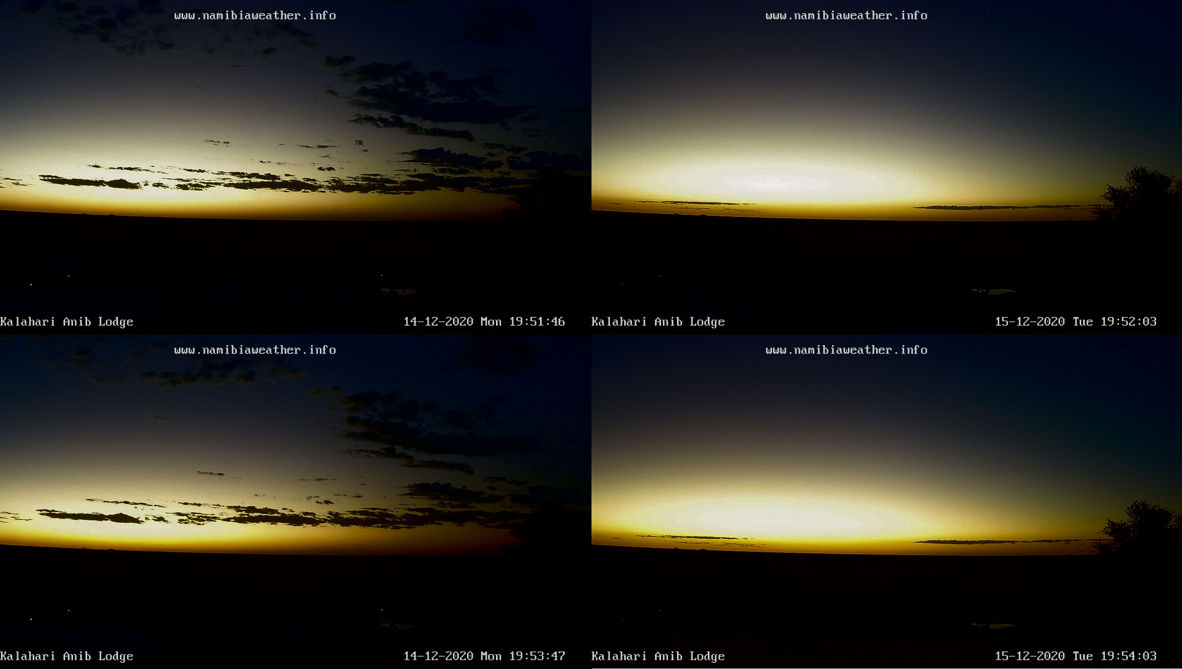
17 – Kalahari Anib Lodge – the last webcam considered, according to my order shown on the map (Pic. 24). Because of a very good direction, roughly towards the sunset, I could see how the atmosphere behaves when the thin crescent instead of the full solar disk goes below the horizon. I could spot a significant darkening of the sky near the right frame edge (towards the northwest). The 88% obscuration during the peak of the eclipse and its location about 420km from the southern extended “totality” limit could make the umbra visible just above the horizon assuming, that a similar obscuration was noticed in Scotland. Here, the webcam frame didn’t reach that far toward the north. On top of that, there is a tree in the frame, roughly in the direction, where something interesting would be visible at the eclipse peak. Spark clouds also weren’t helpful. It’s harder to gauge the changes in the sky coloration and brightness at higher angular altitudes.
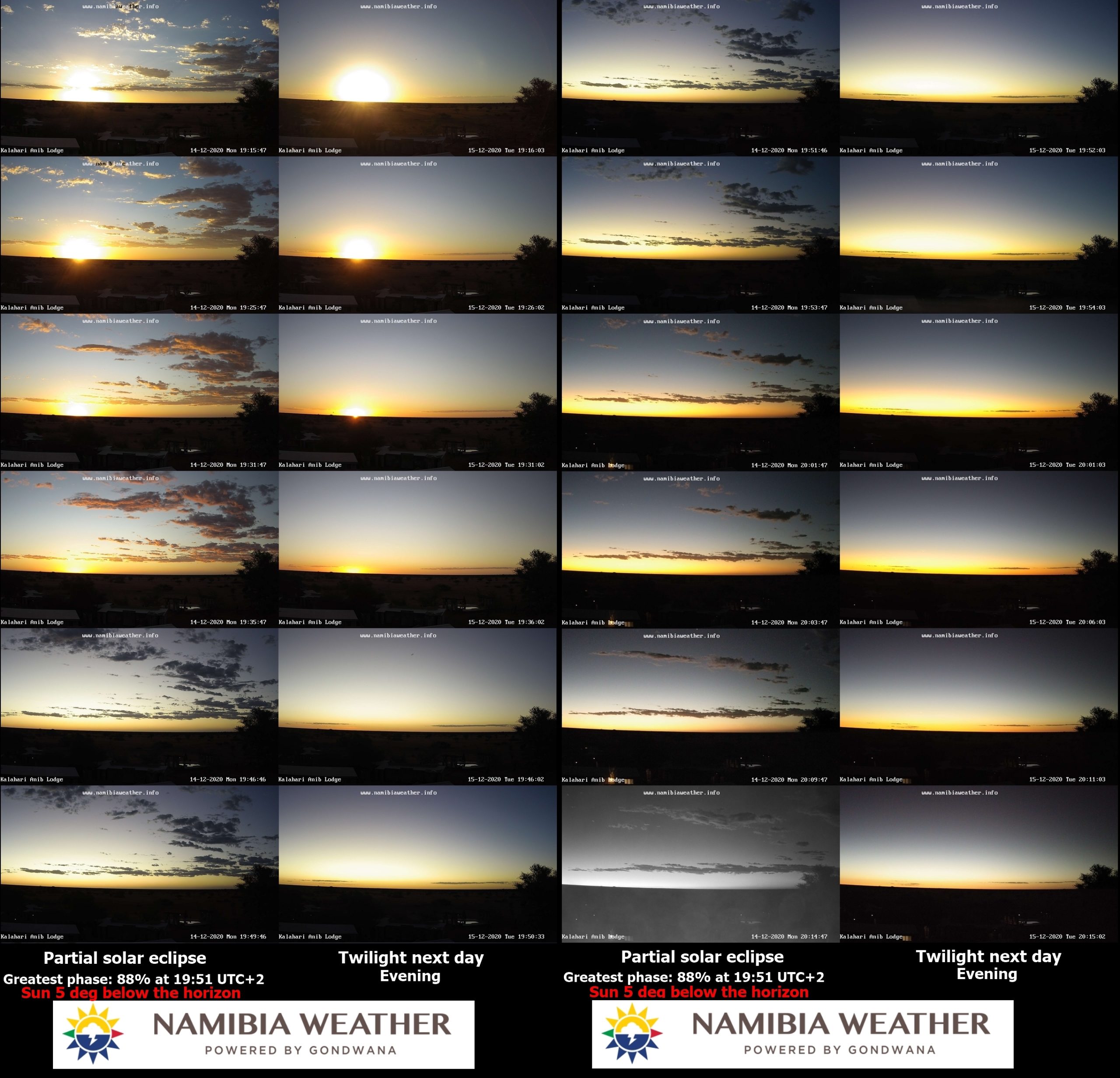
Pic. 90 The comparison of twilight during the eclipse and non-eclipse conditions in the webcam shots captured at Kalahari Anib Lodge (NamibiaWeather.info).
This webcam has a good advantage. Unlike most other webcams in Namibia, it switches off its true coloration almost at the end of nautical twilight, which is great. The image compilation shows traditionally the eclipse event and analog twilight the next day. The planetary boundary layer looks very suspicious on the right part of the frame. Following the webcam line of sight in this direction, the umbra would have been visible roughly in the “place” where this thick haze is discernable. In practice, the straight-line distance is about 800km at least, which completely excludes situations like this, as the umbra could be theoretically visible from a distance of about 600-630km. Another thing is, that the region, where the umbra was moving actually was illuminated by the Sun being about to set, which dissipated the light. The stuff seen in the frame comes from the region, which was simply closer to the extended path of totality. Its darkening comes from the deeper eclipse phase, which results in a lower level of illumination. It applies both to the haze layer as well as the section of the sky just above. The size of the deep penumbra impact is stressed by the weather conditions, which are different between these 2 days concerned. The next day after the eclipse was hazier, but the layer didn’t look as dark as around the greatest eclipse phase a day earlier.
Pic. 91 – 93 The partial eclipse below the horizon as seen by webcam located at Kalahari Anib Lodge and comparison with the exact moment 24 hours later, where: 91 – Normal screenshot; 92 – Colours enhanced; 93 – Brightness and contrast modified (Namibiaweather.info).
The sky coloration is virtually the same. This situation has been explained above. The Kalahari Anib Lodge is located in the same area as Kalahari Farmhouse. The described weather conditions remain the same then. The main thing to see here is a significant difference in the scene brightness. The eclipse twilight is quite dull with a serious extinction visible, caused by the aforementioned haze layer. On the contrary, the shots taken 24 hours afterward are overexposed at the rough solar azimuth.
It’s worth concluding the whole eclipse event from that place by watching this brief video below. I stacked all the webcam shots around the greatest phase. They show penumbral impact clearly.
The very last thing in order to summarize observation by this webcam is the GIF animation comparing the biggest eclipse twilight and the same moment on the following day.

Pic. 76 The simple animation showing the difference in the twilight between the eclipse day (the second part of the eclipse, after the greatest phase) and the same moment a day after as seen by webcam located at Klein Aus Vista lodge (Namibiaweather.info).
7. SUMMARY
The observation results come mostly from the webcams except for fleeting shadows captured from space. All the cameras have HD resolution, except for the one in Chile, which captures frames in 640×480 size. The observation results except the ones received by satellite imagery were reliant on the webcam settings. Next, the still images have been downloaded from each of them. The cameras could record the evening with true coloration down to the end of civil twilight on average. My observations can be linked to webcam astronomy – a new type of astronomical observation, based on the data received broadly from low-light cameras.
The satellite imagery data showed how big the impact of the lunar shadow on the cloud’s coverage, making it fairly undistinguishable under restricted illumination conditions.
Remote observation combined with the live stream broadcasted from Chile, where the sky was fully overcast was fairly useless for any analysis. Besides a significant light drop reported by the recording devices, there are no recognizable events related to solar eclipse occurrence. The eclipsed Sun with a bright corona was visible from Argentina.
The basic goal of this article was probably the World’s second observation of the solar eclipse below the horizon on the Namibia territory. The weather in Namibia usually varies at this time of the year, for reasons dictated by the climate. Usually, the austral summer period in this part of the African continent is wet, featuring frequent thunderstorms and passing rainfalls, and finally prevailing cloudiness seriously reducing any chances for astronomical observations.
The path of totality ended in the eastern part of the Atlantic Ocean, just 370km from the Namibian coastline, making this phenomenon still clearly visible in the atmosphere at twilight. In locations, where the sky was overcast during the eclipse, significant darkness has been reported. The best evidence of it is bright streetlamps or other artificial sources of light, not observed under non-eclipse conditions. The most important webcams, which were located relatively close to the extended path of totality were able to intercept the lunar shadow. Unfortunately, the umbra wasn’t fully visible in any of the webcams. They captured at most a piece of the umbra. The most spectacular observation was done by the Swakopmund Jetty webcam, which was located only 40km from the southern limit of extended totality. The observation product led to preparing the simplified sketch presenting the Earth’s atmosphere response during the solar eclipse below the horizon. It was found, that the umbral border becomes very soft beyond the Earth’s shadow line, which is driven by the lack of direct sunlight scattering in the ozonosphere. The combination of the umbra and Earth’s shadow makes an Earth’s atmosphere double-shaded, by the Moon and by the Earth itself. On the other hand, before the moon’s shadow hits the Earth’s shadow we can observe a significant increment of the reddish tint just outside of the umbral border. It comes from the very thin solar crescent, which shines by the most external parts of the solar disk, where the atmosphere is the thickest and the temperature the lowest at once. A significant difference in temperature between the very middle of the solar disk and its external parts causes the shift toward red. The reddish tint was predominantly observed in all the webcams, as they were located within the greatest phase obscuration of 80% and higher. It has translated both to the sky and the vista in general, making especially the Belt of Venus more expressed than usual. The phenomenon is not strong enough, because it can be vanished by big haze concentration, which also makes the redder sky appear after sunset. The most effective redder sky effect was observed when the Sun was about 4-5 degrees below the horizon. It was the moment when the sunset would be observed in the upper troposphere visible in the solar direction. The long-wavelength light scattering was combined with the influence of limb darkening. Regardless of the sky reddening, the darkness caused by penumbra is visible in any case, although usually stronger after the greatest phase. It’s possibly caused by the light proportion asymmetry between the decreasing amount of scattered light in the atmosphere received at twilight and the fixed relation between the light level decrement and the eclipse magnitude. We can see it best on the webcams, where the greatest phase of the eclipse occurred at the latest moment after sunset. Another issue explaining it lies in the individual webcam settings, which were similar for all of them pretty much across the country. They could reveal the light level difference only when the recorded amount of light was quite low. The twilight was accelerated around 2 degrees on average. Because of a quite poor frame rate and not perfectly fitting the bearing of the most important webcams, further investigation of this whole phenomenon is required. Essential is important to know roughly what happens inside the penumbra and umbra during each moment of twilight, preferably on a degree-to-degree basis. The webcam investigation, even when all the relevant conditions are fit, is not enough, regarding the professional light level measurements especially. The webcams give us the true visual outlook of the optical changes in the Earth’s atmosphere, considering its illuminated part, including the Belt of Venus as well as the Earth’s shadow, which combined with the umbra and also the penumbra makes the atmosphere double-shaded. The accelerated twilight can give some occasions for the celestial observations of objects located close to the Sun at the moment of the eclipse. It can be also a good moment i.e. for searching for some new comets. I hope, that this topic will be developed in the future during the occasion of the next eclipse because is still a lot of stuff, which must be observed.
Mariusz Krukar
References:
- Arditti D., 2008, Setting-Up a Small Observatory: From Concept to Construction, Springer, New York
- Gater W., Vamplew A., 2017, The Practical Astronomer: Explore the Wonders of the Night Sky, Penguin Random House, New York
- Gedzelman S. D., 2020, Solar eclipse skies and limb reddening, (in:) Applied Optics, vol. 59 i.21, p. F78 – F84.
- McDonald L., 2012, Webcam imaging and image processing, (in:) How to observe the Sun safely, p.173 – 196
- Reason, C. J. C., Landman, W., Tennant, W., 2006, Seasonal to Decadal Prediction of Southern African Climate and Its Links with Variability of the Atlantic Ocean, (in:) Bulletin of the American Society v87, p. 941–955
- Roth G.D., 1994, Handbook of practical astronomy, Springer, Dordrecht, Heidelberg, London, New York.
- Trishchennko A. P., Ungureanu C., 2016, Solar Eclipse as a Source of Satellite Image Contamination in Multiscene Clear-Sky Composites, (in:) Canadian Journal of Remote Sensing, vol.42, p. 730-738.
- Wolf M., 2018, Smart Camera Design: Algorithms, Architectures, and Art, Springer International Publishing, Atlanta
- Zhang H., et al., 2004, A Study on Cloud Texture Feature Quantities of the Satellite VIS Imagery with Solar Eclipse Shadow, (in:) Remote Sensing Technology and Application
- Zhang H., et al., 2007, An Improved Method to Eliminate Eclipse Impact on the Satellite Visible Imagery, (in:) Journal of Image and Graphics
Links:
- NASA Gfsc.eclipse “Twenty Year Solar Eclipse Path Tables” 2001-2020
- Total solar eclipse December 14, 2020 – Interactive map from NASA
- SpaceweatherGallery.com/NOAA/Satellite image of the 2020 total solar eclipse
- https://www.space.com/total-solar-eclipse-2020-thrills-south-america-spectators
- https://www.dw.com/en/total-solar-eclipse-wows-people-in-chile-argentina/a-55942837
- https://www.sciencealert.com/a-total-solar-eclipse-just-happened-in-chile-and-argentina-and-the-photos-are-amazing
- https://www.world-today-news.com/chile-a-total-solar-eclipse-threatened-by-bad-weather/
- https://zoom.earth/
- Swakopmund in Namibia – Sunrise & Sunset ephemeris for December 2020
- How webcam work?
- To CCD or to CMOS, That is the Question
- CCD versus CMOS: Which is Better?
- How does the webcam work?
- Does lighting affect fps on webcams?
- The 7 Best Night Vision Web Cameras
- https://www.techwalla.com/articles/how-to-adjust-the-light-on-a-webcam
- https://pro.sony/en_BA/products/ip-cameras/video-security-designed-darkness-ultra-sensitive-camera
- How Digital Cameras Work
- HOW TO: ENABLE NIGHT VISION ON A WEBCAM
- Low light, High Sensitivity Cameras
- GOES satellite imagery viewer
- https://www.nesdis.noaa.gov/
- https://www.goes.noaa.gov/
- https://earthobservatory.nasa.gov/images/147659/shadows-from-a-solar-eclipse
- https://www.space.com/total-solar-eclipse-2020-moon-shadow-earth-satellite-video
- https://www.deseret.com/u-s-world/2020/12/15/22176484/solar-eclipse-2020-satellite-footage-watch-moon-shadow-sun-earth-nasa-noaa-chile-argentina
- Universidad de La Frontera Temuco-Chile – webcam
- Canal 10 Argentina en Vivo
- Namibia regions
- The climate of Okawango Basin
- Climate in Namibia
- Climate in Namibia – Windhoek
Forums:
- https://www.quora.com/Is-it-possible-to-access-the-manual-controls-of-a-webcam-eg-shutter-speed-iso-sensitivity-focus-etc-similar-to-the-way-you-can-with-a-DSLR-1
- https://video.stackexchange.com/questions/20409/how-to-improve-quality-of-a-webcam-video#:~:text=Webcams%20are%20built%20for%20video,until%20it%20looks%20well%2Dlit.
- https://www.reddit.com/r/Twitch/comments/2nsw4s/night_vision_webcam_help/
Youtube:
https://www.youtube.com/watch?v=2H3zALp8DUI&ab_channel=sutc1012
Wiki: