

The text explains the rare phenomenon, in which the azimuths of moonrise and moonset are more extreme. This situation allows us to see distant landscape features with the lunar disk beyond. Learn more about the lunar standstill and its frequency across the centuries. The changes in moonrise/moonset azimuths can give you a clue of how some Megalithic constructions have been set and how the Moon’s path across the sky would have looked like thousands of years before. Moreover, the declination of the Moon isn’t the same. It changes significantly because of the parallax.
Mountains
Information, guidelines, and trips to mountainous areas. Anything related to the mountains and described here.
The Google Earth FOV feature usage in long-distance observations
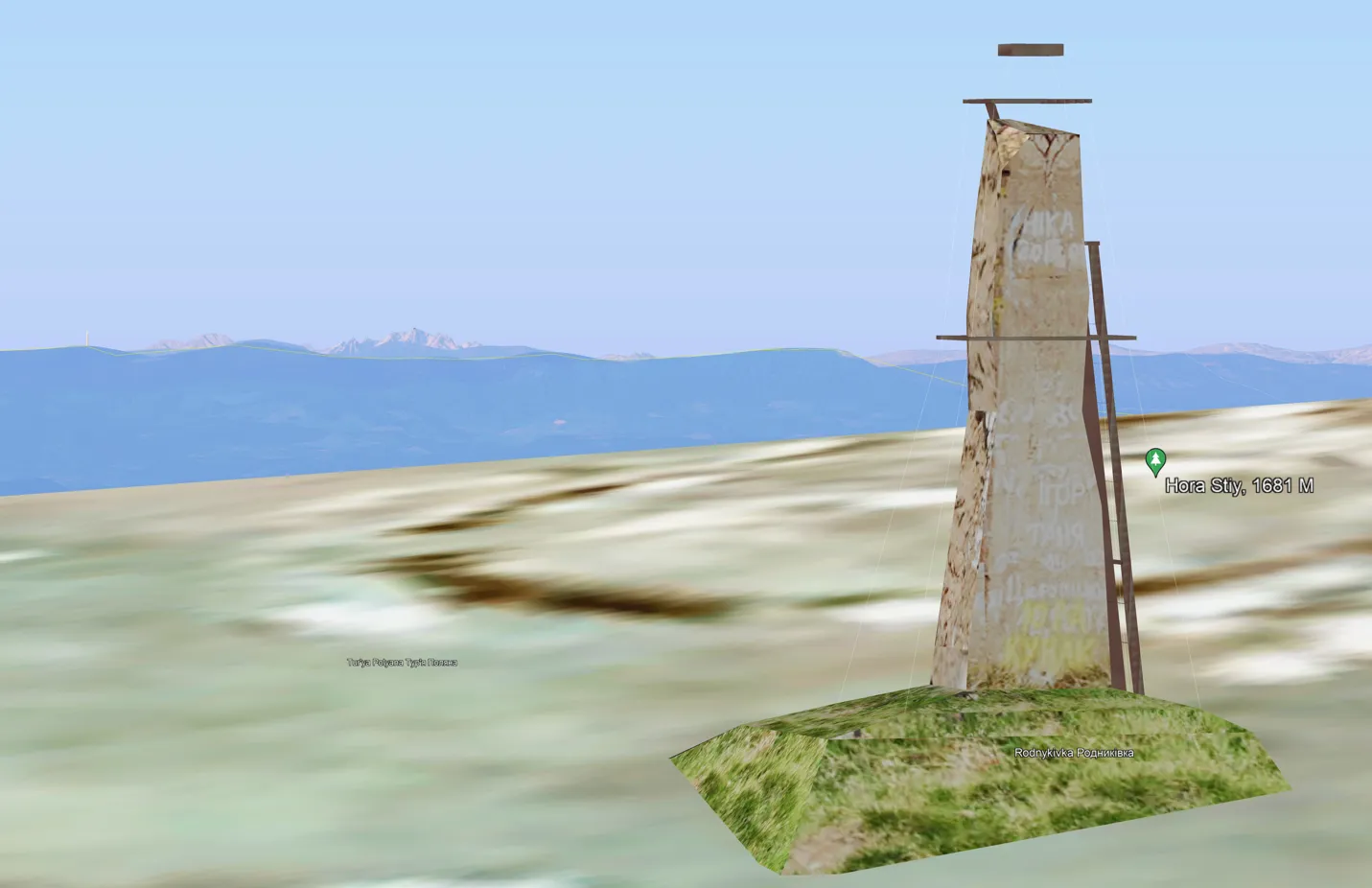
This article presents a nice feature in Google Earth, which lets on getting a telephoto view rendered from any location around the globe. Because the option is to be considered in the aspect of the long-distance observations, it’s indeed a continuation of the thread about the estimation of visibility between two artificial objects. That’s exactly … Read more
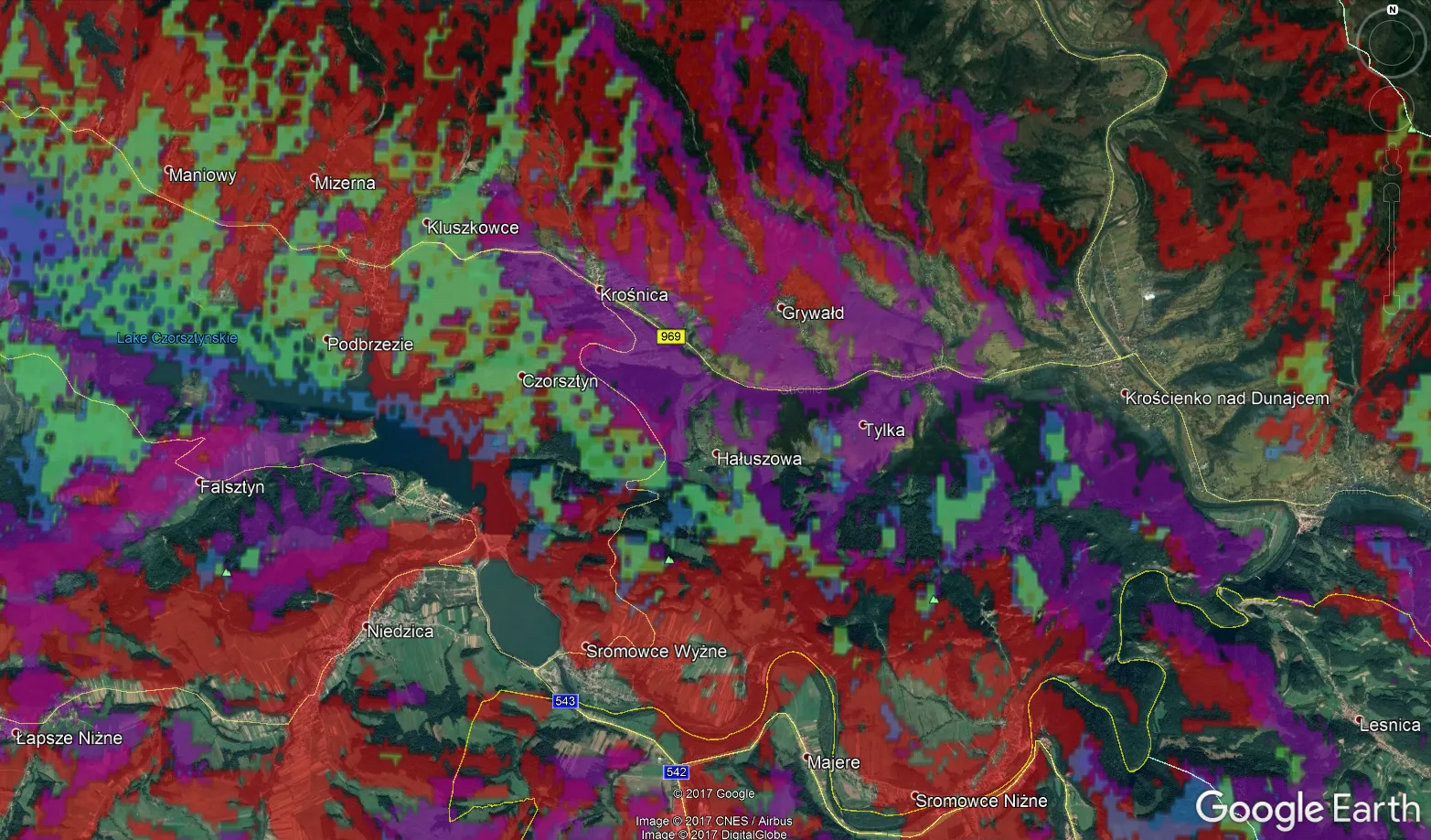
Displaying tourist trails on Google Satellite imagery in QGIS
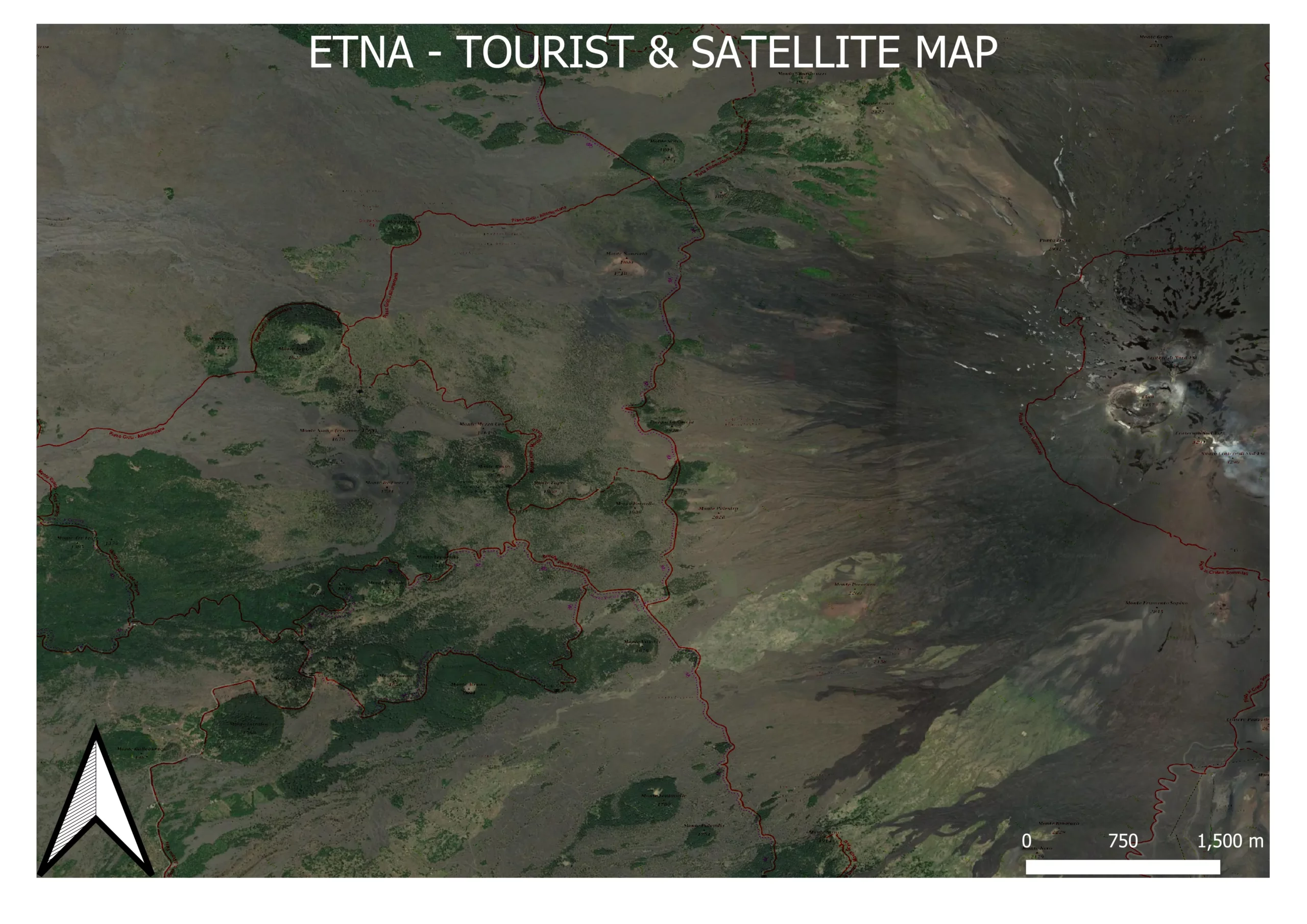
There is a way in QGIS, which allows us to display the tourist trails overlay on Google Satellite imagery. It wouldn’t be interesting that much if not for the fact, that it can be exported as an image or printable as a map in Print Layout. In the next few sentences, I will demonstrate to … Read more
Just partial lunar eclipse of May 16th 2022
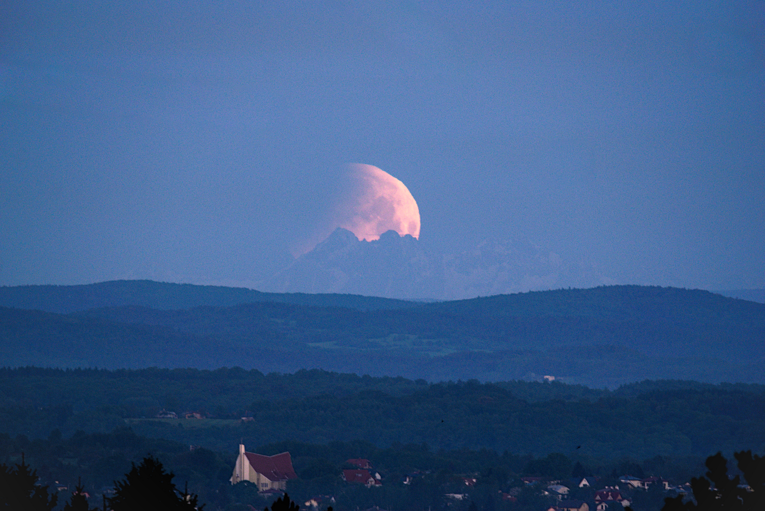
I had a good occasion to watch just a partial lunar eclipse from southeastern Poland – my homeland, this time. The event, although very short, will be remembered probably forever. Before I will get to this point, I must start from the beginning and describe the overall total lunar eclipse of May 16th, 2022 circumstances … Read more
Manual estimation of the visual range between two artificial objects – case studies
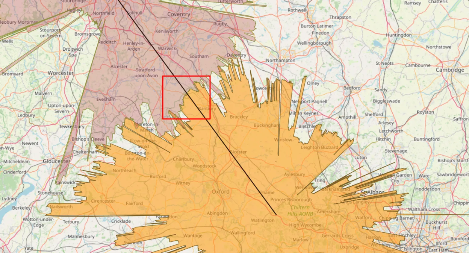
Anyone, who deals with long-distance observations knows all the most popular panorama or visibility cloak generators from the given place. Every user knows the primary malady of all these simulators – they’re based on the DEM (Digital Elevation Model) only. In practice, it means, that all the calculations are based on the pure ground with … Read more
Top 100 the most beautiful places from where you could observe annular or total solar eclipses in the 2021-2040 period

This article is probably a compression of the ebook, which I would like to release in the nearest future about the 500 spots, from where you could observe both annular and total solar eclipses worldwide in the 2021-2040 period. I have inspiration from the Sky and Telescope magazine, which has prepared recently a similar list … Read more
Several important reasons why you should see the 2026 solar eclipse
It’s still quite a lot of time to the 2026 total solar eclipse event, which has been already considered by me in terms of the possibility of seeing its impact on the atmosphere when the phenomenon happens below the horizon. However, the character of this path of totality requires attention far earlier than normal, as … Read more
5 fantastic tips & tricks for the Ulrich Deuschle panorama generator
If you are interested in long-distance observations or simply panoramic views from some location, mainly mountain peaks or hills, you should have heard about the Ulrich Deuschle panorama generator. This is the web-based tool, which in 2010 successfully superseded its predecessor – Kashmir 3D software, which was based on simple digital elevation model (DEM) files … Read more
Rendering the Heywhatsthat.com horizon in Stellarium
I am very excited to announce to you a brand new tool, which has been developed just after the newest Stellarium edition was released. I mean the Stellarium version 0.2 onwards, which is the reach of new features. One of them is the possibility of loading the polygonal type of horizon, known by many of … Read more
Upload vector layers to Windy.com in order to check the weather for your trip
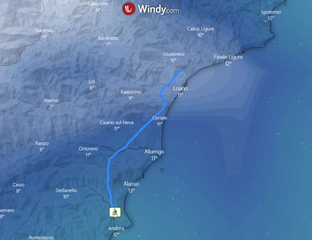
It’s been about half a year since Windy.com launched an option to upload .kml, .gpx and .geojson files into the weather map. It happened thanks to the Leaflet-kml plugin, available here. Apart from the Leaflet Javascript API map software, where we can use this plugin for loading our own .kml files, we can add them … Read more
One day trip to Uzhanian National Park from Wołosate
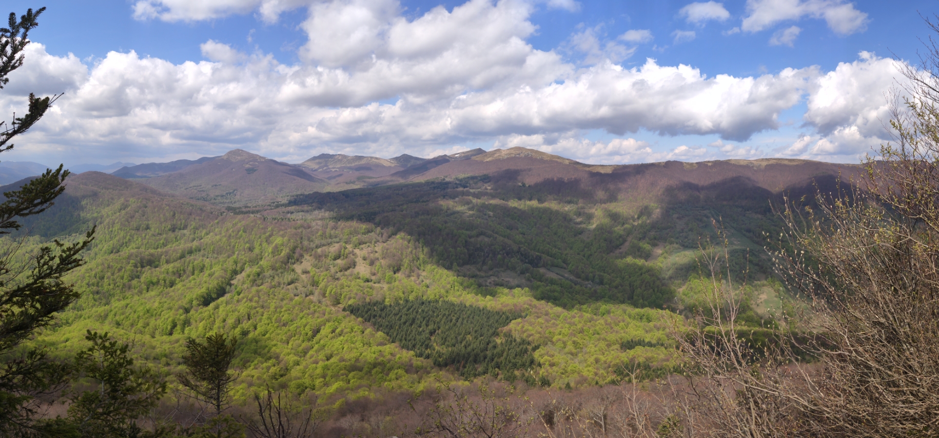
GENERAL INFORMATION ABOUT THE WOŁOSATE – ŁUBNIA BCP Wołosate is a small, and the southernmost village in Poland, which sticks to the Poland – Ukraine border in Bieszczady Mts. The only road, which leads across the village from Ustrzyki Górne is regional road no 897 with a 111km total length from Tylawa to the Poland-Ukraine … Read more
Visual range changes during solar eclipses
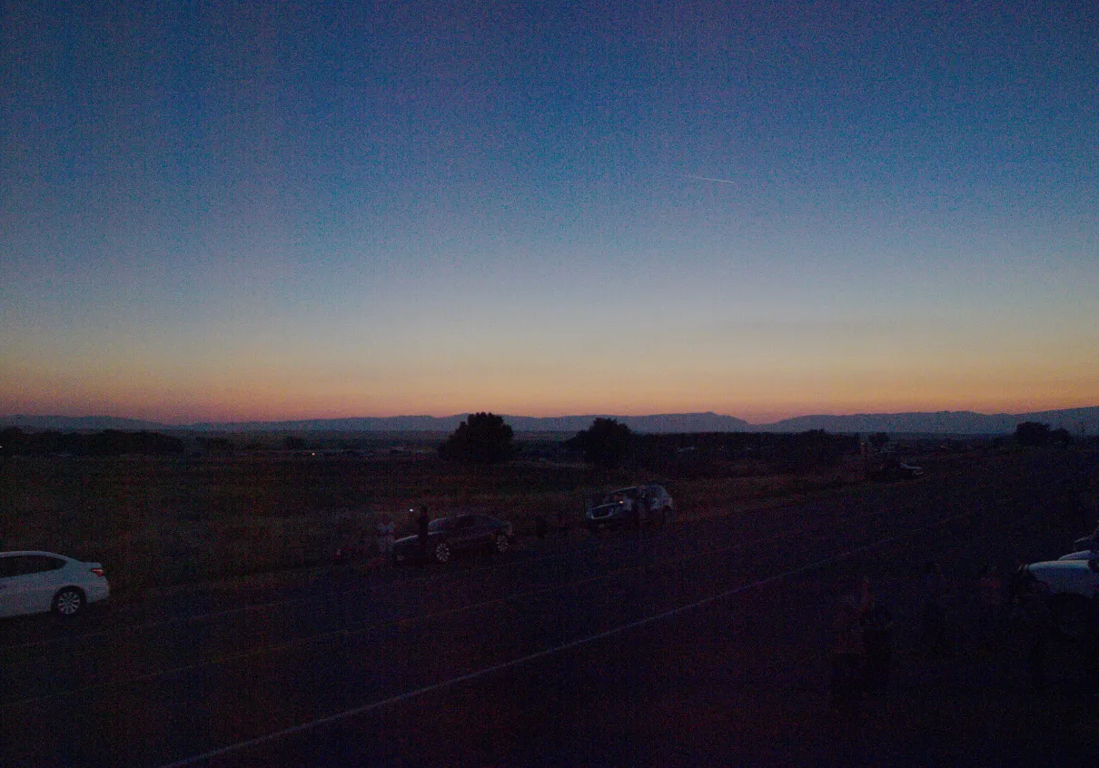
A solar eclipse is a magnificent natural phenomenon, during which the direct Sun is shadowed by the moon to darken the daytime sky (Vollmer, Shaw, 2018). In this article, I would like to draw your attention to another phenomenon, which I “discovered” accidentally during the Great American Eclipse – the visual range changes. 1. INTRODUCTION … Read more
Horizontal visibility as the main factor of long-distance observations, part 1 – weather, astronomical and optical elements
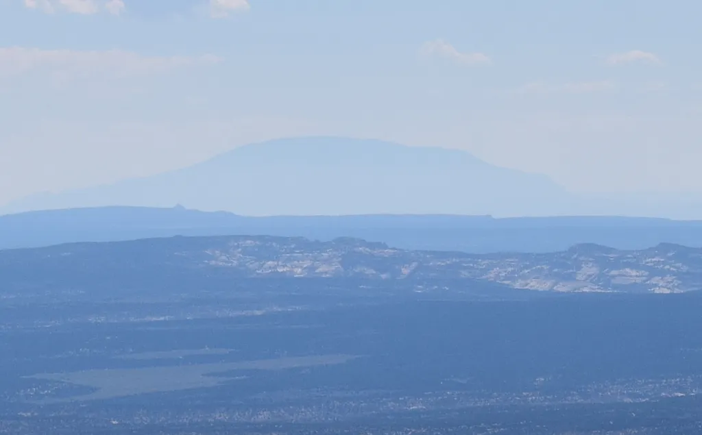
This article is sort of a continuation of issues related to light scattering in the Earth’s atmosphere as well as haze presence. These subjects are closely associated with each other, so some stuff presented here can be pretty much similar and it will be developed on the grounds of my previous articles. This 2-partial article … Read more
Long lens photography from the plane – how it works?
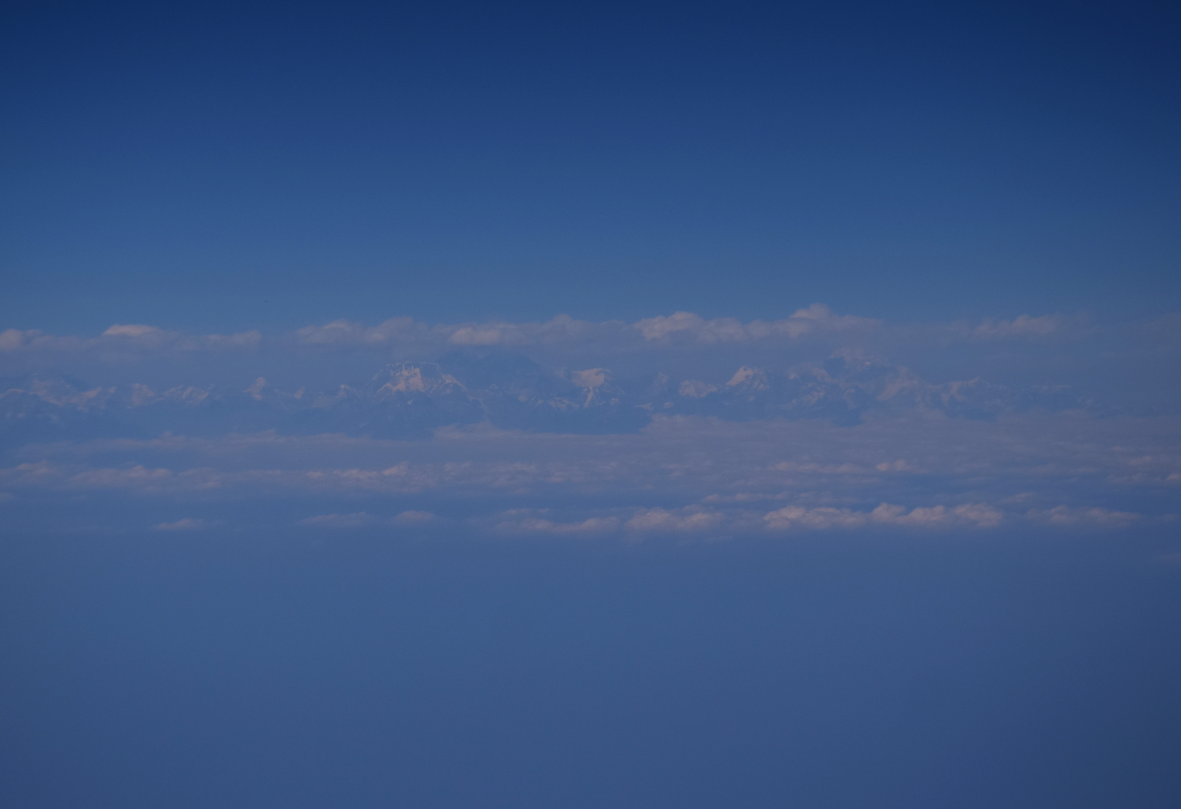
I really like to snap remote objects and mountain outlines. Especially since I got the new telephoto lens – Nikon AF-S Nikkor 55-300mm f4.5-5.6 ED VR. Covering the distant sights from the ground is not only one option, but that may also give you a lot of positive feelings. You can also enjoy a much … Read more
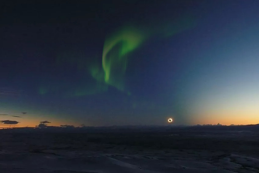
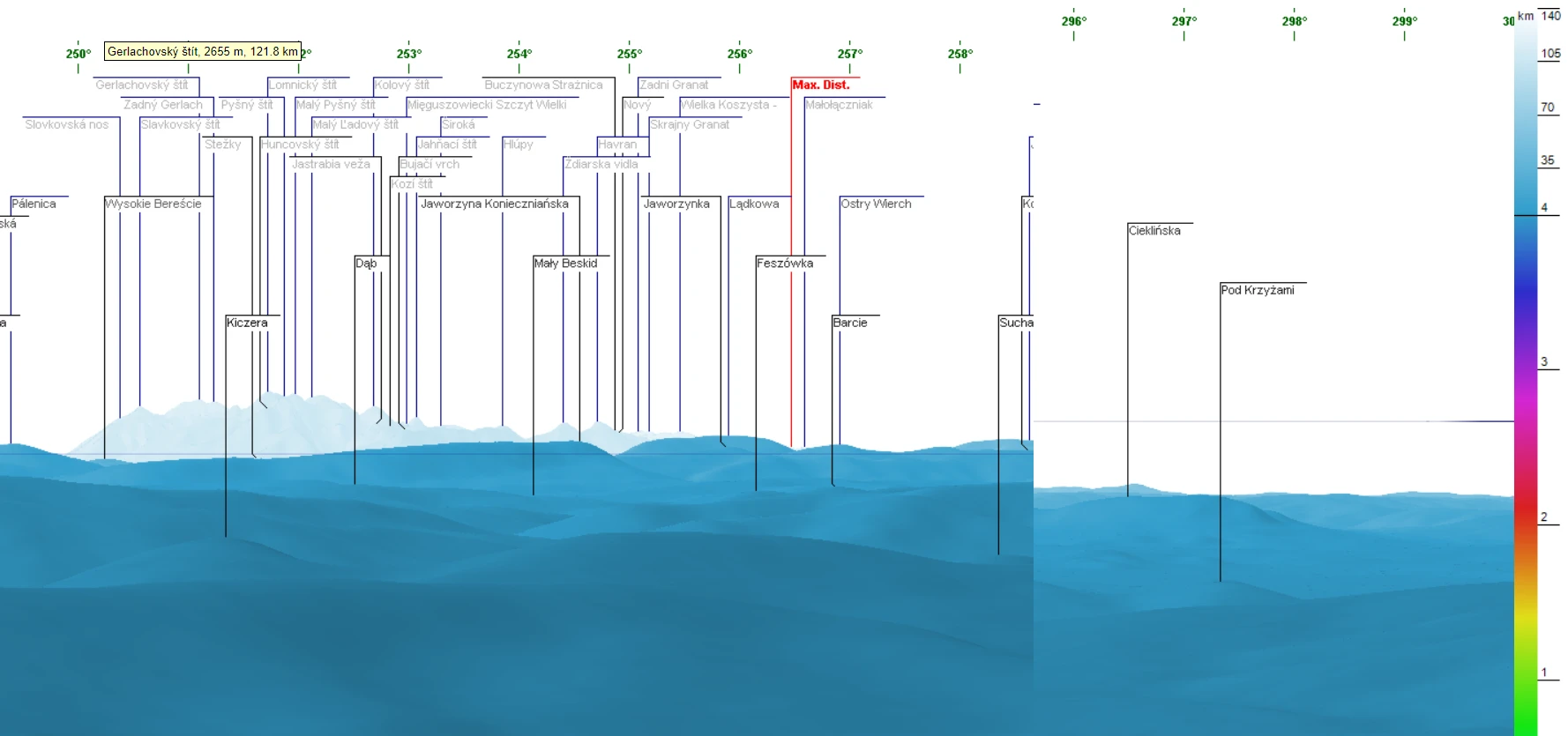
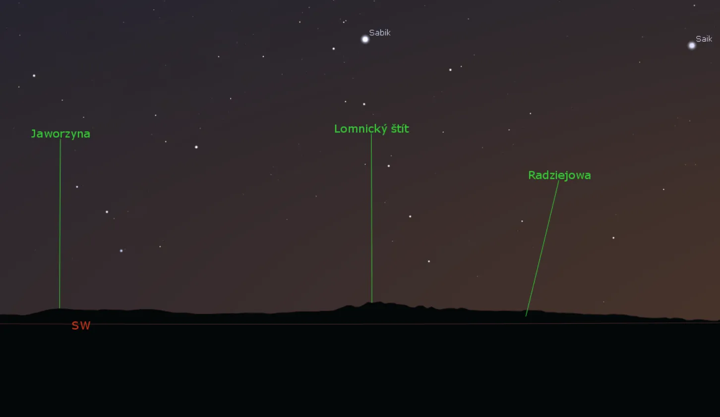
Astrophotography with the Peakfinder.org, part 2 – solar & lunar eclipses
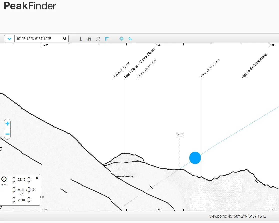
In the 2nd part of this short guide on the Peakfinder.org panorama generator, I would like to focus on another kind of observation, that we can enjoy. There are solar & lunar eclipses. Those celestial events are quite rare (especially solar eclipses) so this is the prime reason, that we should prepare as best as … Read more
Using Heywhatsthat.com to generate a multiple summit-perspective views in Google Earth – part 2
In this part of the article, I would like to say more about multiple summit-perspective views in Google Earth. First of all, previously I have described largely how to manage the heywhatsthat.com panoramas in Google Earth. Now you will see how to put a few summits into your Google software and manage them correctly. Let’s … Read more
Using Heywhatsthat.com to generate a multiple summit-perspective views in Google Earth – part 1
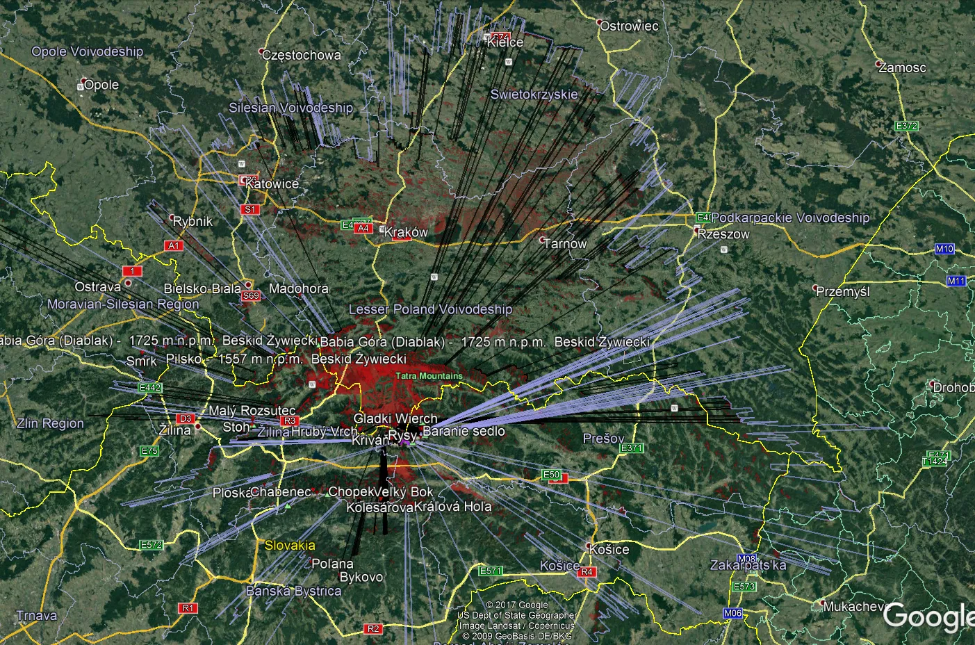
Google Earth has been widely used in geography and GIS. Previously I showed you how to simulate a flood and total solar eclipse path in this tool. There are not only things, that I am going to show you over the forthcoming months. First of all, Google Earth is one of the programs, that I … Read more
The flood simulation in Google Earth
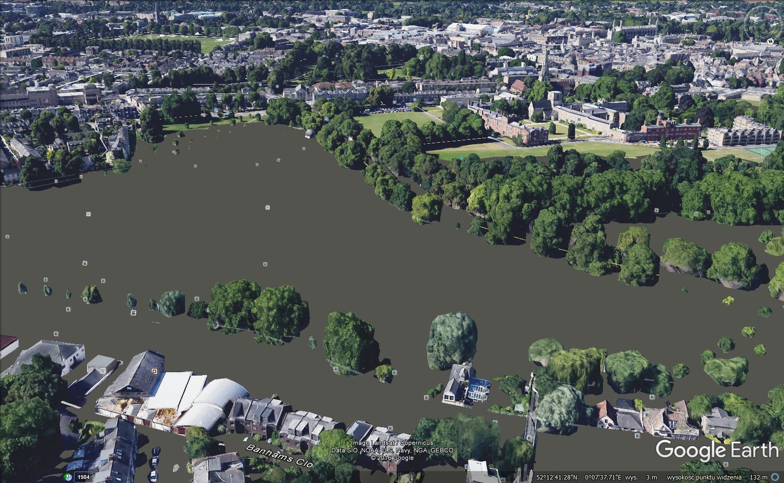
Introduction Google Earth is a handy tool to browse terrain in any part of the globe. Due to detailed satellite imagery, you are able to characterize the interesting area in any line of geographic research. Nowadays 3D quality imagery manages to develop across the World, especially in the most populated areas. The 3rd dimension of … Read more
First trip to Scotland
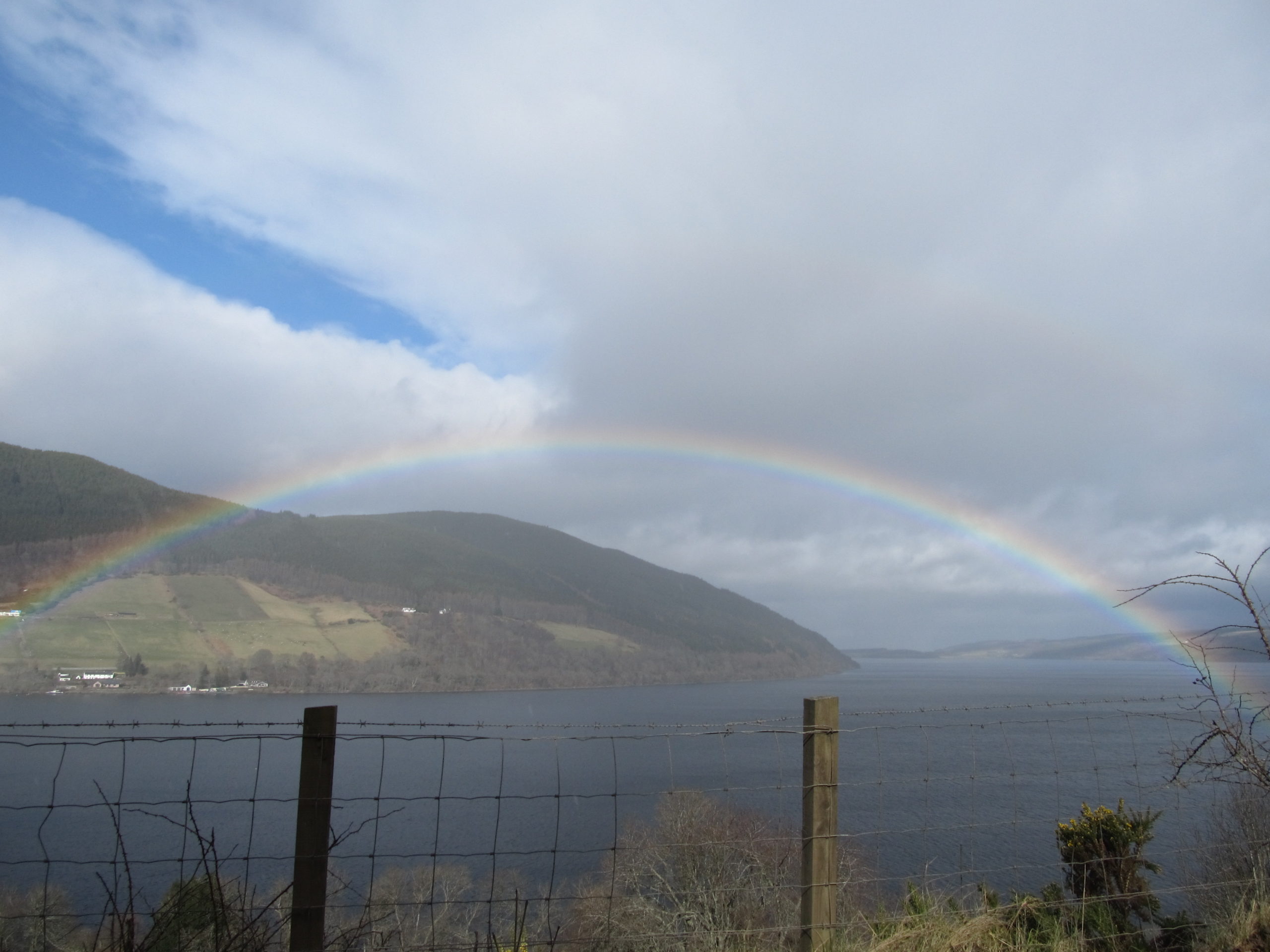
I visited the most beautiful area in Britain just after I came to live in this country. It happens due to an almost total solar eclipse, which I was keen on watching. Read about this more in this article. We set in the late afternoon from Cambridge, our living and working place. The fast Great … Read more
Deep partial solar eclipse in Scotland
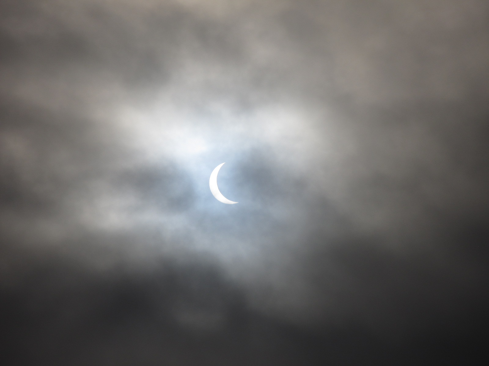
On 20th March 2015, we could witness one of the most spectacular phenomena in the Solar System, the total solar eclipse. The track of totality passed across the North Atlantic and next headed into the Arctic Ocean. This eclipse used to be a logistical nightmare to observe because the only populated places from which the … Read more